Couvet
The Synthetic Site Folder and Site Brief are available for free.
Please register and login to access the Complete Site Folder.
- Synthetic site folder DE | EN | FR
- Site on Google Maps
- Back to map
Data
Category Industrial - landscape - architecture
Team representative Architect - urban planner - landscaper
Location Couvet/NE - Area: Dubied-site on both sides of the Areuse River
Population Couvet 2,760 inhab. - Municipality 12,000 inhab.
Strategic site 67 ha - Project site 9 ha
Site proposed by The Municipality of Val-de-Travers in partnership with the State of Neuchâtel
Owners of the site Private owners, town of Val-de-Travers and Canton of Neuchâtel
Commission after competition Mandate for project development in the Dubied sector, the industrial area and the village center.
More Information
How can the site contribute to the adaptable city?
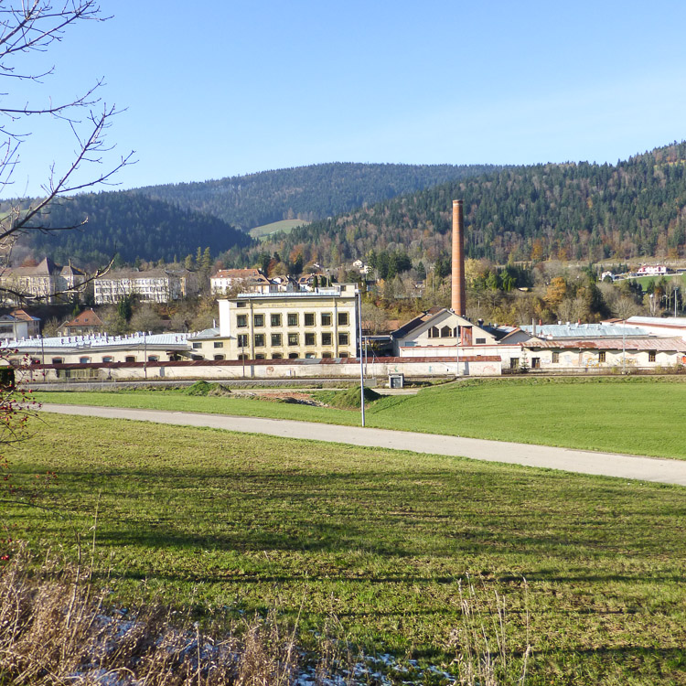
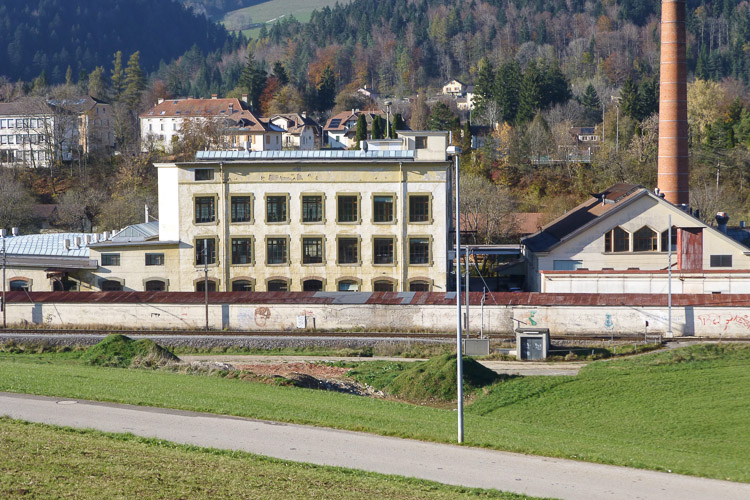
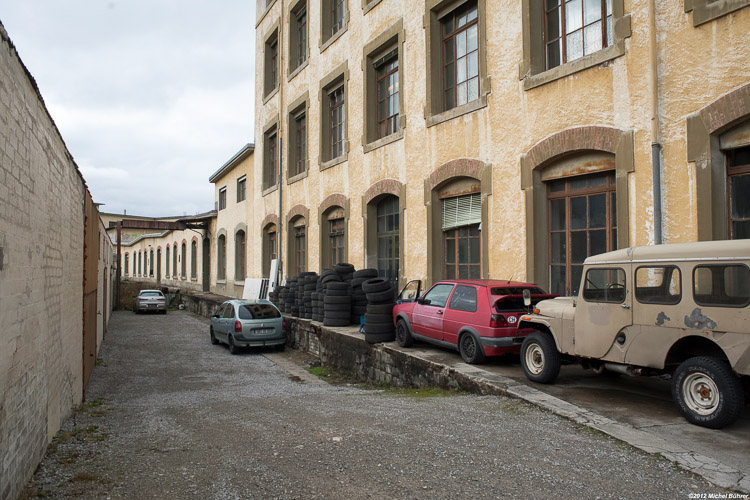
The site was built gradually starting from the mid-nineteenth century, as a piecemeal response to the needs of the Dubied Company, a large company, which produced knitting machines and employed up to 2,000 employees. It left some lasting memories and played a major ole in the local history. It also had a strong influence on the lives and psyche of the people of the region. It is the Dubied Company that set the development pace of the whole town of Couvet for a century and a half, before closing down in 1988.
The site included then industrial buildings (warehouses, storage), assembly and production halls, as well as administrative buildings, which were sold piecemeal to multiple owners. Currently, this large built-up area (project area A) is home to various business and craft activities located in the most remote parts, a center for adult education, and a small business hotel. Large dilapidated areas are used for storage. The demand for quality modular surfaces, for industrial or artisan activities, offers a great opportunity to refurbish the site. Especially since it is now recognized by the state, together with the neighboring industrial Léchère zone as a “cluster for regional economic development”. Some noteworthy buildings of the site should be preserved; however, a large amount of freedom is left to the young planners to decide on the best density and the best use of the site.
City strategy
The project should organize spaces defined by a succession of structures built over a century of industrial activity and provide a comprehensive response, which should include a link-up of the area with the expansion of the industrial area in the Léchère sector on one side and the town center on the other side. The latter includes the Grand-Rue (Main Street), the redevelopment of which could take advantage of the new impetus created by the renewal of the Dubied site.
Site definition
The Val-de-Travers spreads over some 20 kilometers and is located to the west of the Neuchâtel Canton, partially bordering the Vaud Canton. The valley follows the Areuse River, an important component of the Region identity. During the past centuries, the nine separate old villages expanded to form now an urban back bone called the Val de Travers Town. The valley currently inhabited by 12,000 people, was always an important communication route between Switzerland and France in the past. It experienced a significant growth starting at the beginning of the 19th Century, based on industrial activity (clock making, mechanical industry, machinery and textile in particular).This industrial past left its mark on the identity of a region that remains open to the world and to technological innovation. In the town of Couvet, the streets run parallel to the Main Street and perpendicular streets link the various blocks. At first, the northern sector was used to build small apartment buildings, (3 story high above a ground floor containing the main entrance) and small single family houses that are simple and functional. At the same time, larger homes were built at the eastern entrance of the village.
Adaptability: main challenges to take into account
Transport and mobility:
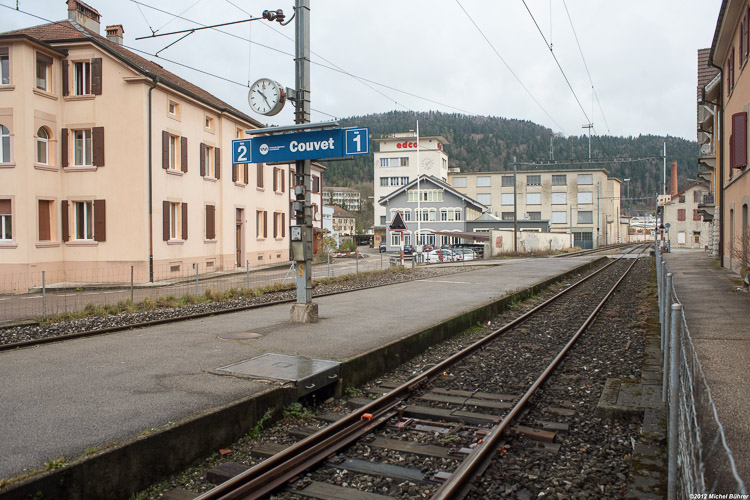
The town of Couvet is served by the railway line Neuchâtel / Val-de-Travers. The main station is located directly west of the Dubied site. There is also a stop at the eastern end of the Léchère site that should be replaced in the future by a new station in the heart of the development cluster (Action Plan B).
Several bus lines stop in front of the Sports Centre (North of the Action Plan B area).
Road access via the Cantonal highway from Neuchâtel to Pontarlier.
The proposals shall take into account the access conditions to the site and the mobility solutions (roads, rail, pedestrian lanes and parking space). A new watch making production unit currently under construction in the Léchère site will create hundreds of new jobs.
The development of the area will certainly increase the use of public transport, the road traffic, the need for parking space and pedestrian movements. New infrastructure should be built and the old one improved while the quality of the links between the town center and the development cluster should be improved.
New lifestyles:
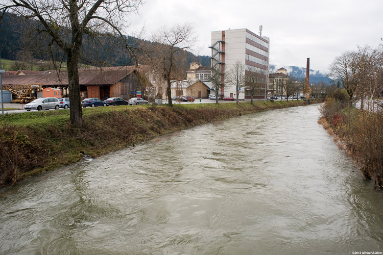
The spaces between the station, the bridge over the Areuse River, between the Areuse River and Main Street should be seen as means to promote regional pedestrian tourism. In addition, the proposals should be consistent with the new mobility concept promoted by local authorities throughout the municipal territory (30kmh speed limit for car traffic, lanes for bicycles and strollers, pedestrians lanes throughout the built environment, parking space) .The project shall emphasize the relationship between the Areuse River, the Dubied site and its extensions.
Inter-company cooperation:
Local economic actors usually develop an ability to work as a network, to solve technical problems, meet common needs or engage together in regional development. The Local Authorities intend to promote interaction between the economic stakeholders, tool and machinery sharing and meetings of the trades’ people on the site.
Questions on the site
A number of Autocad files (dwg) are available in the Study site file and in the Project site file (6 altogether). They seem to be all similar. Is it normal?
Yes, they are the same but the scales are different.
The Autocad files available in the standard document package include a list of overlays identified by a number. Do you have another Autocad file that could be made available to us with overlay names corresponding to specific locations (buildings, roads, land plots, etc.)?
No.
Is it possible to consider the introduction of housing as a complementary program?
Yes.
During the site tour, did the organizers take photos inside the buildings? If yes, is it possible to have them?
No, we don’t have any building’s interior pictures to give you.
In what language should the project be submitted (French or English)?
See rules art. 4.3 « The projects must be written in the site language (thus in French) or in English, except the digital document which has to be in English only, or in English and in the site language. »
If our project requires tearing down part of the existing buildings, do we have to rebuild them somewhere else in the project site?
Not necessarily so. However, the possibility of tearing down one or more building will mainly depend on the activities currently deployed there. The large buildings at both ends of the site are home to a number of companies. The buildings are in good condition overall. On the other hand the built areas located in the center of the site are decrepit and shelter very few activities.
Is it possible to have an estimation of the number of people currently working in the Dubied site? How many people working in the Léchère site?
There are currently over hundred people working in the Dubied site with a full time job. In addition, there are between 100 and 200 people (depending on the season), enrolled in training sessions taking place in the site at the CNIP (the Neuchatel Center for professional integration).
In the La Léchère area (including the part located north of the river), there are currently about 200 industrial jobs. Altogether, there are over 400 people in whole development cluster (Dubied+ Léchère sites). With the opening of the Cartier factory in the weeks to come, this figure will rise to 550 and more than 700 over time.
Let’s not forget the existence of other jobs in the site, including the twenty employees of the Regional Sports Center and its restaurant.
You talk about "following environment rules". Is it mainstream environment principles or is there a special regulation for the region that we need to follow?
The general rules of environment protection. But the current local regulations must be complied with.
Should the activities currently operating in the site - like the garage or the power station - be taken into consideration?
Yes.
The tallest building in the east (the office building) is currently being refurbished. Does it mean that the building should be preserved?
Yes.
According to the documents received when we toured the site, the “Etel SA” building appears as unfit for any type of use, but we found out that it can be refurbished and reused. What option should be taken into consideration?
This building has recently been bought by a company working with leading edge metal alloys, which will set up shop there. The company has started some minor renovation work. Tearing down the building is not an option and planning a new use of that building would involve moving out the new company and pay them at least an equivalent compensation.
Could you clarify the answer made for the question related to Autocad files layers? The answer provided refers to Marly site and not Couvet site in Switzerland?
Yes.
What kind of trains are using the regional railway track ? Are they of the same type as those using the national railway tracks? Are they interconnected in Travers?
Train régional.
Non, celui qui circule au Nord du village est emprunté actuellement par le TGV.
Do we have to take into consideration the maximum height of 12 meters as specified in the new urban planning regulations?
Yes.
The B Area next to La Léchère means just the location of the future railway station or are there any additional constraints as well?
It just means the B area.
A large amount of information was sent on the Dubied site, but not much for the La Léchère site … All we can find on the Web is about that second site (it is part of the study site, but it is outside the project site). Should we take it into account or, on the contrary, should we ignore currently on-going projects like the Cartier project or other on-going construction projects?
You must take in to account the existing structures. The development project must have a link with the Areuse River (connections, a systematic approach to mixing the industrial activities and the natural environment).
In the COUVET-CH-PS-AP3.jpg file, only two buildings are to be preserved. From the answers given to previous questions, it seems that some other buildings should be preserved as well. Please, could you identify clearly the buildings that must be kept and provide an updated COUVET-CH-PS-AP3.jpg file as a consequence?
Some buildings may have an interesting architecture or may play a special role in the site layout. It’s up to you to decide.
What are the buildings to be preserved in the Dubied site?
The first buildings.
Is it possible to have the documents COUVET‐CH‐T‐Pr2.pdf / COUVET‐CH‐T‐Pr3.pdf / COUVET‐CH‐T‐Pr4.pdf / COUVET‐CH‐T‐Pr5.pdf?
See “0-New_docs_after_launch”.
Is there any possibility to add a SCHEME OF ACTUAL USES to the information provided? Where we can understand better which are the buildings being used (totally/partially) and which uses are being held there?
There is a fairly high turnover among the users of the premises, but the activities are mainly services and crafts.
What is the actual situation of the little buildings that are located around the train station? Is it possible to considerate the possibility of tearing down some of them? We are referring to the buildings that are near the railroads and the bridges that connect the town centre with the project site.
Housing and retail, as long as they are within the limits of the main project.
Is the lowest part of the CNIP, the one storey building next to the railroad, completely in use nowadays? If not, is it compulsory to maintain this part?
The east part of the building is currently used an the west part is included in the main project.
Is it possible to build below the ground?
You have a free hand.
Do we have to keep “as is” the football field and the shooting range in the B Area (shaded in yellow)? Or is it possible to relocate them elsewhere or even to get rid of them altogether?
The candidates have a free hand.
Is it possible to have a list of the different uses or enterprises that already work there and the place that they occupy there? It will be very interesting to decide which building should be respected or what enterprises must be relocated.
Mainly vehicle repairs. Bicycle wholesale business. Tinplate and construction timber workshops. The first buildings are used by a Government institution (CNIP) in the east side and a business incubator in the west side.
How many square meters should be built for business activities?
The usable area is not a key factor. The quality of the newly created areas and the overall development plans proposed by the candidates are the most important.
Is it possible to consider tearing down the lower body right behind the CNIP building ( facing the railway, the one storey industrial part), and reorder the activities that are being developed there?
Yes.
Are there any permanent uses at the one storey part of the cnip? Could it be possible to modify or tear down part of it so the entire site can be physically connected?
No. The buildings that are preserved in the program must be kept. Especially the CNIP building and the first building to the west.
Where can we find the new urban planning regulations?
Please use the following link.
The B zone, or buffer zone, is thought to be a meeting point and a link between the banks of the river. However it is indeed quite big. Could we use some part of it as part of A?
Yes.
Is it possible to include different uses in the site? Like housing?
Yes.
Is there natural gas supply on the site?
No.
Could the train station be located in other site or should be in the specific one?
It has to be located in the site.
The programme of the specific proposal is a train station, but could it be related to other programmes?
No. Its construction is scheduled over the mid/ long term.
Where can we find the new urban planning regulations regarding the maximum heights? We would like to include all the regulations.
Please use the following link.
Is it possible to have some inside pictures of the buildings?
We don't have any building's interior pictures to give you.
Do you have a dwg file with the contour lines?
We are trying to obtain the data from the Neuchatel "Géomatique Department".
We can not find a list of the documents to submit. Is there some fundamental documents that are not to be missed?
Please check the Europan 12 Contest Rules, Art.4.4.
This site is connected to the following theme
Heritage of the Future Heritage is generally thought to look back to the past, but conversely it could be said that it should look to the future. Heritage is usually considered to be extraordinary, but is there not a case for thinking about the definition of “ordinary heritage”? Heritage is customarily perceived as an architectural object, but this office will explore ways to “create heritage” in three types of context where it is in principle lacking: the transformation of orphan districts, the conversion of neglected buildings or plots, the redevelopment of abandoned industrial zones or enclaves.
It can be hypothesised that the more the city, in both its morphology and its functions, spans, recaptures and expresses the eras and phases of its development, the more it develops its capacity to adapt to change, its potential for urban adaptation and its ability to resist sudden crises. So the question is: does creating heritage mean increasing the capacity to adapt the future city?
Questions on the site
You have to be connected –and therefore registered– to be able to ask a question.
Fr. 16 May 2025
Deadline for submitting questions
Fr. 30 May 2025
Deadline for answers
Before submitting a question, make sure it does not already appear in the FAQ.
Please ask questions on sites in the Sites section.
Please ask questions on rules in the Rules section.
If your question does not receive any answer in 10 days, check the FAQ to make sure the answer does not appear under another label or email the secretariat concerned by the question (national secretariat for the sites, European secretariat for the rules).