Graz
The Synthetic Site Folder and Site Brief are available for free.
Please register and login to access the Complete Site Folder.
- Synthetic site folder EN
- Site on Google Maps
- Back to map
Data
Category Urban
Team representative Architect - urban planner - landscaper
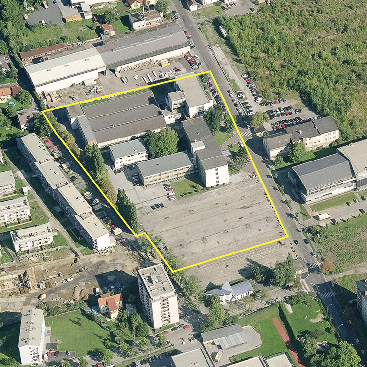
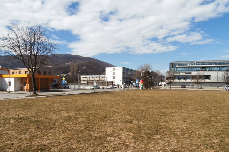
Location Graz - Eggenberg
Population 270,000 inhab. - Conurbation 423,000 inhab.
Strategic site 14,2ha - Site of project 2 ha
Site proposed by City and site owner
Owner of the site Waagner-Biro, AG
Commission after competition Involvement in further implementation procedure on the urban and architecural level
More Information
How can the site contribute to the adaptable city?
Graz is one of the fastest growing capitals in Austria with a booming housing market. The conversion of former industrial areas in mixed use developments must not expel the working areas but integrate them in a sustainable living-working environment.
The challenge is to define the way in which the heritage of the industrial structure can be considered. Instead of deciding only between preserving and erasing, a strategy of smart adaptation could trigger an urban environment with a distinct character, in which various scales might coexist.
Adaptation could be addressed as a laboratory in search for new modes of coexistence as for scale, programme and building. Especially challenging is the development of a school campus that has to be “adapted” in order to leave options for growth, and sharing, so that the school becomes a place with multiple rhythms of use.
City strategy
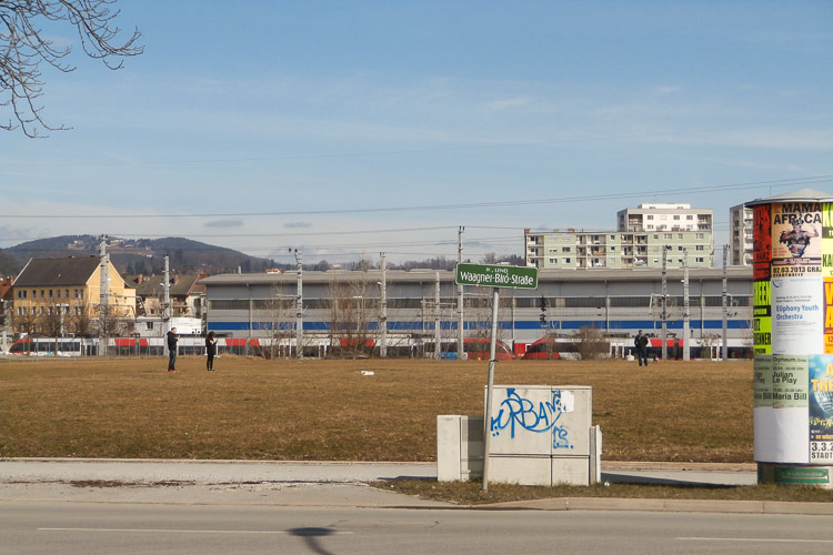
The city has been supporting the comprehensive transformation of large industrial areas into mixed use neighbourhoods in order to enhance the urban quality of these monofunctional environments. The areas close to the rail tracks provide one of the largest reserves for inner city growth, being much more desirable than growing in the peripheral areas.
The Europan competition is integrated in the Smart City Project which embodies the city’s highly ambitious strategy to convert this blind spot into a mixed use urban centre, absorbing the noisy „riverside“ of the railway. Especially important is the area’s transitional condition, mediating between housing developments and heavy infrastructure. The city looks for a strategy which is able to attract different users and activities at the interface of these two poles, integrating housing and its specific demands in an area that offers more than mono-residential neighbourhoods.
Site definition
The site is characterized by its schizophrenic fringe condition: heavy infrastructure in the east, calm housing developments in the west. On-going transformation has started to question this polarity, making the area a challenging “meeting point” where housing and infrastructure interact.
Two years ago, the city launched the Smart City Project “Graz Mitte”, a comprehensive ecological concept on the level of energy, mobility and social sustainability. The Smart City development corresponds to the Europan study site, encircling the “Helmut List Concert Hall”, right at the opposite side of the project site. This hall represents an important cultural facility for the city. Its refurbishment is exemplary for the continuous transformation of the area which finally has opened up the possibility to create a new central neighbourhood.
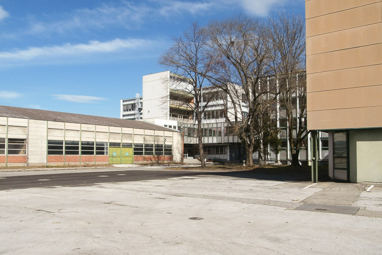
The dynamics in and around the Europan site are extraordinarily high: more than 1,000 housing units, an experimental power plant, a school complex, as well as large public spaces will give the area a radically new significance. There are still two industrial buildings existing on the project site. It has to be explored whether and how they can be integrated in the new development.
The ambition of the site owner, Waagner-Biro, to address the issue of the site’s memory in a creative and productive way, exceeds the limited options of upgrading existing structures to contemporary building standards. Rather, the inspiring ambience of an increasingly hybrid area under heavy transformation should be the starting point for a re-interpretation of the site’s identity.
Adaptability - main elements to be taken into account
Adaptability shall be addressed in three challenging scales:
Transition: How can the new development explore the adaptability of the existing structures and ambiences? Could there be a productive response to the schizophrenic condition of housing and industry without erasing the memory of the industrial developments?
Urban structure: Could the urban strategy itself initiate a structure which is stable and significant enough to create an urban quality beyond building? For which areas/elements/phases does the urban plan encourage and enable adaptability? Open House – indeterminacy: How does adaptability operate on the level of the built structure? Due to an exciting programmatic indeterminacy (the growth of the school development is unforeseeable) the strategy for the built development has to absorb quite different development options: what kind of typological smartness can be offered for this fuzzy programmatic future?
Questions on the site
Is it possible to have some documents about the Smart City Project that is just in the strategic site?
We already updated further information on the Smart City project. In addition we will upload the "freshly" designed plan and section of the energy tower project which is located between the Helmut-List-Halle and the project site.
What type of pollution is contaminating the ground?
It is not examined what kind of pollution exactly. Due to the site's history the pollution is related to the steel production process. It is alsopossible that a future examination condition of the ground might reveal that the site is not seriously polluted. For the project development this means that underground parking can be suggested without heavy consequences.
What is the use of the building in front of the Wagner Biro factory, on the Peter Tunner Gasse? (right before the tunnel under the railways).
The use is a car dealer.
The rahmenplan defines a precise guideline for the intervention: in the strategic site it is supposed to place sports fields and sport supplies; in the extended site there is already a project for future development. At what level do we have to follow this guideline? How much we are conditioned by UPD?
In the study area east of the Waagner-Biro-Strasse the main task for the Europan competition is to provide a strategy for characterizing the public spaces, linking the study area convincingly to its surrounding and the larger context. There will be another competition in this area which will deal with the development of the built masses, it will run outside of the Europan procedure.
Concerning the project site: the UPD only defines heights, denisty and outer limits of the range of the areas where one can build. There is no hint about typological development. Even the heights have to be seen as strong recommendations. If a project convincingly suggests to change the heights it might be ok if the jury agrees that the proposal is reasonable.
The transversal public park has to be repected, also its southern limit which consumes the northern fringe of the project site. Concerning the green area on the project site (3.000m2 green area in the UPD: we have uploaded detailed information about this green area concerning its possible integration in the development of the of the outdoor areas of the school program.
What about minimum distance between buildings? Are there rules we should respect about the distances between new buildings?
Between sites of different owners the minimum distance between buildings is their total number of floors plus 4 metres.
If the buildings are on the same site, the distances can be smaller. In case of rooms which need daylight (any kind of rooms to stay), the issue of light is important: at least one has to respect the 45 degree light angle rule, which means that the a building has to allow the light to arrive at the lowest window of the neighboring building in a 45-degree ray (to be demonstrated in a section).
Is there any minimal distance between buildings that has to be respected?
Between sites of different owners the minimum distance between buildings is their total number of floors plus 4 metres.
If the buildings are on the same site, the distances can be smaller. In case of rooms which need daylight (any kind of rooms to stay), the issue of light is important: at least one has to respect the 45 degree light angle rule, which means that the a building has to allow the light to arrive at the lowest window of the neighboring building in a 45-degree ray (to be demonstrated in a section).
The existing buildings on the project site could be demolished? or be used alone the metal structure as a intermediate space without facades? or the new housings in the north of the project site are be integrated into the structure of the existing buildings?
There is no new housing project in the north of the project site. The brief and the minutes of the site visit describe clearly what are the options concerning the existing structure. It is up to the teams to decide the strategy. Considering the demands of densification and the problems which come up with issues of use (today's safety regulations, building physiology, etc.) the reasons for preserving fully the existing structures are rather weak. Therefore, the "dismantled steel skeleton" as a landscaped element should serve you as an example to reconsider the issue of preservation, developing a smart strategy of re-use. If you cannot propose any reasonable strategy, matching the high demands of densification and use-value, we recommend a replacement of the existing structures by new buildings.
the definition of two different scenarios is intended to be both represented on the A1 panels or each group has to choose one?
Both scenarios have to be addressed!
for the extended site (east side of waagner-biro strasse) the proposal must include an urban development at a built masses definition or we have to consider this area as empty?
As the brief describes, the area will be developed, following the height and density-parameters of the UPD. There will be extra competitions (not part pf Europan) dealing with the typologocal development. Therefore, the brief asks you to propose a concept for an overall networking of this area including ideas about the quality of the in-between spaces. The city intends to integrate this concept and integrate them in the future implementation.
cm4 dxf doesn't works, I've downloaded it several times but it never works. can you replace it?
We replaced the file "GRAZ-AT-C-M4.dxf". The new file is now called "GRAZ-AT-C-M4-replaced.dxf".
A couple of questions about the UPD: -The heights which are indicated seem sometimes not to correspond with the existing buildings, like the car dealer, fitness center and youth center. Does it mean those are going to disappear in the long range? -The heights indicated (22,5 and 26,5m) north of the western park seem quite high so close (ca. 20m) to the low density and small scale existing houses to the west. How fixed are those heights? -Is there any information on the cooling towers, which are indicated close to the List Halle? -If the ground is contaminated, shouldn't it be cleaned anyway (since it is going to be a inhabited area, also school, etc)? -On page 23 of the competition brief, 1. Location on the site: it is stated that there is a concentration of density in the north of the project site (next to the park). But it can't be seen on the UPD plan: instead it shows an increasing density parallel to Waagner Biro strasse. Or is the part north of the park meant? But this doesn't belong to the project site. Can you make this clear?
The UPD is an instrument which defines the potential of future development. The car dealer, youth centre and fitness centre are definitely not addressing this potential. Moreover, the fitness centre soon will be repaced by a new buiding (housing on upper floors, ground floor wth café/urban uses), as mentioned in the brief (heights of new building correspond to UPD)!
The heights of the UPD are a recommendation which can be reflected by the teams and, if there are good reasons, modified.
The concentration of density along the park is a strategic response to the challenge of the campus-option, which demands a specific densification strategy that is not reflected yet in the UPD, but was developed during the preparation of the Europan brief.
Which cooling towers do you mean?
As it has turned out, the contamination of the ground is not verified and need not be considered in the competition project.
This site is connected to the following theme
From Mono-Large to Multi-Mix Sites are undergoing two kinds of closely related transformation: the first from a single large entity to a multitude of smaller parts; the other from a mono-functional entity to a mix of functions and uses.
Both transformations generate a greater degree of spatial and programmatical complexity, which is an essential quality of genuine urbanity.
In these transformations a system composed of smaller, separate and different elements is potentially more adaptable. If one part becomes redundant, it can await change or replacement without too great an impact on an area. If new needs arise, these can be more smoothly absorbed into a differentiated pattern of distribution. A fine urban mix is more adaptable than a large mono-functional cluster.
Questions on the site
You have to be connected –and therefore registered– to be able to ask a question.
Fr. 16 May 2025
Deadline for submitting questions
Fr. 30 May 2025
Deadline for answers
Before submitting a question, make sure it does not already appear in the FAQ.
Please ask questions on sites in the Sites section.
Please ask questions on rules in the Rules section.
If your question does not receive any answer in 10 days, check the FAQ to make sure the answer does not appear under another label or email the secretariat concerned by the question (national secretariat for the sites, European secretariat for the rules).