Paris
The Synthetic Site Folder and Site Brief are available for free.
Please register and login to access the Complete Site Folder.
- Synthetic site folder EN | FR
- Site on Google Maps
- Back to map
Data
Category Urban - architectural
Team representative architect - urban planner - landscaper
Location North-East area of Paris
Population Conurbation 10 millions inhab. - City 2.2 millions inhab. - 18th arrondissement 200,000 inhab.
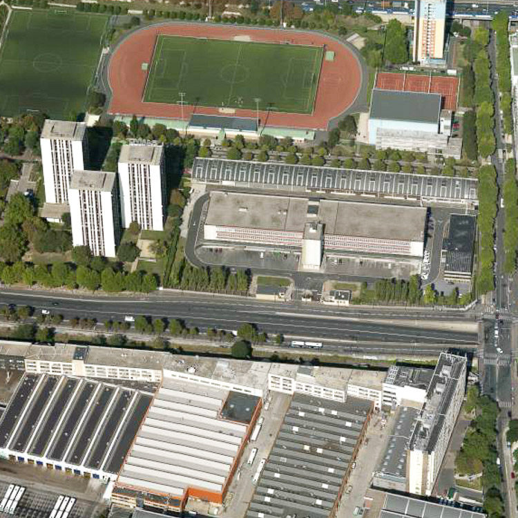
Strategic site Porte des Poissonniers 27 ha - Project site: 4 ha
Site proposed by City of Paris, with those partners on the project : Mairie d’arrondissement, RATP, Ministère de la Défense
Owner(s) of the site Ministère de la Défense, Ville de Paris
Commission after competition urban design project, redesign of public spaces, architectural project management in connection with partners
More Information
How can the site contribute to the adaptable city?
At the heart of the Paris metropolis, the proposed site, Porte des Poissonniers in northern Paris, is part of a large and evolving section of the Parisian suburbs. A strategic study is currently underway with the aim of remodelling this sector as a dense, robust and sustainable urban zone, and gradually incorporating the city tomorrow into the city of today.
Four themes, linked with the specificities of the site’s location, are involved in this exploration of the adaptable city: the accessible city framework, the dense mixed city, the city and nature, timeframe management as a factor in urban projects.
City strategy
The PLU (local urban masterplan) and the PADD (sustainable development plan) for Paris are both part of the global objective of building a sustainable and community-minded city in order to reduce the social and spatial inequalities inherited from the past. The city is working on the transformation of large development areas, almost 10% of its territory, mostly in the suburbs. The proposed site falls within one of them. With an urgent need to build housing, almost 6000 dwellings a year (with a total target of funding 40,000 social dwellings over the period 2008-2014), the City is looking for urban forms that take account of the diversity of contemporary living patterns in a large metropolis and objectives of sustainability, solidarity and social mixity.
Site definition
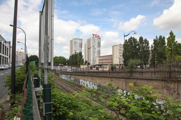
Situated at the interface between Paris and its inner suburbs, the reference area falls within a 200 ha project zone within Paris: “Paris North, North-East”. It is near Porte de la Chapelle, one of the main gateways of Paris, a point where the inner ring-road (Boulevard Périphérique) meets the A1 motorway. It is located in the strategic axis of the new Greater Paris centres, between the two station hubs of Gare du Nord and Gare de l’Est and the future Pleyel - Saint Denis multimodal station. It will ultimately enjoy excellent public transport provision.
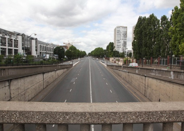
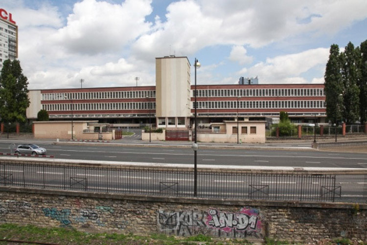
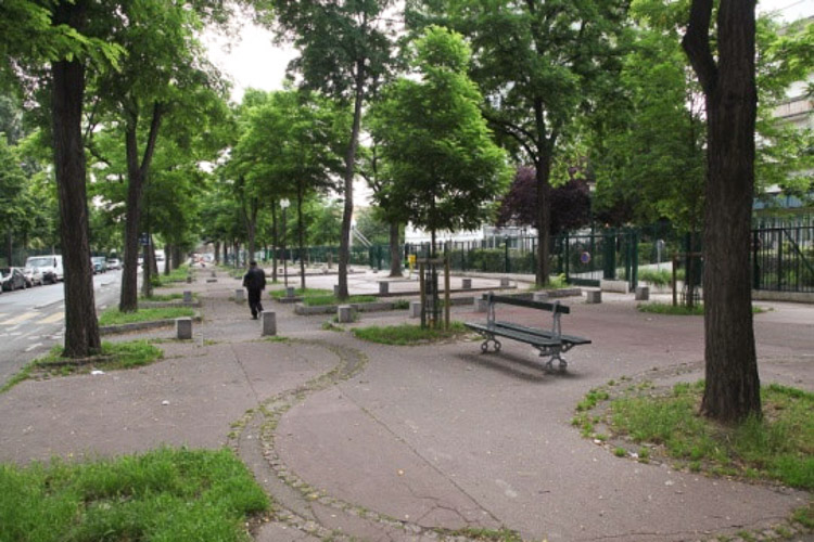
Located on the edge of the former suburban districts, Porte des Poissonniers consists of a traditional urban fabric, the footprint of large industrial activities and 1960s-1970s urban projects such as social housing, amenities, stadiums, separated by major infrastructures, roads and railways.
For the Europan competition, the remit is to explore two scales: the first is the study site covering 27 hectares, notably including a large 8 hectare plot belonging to the RATP (independent Paris transport board) and, within this reference area, a 4 hectare project site encompassing development land belonging to the Ministry of Defence, and its immediate surroundings.
Adaptability : main elements to take into account
The site raises the question of transforming and adapting a dense city fabric. The conversion of this area will focus on the transformation of the interstices and large land areas. Urban changes will need to take into account the existing functions that the city needs to retain. The possibilities for change in this sector must harmonise with both the metropolitan and the local scale, by fostering the establishment of a strong urban framework to support the development of a dense and mixed fabric that will allow the emergence of new neighbourhoods and more dynamic and diverse economic activity.
The remit is to reconcile a certain density and diversity of complementary functions and uses with a priority on housing: a social and generational mix, with corresponding local amenities and services, together with activities that contribute to a rich neighbourhood life.
The candidates will need to think about the metropolitan dimension and put forward proposals that operate at two different scales:
- The urban strategy: response at the scale of the study zone for which they need to propose a strategy illustrated by one or more scenarios for spatial change. The remit here is above all to think about potential short-term, medium-term and long-term changes to the area through an action strategy that links the themes and options described above, and harmonises them with the richness and complexity of the existing fabric.
- A sustainable and adaptable neighbourhood: response at the scale of the project site, with urban and architectural proposals that prioritise residential functions, with a varied range of housing, and ideas for new sustainable neighbourhoods in the dense city, with open spaces and buildings adapted to modern living patterns, founded on social relations based on solidarity, communication, community.
Questions on the site
Avez-vous une 3D du site ?
no
Is it possible to get a functionning plan of the RATP?
see earlyer answer and new document on line
How many people do work for the RATP and what are their working frequencies (weekdays and weekends)?
see earlier answers to questions
Est-il possible d’avoir la légende de la carte PARIS-FR-C-M01.pdf (p18) ?
updates maps online
Pourrions-nous avoir plus de précisions sur la carte PARIS-FR-C-M02.jpeg (p. 20) en terme de programmes sur les opérations réalisées/en cours, les études en cours/engagées ?
See additional documents on neighbouring projects online.
Pourrions-nous avoir les plans et façades de la caserne de gendarmerie.
these documents are not available
Serait-il posible d'obtenir le cadastre dwg de la ville de Saint-Ouen?
this document exist at the district "Plaine Commune"
Shall we destroy the gymnasium or keep it as such?
seesite folder; the equipment isnecessaryto the district, if it is demolished will need to rebuild it
What are the buildings that are doomed to disappear in the reflection and project site.
These answers are detailed in the site folder and the account of visit.
est-il possible d'avoir les légendes des cartes pdf Cm01 à M04?
all is on the site folder, and news documents
Est-il possible d'avoir des précisions concernant le comblement des tremis du bd Ney (TRAM) ? Notamment au croisement du boulevard et de la rue des Poissonniers?
The hopper at the crossing of the Bd Ney with Rue des Poissonniers will be completely filled; the intersection of two streets and the passage of the Tramway will be upgraded.
Quel est la proportion de surface d'ateliers, de parking, et de bureaux, la RATP est-elle prête à céder ?
On the subject of opportunities for development of the site (see new document) the RATP has clarified this issue in the following manner:
It is an industrial site or work week and part ends weekend thousands of people; the site is essential to the functioning of the services rendered by the Régie in the Paris region and Paris in particular, none of these activities cannot be deleted.
Est-il possible d'avoir un plan des altimétries ou de la topographie ?
sections on filefolder
Pouvez-vous rappeler le nombre "maximum" de places d'hébergement d'urgence que vous souhaitez garder sur le site de projet ? (n'est pas indiqué dans le CR de visite du 29-03-13)
all is written on the sitefile
Pouvons nous avoir les plans détaillés (plan, coupe façade) de l'ensemble des bâtiments se trouvant sur le site du ministère de la défense?
not available
Pouvons nous avoir les plans détaillés (plan, coupe façade) de l'ensemble des bâtiments se trouvant sur le site de la RATP?
not availble, but see new document on line and answer to earlyer question
Pouvons nous avoir les côtes altimétriques des pieds des bâtiments de la zone projet?
not available
Est il possible d'avoir le schéma directeur du projet "Chapelle International" au format dwg?
no, this document is not available
Quelle surface et quels bâtiments doivent être gardés par la RATP?
see earlier answer and new document online
"Dans le cadre du prolongement du tramway T3 les trémies du boulevard Ney seront supprimées" De quelle façon cela est-il prévu?
see the earliers answers
Peut-on récupérer le DWG des courbes de niveaux?
all documents availables on site folder
Les futures stations du tramway de la porte de POISSONNIERS et de la porte de Clignancourt seront elles à la hauteur actuel du Boulevard Ney ou elles seront remontées au niveau des ronds point? Merci
see early answers
Dans quelle mesures et limites peut-on réhabiliter la caserne Ney: doit-on impérativement la conserver? peut-on la réhabiliter, la reconvertir? Est-il envisageable de construire sur son toit? Peut-on au moins modifier ses façades?
it's your own choice
Doit-on qualifier le site de projet, en ZAC par exemple ?
it's your own choice
Concernant les zones situées dans le site de réflexion mais en dehors du site de projet, notamment la parcelle appartenant à la RATP au Sud, peut-on faire des propositions d'implantations et/ou de transformations ?quel détail apporter à ces propositions ?
It is specified in the site folder, chapter site reflection + see also answer previous question+ new map on sitefolder
La caserne Ney est-elle constituée d'un seul grand bâtiment, ou bien aussi du long hangar au Nord, et d'un autre bâtiment vers l'Est? doit-on impérativement conserver ces bâtiments? peut-on les réhabiliter, les reconvertir?
see sitefolder and visit report
Est-il attendu que l'on qualifie et donne un statut précis aux logements projetés : habitat social, collectif, mixte etc ?
please see the site folder
Le dossier du site fait état d'un COS compris entre 3 et 4: est-ce l'état actuel ou celui souhaité après intervention? Dans cette deuxième option, le COS compris entre 3 et 4 comprend-il les bâtiments existants, ou seulement ceux que nous devons projeter?
it's actual; you can imagine another situation
Quelle est l'emprise exacte dont a besoin la RATP pour stationner ses bus? Quelle est la fonction actuelle de la halle championnet?
see early answer to this question, and nex ratp map on line
Est-il possible d'avoir quelques éléments (plans, volumétriques) concernant le projet de la ZAC du lycée Rabelais ? A-t-il eu à ce jour un projet d'aménagement de l'avenue de la porte de Clignancourt en liaison avec les puces de St Ouen? La section de la petite ceinture entre la porte de Clignancourt et la porte de la Chapelle restera-elle en activité ferroviaire ou sera-t-elle réhabilitée en jardin comme d’autres sections au Sud de Paris ? Dans l’atelier du Grand Paris, a été proposée l’idée d’une couverture ‘verte’ des voies ferrées partant de la gare du Nord et traversant la périphérie. Cette hypothèse est-elle à prendre en compte dans les réflexions du projet ? Pourriez-vous nous fournir quelques photos de l’intérieur et de l’extérieur du grand hall à conserver du site de la RATP ? Quelle surface nécessaire pour le dépôt de bus si on considère que les ateliers de fabrications seront emmenés à disparaître ?
related projects around reflexion site : see new documents online
railway green belt: see site folder
the reflections carried out in the context of the atelier du grand paris are hypotheses
We have no photos inside the ratp site, see information in previous answers on the ratp site but also see new document ratp online
Pouvez vous nous transmettre le plan dwg de Saint-Ouen?
we haven't this document
Pourriez vous nous fournir des altimétries de la petite ceinture? Merci
all documents on site folder
Vous avez parlé d'une hauteur constructible limitée à 50m. C'est une décision définitive ou c'est possible de monter à environ 30 étages en références aux trois tours voisines (et aux autres parisiennes également)?
you can propose
This site is connected to the following theme
Networked Territories Some sites have expanded urban potential because of their connection with a larger entity. This entity might have a concrete physicality, such as a mobility infrastructure, or might be a virtual network of relationships between a number of urban nodes. Although the communities inhabiting or utilizing these sites may be small and apparently isolated, the connection with the network opens up possibilities for a richer urban life, for a new mix of different programmes and a more complex urbanity.
How can we prepare these territories to endure the different scenarios that might emerge on the other elements of the network or in the network itself? Should they be arranged in a way that makes it possible for them to adopt different roles within the network? How can they adapt to the possibility of major changes to the network, even its disappearance, through the definition of their own urban and architectural characteristics?
Specific documents
Questions on the site
You have to be connected –and therefore registered– to be able to ask a question.
Fr. 16 May 2025
Deadline for submitting questions
Fr. 30 May 2025
Deadline for answers
Before submitting a question, make sure it does not already appear in the FAQ.
Please ask questions on sites in the Sites section.
Please ask questions on rules in the Rules section.
If your question does not receive any answer in 10 days, check the FAQ to make sure the answer does not appear under another label or email the secretariat concerned by the question (national secretariat for the sites, European secretariat for the rules).