Saint-Herblain
The Synthetic Site Folder and Site Brief are available for free.
Please register and login to access the Complete Site Folder.
- Synthetic site folder EN | FR
- Site on Google Maps
- Back to map
Data
Category Urban - architectural
Team representative Architect - urban planner - landscaper
Location Saint-Herblain
Population City 43,119 inhab. - Conurbation 582,159 inhab.
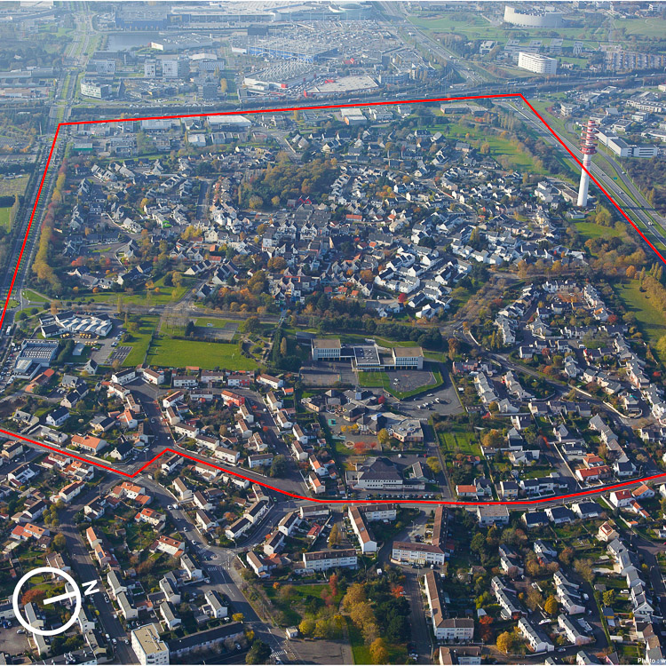
Strategic site 71.1 ha - Project site 17.8 ha
Site proposed by City of Saint-Herblain and Nantes Métropole
Owner(s) of the site Saint-Herblain Municipality, Nantes Métropole, social housing investors
Commission after competition Urban design project, urban project management, redesign of public spaces ; architectural project management will be certainly introduce with social housing investors associated
More Information
How can the site contribute to the adaptable city?
Located 5 km west of the city of Nantes, the Preux district is at the centre of an urban sector currently under strong land pressure, the focus of several projects managed by Saint-Herblain Municipality and Nantes Métropole. Although linked to Tramline 1 and ringed with structural roads, the site remains shut in on itself. Designed to a tight and rigid urban scheme, poorly connected to the peripheral districts and surrounded by detached housing, the Preux district is failing to adapt unaided to the emerging new dynamics.
The goal is therefore to explore the district’s deficiencies and qualities, and to propose a graft strategy of metropolitan adaptability.
City strategy
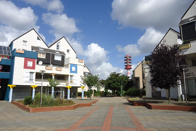
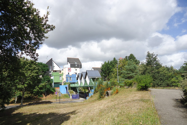
Built between 1979 and 1982 on a garden city model, the district won an international prize in 1984, but is now being overtaken by metropolitanisation. Invisible from the main communication axes, under competition from nearby shopping centres, it has lost most of its businesses and shops. Despite an attractive living environment, the neighbourhood is gradually closing in on itself and is beginning to decline. Saint-Herblain Municipality and Nantes Métropole are therefore now looking for innovative project strategies based around:
- connecting Preux with the surrounding districts and the new public transport systems,
- regenerating a neighbourhood through innovative and high-quality living conditions.
Site definition
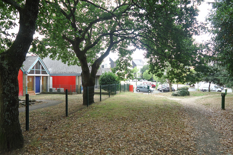
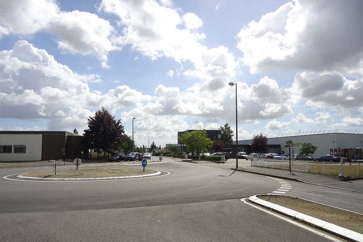
Located at the intersection of several urban fragments, the project site constitutes a strategic area for the restructuring of the district. It encompasses Place de Preux, a former focal point that has now lost its shops and activities, and a complex of detached houses and apartments within an inward-facing urban layout. To the west, it backs onto the Preux Business Zone (Z.A.). To the east, it is bounded by the back of the Crémetterie district which has several significant local amenities. In the centre, Rue Pablo Neruda forms a north-south axis where the land is under municipal ownership. Ultimately, this street will connect the future la Baule (north) and Allende (south) Designated Development Zones (ZAC), which will accommodate housing, offices and amenities along two major east-west urban roads
Adaptability : main elements to take into account
Reflecting the aspiration of the designers of the Preux district in the 1970s, the goal will be to devise a new urban and architectural concept in tune with metropolitan lifestyles, whilst exploiting the site’s intrinsic qualities and harmonising with recently completed or planned urban operations.
This will mean, for example, exploring the urban framework with respect to travel modes and interdistrict relations.
It will also mean devising new relations between housing and work: what to do with currently empty premises (shops, workshops, etc.), how to adapt the Preux Business Zone and reconcile, even integrate, it with small business activity in order to avoid the creation of superspecialised urban archipelagos? Submissions will also need to explore the future of the district’s declining central square.
Teams will also be invited to explore evolutionary scenarios for the district: how to adapt it to energy priorities (energy inefficient housing), social priorities (a population that is ageing or with reduced mobility), how to accommodate new inhabitants (densification of three plots, BIMBY type strategies, changes to the fabric…), how to implement building processes that are themselves adaptable, flexible, and even reversible? Etc.
While Saint-Herblain municipality and Nantes Métropole are seeking forward-looking ideas on the future of Preux, these will nevertheless need to take the form of processes and scenarios that are themselves adaptable to ongoing and future urban dynamics.
Questions on the site
Le site de Saint Herblain comprend de l'existant : le dossier complet sur le site comprend-il les plans intérieurs des bâtiments ?
The documents do not include the interior plans. Partial existing plans have been loaded to the server. Additional informations regarding housing types are also on line.
Serait-il possible d'avoir la topographie et la végétation du site au format dxf/dwg ?
see new document with greens areas and topography online
Serait possible d'obtenir les courbes de niveaux en dwg ?
See new document with greens areas and topography online
Serait-il possible d'avoir d'avoir un fichier (dwg) avec les niveaux NGF du site ?
complete document on line
Est-il possible d'avoir un plan topographique inforamtisé (dwg, dxf) avec des points de niveaux du site ?
document online
Pouvez-vous nous fournir les documents suivants ? - Livre (PDF): Preux : quartier et architecture ou « de la conception à l’usage », Martine Lanoe-Corbin, Joëlle Deniot, Université de Nantes, Département de Sociologie, Mémoire de maîtrise de sociologie, Nantes, 1989.
- Livre (PDF): Projet de quartiers, Architecture et construction, Ministère de l’urbanisme du logement et des transports, Paris, 1985.
- Le PDU de l’agglomération de Nantes avec la carte du projet des circulations douces dont une carte précise des voies cyclables existantes et en projet
- Des documents concernant le Cours Hermeland : son schéma directeur et une carte plus précise (limite et parcours), son plan de gestion (gestion végétale et hydraulique)
- Une carte des réseaux humides de Saint-Herblain (des cours d’eaux invisibles ou disparus)
- La carte du chauffage urbain
- Les programmes des ZAC Allende et de la Baule.
- Les plans et coupes de l’opération du Boulevard de la Baule exposés lors de la présentation du 18 avril 2013 dans la salle Pablo Neruda. Les plans et coupes de l’opération Allende.
- Les courbes de niveau de notre site et de ses abords en dwg ou dxf.
on line :
topographic map, zac de la Baule ( maps, sections), urban heating map , Nantes Metropole transport and pedestrians + bykes itinaries planification on NM website,
see news documents on sitefolders
also,
you can buy or ask for in librarys :
- Livre (PDF): Preux : quartier et architecture ou « de la conception à l’usage », Martine Lanoe-Corbin, Joëlle Deniot, Université de Nantes, Département de Sociologie, Mémoire de maîtrise de sociologie, Nantes, 1989.
- Livre (PDF): Projet de quartiers, Architecture et construction, Ministère de l’urbanisme du logement et des transports, Paris, 1985.
Peut-on avoir sur ce site un fichier dwg avec les cotes altimetriques ?
A new document have been put on line
Sur le compte rendu de la visite du site il est question de trois documents joints au .pdf. (deux .ppt et un .jpg). Je ne trouve pas ces documents, y'a-il une adresse à laquelle il seraient disponibles ?
visit report is online, with only two associated documents
Pourrions nous avoir les informations suivantes : nombre de logements dans chaque parcelle (essentiellement dans les logements intermédiaires et collectifs) ; les plans de RDC et d'étage des logements collectifs et intermédiaires ; savoir dans quels bâtiments il manque des ascenseurs.
Addtional partial plans and documents regarding housing types (per lessor) have been put on line
Quels sont les marges de manoeuvre vis-à-vis du garage renault et de la carrosserie minguet sur le boulevard Allende ?
The city of saint-herblain has no particulars contacts , and the candidats ca make propositions about transformations and evolutions of this area, according with the main proposition ; after the competition, the city will take contact , in partnership with nantes Metropole with owners and workers on the site.
Est-il possible d'avoir les documents initiaux (plans, intentions, ...) du projet du quartier de Preux, ainsi que ceux du projet de la zone commerciale Atlantis ?
no more informations
Peut-on obtenir les différents règlements relatifs aux espaces communs/publics (communaux, résidence, copropriété...) en vigueur ?
no special information
Pouvez-vous nous fournir le dwg duquel est tiré le fichier "SAINTHERBLAIN-FR-SS-M02.pdf" comprenant l’ensemble du réseau viaire (rues, trottoirs …), l’ensemble du bâtit, les courbes de niveau, etc.
documents available in site folder
Quel était l’usage du la petite structure maçonnée présente dans le parc logeant la rue Jean Jaurès à l’entrée sud est du quarter ? (un puits, un four… ?)
no special information about this heritage
This site is connected to the following theme
Dynamic urban platforms Revitalising currently unattractive public spaces needs consideration on a broader scale than the immediate site environment. Even if these spaces are sometimes small in scale, they are strategic levers for activation on an urban level. Their impact in terms of identity and image often exceeds their physical limits and calls for a wider transformation of the existing fabric. Blind spots that have never had adequate use, or places whose initial functions are now obsolete or out of sync with the requirements of the inhabitants, can serve as platforms for activation and appropriation to mobilize the local population or a broader public. The development or redevelopment of these areas can be approached in many ways: in the form of refreshment by multifunctional spaces, with temporary or extendable structures acting as acupunctures, or as a trial balloon to put a site on the map, initiate private co-financing or investment and find new rhythms of intensity.
Specific documents
Questions on the site
You have to be connected –and therefore registered– to be able to ask a question.
Fr. 16 May 2025
Deadline for submitting questions
Fr. 30 May 2025
Deadline for answers
Before submitting a question, make sure it does not already appear in the FAQ.
Please ask questions on sites in the Sites section.
Please ask questions on rules in the Rules section.
If your question does not receive any answer in 10 days, check the FAQ to make sure the answer does not appear under another label or email the secretariat concerned by the question (national secretariat for the sites, European secretariat for the rules).