Seraing
The Synthetic Site Folder and Site Brief are available for free.
Please register and login to access the Complete Site Folder.
- Synthetic site folder EN | FR
- Site on Google Maps
- Back to map
Data

Category Urban
Team representative Architect
Location Seraing 50°36’54" N +5°’30’32" E
Population Seraing 64,449 inhab. (on 3548 ha) - Sérésienne Valley: 15,500 inhab (on 800 ha)
Strategic site ± 10 ha - Project site ± 3 ha
Site proposed by Eriges, Spi, Arcelor Mittal
Owner of the site SPI et Arcelor Mittal
Commission after competition Urban project management role, project management of an architectural program
More Information
How can the site contribute to the adaptable city?
After a first announce of the closure of the hot iron and steel industry, the town of Seraing decides to develop a masterplan on ± 800 ha of the territories of the Meuse valley in order to transform its industrial moribund city image into a sustainable and smiling city.
This by essentially creating, as key elements, a new entrance to the city and an urban boulevard witch will facilitate the east-west crossings and to resolve mobility problems. The site of project of 3 Ha is situated between this boulevard and an important part of the old industrial zone. The aim is to arrange there a housing park with quality housing in a green environment, offices and proximity shops. The site will have to be thought in relation with its neighbourhood also being the subject of urbanization in relationship with the masterplan.
City strategy
The city of Seraing has launched out for several years into a real policy of urban requalification and sustainable development. Many forces were released in favor of the refitting of the Seresien valley and several projects are raised from it. The development of a new masterplan, the creation of an autonomous communal management (Eriges RCA) and the restoration of private and public buildings are on the way. The installations envisaged by the new masterplan are currently already in phase of implementation: the requalification of the entrance of the city by the widening of the Cockerill street, an old physical border between the town centre and the industrial territories and by the construction of a new administrative City…
Site definition
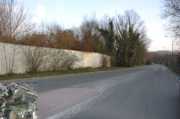
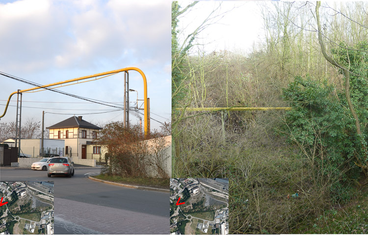
The project site forms the west part of the reflection site, in a currently quite hybrid area. It located in the south of a railway, only East-West connection, having phased out its traveler function on behalf of the industrial function. The path of future urban boulevard will serve habitat and small businesses zones by being the only major east-west link for automobile traffic and public transport. The site of project is situated at the opening of the Lize stream valley wich is partially buried. It is enclosed between a roundabout of the new boulevard, the Hospital street and the Dollet street. The site, wich presents nowadays an thankless topography, will be surrounded by a place established on the boulevard, a SME zone on the right and a private allotment of private housings in the south.No other construction is currently located on the site except for an industrial building to the North and the presence of a storm water basin and an air gas line.
Adaptability : main elements to take into account
> New mobility
The site will be led by the urban boulevard and the Hospital street on one side and by little internal streets to the site. These serve only to distribute the housing wich are not accessible from the main streets. The cars can’t be parked into the site in order to privilege modes of soft travels within the site and to keep the “country” character of the site.
> New ways of life
The site of reflexion is composed of a mixed program including SME, offices and residences. The links between inhabitants, tradesmen and workers will be reinforced within the same zone. A social cohesion is required by binding the various districts. Multifamily and mixed housings are envisaged on the site of project.
> New sustainable development
The development of Seraing is registered in a policy of “low carbon”. This operation, financed by the federal Policy of the “Big cities”, gathers companies in bunches in order to improve their synergy in an innovating manner. The refitting of each zone of the masterplan is thus registered in this environmental logic. The site of project wants to have an environmental high-quality with low energy architecture, the creation of trade of proximity, the maximum abolition of the cars within the site…

Questions on the site
Are the limitations of the project site (yellow lines) fixed or can we choose another place within the strategic site (red lines)?
The limitation of the project site are fixed as the landowner of this part is the person who will pay for and implement the future housing constructions that are the essential subjects of this competition.
Sur la légende du plan "SERAING_BE_PS_M4", les puits de mines sont-ils les ronds verts foncés ou les carrés vert clair ?
Ce sont les ronds vert foncés. Il arrive couramment que les autorités administratives acceptent de réduire le rayon inconstructible de 25m à 5m pour autant qu'une étude d'ingénieur apportent des justifications techniques suffisantes. Pour le concours, nous retiendrons cette hypothèse favorable.
Can we visit the site outside of the programmed visit?
Yes, but practical questions will certainly be asked on site, particularly regarding its configuration.
What is the exact limitation of the project site?
The exact limitation is the one on the following documents: "SERAING-be-PS-M1" and "SERAING-be-SS-M1" (yellow limitations).
Dans le cadre de l'étude, est-il possible de récupérer un plan informatisé de la zone ?
Réponse à venir
SERAING_BE_PS_M4: if the dark green dots indicate mine shafts, what are those yellowish squares ? Do you also have any technical/historical data available about the mine shafts, how were they closed or constructed?
The yellowish squares are situated outside the Europan site.
Are the railways ending in the strategic site, next to the project site boundary, currently used ? If yes, for which scope ? Could they be encompassed in the project ?
The railways next to the strategic site, frequently used in the past, will be no more industrially used because of the ending of the steel activities. But it may be used for public transport in a few years.
Doit-on préserver les bâtiments industriels situés dans la partie nord du "strategic site"? Dans le master plan il ne semble pas être préservé.
Etant donné qu'ils se situent dans la partie "stratégique", on peut comprendre qu'un projet à moyen-long terme envisage le remplacement de ces bâtiments.
Est-ce qu'il existe un périmètre de non-constructibilité autour de la ligne à haute tension ?
Non
Qu'implique la dépollution de ces sols: devront-ils être déblayés, traités puis remis sur place avant la construction de logement? Sur quelle épaisseur de terrain ?
Une étude sur le sujet sera réalisée en préparation de la phase de réalisation.
L'ébauche indicative sur le site de projet qui se trouve dans le document "analyse détaillée du contexte territorial et urbain" montre une implantation de futures voiries et de la future place qui ne correspond pas au masterplan. Quel est le schéma à suivre et quelle est l'implantation de la place ?
Le Boulevard Urbain suivra assez fidèlement la trajectoire prévue au Master plan. Le principal rond point (existant actuellement) se trouve d'ailleurs représenté sur l'ébauche indicative à son emplacement actuel. Les autres voiries et des espaces publics complémentaires peuvent être proposés dans le projet.
Par raport au petit ruisseau de la Lize, le fait de le canaliser présente-t-il des limites à la construction ?
A priori non.
Est que le terrain a déjà été décontaminé ? Est-il possible de le cultiver ?
Au stade actuel, le terrain n'est pas encore décontaminé. La suite du projet devrait prévoir les mesures à prendre afin de le rendre compatible avec une utilisation urbaine.
Les sites de la déchetterie et de la cockerie resteront-ils de propriété privée une fois terminé leur activité ?
Ce site devrait être en activité jusqu'au moins 2022, date à laquelle leur licence d'exploitation se terminera... Il est difficile de prévoir l'avenir. Mais les autorités feront sans doute tout pour que ces ativités ne se poursuivnet pas.
Peut-on avoir un plan informatisé avec le cours des ruisseaux ?
Non. Si vous le souhaitez, vous pouvez travailler en consiudérant le site comme plat.
This site is connected to the following theme
In-Between Time Adaptability is about processes that offer creative possibilities for a project to incorporate uncertainty, lack of funding, the unknown future role of the competition site, or even long-term territorial transformations that affect the site.
So how can the “waiting period” before implementing a project be structured in such a way as to facilitate multiple scenarios, to involve numerous stakeholders, ultimately to allow changes to the initial vision? The intelligence of a project can depend on different processes that arise out of the dynamics of the site context. In other words, given time, a project can, so to speak, grow organically out of the site.
Questions on the site
You have to be connected –and therefore registered– to be able to ask a question.
Fr. 16 May 2025
Deadline for submitting questions
Fr. 30 May 2025
Deadline for answers
Before submitting a question, make sure it does not already appear in the FAQ.
Please ask questions on sites in the Sites section.
Please ask questions on rules in the Rules section.
If your question does not receive any answer in 10 days, check the FAQ to make sure the answer does not appear under another label or email the secretariat concerned by the question (national secretariat for the sites, European secretariat for the rules).