Vichy Val d'Allier
The Synthetic Site Folder and Site Brief are available for free.
Please register and login to access the Complete Site Folder.
- Synthetic site folder EN | FR
- Site on Google Maps
- Back to map
Data
Category Urban - architectural
Team representative architect - urban planner - landscaper
Location Bellerive-sur-Allier, Charmeil
Population Conurbation 80,000 inhab.
Strategic site 400 ha - Project site 128 ha
Site proposed by Vichy Val d’Allier Intermunicipal District
Owner(s) of the site Manurhin Defense – GIAT Industries
Commission after competition Urban and landscape strategy study, feasibility studies for the first operational areas (depending on the orientations of the selected projects), foreshadowing of a permanent or temporary reception centre, relating to public access. Urban and landscape strategy management and architectural project management to be introduce with partners
More Information
How can the site contribute to the adaptable city?
The site combines the problems of recovering an industrial site, of adapting this site to new economic activities and of transforming an area that has long been closed to local people. The dimensions of the project site (more than 100 ha) require the development of a transformation strategy that is flexible in its process, modular in its use of space and adaptable over time, able to adjust to different implementation timeframes. These dimensions call for urban and landscape choices that can maintain a certain autonomy between different parts of the site in terms of access and programming. The adaptation and reuse of a notable industrial workshop will be an opportunity to test the architectural possibilities offered by this building and the types of activities and uses it can accommodate in the short or long term.
Vichy val d’allier strategy
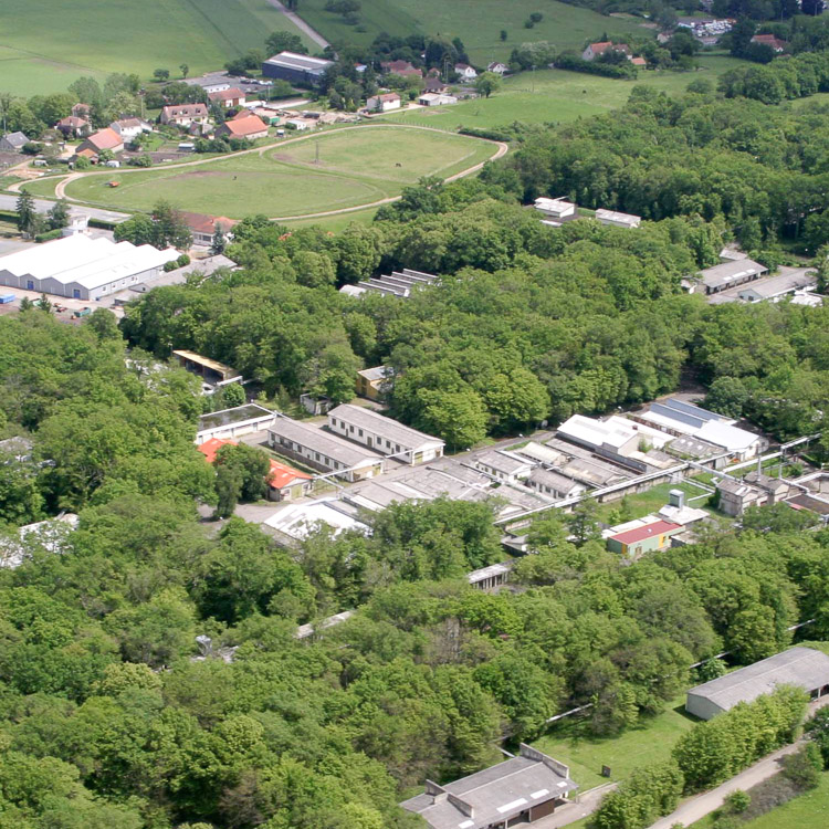
The Vichy Val d’Allier conurbation combines economic activities linked to well-being, relaxation and leisure, with dynamic industrial activities : cosmetics, agri-food, biomedical, electronics and engineering. The Montpertuis Palazol site was occupied from 1937 by the firm Manurhin Défense, a subsidiary of GIAT industries, specialising in the manufacture of arms and munitions. Closed in 2006, the site is currently undergoing explosives safety work which will be completed in 2015. Recovering the site is a major priority for the town’s economic development at the heart of the Clermont-Ferrand Riom Vichy metropolitan region. VVA wishes to reopen an attractive zone on the town’s left bank to the population and to introduce new uses, in an area where road access is set to improve.
Site definition
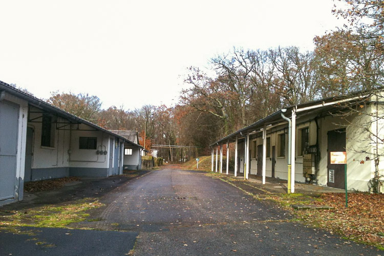
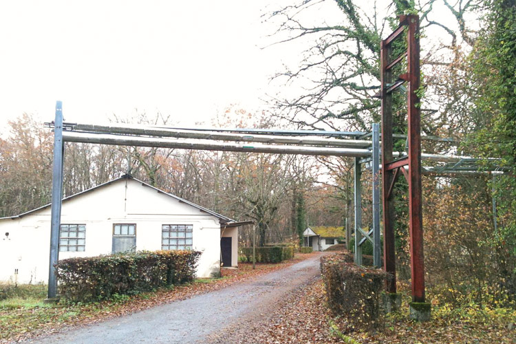
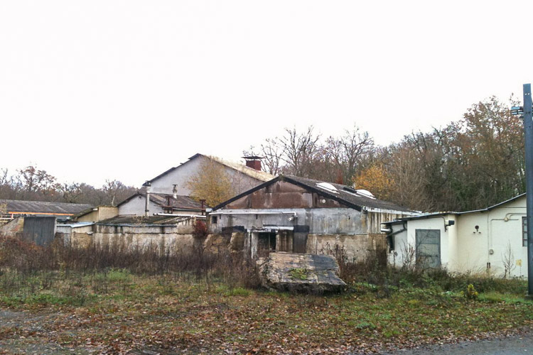
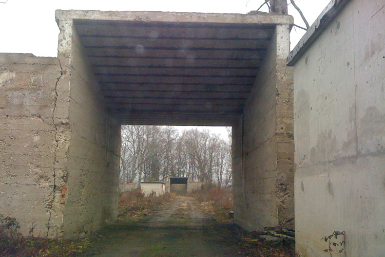
Five minutes from Vichy town centre and near an open-air sports complex, the project site (128 ha) is part of a SEVESO II classified protected zone (400 ha - strategic site). Because of the dangerous nature of the former industry, the prohibition on building in this area has restricted urbanisation to the left bank of the Allier. The explosives safety measures currently underway include excavation work to neutralise the traces of explosives present in numerous places. The site contains 160 buildings constructed at different times. Most of them are set for demolition, since they have little potential for conversion and will be expensive to refurbish. This slightly undulating plateau stands within an entirely wooded environment, overlooking the Allier Valley. It occupies a place in the communal memory of the residents and the people who worked there over the years.
Adaptability : main elements to take into account
Adaptability of the existing fabric: consider the building and landscape legacy of an industrial site that has been closed to the population and protected for security reasons for more than 70 years.
Adaptability of an unusual landscape: devise a transformation that reconciles reoccupation with an attention to nature, the river and vegetation.
Economic adaptability: find a flexible method of development that can adapt to the needs of different economic actors.
Programmatic adaptability: define a strategy of conversion and an evolving process that can adapt to several types of use in space and over time.
Adaptability to new uses: consider how the area will be opened up to the population and accommodate new uses, compatible with the site’s economic and industrial character.
Vichy Val d’Allier’s objective is to maintain the site’s productive and economic role, by adapting it to new activities. The remit is to devise a new-generation industrial campus that mixes different types of economic entities (from 200 to 10,000 m²) and several types of programme, including specific housing and services generated by the activities themselves. At present, these activities cannot be fully identified, hence the need to design a gradual and adaptable process of conversion. Finally, the opening up of the site to the population and to the town is an opportunity to think about the future of the left bank in relation to local and metropolitan dynamics, in relation to its urban and landscape components, in particular by protecting areas that are currently not urbanised.
Questions on the site
Could we get DWG more complete plans ?
No, unfortunately.
Can you give us more informations about the north-west bypass (number of lanes, type and design of interchanges) ?
No more details than described in the complete site folder.
Could we give us more informations about the natural aera near the river ? Especially if projects are planned ?
It's a flood plain wich wil remain natural. VVA is not currently planning any kind of development on this site.
Bonjour, concernant le document des zones déjà déboisées (doc. VICHY-FR-PS-M25): 1) nous n'avons pas remarqué de différences par rapport aux boisements présents sur la photo aérienne fournie (VICHY-FR-SS-AP01), faite exception pour la partie nord du site Montpertuis. Pouvez-nous nous le confirmer? 2) y-a-t'il ou bien y-aura-t'il d'autres zones déboisées une fois la dépollution terminée? Pourriez-vous nous donner une carte répertoriant l'ensemble de zones déboisées à terme? Merci !
no more information
Bonjour, pourriez-vous nous fournir des études du trafic sur les infrastructures routière en proximité du site de réflexion (notamment sur la D6)? Merci!
not available
Une zone à l'intérieur du périmètre d'étude apparaît sur l'un des derniers documents chargés sur le site internet Europan "VICHY-FR-PS-M25" alors qu'il n'était pas présent jusque là : doit-on sortir ce périmètre du projet ?
no modification
Bonjour, pouvez-vous nous fournier un dossier photo plus détaillés sur le tunnel de tir? merci
all pictures availables on site folder
This site is connected to the following theme
Ecorhythms The contemporary city aims to anticipate the future and adapt to its unpredictable changes. Various strategies are currently being developed to achieve a creative resilience, in other words adapt to a changing environment. Working on Ecorhythms means basing urban development on a strong synergy between urban and natural environments in order to break with a principle of opposition that has separated city dwellers from natural realities and gradually undermined those realities.
This separation between the city-dweller and nature is not only spatial, but also temporal. Indeed, a landscape is not a pretty image but a living environment governed by cycles (seasons, day and night, tides, climate variations, flora and fauna) forces of growth, fast and slow movement, migration and transhumance, etc.
In contrast with modernist town planning, which reinforced a division between urban rhythms and nature, the remit – through the strong presence of landscape on the sites – is to encourage the introduction of operational processes based on the maintenance or regeneration of these Ecorhythms.
Specific documents
Questions on the site
You have to be connected –and therefore registered– to be able to ask a question.
Fr. 16 May 2025
Deadline for submitting questions
Fr. 30 May 2025
Deadline for answers
Before submitting a question, make sure it does not already appear in the FAQ.
Please ask questions on sites in the Sites section.
Please ask questions on rules in the Rules section.
If your question does not receive any answer in 10 days, check the FAQ to make sure the answer does not appear under another label or email the secretariat concerned by the question (national secretariat for the sites, European secretariat for the rules).