Genève
The Synthetic Site Folder and Site Brief are available for free.
Please register and login to access the Complete Site Folder.
- Synthetic site folder DE | EN | FR
- Site on Google Maps
- Back to map
Data
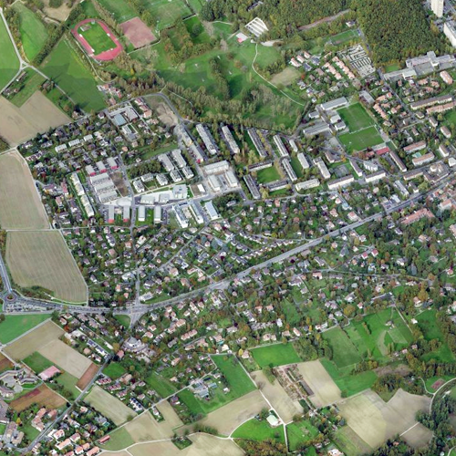
Category Urban - architectural
Location Onex - Bernex - Confignon, Switzerland
Population 1,240 inhab.
Strategic site Territory of the Onex, Bernex and Confignon Municipalities - Project site 54.8 ha
Site proposed by Republic and Canton de Geneva
Owner(s) of the site Private owners and State of Geneva
Commision after competition Mandate to study and assist the transformation process of the suburban single dwelling area
Team representative architect - urban planner - landscape architect
More Information
How can the site contribute to the adaptable city?
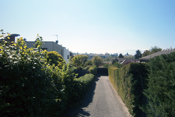
The proposed site is part of a suburban fabric made of “villas”. In the late fifties, increasing the density in that type of urban environment became a strategy that contributed to densify substantially the number of housing units in the Geneva territory.
First, large expanses of free land were used to develop quality neighborhoods. In recent times, densification had to be carried out on plots of land that were smaller and already built, based on a development procedure favoring the replacement of villas by land reorganization and the construction of collective housing. However, many villas are still inhabited by their owners who are afraid that housing developments will threaten their home-owner lifestyle, their social ties or their moving and shopping habits.
Another blocking factor comes from the use of complex planning tools, which create significant constraints, particularly in terms of land-price control or minimum density.
This led to a patchwork of small development projects, based on land acquisition opportunities, without any overall urban project or coordinated land-use strategy.
Therefore, the objective is to suggest a transformation of the suburban fabric based on a method that could better reflect the aspirations and interests of the existing stakeholders, while promoting a rapid emergence of new densely populated neighborhoods (land-use index 1.2 minimum).
The transformation should breed social and morphological diversity structured around public spaces and facilities, in order to create a vibrant and high quality urban life.
City strategy
In the proposed site, the State of Geneva wants to test a new type of territory planning, less centralized and more flexible, with the aim of making the whole territory planning process and housing production more efficient. Used as the guideline to a progressive urban transformation, the project will help define new operating procedures, while revisiting the role of the stakeholders or the approval process by local authorities. However, for urban density issues and public access to open green areas we expect results similar to those obtained with the use of existing tools.
Site definition
The site involves three suburban municipalities, whose links to the heart of the metropolitan area were recently strengthened with the opening of a tramway line. The area is also very well connected to the road and motorway networks. There are a few dead ends which is not unusual in a suburban environment. Soft mobility will not be easy to implement throughout the site considering the break created by Chancy road, one of the main thoroughfares of the urban area.
Even if the site is located far away from the centers and public facilities of the Confignon and Bernex villages and loosely connected to the neighboring town of Cressy, it will be close to the future Bernex north neighborhood with the creation of a new downtown area and a future agro- urban park.
Future of the site in relation to the site family and to Adaptability
Some small parts of the site have already been the object of a progressive densification, resulting in a significant fragmentation of the land plots, the construction of non-detached homes and the development of social heterogeneity. Large estates with few buildings – legacy of ancient large agricultural properties – are still present, especially south of Chancy road.
The site morphological and social diversity must be used as the basis of the transformation process considered. The challenge consists in reconciling social realities with densification and land use constraints.
The project will have to deal with a lack of open spaces, public facilities and an absence of diversity. De-compartmentalization and a better accessibility of the site will be needed as well. That means upgrading the road network and improving the connections with soft mobility networks, particularly with public transport stops and communal centers. Parking issues will be treated in sync with the successive development stages, but they must minimize soil sealing and the use of the land surface.
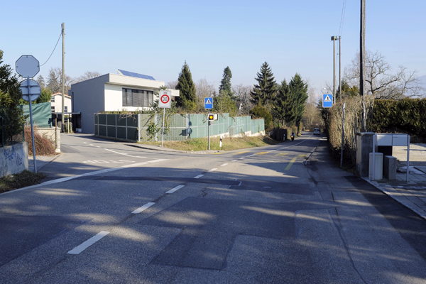
Emphasizing existing green structures and a selective preservation of existing trees will contribute to the future identity of the neighborhood. The existing greenery and plants are very representative of current residential areas, with a strong presence of mixed hedges and a wide range of plant species. However, some wooded hedges - a legacy from the past - can still be seen on the southern slope, close to the agricultural area.
Questions on the site
Can you provide the following demographic information: Number and composition of households insite + Breakdown of the site inhabitants by age group?
Data on households and household members is available only at the canton (township) level. That information is available in the OCSTAT website: Households / Population and households / Survey of the households in the Geneva Canton (township), 2011 results.
No, we can’t provide any information on the number of inhabitants by age group.
May you please share all external web documents referred to as http links in the pdf brief? Wirh 2 exceptions (Bernex, Cherpines), all links were unaccessible or timed out.
The link with the Website of the Swiss Confederation appears to ask for an authentication. You just have to click on “Ok” and you will have access to the site.
May you please share complete zoning constrains and documents for the site, including setbacks? What are parameters of zone 5 villas?
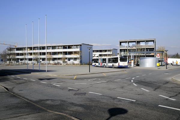
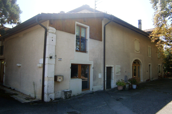
May you please indicate on a map where the site images are taken from?
The street name or location where the photo was taken are written on the photo.
Do you have a socio-demographic analysis of the project site? Do you know the employment structure of the site?
1,194 people were living in the considered perimeter as of December 31, 2014. Breakdown of the population by age group:
- 0 to 19 years old: 285 people
- 20 to 64 years old: 610 people
- 65 years old and over: 299 people
For a list of addresse without inhabitant, please refer to FTP, folder "0-New_docs_after_launch", document GENEVE-CH-SS-M15.PDF.
Do you have a real estate market survey: property turnover, prices, etc ? Are there many real estate transactions, etc.?
You will find statistics and more information in the website of the Republic and Canton of Geneva.
On the scale of the Canton of Geneva, what are the consequences of the tight real estate market ? More to the point, what are the families that do not have access to adequate housing? What are also the families’ expectations in terms of housing? How are the land use indexes calculated?
You will find several online publications from Swiss firms, companies or institutions on their website, such as Wüest & Partner, Crédit suisse, etc. You can also check the website of the “Office du Logement” (Housing Department).
What are the rules for calculating the land use indexes?
For the land use index calculation, please check Article 2A, subparagraph 4 LGZD.
The project brief defines a minimum density index of 1,2 to achieve, but is there a maximum?
No.
How has the desired density of inhabitants / jobs per hectare been calculated? The project brief mentions a desired density between 100 and 200.
It’s a data provided in the specifications and the following must be taken into account: the ratio 100 by 200 for 1 hectare relates to the ratio of 1 inhabitant for 2 jobs.
Which are the current density indexes allowed in the "villa area" for plots under 5,000 sqm?
The densities for the villa area (5th zone) are set in Article 59 of the LCI.
Which is the year of construction of the buildings of the foyer "Les Ormeaux". Are the buildings in good state and worthwhile keeping?
They were built between 1960 and 1970. The buildings must be preserved.
This site is connected to the following theme
How to integrate vacant sites in urban development? Changes in economy, governance or society can give rise to overwhelming vacant spaces in the urban landscape: entire building complexes waiting for new users, former military zones, leftover green areas... These spaces cannot be taken up in normal/organic urban development as they are far too large and in need of full adaptation. Where should we therefore search for elements to fill the emptiness up and when can we consider it as a value? How can we give sense to vacancy and integrate it in new ways of making the city?
Questions on the site
You have to be connected –and therefore registered– to be able to ask a question.
Fr. 16 May 2025
Deadline for submitting questions
Fr. 30 May 2025
Deadline for answers
Before submitting a question, make sure it does not already appear in the FAQ.
Please ask questions on sites in the Sites section.
Please ask questions on rules in the Rules section.
If your question does not receive any answer in 10 days, check the FAQ to make sure the answer does not appear under another label or email the secretariat concerned by the question (national secretariat for the sites, European secretariat for the rules).