Moulins
The Synthetic Site Folder and Site Brief are available for free.
Please register and login to access the Complete Site Folder.
- Synthetic site folder EN | FR
- Site on Google Maps
- Back to map
Data
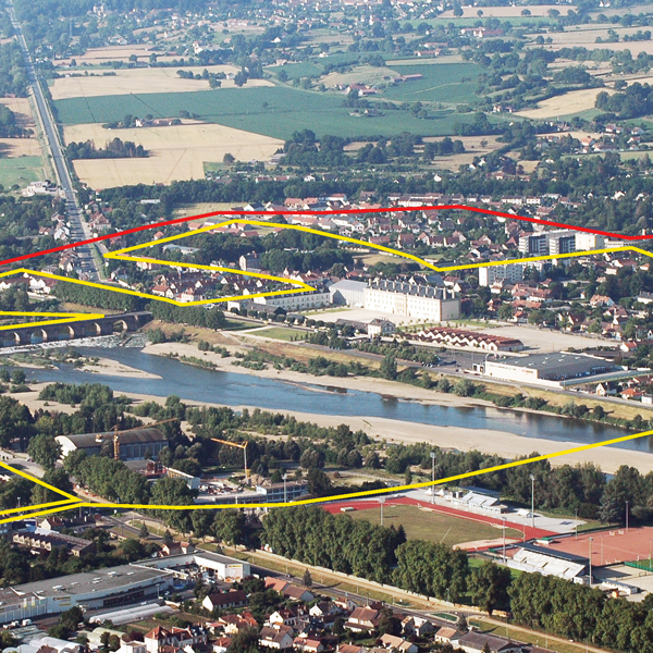
E13-FR-Moulins_Cover
Category Urban - environmental - architectural
Location Moulins - Neuvy (03000)
Population Conurbation (26 municip., 750 sqm) 58,000 inhab. - Moulins 22,667 inhab.
Strategic site 570 ha - Project site 105 ha
Site proposed by Moulins Communauté and the Town of Moulins
Owner(s) of the site Moulins Communauté, Town of Moulins, social landlord
Commision after competition Urban study, urban project management, public space project management, some architectural project management missions could be introduced
Team representative architecte - urban planner - landscaper
More Information
How can the site contribute to the adaptable city?
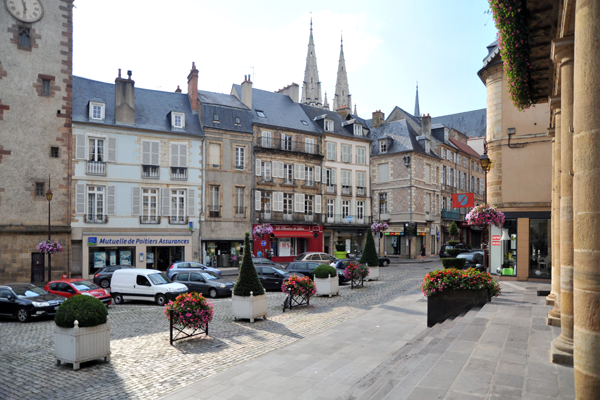
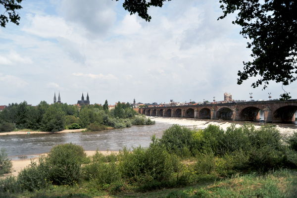
The site is located along the Allier river which flows through the city and connects the heritage past and landscape, full of history, with the whole intermunicipal territory.
The site is experiencing strong urban evolutions owing to the implementation of a new bridge to speed up traffic flows on the current Régemortes bridge, the one and only but dilapidated crossing point between the two banks. Thus, the right bank - holding the heart of the old town - and the left bank – a potential support for new urbanity – will have to find mutual accommodation. In a local context of demographic decline, the perspective of this new crossing infrastructure is in line with an open projects and large-scale approach aimed at linking a stimulating process which supports the emergence of public or private initatives, more localised, imbued by the intervention contexts. Eventually, an urban coherency will have to emerge from the different territories, using the river as their basic feature and the banks to merge them. Thus, the objective is to welcome and allow the appropriation of new places of living, fostering social connections to create a harmonious balance between the two banks. The project can play a pro-active part for all the possible actors only if it is introduced in a dynamic framework for thinking about the new approaches that could be found, regarding the multiple appropriations of the urban space.
City strategy
The City has undertaken policies to requalify the banks of the Allier. Various projects have been carried out, especially on the right bank side in favour of soft mobility. Similarly, a recreational area has been created upstream of the river, related to the urban renewal programme launched in some districts like the « grands ensembles », social housing in Southern Moulins. With the creation of a new bridge over the Allier, there is a will to keep these actions going to make possible the connection between the bridge and networks technology and the landscape enhancement.
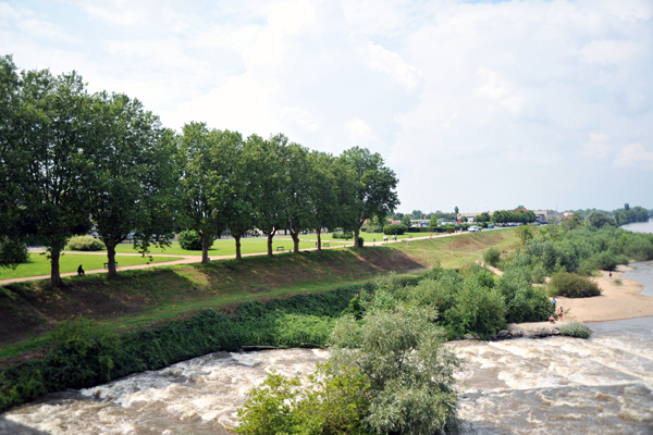
The left bank of the Allier, also called La Madeleine district, has kept a wild aspect. The forecourt of the Centre National du Costume de Scène, a key place for cultural and tourist attractiveness in this entry sector of the city, is naturally extended by a tree-planted wide public space. Heading to the North, the extension of the roads into the depth of the urban or agricultural sectors (it was negociated with a lot of diplomacy) has shown opportunities for a maturation of a contemporary urbanity pending to be studied and implemented.
Moulins Communauté and the City are looking for innovative proposals that could foster a dynamic for a global development on the left bank thanks to a balance which benefits the whole conurbation.
Site definition
The Allier separates the old districts of the City –dense and rich in a remarkable architecture- built on the right bank, from the Madeleine district, urbanised during the 19th and 20th centuries and whose roads are more or less continuously bordered. Despite no articulation zone between natural and urbanised sectors, the river resists to the urban pressure and some of its banks still have a wild aspect. Thanks to its high environmental and ecological qualities, the river was classified as a Natura 2000 site. The banks, beyond the beaches, more or less domesticated or covered by vegetation, have been backfilled in order to dam the river bed and to prevent the city from flooding.
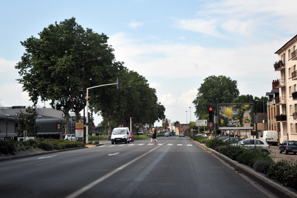
It has already been decided that the future bridge will be located on the extension of the Cours de Bercy, on the right bank. Beyond, a sports complex has been built along the Allier. Despite the development projects that were carried out, the banks are still bearing the stigma of the former National Road 7 which became, in 1996, a bypass for the town. The way the different spaces are organized highlights some issues : the road network, concentrated above the river banks, has encroached some parts of the land over time until the houses ground floors were buried while a backfill was emerging on the other side. The left bank is characterized by heterogeneous suburban buildings around the Régemortes bridge and by the former Villars barrack (registered as historic monument) hosting now the Centre National du Costume de Scène which gives additional value to the bank and that should be enhanced. The landscape is also strongly marked by the commercial equipment overlooking the view over the bank.
Future of the site in relation to the site family and Adaptability
Regarding the change of this sector, teams are invited to work on innovative scenarios that fully integrate nature into city. It is a question of implementing an adaptable gestion of the project to rebalance the territory in a harmonious way and take into account the river - outstanding natural space - and its surrounding landcape, while considering its new crossing and its inherent flood risks.
It also means to adapt to environmental, regulatory and temporary constraints, specific to the territory at the heart of the conurbation (« urbanising » without growth) and to create the conditions for an economic (new or existing activities and sectors) and social (supply of housing, performing and economical services) attractiveness.
These factors of a steady change will generate a leverage effect and influence the whole community territory.
Candidates will also be encouraged to suggest mobility solutions, in continuity with the need of an ecological transition, to focus on a re-appropriation of the city within its social and human dimensions.
Therefore, rhythms and duration of changes, role of the actors, prospective notions of usage, economic considerations are a windfall to program and implement opportunities that could enhance the quality of public space. It will reveal a specific environment in which new connexions will create future crossings. Made of continuities and urban porosity, this environment should be developed and articulated between city and countryside.
Questions on the site
The site plot and the topography (especially the bank) do not appear on the .dwg provided by the site’s folder. Is it possible to transmit those data as they seems essential to the development of the urban project?
Unfortunately we don’t have any other topographic document than those already transmitted.
May we have the review of the official visit from Thursday 26th March?
You will find it on the site webpage.
Is traffic data on the avenue des Soupirs, avenue Orvilliers either side of the bridge and either circulation side, existing? Same thing for the route de Montilly and the route de Clermont as well as for the Cours de Bercy?
It's on line in the 'New docs after launch' file as MOULINS-FR-SS-M06.
May we have a layout plan of new roads which are forecasted on the left bank over the bridge’s end?
Those elements are integrated in the Artélia’s document related to the bridge.
No other road is forecasted.
In the document « Social and cultural geographic context », page 8 relative to the risks of the dikes, it is writing : «no new construction should be planned in a zone 100 meters in width for each meter of the dike's height. ». Do we have to follow this rules ?
It seems delicate to take into account this measure as it becomes then impossible to develop the area.
You shall rely on the current regulation.
Is it possible to get the cadastral plans of the cities around Moulins ? (especially on the left bank)
Unfortunately we don’t have any other topographic document than those already transmitted.
May we have the cadastre digitalized in an Edigeo or shape or tab file? as well as hiking path of the region in a GIS files?
Yes but you will have to assemble the cadastre on your own…
You can consult the local hiking paths network on the website of Moulins Communauté but we will be able to provide GIS data (by the 27th May, late afternoon.)
Is there any planning project currently happening in the unused building of the CNCS? May we have the plan, facades of the CNCS and its annex in DWG file?
There is an extension’s project of the storage area of the CNCS in the former Captain’s housing – L-shape building nearby the current storage area.
The buildings of the CNCS are State property.
For the other buildings no project currently considered.
May we have the plan (eventually the facades if available) of the DDT building which is located on the left banks in continuity with the towpath?
No plan at our disposal
What use of the Iron bridge? Who is its owner?
The Iron bridge is a property of the SNCF. A daily material drives to Meillet’s stone quarry, 30 km away from Moulins. The line is an axe to strengthen, from SNCF point of view and cannot be used for any other matters.
Is a dismantling forecasted on the disused gravel pit nearby the dead arm of the Allier river at the south of the city? If yes, will it be managed by the city or a private actor? What measures will be implemented to limit the consequences of the bed river digging?
No project forecasted – out of the project zone.
This site is connected to the following theme
How to transform physical obstacles into new connections? We understand “bridges” as linear connections between different contexts spanning over a barrier, which may be a river, a railway track or other physical obstacles. But we sometimes can transform the obstacle so that it allows movement in different senses and directions, becoming a connecting element rather than separating barrier. The obstacle may be inhabited, cut or criss-crossed; it can become an opportunity to increase density, change the functions on either side or bring a new perspective to a familiar context.
Specific documents
E13 FR - Lancement : Marne-La-Vallée, Moulins & Saint-Brieuc
Questions on the site
You have to be connected –and therefore registered– to be able to ask a question.
Fr. 16 May 2025
Deadline for submitting questions
Fr. 30 May 2025
Deadline for answers
Before submitting a question, make sure it does not already appear in the FAQ.
Please ask questions on sites in the Sites section.
Please ask questions on rules in the Rules section.
If your question does not receive any answer in 10 days, check the FAQ to make sure the answer does not appear under another label or email the secretariat concerned by the question (national secretariat for the sites, European secretariat for the rules).