Carouge (CH)
The Synthetic Site Folder and Site Brief are available for free.
Please register and login to access the Complete Site Folder.
- Synthetic site folder DE | EN | FR
- Site Brief DE | EN | FR
- Site on Google Maps
- Back to map
Data

Carouge (CH)
Scale M/L urban and landscape
Team representative urbanist, landscape architect, architect / multidisciplinary teams
Location Carouge, Geneva
Population 23,000 inhabitants
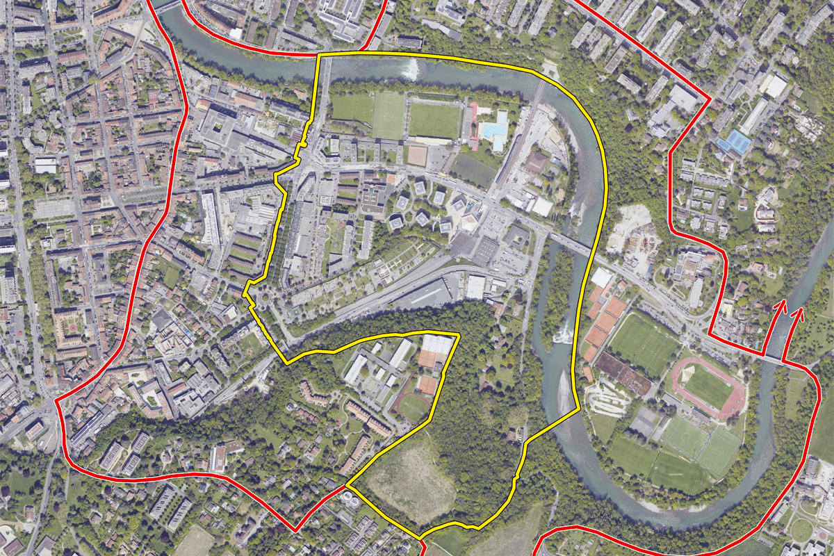
Strategic site 200 ha - Project site 2.7 ha
Site proposed by State of Geneva / City of Carouge
Actors involved State of Geneva / City of Carouge
Owner(s) of the site Mixed: private & public owners
Commission after competition Workshop with winning entries. & urban study to be discussed
More Information
Urban City Strategy
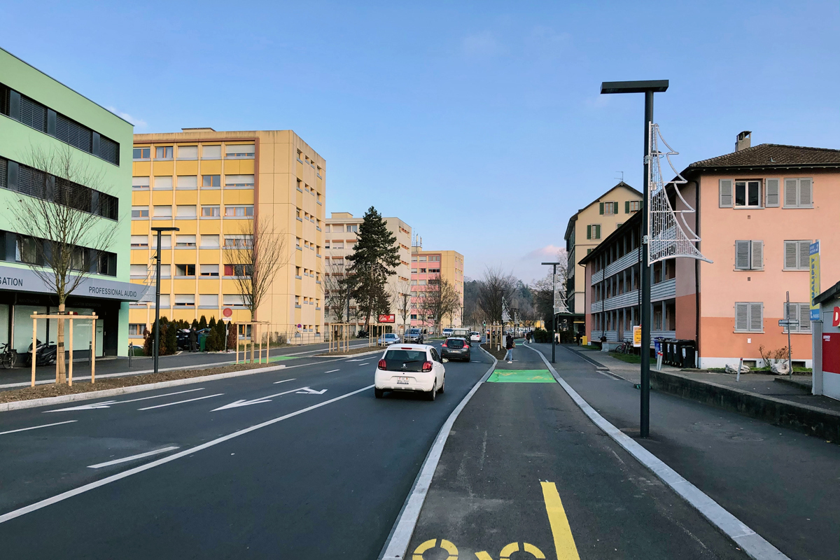
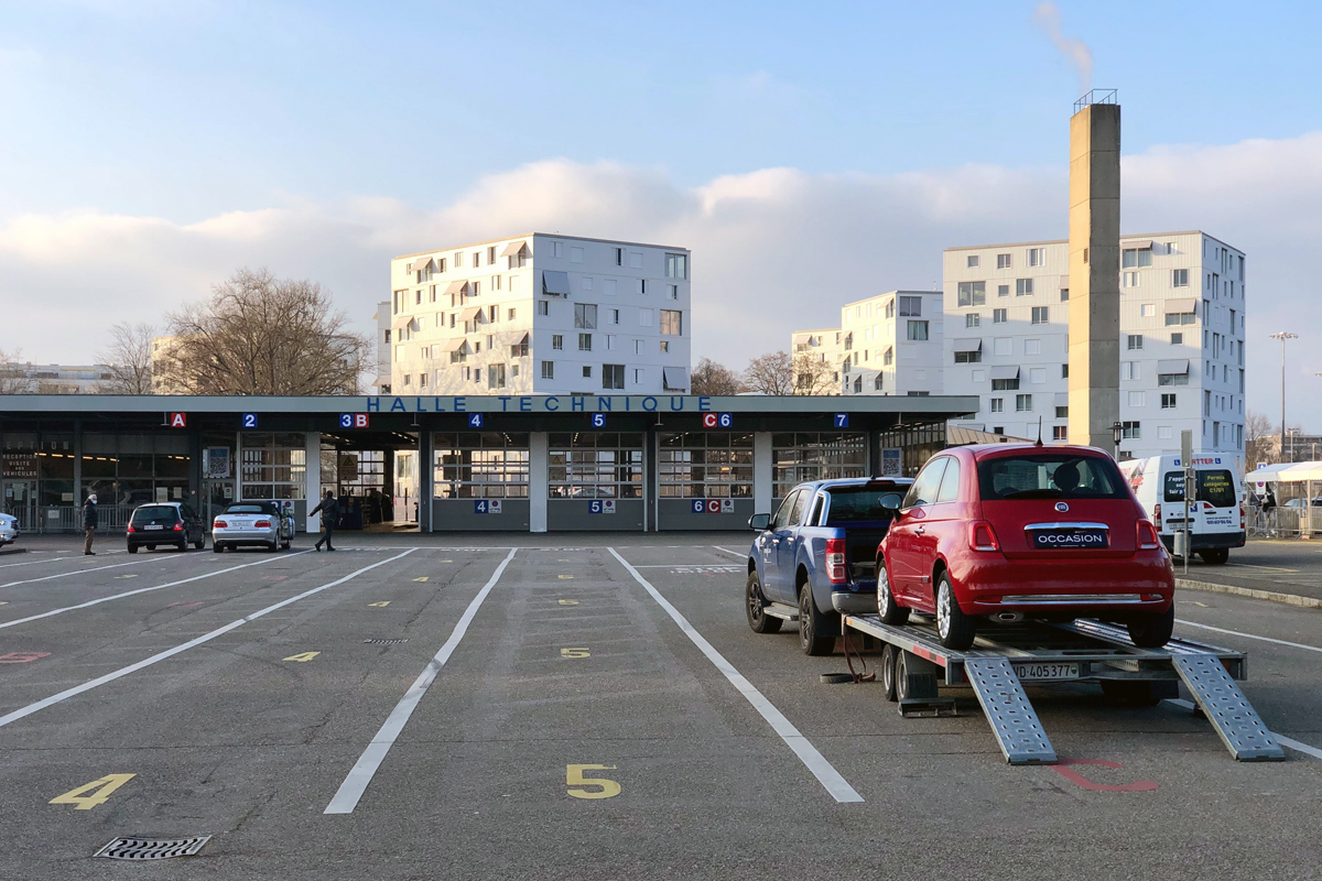
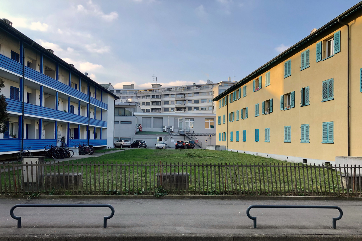
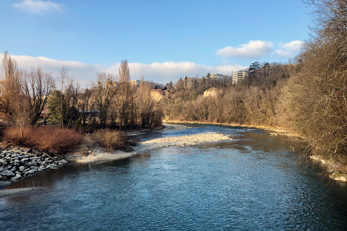
The project area is entirely located within Carouge municipality in the Fontenette sector. It is characterised by a disparate, fragmented and sectoral urban fabric, with no defined centre and no permeability to pedestrians. As a suburban area, it nevertheless plays a major role in connecting the natural and urban fabrics and as a gateway to the dense urban fabric of Carouge and Geneva. Many projects have recently been completed and others are in the study phase. These reflect a dynamic of localised developments where the plans are not framed within any broader vision
Site Definition
Europan 16 is an opportunity to give meaning and identity to this territory. This process needs to be approached with consideration of its different components, which will be maintained, reinforced, attenuated or even removed in order to produce a living piece of city that will contribute to progress towards the Ecological and Solidarity- Based Transition (TES) which has a similar purpose to living cities.
The Fontenette site is characterised by the juxtaposition of entities that lack any overall coherence, producing an area that suffers from a lack of identity and where interactions between the components need to be developed. There is no masterplan currently developed for this site, by contrast with the rest of the municipal area. It is therefore a “void” in terms of planning and its future presents numerous challenges and does not fully take advantage of the presence of nature (the Arve River, green artery, moraine), which could play a major role and form the basis of a new identity and a source of future meaning.
The Municipality and the Urban Planning Office are looking for a global project that combines the urban, landscape and the environment, which could become an example and a model.
How Must Metabolism and Inclusivity Be Developed and Connected?
Priorities and lines of concentration have been defined. These have been prioritised to steer the teams towards desired developments, without entirely excluding other still relevant themes associated with Living Cities and the Ecological and Solidarity-Based Transition (TES). This means that they will have to familiarise themselves with the project site. Their task will be to propose future orientations for change in this inhabited zone and its embedded practices.
Theme 1: Nature as the structuring framework. In this project, it is essential to characterise nature, to give it a meaning, to define ways of highlighting it, to identify its functions and envisage it as a network and the idea of revealing the natural specificities of this area.
Theme 2: Giving the area an identity. Carouge Municipality recently joined the “Conurbation Core” PACA*, revealing a new facet in the identity of the area, now considered to be a component of the core of the conurbation of Geneva. This shift in vision for Carouge further emphasises the importance of rethinking the character of the area. This process is underway in different neighbourhoods in Carouge, but the Fontenette sector is distinctive in that the process of reinventing its identity has yet to begin.
Theme 3: Opening up. Fragmentation, isolation and heterogeneity are obstacles to the creation of links between inhabited milieus (urban, natural) and the beings that live in them (biodiversity and social diversity). The lack of social engagement in this area also reveals the absence of social and urban cohesion. There is a real issue of multiple kinds of opening in this zone: opening between neighbourhoods, opening onto nature, opening between people, opening to the rest of the territory.

Questions on the site
Are there any specific rules about the material that needs to appear in the panels apart from the ones that are described in EUROPAN 16 submission rules? For example: specific scales for the plans, maximum number of images, need for a compulsory axonometric drawing or areal image of the proposal and it's surroundings, etc.
E16 Carouge-Fontenette: recommendations for project submission.
The participants are expected to provide concrete urban responses for the entire study area. The documents presented must allow the jury to clearly evaluate the projects through an intelligible graphic rendering composed mainly of the following information
1. Main documents:
- An overall axonometry (isometry) or partial axonometry of the project according to the theme(s) addressed by the competitors - Ideally on the first panel / scale to be adapted to A1 format
- A plan of the exterior design and spatial organisation of the site or partial plan(s) according to the theme(s) addressed by the competitors - Ideally on the 2nd panel / scale to be adapted to A1 format
- An overall illustration or partial illustrations showing the desired atmosphere of the neighbourhood (free format: image, sketch, photo of a model, photo-montage, etc.) - Ideally on the 3rd panel / scale to be adapted to A1 format
2. Auxiliary documents : (free layout and scale)
- Diagram of existing / modified / planned natural resources. (Vegetation, trees, green areas, water integration, etc.). Ideally with identification of permeable and impermeable surfaces. Linked to theme 1 - Structuring nature p. 8 of the brief.
- Diagrams of outdoor spaces with identification of uses (squares, plazas, playgrounds, sports, relaxation, activities, leisure, etc.). In relation to theme 2 - Give the district an identity p. 8 of the specifications.
- Existing/modified/projected soft (pedestrian, cycle, etc.) and motorised (vehicles, public transport, services, etc.) mobility schemes. In relation to theme 3 - Decompartmentalise p. 9 of the brief.
- Diagram of the building fabric with identification of the buildings retained / demolished / enlarged / planned / etc. if the project provides for a transformation of the building perimeter. Ideally, with an indication of the approximate surface area / building potential.
- Diagram identifying the planned programme for the site (architectural and/or urban).
- Phasing diagram showing the feasibility of the project, if the proposal foresees a phased transformation. Ideally with a representation of the public/private land.
The documents listed above are recommendations to facilitate the reading of the projects. However, we leave it to the participants to freely interpret or complete these rendering elements according to the project and/or the approach presented.
1-Where can we find the document quoted in the Appendix: " Plan directeur Comunal Carouge 2011"? I only find online the one of 2009.
Yes, currently there is only the 2009 master plan. (The 2011 version does not exist). The new master plan (2nd generation) is currently being studied.
2-Is there any urban mobility study available of the site?
To date, there is no mobility study specifically dedicated to this sector. The main mobility issues at present are as follows:
> The middle ring road: https://www.ge.ch/dossier/transports/loi-mobilite-coherente-equilibree-lmce/deploiement-ceinture-urbaine
> The agglomeration greenway: https://www.google.com/url?sa=t&rct=j&q=&esrc=s&source=web&cd=&ved=2ahUKEwir6cyusqjxAhW4wAIHHYKmBF4QFjACegQIFBAE&url=https%3A%2F%2Fwww.geneve.ch%2Fsites%2Fdefault%2Ffiles%2Ffileadmin%2Fpublic%2FDepartement_2%2FDocuments_themes%2Fpl7-plandirecteur-communal-2010-2020-ville-geneve.pdf&usg=AOvVaw00E9WjEINQ_XxW0Xk9-VdB
> Particular attention to surface parking and underground car parks.
The objectives of the cantonal climate plan with regard to mobility are as follows:
> The evolution towards a decarbonised mobility implies changes in behaviour, with priority given to reducing the number of kilometres travelled by individual motorised transport, a modal shift towards soft modes and public transport, but also the development of less emissive vehicles.
The main measures of the climate plan in terms of mobility are as follows
> Increasing the supply of public transport
> Improve and increase soft mobility networks
> Optimise the transport of goods
> Increase the share of electric and hydrogen vehicles
3-Could the "La Fontanette "swimming pool be dismantled? Or would it be possible to modify the winning proposal of the swimming pool competition?
This is done in the context of an ideas competition. In principle, such an intervention is not forbidden if the urban proposal justifies it.
For a project resulting from an open competition, the political and public repercussions of such a modification, at the municipal urban planning level, are questionable.
4- Would it be possible to build housing blocks in the floodable area near the river, if the terrain ground is elevated?
This is done in the context of an ideas competition. In principle, such an intervention is not forbidden if the urban proposal justifies it.
However, the relevance of such a proposal in terms of environmental impact is questionable and must be explained.
5- Would it be possible to dismantle the La Fontenette football fields, and provide this area with new uses?
This is done in the context of an ideas competition. In principle, such an intervention is not forbidden if the urban proposal justifies it.
This site is connected to the following theme
Care Care is about recognizing the vulnerability of our living milieu. It is about finding new design ways to pay attention to marginalized, hurt, or ignored areas and help to repair them.
Valorizing Natural Elements and Landscapes
These sites are located at the edge of parks and forests or situated within agricultural or planted areas. The projects’ actors have to embrace mechanisms of care for natural and manmade landscapes. The sites may be transformed into interfaces with porous edges to support the habitats of the landscapes.
Specific documents
Questions on the site
You have to be connected –and therefore registered– to be able to ask a question.
Fr. 16 May 2025
Deadline for submitting questions
Fr. 30 May 2025
Deadline for answers
Before submitting a question, make sure it does not already appear in the FAQ.
Please ask questions on sites in the Sites section.
Please ask questions on rules in the Rules section.
If your question does not receive any answer in 10 days, check the FAQ to make sure the answer does not appear under another label or email the secretariat concerned by the question (national secretariat for the sites, European secretariat for the rules).