Hjertelia (NO)
The Synthetic Site Folder and Site Brief are available for free.
Please register and login to access the Complete Site Folder.
- Synthetic site folder EN
- Site Brief EN
- Site on Google Maps
- Back to map
Data
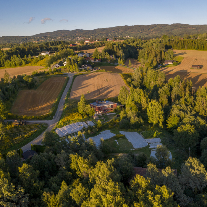
Hjertelia (NO)
Scale S - urban and architectural
Team representative urbanist, landscape architect or architect
Location Hønefoss, Ringerike
Population 9,600 inhabitants
Strategic site 60 ha - Project site 3.7 ha
Site proposed by Ringerike municipality
Actors involved Ringerike municipality
Owner(s) of the site Ringerike municipality
Commission after competition Preliminary architectural study of pilot project. Commission value 500 000 NOK.
More Information
Urban City Strategy
Hønefoss is a town on the cusp of radical transformation. To expand on the town’s rapidly changing identity, the task is to develop a new pilot neighbourhood which embraces sustainability in its broadest sense. The project site Hjertelia sits on farmland close to the town centre and the goal is to build an inclusive community through new housing typologies and architecture that enhances the productive capacity of the landscape.
Degradation of natural and agricultural land into low density suburban housing is a pressing concern all over the country. As a reaction, the ambition in Hjertelia is to develop the lot as a sustainable alternative to the typology of detached homes that dominates the Norwegian landscape. The development must be planned around mobility solutions for pedestrians and cyclists.
Site Definition
Through Europan, Ringerike municipality wants to investigate how Hjertelia can become an experimental pilot neighbourhood based on urban farming and social forms of living that underpins belonging in a town undergoing large scale changes. The ambitious goal is to show the way for further development within the study area, and more so, contribute with new examples to a common library of housing typologies for the future.
How Must Metabolism and Inclusivity Be Developed and Connected?
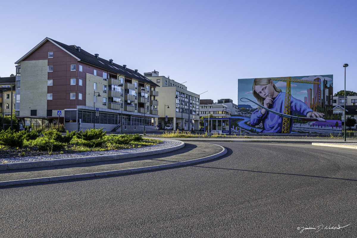
When the new railway arrives in Hønefoss, the shorter journey time to Oslo will change everything. Suddenly the town will be integrated with the Oslo region and serve as a suburb to the fast-growing capital. Expecting to see explosive growth, Hønefoss has the potential to absorb extensive development in the town centre. The population of the municipality is forecast to increase from 30,000 to 40,000 by 2030. Most of the growth will take place in the centre of Hønefoss. The goal is to accommodate 7,000 new residents in and around the town centre, the downtown area which is currently home to just over 1,000 people. Growth on this scale will result in major changes for a municipality which is heavily car-dependent and where most people live in detached houses away from the town centre. The town's mobility infrastructure will have to undergo a major transformation, and all growth must be based around public transport, cycling and walking.
Yet urbanisation involves bigger challenges than mobility planning. The rural and agriculturally based community will aspire to grow quickly with a new kind of educated and urban population. The identity of Hønefosswill be challenged. Many people are asking whether anyone would want to move to Hønefoss to live in a flat at all, considering how the district is better known for its agriculture and beautiful ravines than for its trendy cafés. What we do know is that an urban identity in Hønefoss will be different from urban identities in large cities. As it takes on population growth, climate change and technological advances in agriculture, Ringerike will have to build denser. How can a new kind of urban identity be expressed in a peripheral agricultural district such as Ringerike?
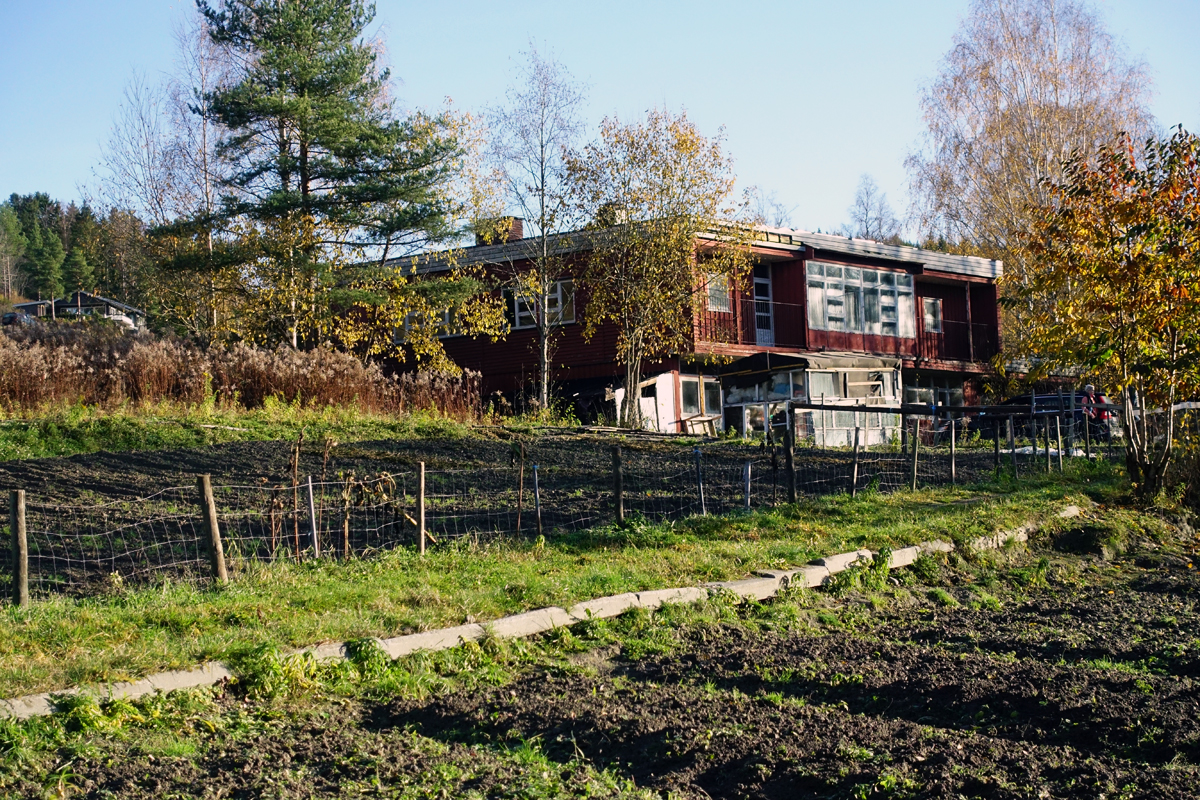
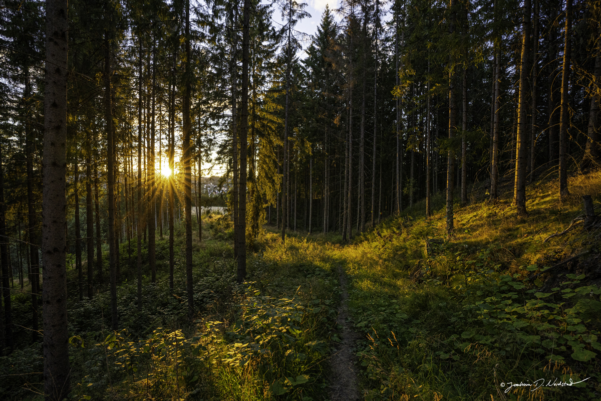
The development of Hjertelia has been controversial because the area consists of farmland and forest. Development of such suburban woodland and agricultural plots is common on the fringes of many small Norwegian towns and a major challenge globally. Yet the zoning plan for Hjertelia and the adjacent areas has been approved by the politicians, and parts of the area are already under construction. The local authority wishes to use its property in Hjertelia to develop an ambitious example of sensitive and site-specific architecture and outside space which helps intensify the ecology and productive properties of the landscape.



Questions on the site
Where can I find the cartography contained in the brief at page 10-11? Is there a way to obtain dwg file of the municipality of Ringerike?
A dwg filed of the municipality has been uploaded to the 0-new_docs_after_launch folder. Note that it does not contain terrain contour lines as the municipality is large and it was making the file too big.
Is there a precise number of people to be accommodated in the project area?
There is no precice number of people the project has to accomodate. The municipality sees the competition as a way to explore the capacity of the area and does not want to curb interest by demanding a set number of inhabitants.
Is it possible to have a more precise map which marks the areas with spontaneous trees and the areas with planted trees?
Unfortunatly such a detailed survey does not exist. The municipality has provided us with a new map showing us the type and quality of forrest in the area. However it is not much more detailed than the what is contained in the brief.
The map can be found under 0-new_docs_after_launch folder and is in norwegian. Exisiting maps do not show if forrest is planted or "natural", however one can assume that the spruce forrest is planted and the birch forrest natural.
Map ranslation:
Bjørk=Birch, Furu=Pine, Gran=spruce.
Red indicates old forrest, green slightly younger, while light green indicates younger forrest. The number indicates the productive quality of the forrest, also called "bonitet".
The old school should be kept and refurbished or demolished? What is the building’s status?
It is up to the teams to come up with solutions for refurbishment and to evaluate if the build should be a part of the new project or not. It can be kept, altered or be demolished to give space for another building.
The building is a condcrete structure. The loadcarrying parts should be in order. A major refurbishment has to be performed. The existing design can be challenged and altered.
Are there any current planning documents regarding the new station and the new plans in the center of Hønefoss? When will the construction work start? How realistic are the many bridges shown in the visualizations as a connection of the two shore sides?
There are no current planning documents regarding the new station and the new plans in the center of Hønefoss.
The new station is still in a planning process and is subject to a cost reduction scheme. Hence, there is no final design. But there will be no change in where it is placed.
We are currently working with a bridge project from Petersøya to Støalandet, this is approximately 500 meters upstream in the river from the planned bridge that will join Schjongslunden to Hjertelia. The bridge to Hjertelia is the next bridge that will be realized.
Can you further explain the Sabima evaluatuon system and criteria? It is referred to in the brief, but the Sabima website is only Norwegian.
The Sabima index is a ranking of how well the local governments protects nature and wildlife. The evaluation criteria can be found here (Norwegian): https://www.sabima.no/naturkampen-vurderingskriterier/
The municipalities that have received the highest score are characterized by the fact that they have:
-decided that they should be area-neutral
-made a municipal sub-plan for biodiversity
-set aside a usable share of the operating expenses in the municipality for biodiversity and outdoor life
-reallocated little cultivated land
-has a “fresh” / newer municipal plan
-granted few or no exemptions for construction in the beach zone
-granted few or no exemptions for new cultivation
-given few or no permits for construction along fresh water
-granted few or no permits for construction in nature, agriculture and outdoor areas
-granted few or no exemptions from the plan in general
It is these ten points that are further referred to as the indicators
Ringerike municipal is ranked in total 345 out of 356 municipalities
-
Protect nature 341 out of 356
-
Trying to improve and preserve nature 306 out of 306
Having mentioned this, over the last 2 years we have been working hard to improve how the municipality works with wildlife and protection of nature. Participation in Europan is part of this strategy.
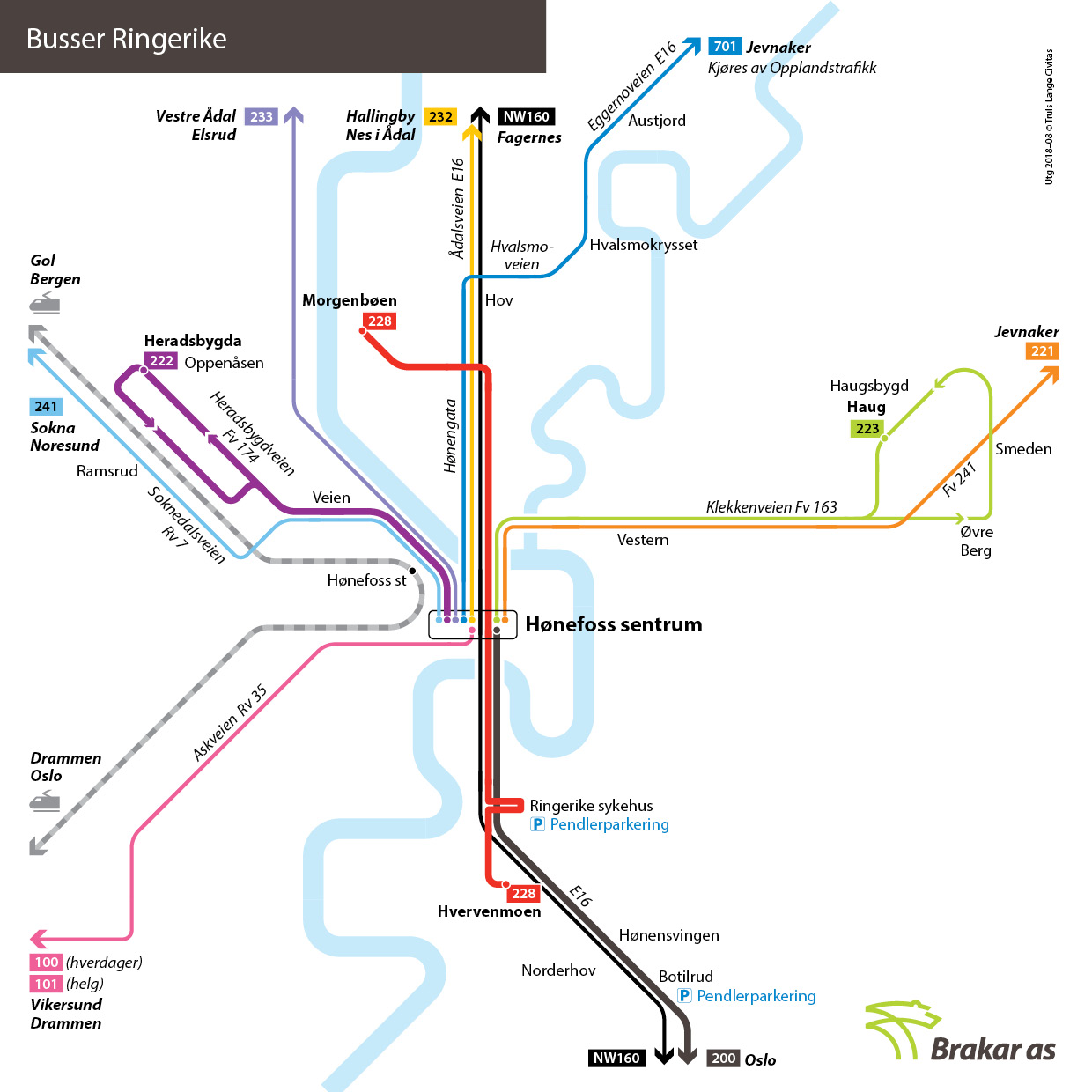
What kind of sharing mobility offers will be available in Honefoss?
We are not sure exactly what is meant by this question. The contestants are free to suggest new forms of mobility.
Below is a map of local bus services in Hønefoss:
This site is connected to the following theme
Care Care is about recognizing the vulnerability of our living milieu. It is about finding new design ways to pay attention to marginalized, hurt, or ignored areas and help to repair them.
Valorizing Natural Elements and Landscapes
These sites are located at the edge of parks and forests or situated within agricultural or planted areas. The projects’ actors have to embrace mechanisms of care for natural and manmade landscapes. The sites may be transformed into interfaces with porous edges to support the habitats of the landscapes.
Specific documents
Questions on the site
You have to be connected –and therefore registered– to be able to ask a question.
Fr. 16 May 2025
Deadline for submitting questions
Fr. 30 May 2025
Deadline for answers
Before submitting a question, make sure it does not already appear in the FAQ.
Please ask questions on sites in the Sites section.
Please ask questions on rules in the Rules section.
If your question does not receive any answer in 10 days, check the FAQ to make sure the answer does not appear under another label or email the secretariat concerned by the question (national secretariat for the sites, European secretariat for the rules).