Bregenz-Hard-Fussach-Höchst (AT)
The Synthetic Site Folder and Site Brief are available for free.
Please register and login to access the Complete Site Folder.
- Synthetic site folder EN
- Site Brief EN
- Complete site folder
- Site on Google Maps
- Back to map
Data
Bregenz-Hard-Fussach-Höchst, Vorarlberg (AT)
Scales XL/L
Team composition architect, urbanist and landscaper (architect in the team is mandatory)
Location Bregenz/Hard/Fussach/Höchst,Vorarlberg
Population 55, 788 inhabitants
Reflection site 1286 ha - Project site 120 ha
Site proposed by Land Vorarlberg
Actors involved Land Vorarlberg, Planning office and mayors of Bregenz, Hard, Fussach and Höchst
Owner(s) of the site Land Vorarlberg, private owners, others
Commission after competition There is a definite intention to involve the nominated team in the strategic processes and master planning.
More Information
SITE / CONTEXT
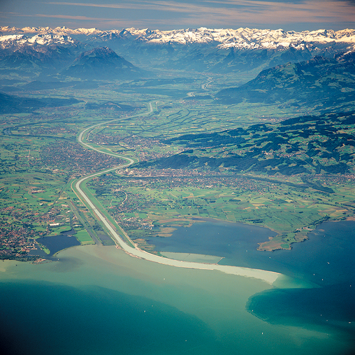
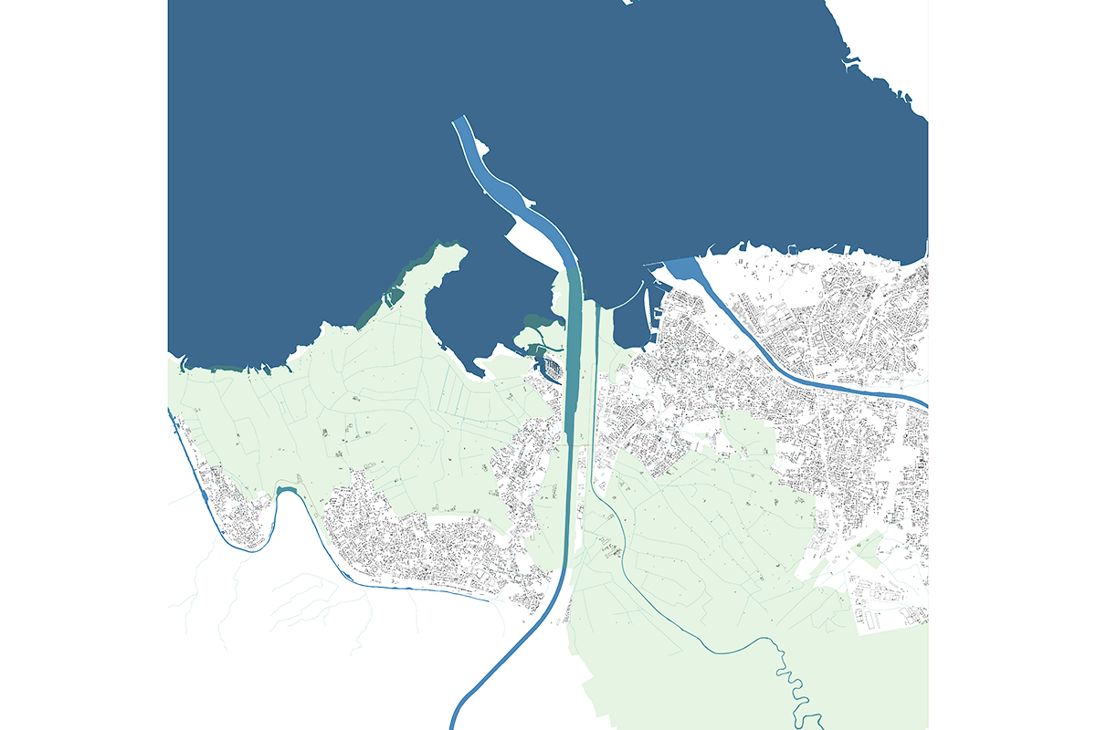
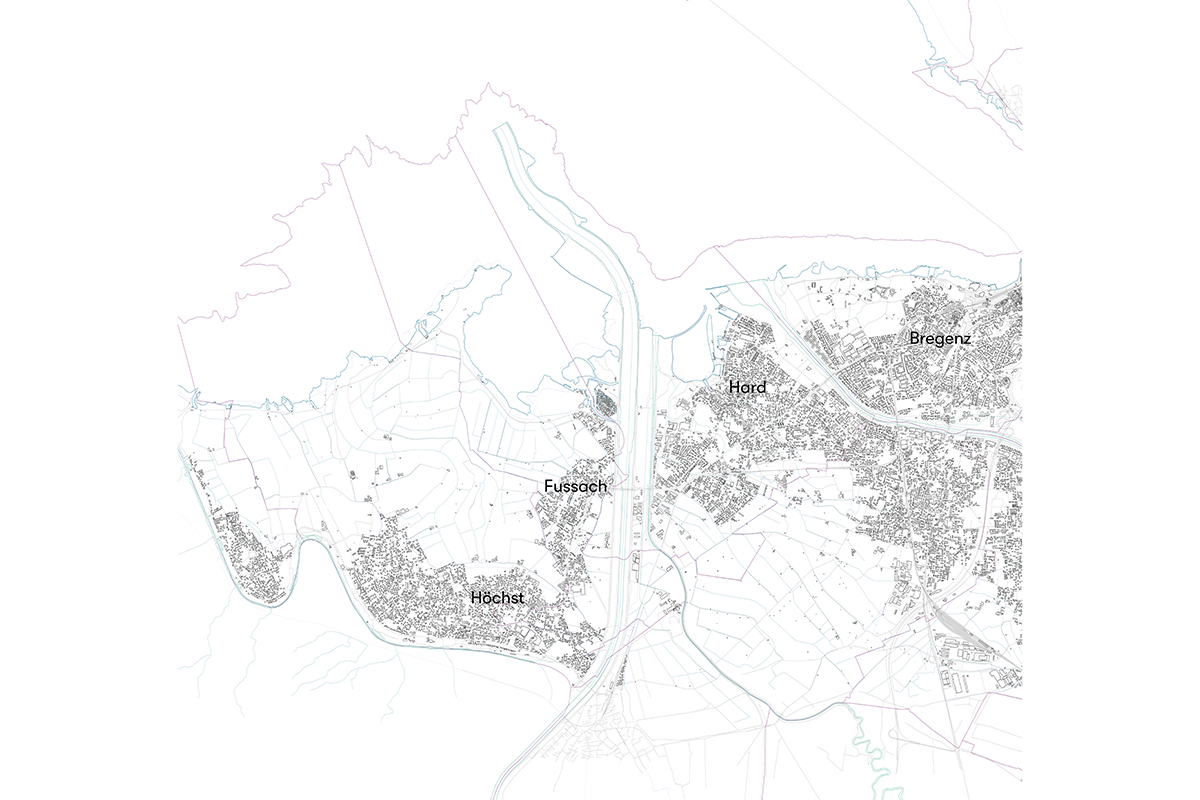
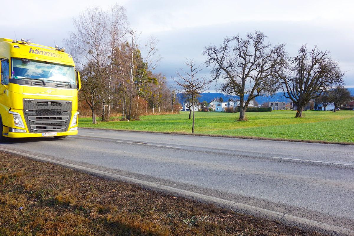
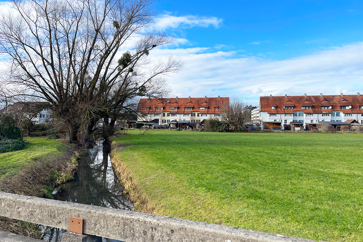
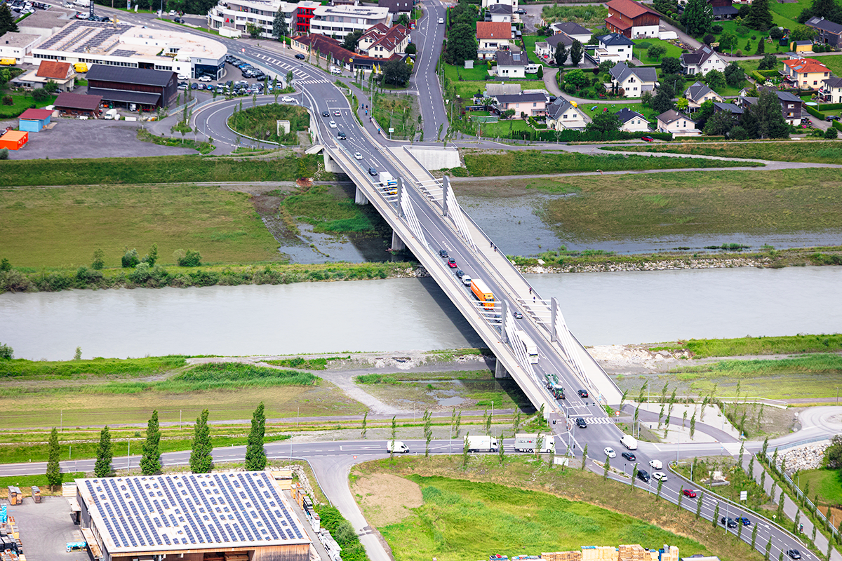
In Vorarlberg, the L202 or “Magistrale” is a crucial logistical artery linking Switzerland, Austria, and Germany. It drives economic growth by enabling trade and supporting local industries. However, this prosperity comes at a cost for villages along the route, where heavy car and lorry traffic disrupts daily life, creating noise, pollution, and safety concerns. The contrast between high-speed transit needs and the slower rhythms of village life highlights the urgency for solutions that balance mobility with livability. The L202 runs through three villages—Höchst, Fussach, and Hard—before reaching the city of Bregenz. This corridor is part of the Rhine Delta, an economic hub that, together with the Rhine Valley, is home to 80% of Vorarlberg’s population and most of its commercial activity. The region’s proximity to Lake Constance and the Alps makes it a popular tourist destination, while two Natura 2000 sites underscore its environmental significance. Urbanization has shaped the region into a continuous settlement. Its polycentric landscape distributes cultural, educational, and health services across multiple centers, while strong cross-border links encourage commuting. The Magistrale interacts with village centers, edge zones, and natural landscapes, creating diverse spatial experiences. Nearby train stations further enhance connectivity and support alternative mobility. The overarching vision is to transform the Magistrale from a traffic-dominated corridor into an inclusive, green, and safe space for all users. By integrating infrastructure with ecological, social, and programmatic needs, the road will no longer serve as a barrier but as a corridor of change—one that enhances existing structures while fostering new ideas for a dynamic and sustainable future. Fussach Höchst Natura 2000 area © Land Vorarlberg Bregenz Hard ecological map © Land Vorarlberg Orthophoto with reflection site (red) and projekct site (yellow) © Land Vorarlberg.
QUESTIONS TO THE COMPETITORS
This brief calls for a concept that formulates a strategy for reimagining this heavily frequented motorized street, which cuts through villages and sensitive landscapes. What tools and actionable guidelines can address the entire length of this corridor to gradually transform it into a space of potential and a forward-thinking approach to infrastructural corridors like this?
At the core of your strategy lies a pivotal question: How can this route be transformed into an open space of possibilities—one where neighborhoods, green areas, and active mobility can thrive alongside motorized traffic? Can this very infrastructure, which supports economic prosperity, evolve into a system of synergy, fostering an “Erlebnisraum” that benefits all who interact with it?
From your initial thoughts to the acts of creating, designing, writing, and drawing, the principle of Re:sourcing should be woven into every decision, ensuring a holistic and sustainable approach at every step.

Questions on the site
You have to be connected -and therefore registered- to be able to ask a question.
This site is connected to the following theme
Re-sourcing from natural elements How to design processes and projects for the revaluation of landscapes that focus on the interdependencies and eco-dependencies of resources (natural, cultural, productive) and the territory? The regeneration of landscapes can become a mediation tool between residential areas, facilities, and obsolete infrastructures and territories undergoing transformation (even at risk) as a result of the effects of climate change. Is an invitation to think at the resources of the area in a regenerative way to support a healthier environment for humans and non-humans?
Regenerating Landscapes
Specific documents
Questions on the site
You have to be connected –and therefore registered– to be able to ask a question.
Fr. 16 May 2025
Deadline for submitting questions
Fr. 30 May 2025
Deadline for answers
Before submitting a question, make sure it does not already appear in the FAQ.
Please ask questions on sites in the Sites section.
Please ask questions on rules in the Rules section.
If your question does not receive any answer in 10 days, check the FAQ to make sure the answer does not appear under another label or email the secretariat concerned by the question (national secretariat for the sites, European secretariat for the rules).