Nailloux (FR)
The Synthetic Site Folder and Site Brief are available for free.
Please register and login to access the Complete Site Folder.
- Synthetic site folder EN | FR
- Site Brief EN | FR
- Complete site folder
- Site on Google Maps
- Back to map
Data
Nailloux (FR)
Scales XL/L
Team composition Architect mandatory
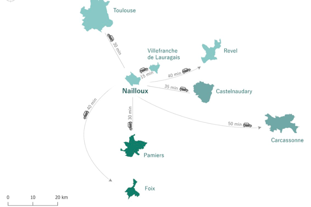
Location Nailloux
Population 4,200 inhabitants
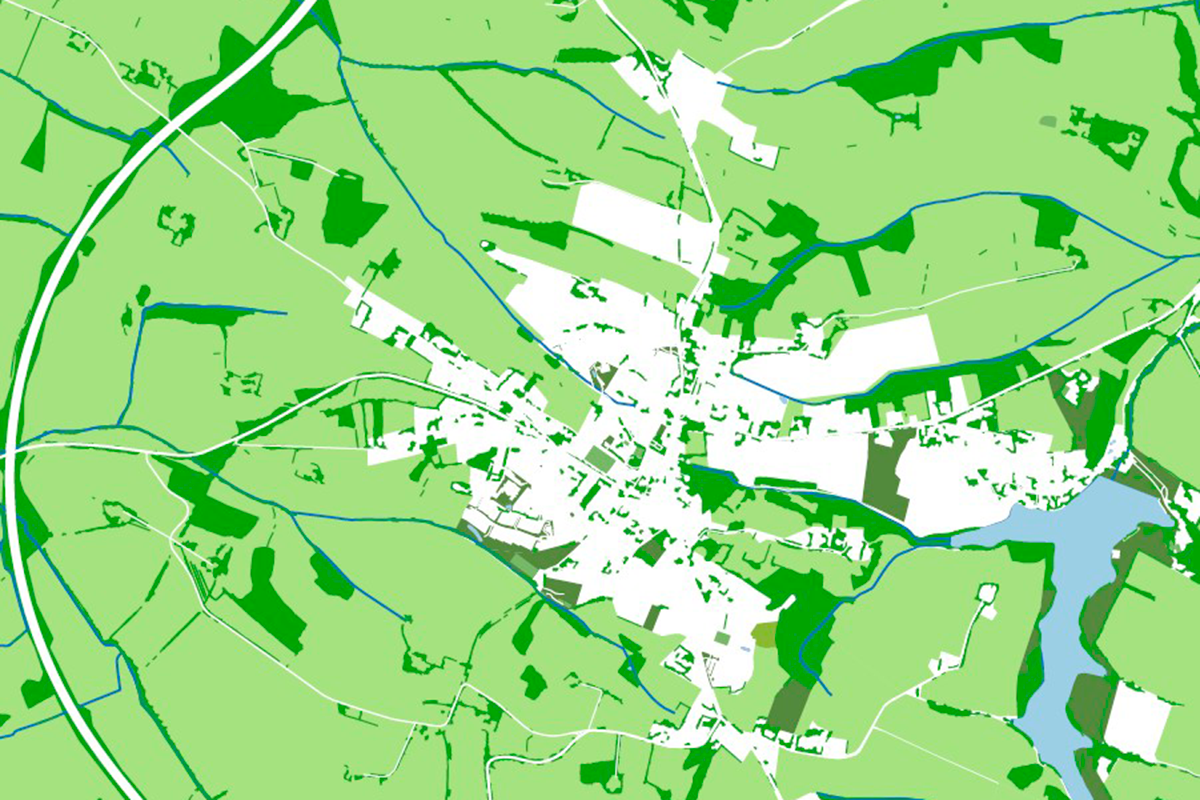
Reflection site 159 ha - Project site 14 + 1 ha
Site proposed by Town of Nailloux
Actors involved Town of Nailloux
Owner(s) of the site Ville de Nailloux + private individual
Commission after competition Opportunity and feasibility studies, guide plan, urban and landscape project management, architectural project management, signage study.
More Information
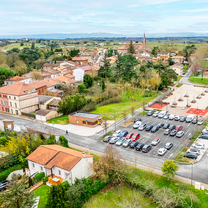
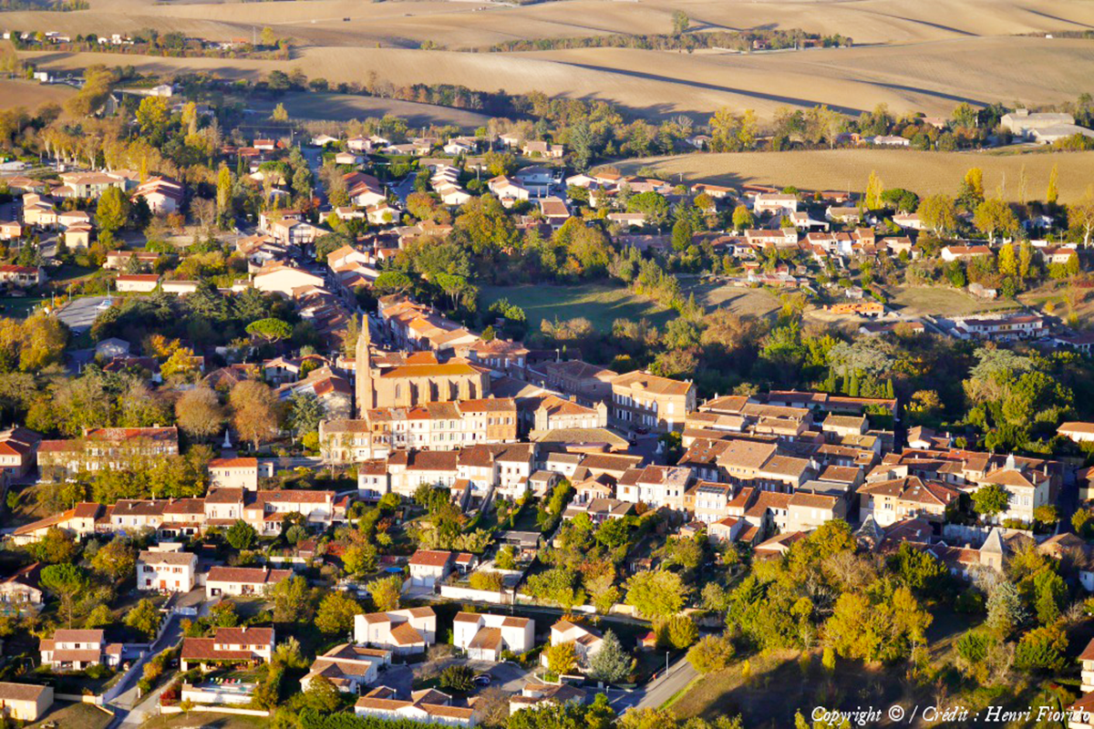
SITE/CONTEXT
Nailloux was historically a rural commune, perched on the crest of a Lauragais hillside. Since the 2000s, with the construction of
the A66 motorway, the travel time between Toulouse and Nailloux has been reduced by seven minutes. This new road connection
has sparked significant peri-urban expansion, quadrupling the town’s population over the past two decades. However, during this period, the development of housing estates and public facilities has occurred in a fragmented and opportunistic manner.
In 2020, recognizing the dispersed and poorly connected nature of local services, the municipality launched an initial phase of interventions to strengthen the structure of the town center. The aim was to enhance the quality of life in Nailloux, reduce residents’ dependence on cars, and stimulate the local economy. Now, as this first phase nears completion, the town is eager to build on this momentum. The ambition is to coordinate multiple strategies, including the creation and relocation of public facilities, the development of economic activities and housing, and the reinforcement of green and blue infrastructure.
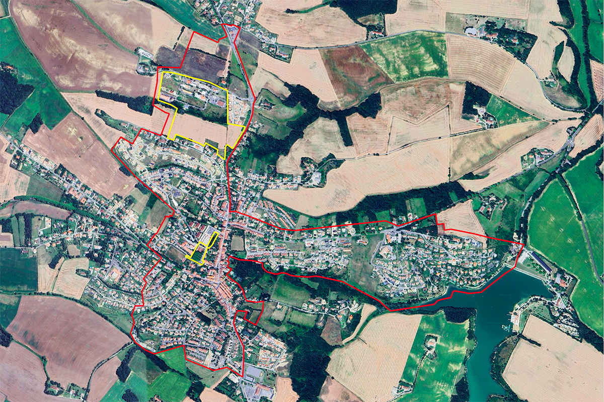
Two project sites have been designated for the competition:
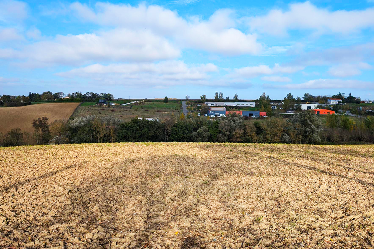
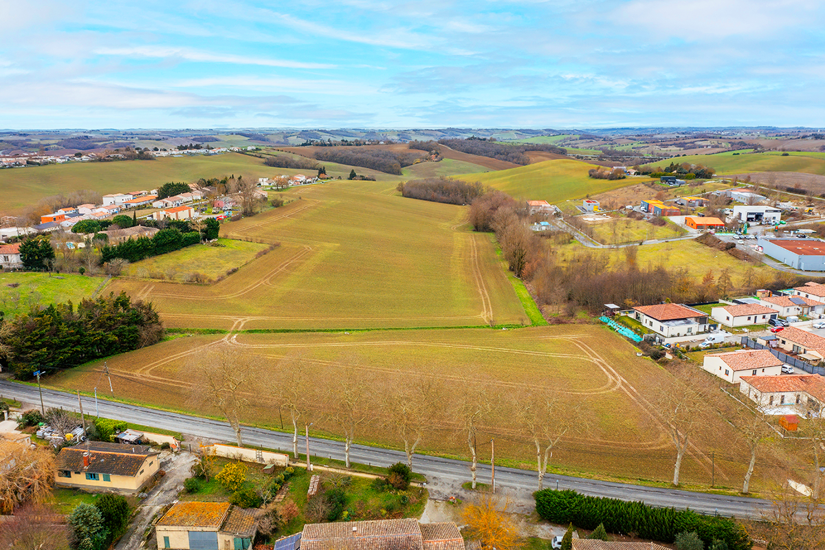
- The first site, located north of the town, is intended for space-intensive developments, as Nailloux lacks reusable brownfield sites. The local urban plan (PLU) identifies three designated development areas (OAPs) where commercial, service, and craft activities (Le Tambouret) are planned, alongside housing, a multi-sports field, a central kitchen, and a school (Abetsenc de Trégan). This site presents a pronounced topography.
- The second site is centered around a new unifying public space, the Esplanade de la Fraternité, which hosts the weekly market
and festive events. By clearing underutilized plots within the town center and potentially relocating the tennis courts to Abetsenc de Trégan, the municipality aims to expand the range of services and facilities available in the heart of Nailloux.
QUESTIONS FOR COMPETITORS
How can the municipality’s new urban development strategy be effectively translated into concrete design solutions? What approaches can improve water management in this hilly landscape, which is increasingly affected by drought? How can Nailloux become more walkable and bike-friendly? What strategies can help reduce dependency on the Toulouse metropolitan area and mitigate commuter flows?
At the scale of the Tambouret - Abetsenc de Trégan project site:
- How can a stronger dialogue be established with the surrounding agricultural fabric? Should the site’s topography be modified to accommodate the municipality’s program, or should the program be adapted to the existing terrain? How can urban development be reconciled with enhancing the ecological quality of Abetsenc de Trégan, currently dominated by monoculture? Where should strategic access points be created to better integrate the site with surrounding infrastructure?
At the scale of the Fraternité project site:
- What built forms and spatial compositions can be envisioned between Parc de la Fraternité and Rue des Agriculteurs to balance urban density with respect for the town’s historical fabric? What types of uses—or even built structures—could be introduced on the current tennis court site?
Questions on the site
You have to be connected -and therefore registered- to be able to ask a question.
This site is connected to the following theme
Re-sourcing from social dynamic A missing layer of urbanity is added on a territory with underlying complexities. In all these large sites, the question is how inhabit them, how to relate to them, how to add a human ecosystem while negotiating the pros and cons of the existing complexity. It may be to reconsider an urban interrupted development, to care wounds left or created by old or new infrastructures; to regenerate sub-standard housing or the damage left behind a brownfield, to reconsider a river or former agricultural fields.
Creating New Urban Relationships
Specific documents
Questions on the site
You have to be connected –and therefore registered– to be able to ask a question.
Fr. 16 May 2025
Deadline for submitting questions
Fr. 30 May 2025
Deadline for answers
Before submitting a question, make sure it does not already appear in the FAQ.
Please ask questions on sites in the Sites section.
Please ask questions on rules in the Rules section.
If your question does not receive any answer in 10 days, check the FAQ to make sure the answer does not appear under another label or email the secretariat concerned by the question (national secretariat for the sites, European secretariat for the rules).