Versants versatiles
Saint-Brieuc (FR) – Runner-up
TEAM DATA
Team Representative: Nicolas Pineau (FR) – architect; Associates: Jean Chevalier (FR) – architect landscaper; Gaylor Chiari (FR), Noémie Schmidt (FR), Marie-Eve Turpeau (FR) – architects
Contributor: Alexandre Renimel (FR) – student in architecture
1 place René Bouhier, 44100 Nantes – France
+33 6 98 50 85 20 – nicolaspineau@gmx.com
See the complete listing of portraits here
See the site page here
G. Chiari, N. Schmidt, N. Pineau, M.-E. Turpeau, A. Renimel & J. Chevalier
INTERVIEW
Click on the images to enlarge
1. How did you form the team for the competition?
Our team was formed out of shared experiences during our common classes at the architectural school of Nantes. After developing some complementary skills through lectures and professional experiences, we have chosen to meet again for a new project, an opportunity to offer a vision of tomorrow’s territory.
2. How do you define the main issue of your project, and how did you answer on this session main topic: Adaptability through Self-Organization, Sharing and/or Project (Process)?
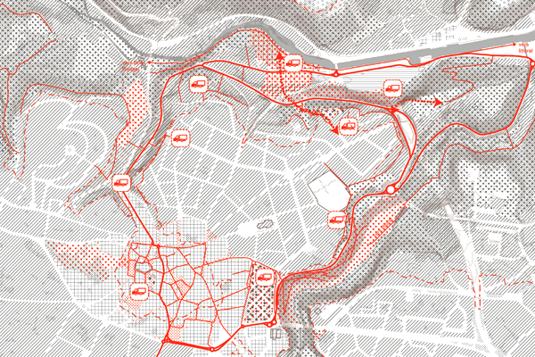
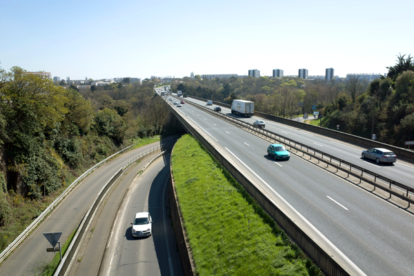
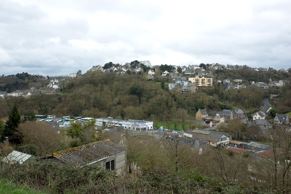
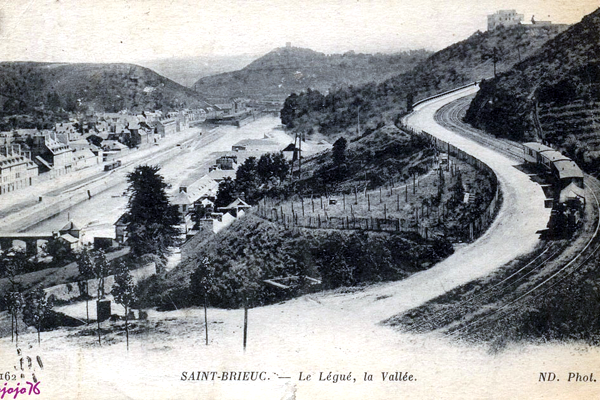
Our reading of the project site made us notice one of the strong singularities of the territory of St Brieuc: topographic NGF line 80m, a separation between two entities, the urban spaces of the plateaus and the natural spaces of the valleys. An alteration of this dichotomy appears and reinstates the historical city centre of St Brieuc in the valley entity. The stake of the project is to intervene on this edge, scramble the linearity and make it more porous.
Rather than a pre-established masterplan, we intend to make of the project an instrument for a transformation process of which the long-term inscription will allow its regular adjustment. Two tools will provide adaptability: the landscape projects and mobility. These tools will be given to the local actors to allow them to modulate and adjust their transformation actions according to the site and the temporality. This is a way to support political, environmental and social processes all along an urbanism strategy instead of one global and rigid masterplan.
3. How did this issue and the questions raised by the site mutation meet?
The project suggests transforming the separating and dichotomous characteristic of NGF line 80, to spread on the large territory a work of meshing and distribution between natural landscape and built landscape. This approach allows us to define a new system of landscaped town planning by conferring possibilities of isotropic deployment on both sides of the NGF line 80 m.
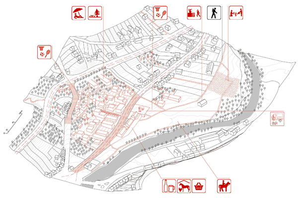
The city centre, with its dense urban meshing, will be transformed by the diffusion of landscape continuity from a valley to another, between the Promenade park and the Poulain-Corbion place.
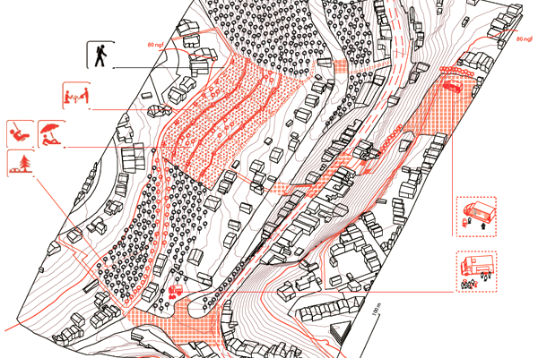
On the derelict industrial site, the project proposes to make the meshing of the residential plateau slide along the hillside, to welcome a mixed program of houses and activities, in particular food-processing in link with the old nourishing function of the valley.
Besides these two specific sites, our response strategy becomes attached as well to a more global scale, made possible by the deployment of the NGF line 80m on the large landscape. The mobility project tends to reveal the potential of the pedestrian connection to turn the valley in a traversable space and the hillside in a habitable space. To activate the public place and reveal the landscaped qualities of the valley to inhabitants, locations of mobile small vans proposing itinerant programs punctuate the whole border constituted by the current NGF line 80 m.
4. Have you treated this issue previously? What were the reference projects that inspired yours?
In terms of methodology, we were influenced by the cartographic approach proposed by the project studio "Le même et l’autre" in the architectural school of Nantes, within which we produced a complex reading of the territory of Urbino (IT). This cartographic approach allowed us to have NGF line 80 m emerge as a singularity.
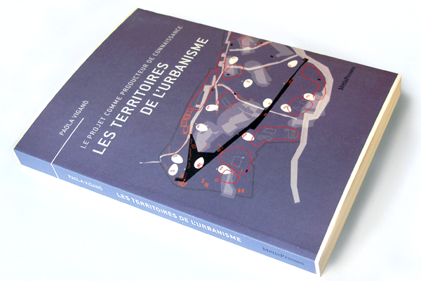
More widely, we follow Paola Vigano when she says that the project can produce knowledge (see “Les territoires de l’urbanisme”), according to the tools put in place. Theoretically speaking, we also agree with her on the potential of the nebulous city, or with Alain Bourdin on the necessity of thinking the uncertainty within the urban practice.
Our landscape approach is marked by Michel Desvigne for its vision of the project as a process as well as by Lewis Mumford when he questions the place of the landscape in the urban development.
Finally, history can also become a reference source through the variety of still readable elements on site: the infrastructures of Harel de la Noe, the traces of old food-producing uses of the valley…
5. Today –at the era of economic crisis and sustainability– the urban-architectural project should reconsider its production method in time; how did you integrate this issue in your project?
We do not propose a fixed project but a transformation through actions, targeted in time and in space. This methodology goes along with an economy of means to create potentials at first and avoid concentrating the means of the community in an immediate transformation for which the results might be uncertain. This urban strategy deploys over time according to the different actors and integrating the hazards of urban development. It is an open and always evolving system allowing adjusting the transformation actions in time and according to the resulting effects.
6. Is it the first time you have been awarded a prize at Europan? How could this help you in your professional career?
It is the first time that we have participated to Europan. Europan is for us in a professional point of view a facilitator offering the opportunity to directly discuss with local operators and allowing us to follow experimental paths. This “out of frame” procedure, clearly more open than a classic public commission, offers us a privileged opportunity to offer a prospective vision for the territory.