Reversing the Grid
Paris-Saclay (FR) – Winner
TEAM DATA
Team Representative: Maia Tüür (FR) – architect-urban planner; Associates: Yoann Dupouy (FR) – urban planner
TU-DU, 95 rue de la Roquette, 75011 Paris – France
contact@tu-du.fr – www.tu-du.fr
See the complete listing of portraits here
See the site page here
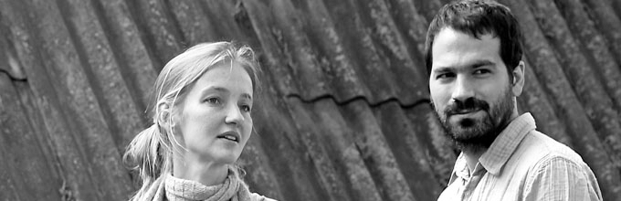
M. Tüür and Y. Dupouy
INTERVIEW
1. How did you form the team for the competition?
We met for the first time in an office of urban planning and architecture in Paris in 2007, where we had several occasions to collaborate for different kinds of projects. These common reflections led us to our first real collaboration in 2010 when we participated in an urban design competition in Tallinn (Estonia) for the area around the museum of architecture. The size of the competition site was also limited and our analysis of the area made us realize that the relations of the site to its surroundings in different scales were as important as the design itself of the project site. The complexity of the task was not to design an urban space but to generate, by activation of the relations, quality urban spaces. Our reflections on the site of Paris-Saclay grew out of this first common experience, as our main goal in the project was to reintegrate the project site into its surroundings by redefining the connections of the site to its territory on different scales.
2. How do you define the main issue of your project, insisting on how you answered on this session main topic: adaptability and urban rhythms?
Our proposal for the Paris-Saclay site is first and foremost a territorial project. Our project is about looking for coherence between different existing territories (plateau, slope, valley) by enhancing the specificities and characters of the site. The quest for the territorial coherence is double, as it has to be conceived in accordance with the significant developments on the plateau, as well as the existing neighbourhoods in the valley of the River Yvette.
On a site of this scale –around 300 ha–, it appeared to be difficult to imagine one continuous urban pattern that would have been dense enough to generate quality places to live in. The territory didn't seem to be appropriate neither for a scenario of even greater polarization of activities. Consequently, the ambition of our project is to overstep the difficulties by creating three different "environments". The three "environments", taken as a whole, form a tool to generate coherence between different territories. And in order to do so, the "environments" are interdependent – they are defined in relation to each other and they share their limits. However, each "environment" has its own logic - a particularity that guarantees a generous adaptability for the project. The talk about different "environments" is also a way to deal with the question of rhythms, an issue that is crucial for the site. In our project each "environment" has its own particular rhythm of development and functioning. The scheme gives us a possibility to develop an order of coexistence of different rhythms in various scales and laps of time.
3. How did this issue and the questions raised by the site mutation meet?
The logics of organizing the site by creating three different kinds of “environments” is, according to us, a powerful measure that gives a possibility to clearly answer the major issues of transformation of the site.
As the Paris-Sud campus has no evident connections with the urban neighbourhoods and as the neighbourhoods lack mixed urban areas, we propose to create an “intermediate cityscape” –a fringe area of interfaces and urban diversity between the neighbourhoods of the valley and the university sector. The areas of the “intermediate cityscape” will host mixed-used developments with different kind of habitat and activities.
Considering the absence of legibility and practicability of the nevertheless remarkable landscape of the site, we imagine implementing a “natural grid” on the natural spaces, a system with a structuring effect and yet extremely flexible. This tool would reveal the geographical conditions and the existing landscape by imagining situations of “tensions” between the existing elements (like the Yvette, afforestation, topography, etc.) and the grid.
And finally, as it seems very difficult to integrate various long-term reorganisations of universities and research on site, and as there is also a tendency of isolation of each building from the surrounding space, we propose a concept of “univercityscapes”. The concept takes the form of a continuous urban ground with clear and readable limits. The ground connexts the separated buildings into a common space and proposes a possibility to avoid the actual system of parking on surface – a system that consumes way too much space.
4. Have you already treated this issue previously and could you present some reference projects that inspired yours?
Our proposal was thought and developed around XDGA/Desvignes’s urban project for the plateau Saclay. As a matter of fact, our analysis of the site led us to inverse the concept imagined by XDGA/Desvignes by redefining the key elements of the model. The urban grid of the plateau becomes a natural grid on the hillside and the valley. The existing spaces around the university buildings, integrated to the grid, become pendant to the public spaces on the plateau - generous structuring univercityscapes in the middle of the natural density. Lastly, the intervening nature –through contact with urban areas– becomes an intervening cityscape. In our opinion, the concept developed by XDGA/Desvignes –with its capacity of changing operational opportunities and variable interactions of different actors– has a great potential to guide the development of the territory of the cluster in an adaptable frame on the long range. The project is not based on a formal composition, but rather on a construction of dialectic, capable of creating interactions with different scales concurrently. Our intention is to generate a dialectic with same potential of adaptability for the site Paris-Saclay.
We also worked on the question of adaptability in an international competition entry for the extension of the city centre of Reykjavik (Iceland), on the site of the local Vatnsmyri airport. On this 200-ha territory, we were also dealing with the question of timeline and diversity of developments in an open landscape. Just like on the Paris-Saclay site of the, the proposal was about redefining the relations of the site to its territory and creating different urban environments. The competition entry, developed in the Atelier Pranlas Descours office, was awarded laureate in 2008, just before the bankruptcy of Iceland…
5. Today –within the era of an economic crisis and sustainability– the urban-architectural project should reconsider its production method in time; how did you integrate this issue in your project?
A predefined project would not have made sense for a territory of this scale. It was important to invent a process of development for the site, just like in the majority of urban situations today. In order to define a process capable to lead the developments in the long run and with several actors of the site, the definition of the process has to be adaptable. Consequently, our proposal looked for a concept of organisation of territory, which would be simultaneously as clear and as flexible as possible. A concept that would guide the urban decisions on the large scale, and, at the same time, that could be improved and filled in by proposals of interventions on the local scale. The process of our project is defined by the possibilities of constant redefinition of the concept by the back and forth influences. It is a way for us not to limit the evolution potential of the site.
6. Is it the first time you have been awarded a prize at Europan? How could this help you in your professional career?
This is the first time we have been honoured by a prize at Europan. It happens at an appropriate time as we are willing to further develop a reflection on a concept of planning in the scale of territory. Our respective professional experiences have given us several possibilities to analyse and to work according different concepts of planning in France and abroad. At the very moment, filled in by the experiences of the realities of urban planning today, we would like to further develop an idea of planning interacting simultaneously at different scales. We have started the work with our competition entry for Europan. And the possibility to work for the site Paris-Saclay will give us a perfect opportunity of exchanges and common construction of this concept, as this kind of project only makes sense when shared.