Bruck/Mur
The Synthetic Site Folder and Site Brief are available for free.
Please register and login to access the Complete Site Folder.
- Synthetic site folder EN
- Site on Google Maps
- Back to map
Data
Category Urban - architectural
Location Bruck A.D. Mur, Österreich
Population City 13,000 inhab. - Region 160,000 inhab.
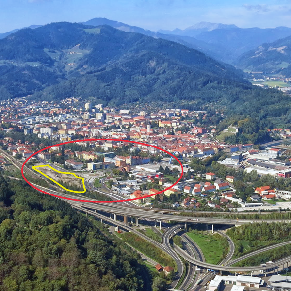
Strategic site 20 ha - Project site 1.5 ha
Site proposed by City of Bruck an der Mur & Federal state Steiermark
Owner(s) of the site Federal state Steiermark
Commision after competition Urban project management role, further involvement in architectural follow-up procedures
Team representative architect - urban planner - landscape architect
More Information
How can the site contribute to the adaptable city?
Together with its neighbouring towns Bruck an der Mur is in the process of forming one of Austria’s 38 city regions. For this transformation a number of strategic adaptations on both levels – the regional and the city – have to be taken. Corresponding with Europan’s subtheme Segregation vs Sharing within the coming years steps of intensified networking and development towards a cross-linked urban agglomeration on an administrative and infrastructural level will take place, including the implementation of a new regional railway stop right on the site. Directly linked to this new railway line the project site is projected to play a central role within this city region. Its exposed and segregated location has to be re-connected to the city center and to be established as the city’s interface with the region through quality-oriented urban mix-use and a sequence of high standard public spaces.
City strategy
The city aims at strengthening its profile and role within the city region by creating a positive dynamic from the central location and easy accessibility of the project site within the city region. The targeted urbanization of the site draws upon existing potentials in the surrounding study area such as the highly- frequented highways and railroad connections, the local rehabilitation facility, the nearby recreational nature resort and easy walkable connection to the city centre. In order to avoid rash restrictions concerning the use of the project site the city has defined a number of non-targets instead of a precise intended use.
Site definition
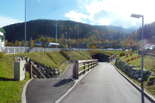
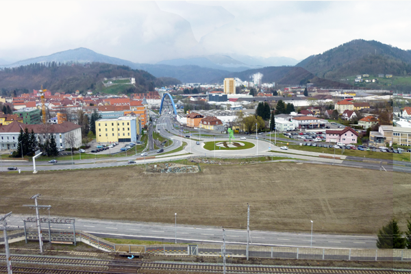
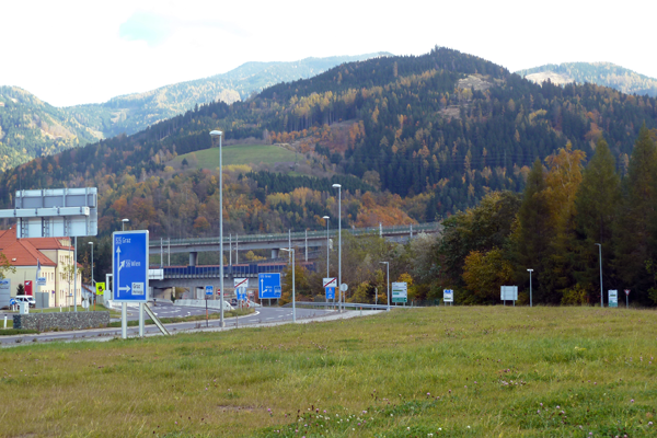
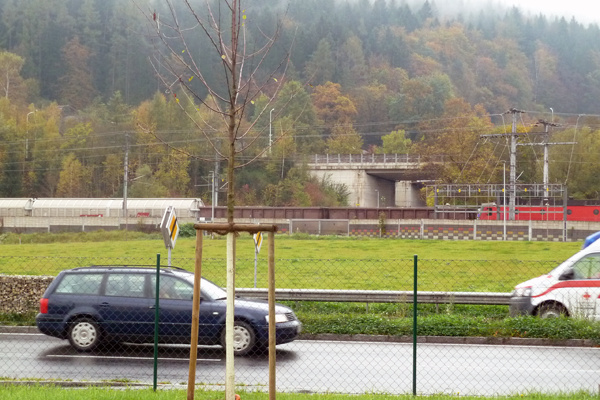
The Study Area extends north from the project site, incorporating the Southern part of the town called Murer Vorstadt. It is defined by its strong borders, the river, the railway tracks and two four-lane expressways crossing at a T-junction that recently has been converted into a round-about. To the West the development dates back to the 19th century with multi-storied housing representative for its time, and a health center. To the East a high diversity of building types and mix-use area has evolved including industry, commerce, single family and apartment housing, public service facilities and a big parking lot creating a multi-layered urban fabric. The project site in the South of the expressway is constituted by its islandlike nature bordered by the railway tracks and expressway. At the moment pedestrian accessibility is only possible through an underpass.
Future of the site in relation to the site family and to Adaptability
The municipality and the province ask for a strong vision which shall promote the potential of the site as a central regional hub, including a strategy for a process which is able to implement step by step this vision. How to explore the site’s role as a double-gate of city and region? How to interconnect the territorial scale of the regional infrastructures with the local fabric?
Collective perception of the site – Through a strategy of communication and actors the currently not highly valued site will be activated in the consciousness of the inhabitants and claim its essential position within the city and its city-region.
Strategy of intermediate programs – A curation of temporary activation with a program that highly reflects the local and regional context in order to establish a unique address for the future development of the site; youth can be seen as target group.
"Centre House of the Region": strong vision – The “Center House of the Region” with its adjacent public spaces should not compete with the city center. The project should be able to absorb temporary uses becoming constant. Also it should absorb programmatic openness acting as an infrastructural hub with a strong urban character.
Mobility & Conectivity – A concept for quality-oriented open and public spaces enhancing the length of stay and strengthening the link to the city center is needed. The site´s high connectitvity (including the new regional railway stop) must be fully exploited, focusing on mobility concepts in order to decrease individual road traffic in favor of railroad traffic and pedestrian links.
Questions on the site
Are there also vector-drawing documents (e.g. DWG) available for "BRUCK-AT-SS-M05.jpg" and "BRUCK-AT-SS-M06.pdf"?
The files "Bruck-AT-SS-M05.jpg" and "Bruck-AT-SS-M06.pdf" are only available as jpg and pdf version. We recommend to superimpose the jpg's in a cad program and draw the outlines of the proposed buildings.
Are there documents available indicating heights of topography and buildings?
Topgraphy: In the file "Bruck-AT-PS-M03" the height differences of the topography are apparent in the naming of layers (in meters)
Building Heights: Information about the building heights will be uploaded very soon.
Is there a 3D model available?
No, there is no 3D model available.
What is exactly meant by the remnants of rural elements on islands 2 as described in the brief? How and where on the Island 2 do they appear?
There are some fragments of farmers structures, e.g. along the river Mur at Brandstetterstraße
This site is connected to the following theme
How to create positive dynamics from a difficult situation? Many sites are faced with difficult urban situations. The origins of these difficulties are to be found in problems caused by urban, economic and environmental factors, as well as differing values and a lack of cultural understanding. Despite these difficulties, the sites nevertheless constitiute a favourable ground for the creation of new dynamics which rely on scenarios of sharing and the adaptation of traditional architectural and urban tools.
Questions on the site
You have to be connected –and therefore registered– to be able to ask a question.
Fr. 16 May 2025
Deadline for submitting questions
Fr. 30 May 2025
Deadline for answers
Before submitting a question, make sure it does not already appear in the FAQ.
Please ask questions on sites in the Sites section.
Please ask questions on rules in the Rules section.
If your question does not receive any answer in 10 days, check the FAQ to make sure the answer does not appear under another label or email the secretariat concerned by the question (national secretariat for the sites, European secretariat for the rules).