Kassel (DE)
The Synthetic Site Folder and Site Brief are available for free.
Please register and login to access the Complete Site Folder.
- Synthetic site folder EN
- Site Brief DE | EN
- Site on Google Maps
- Back to map
Data
KASSEL (DE)
Scales XL/L
Team representative Architect, urbanist and landscape architect
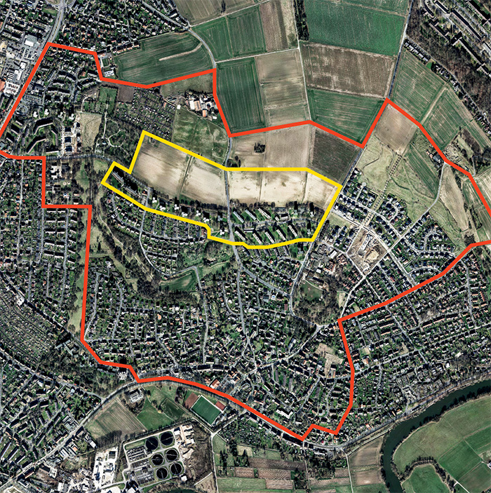
Location Kassel, Wolfsanger Nord
Population 203 479 inhabitants
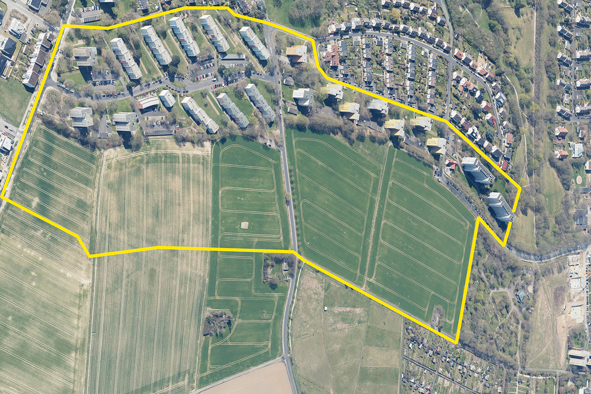
Reflection site 400 ha - Project site 27 ha
Site proposed by City of Kassel
Actors involved City of Kassel
Owner(s) of the site City of Kassel (undeveloped areas), WOHNSTADT Stadtentwicklungsund Wohnungsbaugesell- schaft Hessen mbH, numerous private owners
Commission after competition The city is open to the idea of working with the competition winners (e. g. mandate for an urban plan) on the upcoming planing steps.
More Information
Inhabited milieu's challenges
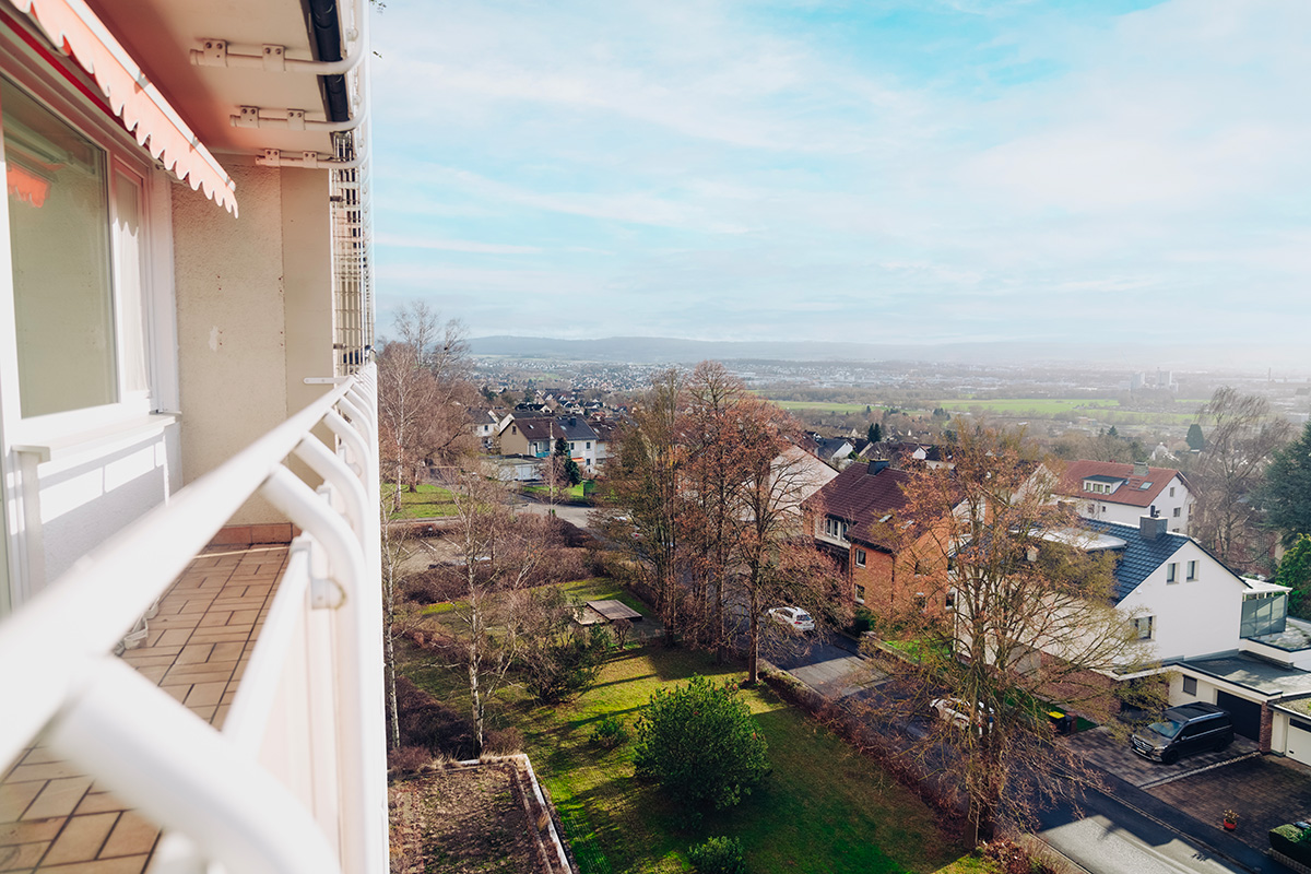
Kassel is located in the geographical center of Germany and with around 200,000 inhabitants is the third-largest city in the state of Hesse. The city has been experiencing dynamic development in recent years, which is reflected both economically and in increasing numbers of inhabitants. The Kassel housing market has been characterized by rising rents and property prices in recent years. The housing supply, especially for households with low incomes, has deteriorated.According to the 2020 housing supply concept, around 8,000 homes would need to be built by 2030 based on population growth forecasts.
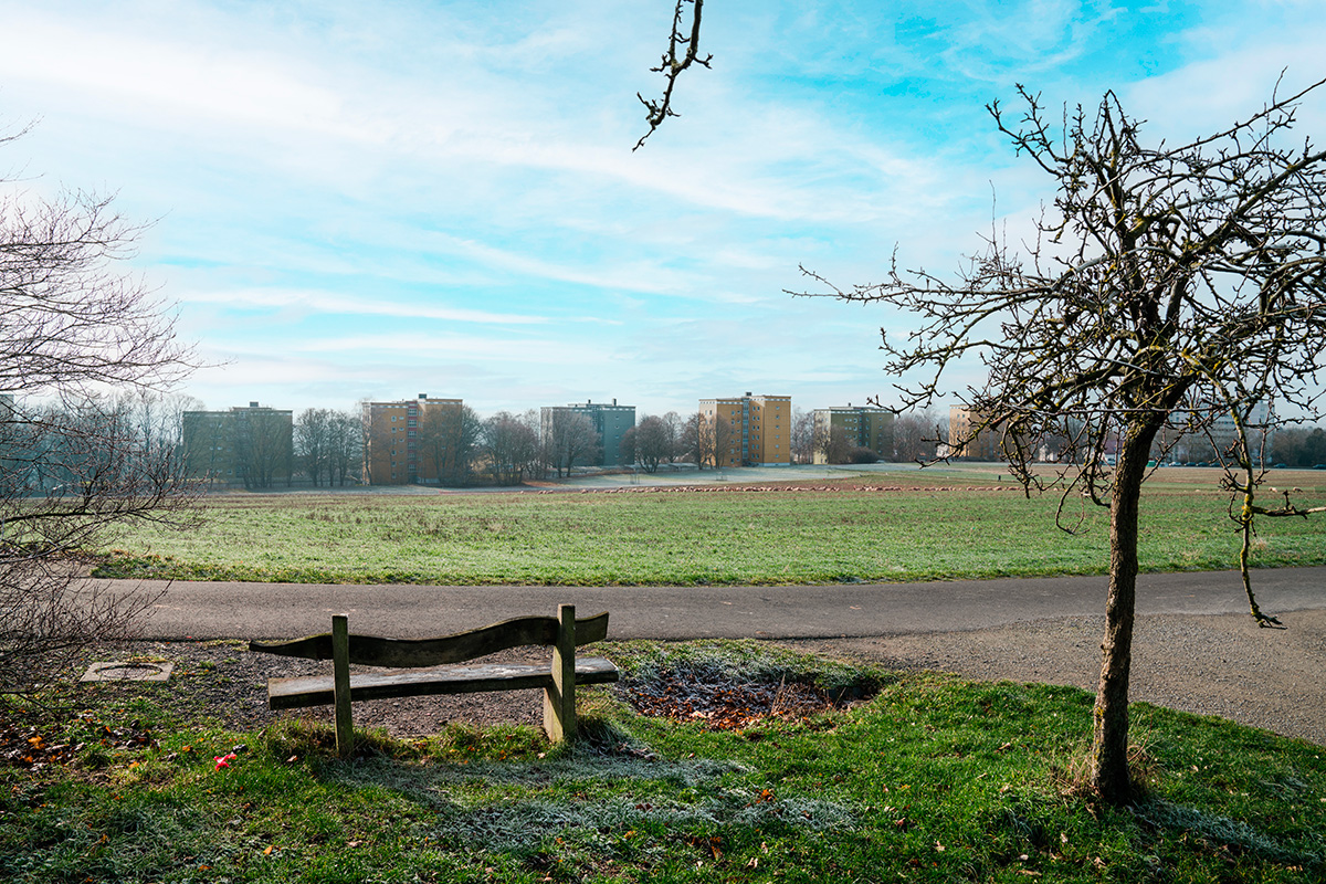
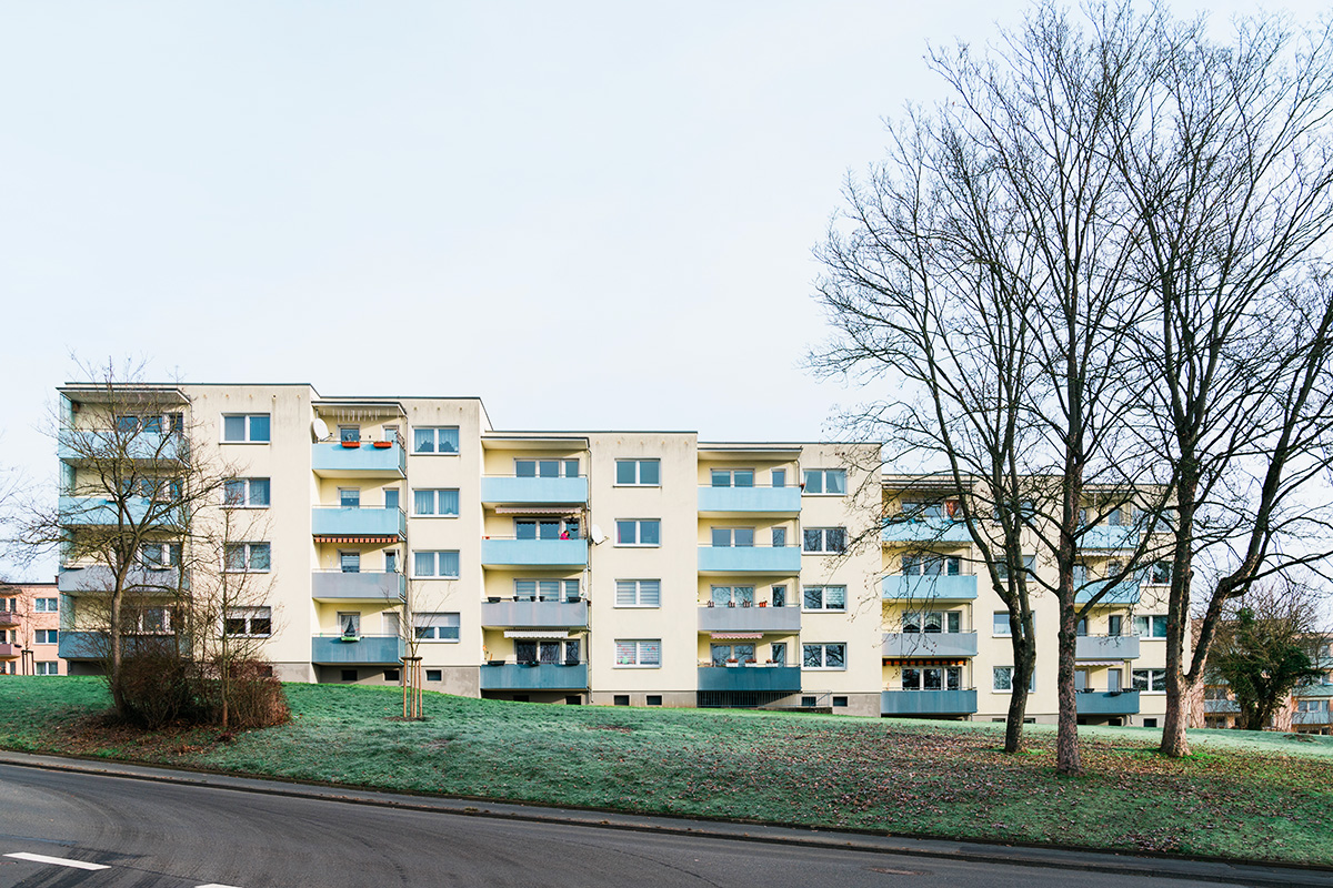
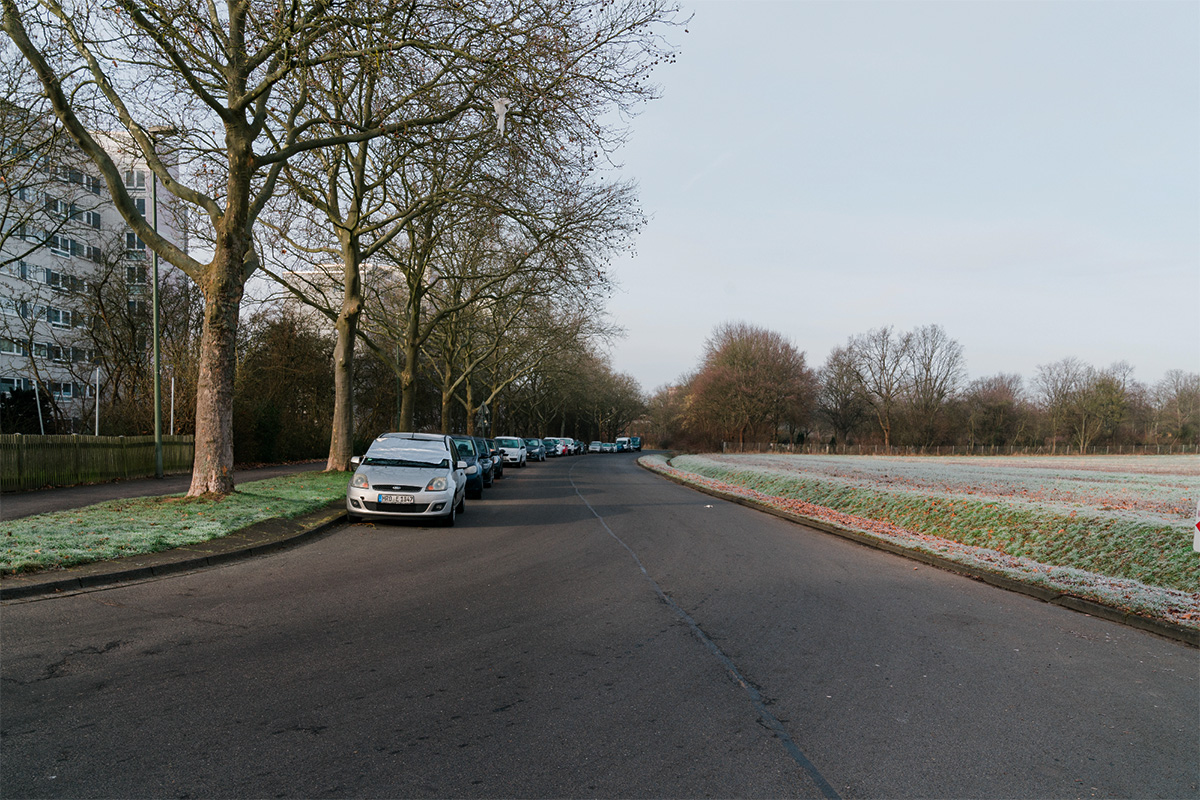
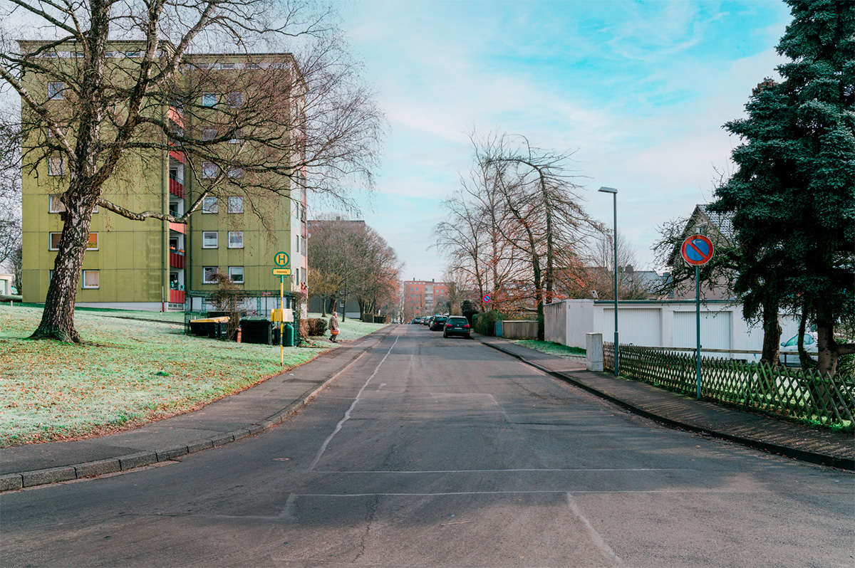
The major challenge for the city of Kassel is to create the necessary housing on the one hand and to achieve the desired climate goals on the other. The previously undeveloped northern outskirts area in the Wolfsanger/Hasenhecke district is of particular importance for settlement development, as the area is one of the few outer reserves for building development. The focus is on the development of the approximately 15-hectare area used for agriculture in the northern part and the approximately 10.5-hectare residential area of the 1960s with high-rise buildings and block buildings that adjoins it from the south.
The special urban and open space planning challenge lies in the balancing act between developing a new residential quarter with a qualified «green» settlement conclusion and integrating it with the existing settlement context and the adjacent landscape. This requires both a sustainably designed and at the same time compact, innovative and experimental housing construction and the use of internal development potential through opportunities for internal densification and improvement of the living environment in the existing neighborhood.
Questions to the competitors
The task is to develop a sustainable, innovative and experimental urban planning model that shows what compact, ecologically and socially sustainable housing development on the outskirts of a city might look like. Climate protection and adaptation, including minimizing land use and soil sealing, sponge city ideas, rainwater management, shading and cooling, and biodiversity, are given particular consideration.
How can a lively neighborhood emerge? What kind of housing does a socially sustainable housing development need that cor- responds to today’s heterogeneous society? What does a socially just, mixed (residential) neighborhood look like? What uses can be combined with living to generate a vibrant neighborhood? What building typologies are necessary for this?
How can communal living forms find a place? How do seniors live? How can a combination of living and care succeed in the neighborhood? What needs do large and small families, single parents, or students have? What might adaptive floor plans look like? How can a climate-friendly, climate-positive neighborhood be realized? What measures for climate protection and adapta- tion do you propose? Can climate protection and adaptation be understood as a design task?
What open spaces does a social, sustainable neighborhood need? How can meeting places be created where the neighborhood can meet? How can retreat spaces be designed? How and where are prominent public areas like small neighborhood squares or multifunctional street spaces where children can play found? What do semi-private open spaces look like? How can the new neighborhood be optimally integrated into the settlement and landscape?
Questions on the site
For the site of Kassel we uploaded additonal documents (Plans and Sections from the existing buildings). You can download them from the Folder "0-New-Documents-after-Launch"
For the site of Kassel we uploaded additonal documents (Plans and Sections from the existing buildings). You can download them from the Folder "0-New-Documents-after-Launch"
Can the maps also be provided in an older DWG format?
Yes, we received the document in the 2000 version. You can find this in the folder "New Documents after Launch" on the server.
In the dwg-file provided, there is one part where the topography lines are missing (on the eastern section of the site). is it possible to provide this part or is it incomplete?
Sorry, there are no more specific documents available.
In the dwg-file provided, there is one part where the topography lines are missing (on the eastern section of the site). is it possible to provide this part or is it incomplete?
The city does not have any further information, sorry.
Would it be possible to get a dwg-drawing of the mining area?
There are no more specific documents available.
What is the current vacancy rate in the existing buildings?
No precise figures are available on the current vacancy rate in the existing housing estate. However, vacancies that do occur are usually either due to modernisation or fluctuation. Vacancy due to modernisation only refers to individual flats. The usual fluctuation-related vacancy rate is between 3 % and 5 %.
Are there planning documents from the 1960s for the urban expansion of the neighborhood?
Sorry, no corresponding plan documents from the 1960s can be provided.
Can the planning for the potential tram extension be provided?
The route considered at the time for a possible tramway extension can be taken from the land use plan (cf. competition p. 44). The route is shown as a purple dashed line and leads from Dessenborn Street in the adjacent development area to the east along the current settlement boundary in a westerly direction into Am Felsenkeller Street. The potential tram route was also taken into account in the City of Kassel's development plan No. VI/48 "Auf dem Dessenborn" (legally binding since 31.03.2006), which adjoins to the east (cf. https://www.kassel.de/daten-und-karten/rechtsverbindliche-bebauungsplaene.php / https://geoportal.kassel.de/Dokumente/pdf/bplan/VI_48.pdf).
The former framework illustrated with Fig. 29 (p. 45) indicates a pictogrammatically marked use at the lower end of the eastern of the two green corridors running in a north-south direction. What use was intended for this area in the framework concept and does this continue to play a role for the current competition task?
In the framework concept (cf. competition p. 45) and there at the lower end in the eastern north-south green corridor, a playground sign is shown. The intention of this is that the desired public and interconnected open spaces should also include play facilities for children of different age groups. This also plays a role for the competition task in that one goal is to create diverse open spaces for diverse user groups, i.e. ecological as well as functional diversity.
This site is connected to the following theme
THINK TABULA NON-RASA! Some nature reserves around the world are deserts –hot or cold–, but they host all kinds of animals and microorganisms hiding in the cracks and crevices, under the rocks. Some of our sites look empty, vacant, but they are not. They are full of life: in the soil, in the air, in the breeze. They are part of a larger balance of natural forces and processes. On these sites, substantial new volumes of programme are required. Think of these sites as the opportunity to multiply the number of life forms, think of the request to build new habitats as an opportunity to design a holistic environment. Think tabula non-rasa!
Designing new habitats as a holistic environment
Specific documents
Questions on the site
You have to be connected –and therefore registered– to be able to ask a question.
Fr. 2 June 2023
Deadline for submitting questions
Fr. 16 June 2023
Deadline for answers
Before submitting a question, make sure it does not already appear in the FAQ.
Please ask questions on sites in the Sites section.
Please ask questions on rules in the Rules section.
If your question does not receive any answer in 10 days, check the FAQ to make sure the answer does not appear under another label or email the secretariat concerned by the question (national secretariat for the sites, European secretariat for the rules).