Dembeni (FR)
The Synthetic Site Folder and Site Brief are available for free.
Please register and login to access the Complete Site Folder.
- Synthetic site folder EN | FR
- Site Brief EN | FR
- Complete site folder
- Site on Google Maps
- Back to map
Data
Dembeni (FR)
Scales XL/L
Team composition Architect mandatory
Location Dembeni (976)
Population City: 15,848 inhabitants, Metropolitan Area: 87,285 inhabitants
Reflection site 83 ha - Project site 11 ha
Site proposed by EPFAM (Public Land Establishment of Mayotte) and CADEMA (Dembeni Mamoudzou Agglomeration Community)
Actors involved EPFAM (Public Land Establishment of Mayotte) and CADEMA (Dembeni Mamoudzou Agglomeration Community)
Owner(s) of the site Department/State
Commission after competition Design studies, urban and landscape project management, overall project supervision.
More Information
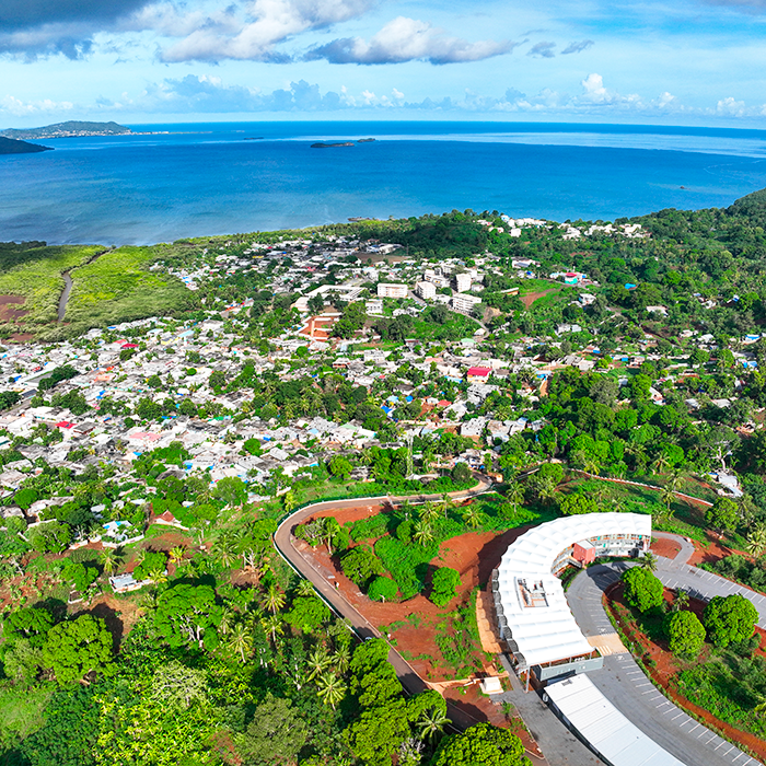
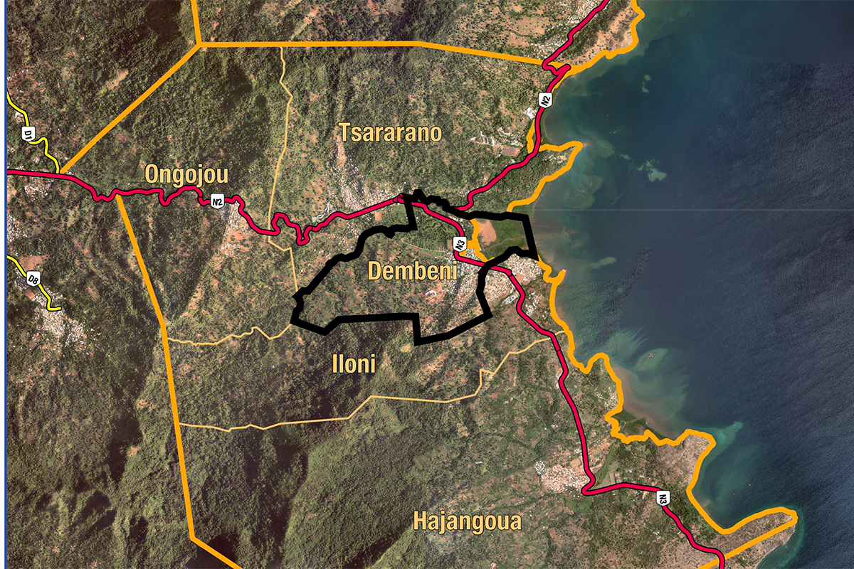
SITE / CONTEXT
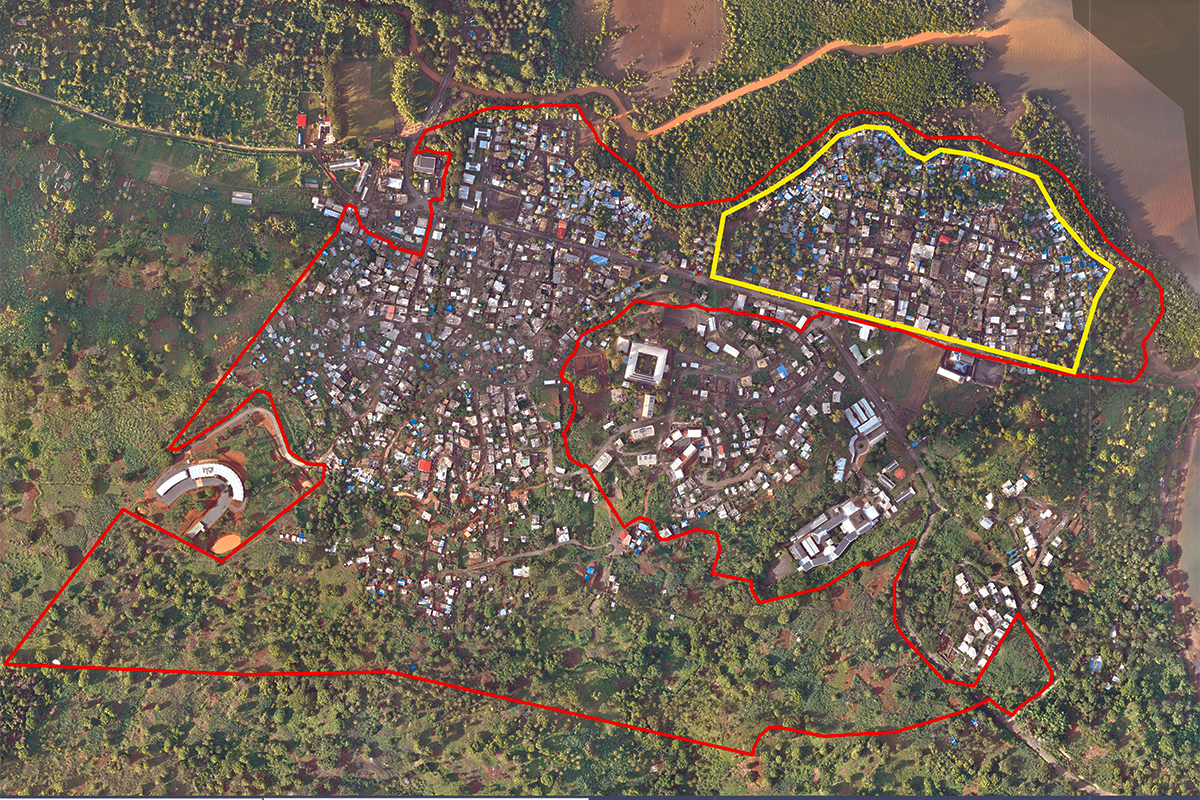
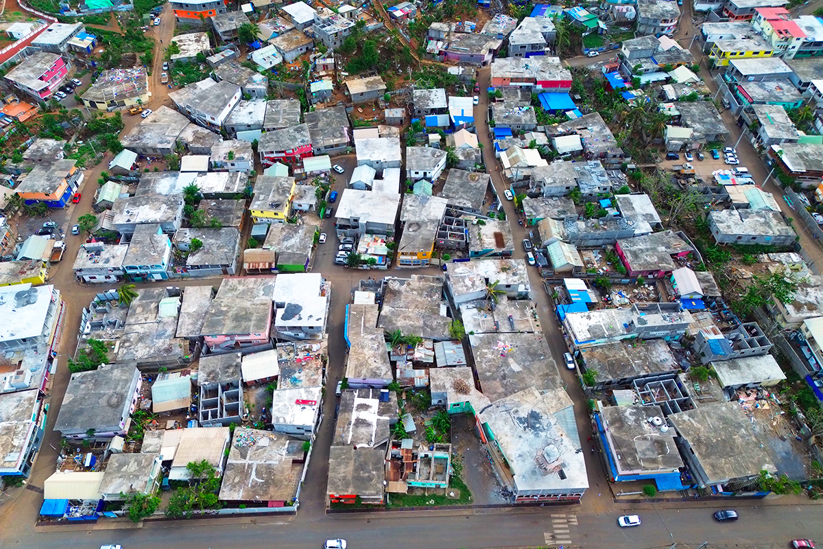
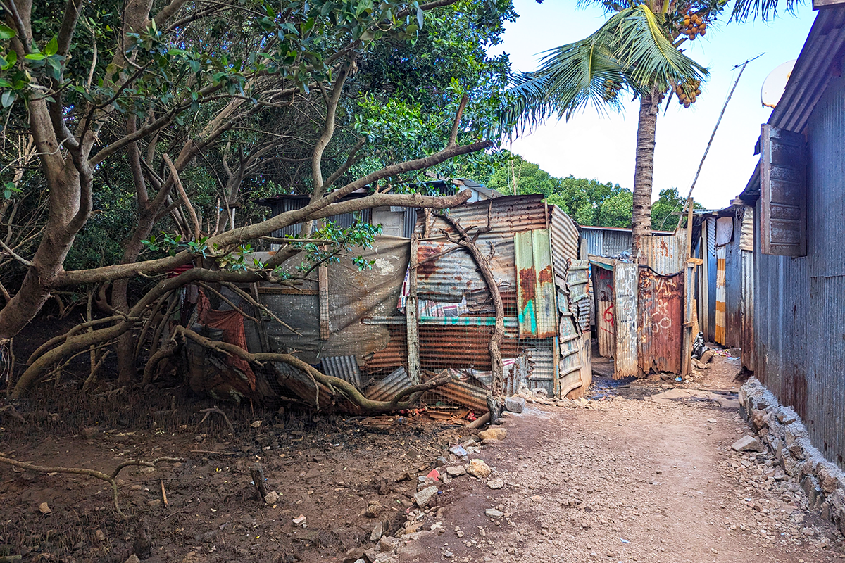
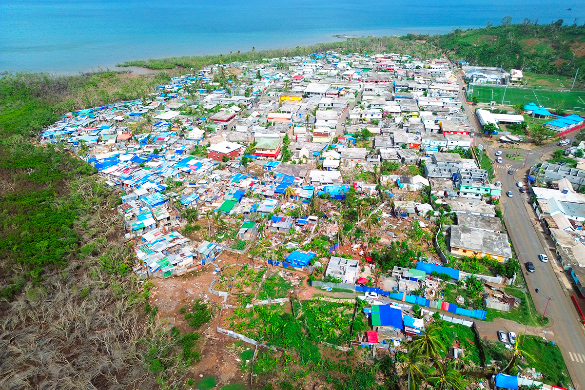
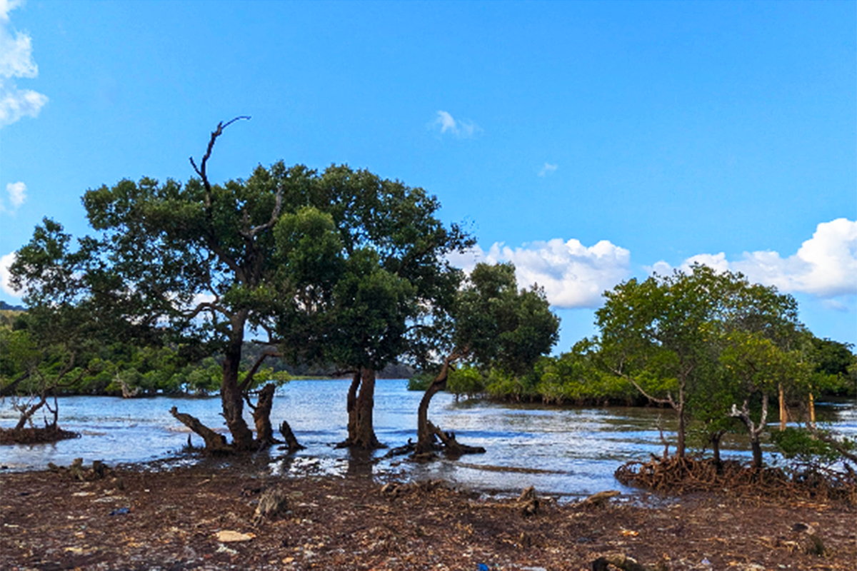
Located in the municipality of Dembéni, on the eastern coast of Mayotte, the site extends along National Road 3 (RN3). Characterized by informal urbanization, it presents a mosaic of self-built dwellings, ranging from simple tin-roofed « bangas » to multi-story concrete houses. Often constructed in high-risk areas and near protected natural spaces, these buildings exhibit a gradual decline in quality as they extend away from the main road towards the mangrove.
Covering 11 hectares, the area serves as a strategic link between the University of Mayotte, the Tsararano-Dembéni mixed-use development zone (planned for 2,600 housing units), and the mangrove ecosystems. It comprises several neighborhoods: Irashi and Mouhokoni in Dembéni, Manyasini and Minadzini in Iloni, all characterized by informal housing. Mapping of the area reveals a stark contrast between a structured urban core and an extensive natural zone, where substandard housing is concentrated—particularly in Manyasini, which in 2017 had 249 dwellings in high-risk areas out of a total of 310.
The passage of Cyclone Chido on December 14 highlighted the site’s resilience. The cyclone’s eye passed during low tide, and the mangrove’s protective role helped reduce its impact on the neighborhood. Informal structures were quickly rebuilt, while concrete buildings, with their flat roofs and low height, demonstrated greater resistance. However, certain infrastructures, particularly schools, suffered more significant damage.
This event underscores the urgent need to integrate resilience strategies against natural hazards into urban planning. Positioned at the intersection of development challenges and ecological preservation, Dembéni represents a testing ground for urbanization models that foster a sustainable coexistence between sensitive natural ecosystems and human habitation.
QUESTIONS FOR COMPETITORS
At the scale of the study site: how can the interfaces between inhabited and natural areas be reorganized to promote resilient urbanization adapted to local socio-cultural dynamics?
What rehabilitation strategies can be implemented in neighborhoods located in high-risk natural hazard zones?
At the scale of the project site: how can mangrove spaces be sustainably reintegrated into the urban fabric while fostering an inclusive approach for residents?
How can innovative solutions be designed to rehouse populations with dignity while enhancing the natural heritage?
This site invites participants to redefine intervention methods for precarious housing by combining architectural innovation, bioclimatic solutions, and the restoration of fragile ecosystems.
Teams will be expected to propose solutions that align with an urban resilience approach and a co-construction process with local communities.
Questions on the site
Will there be a brief in English?
hello,
there is a synthetic file site in English and a complete brief in English.
To be able to read the brief, you'll have to register.
A visit of the site is organized the 17th of april. This visit will be filmed. A report will be written, both in French and in English.
These documents will be posted on the Europan website and accessible for free.
This site is connected to the following theme
Re-sourcing from natural elements
Regenerating Landscapes
How to design processes and projects for the revaluation of landscapes that focus on the interdependencies and eco-dependencies of resources (natural, cultural, productive) and the territory? The regeneration of landscapes can become a mediation tool between residential areas, facilities, and obsolete infrastructures and territories undergoing transformation (even at risk) as a result of the effects of climate change. Is an invitation to think at the resources of the area in a regenerative way to support a healthier environment for humans and non-humans?
Specific documents
Questions on the site
You have to be connected –and therefore registered– to be able to ask a question.
Fr. 16 May 2025
Deadline for submitting questions
Fr. 30 May 2025
Deadline for answers
Before submitting a question, make sure it does not already appear in the FAQ.
Please ask questions on sites in the Sites section.
Please ask questions on rules in the Rules section.
If your question does not receive any answer in 10 days, check the FAQ to make sure the answer does not appear under another label or email the secretariat concerned by the question (national secretariat for the sites, European secretariat for the rules).