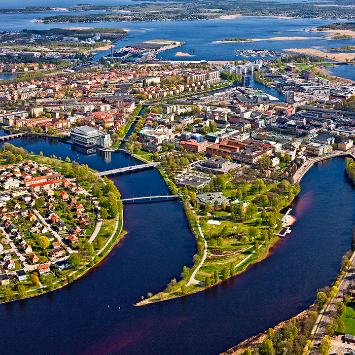
Karlstad (SE)
The Synthetic Site Folder and Site Brief are available for free.
Please register and login to access the Complete Site Folder.
- Synthetic site folder EN
- Site Brief EN
- Complete site folder
- Site on Google Maps
- Back to map
Data
Karlstad (SE)
Scales L/L
Team composition Architect non mandatory
Location Karlstad
Population 97 000 inhabitants
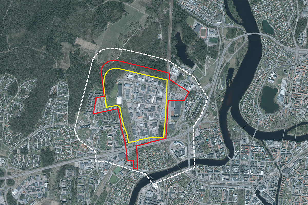
Reflection site 106 ha - Project site 71 ha
Site proposed by Karlstad municipality
Actors involved Karlstad municipality
Owner(s) of the site Karlstad municipality, private developers
Commission after competition Meeting and workshop with the municipality and the prize winning team(s). The proposals will form the basis for a citizen dialogue, a dialogue with politicians, and the development of a planning programme. The ambition is that the winning team will continue to work together with the municipality on the proposal in the planning programme.
More Information
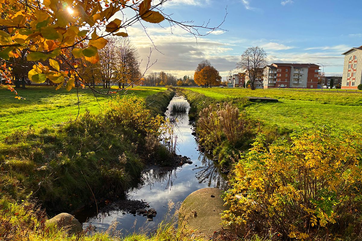
SITE / CONTEXT
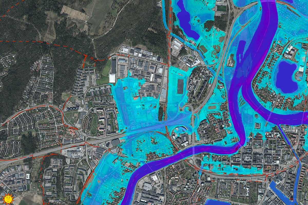
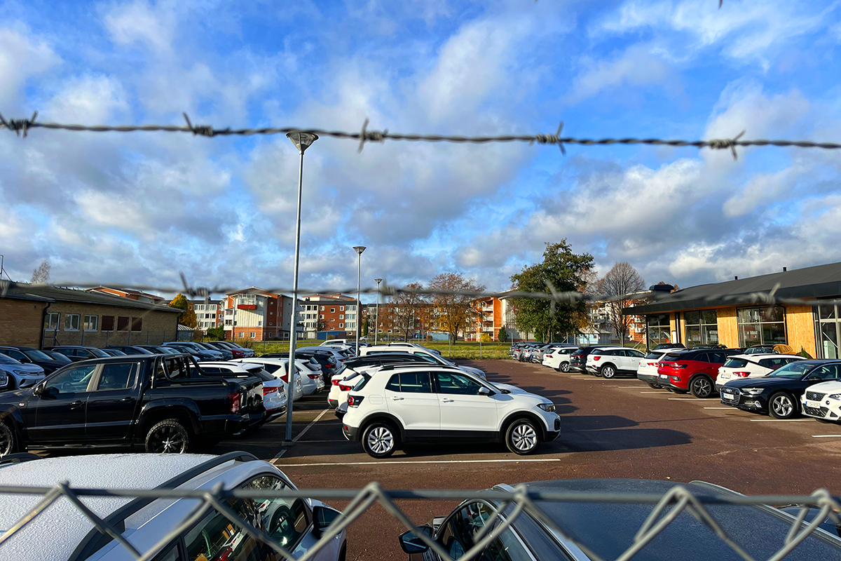
The project site includes Våxnäs industrial area and Låglandet Park, and presents a unique opportunity to shape the future Karlstad. Developed during the 1970s and designed for increasing car use, today the area is dominated by industry, commerce, and sports facilities, leaving it disconnected from its surroundings and unsafe at night.Våxnäs’ strategic location—just two km from Karlstad’s city centre—positions it as a key site for redevelopment into a vibrant, multifunctional district where housing, businesses, public infrastructure, and green spaces coexist. Flooding is a significant challenge due to Våxnäs’ flat terrain and clay-rich soil. Integrating water management strategies into public spaces is critical. Låglandet Park, central to stormwater management, could evolve into a multifunctional district park that blends flood resilience with recreation. Green infrastructure can transform flood-prone areas into assets for recreation and biodiversity, enhancing quality of life and connecting built environments with natural systems.
The I2-Forest, Karlstad’s largest outdoor recreational area and a great biodiversity asset, borders Våxnäs but remains underutilised due to limited access points. Developing green corridors and creating clear entrances can link Våxnäs with ecological networks and strengthen biodiversity. Similarly, connecting Våxnäs to the city centre and other districts through an expanded public transport network, alongside enhanced pedestrian and cycling infrastructure, will reduce car dependency and promote sustainable mobility.
Våxnäs’ redevelopment should be phased, considering existing resources to ensure a sustainable evolution. Key opportunities include the planned relocation of the bus depot, the reconfiguration of areas around the sports fields and Låglandet Park, the temporary use of spaces for cultural or recreational purposes, and the potential repurposing of vacant industrial lots. These incremental changes can catalyse further regeneration, supporting both economic and social sustainability/
QUESTIONS TO THE COMPETITORS
Participants are tasked with reimagining the area as a lively mixed-use neighbourhood, active throughout the day, that integrates a variety of housing, businesses, public spaces, and green infrastructure. The vision must address challenges such as flooding, connectivity, and social cohesion while leveraging existing resources and phasing strategies.
How can flood-prone areas in Våxnäs be transformed into assets for recreation, resilience, and biodiversity? How can water management strategies be integrated into public spaces to address flooding while enhancing quality of life? What strategies can strengthen links between Våxnäs and Karlstad’s green infrastructure, such as the I2-Forest and ecological corridors? How can Våxnäs prioritise pedestrians, cyclists, and public transport while reducing car dependency?
What strategies can ensure coexistence between human activity and the preservation of non-human life?
What phased transformation process and collaboration among stakeholders can ensure long-term success? What existing resources, such as industrial buildings and infrastructure, can be repurposed for sustainable development? How can key sites like the former bus depot and the reconfiguration of areas around the sports fields and Låglandet Park, serve as catalysts for regeneration?


Questions on the site
You have to be connected -and therefore registered- to be able to ask a question.
This site is connected to the following theme
Re-sourcing from natural elements In this family of sites, the potential of soils could guide the evolution of a site in a process of space’s regeneration, intensification or addition. The biological dimension of available land could trigger new ecological and social relations, and interactions between organisms for a mutual benefit. From the horizon to the scale of the microorganism: which is the capacity of soils to infiltrate biodiversity provide ecosystem services and give continuity to the territory?
Reactivating Soils
Specific documents
Questions on the site
You have to be connected –and therefore registered– to be able to ask a question.
Fr. 16 May 2025
Deadline for submitting questions
Fr. 30 May 2025
Deadline for answers
Before submitting a question, make sure it does not already appear in the FAQ.
Please ask questions on sites in the Sites section.
Please ask questions on rules in the Rules section.
If your question does not receive any answer in 10 days, check the FAQ to make sure the answer does not appear under another label or email the secretariat concerned by the question (national secretariat for the sites, European secretariat for the rules).