Nome (NO)
The Synthetic Site Folder and Site Brief are available for free.
Please register and login to access the Complete Site Folder.
- Synthetic site folder EN
- Site Brief EN
- Complete site folder
- Site on Google Maps
- Back to map
Data
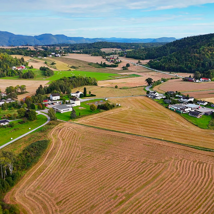
Nome (NO)
Scales XL
Team composition Architect non mandatory
Location Nome municipality
Population 6 587 inhabitants
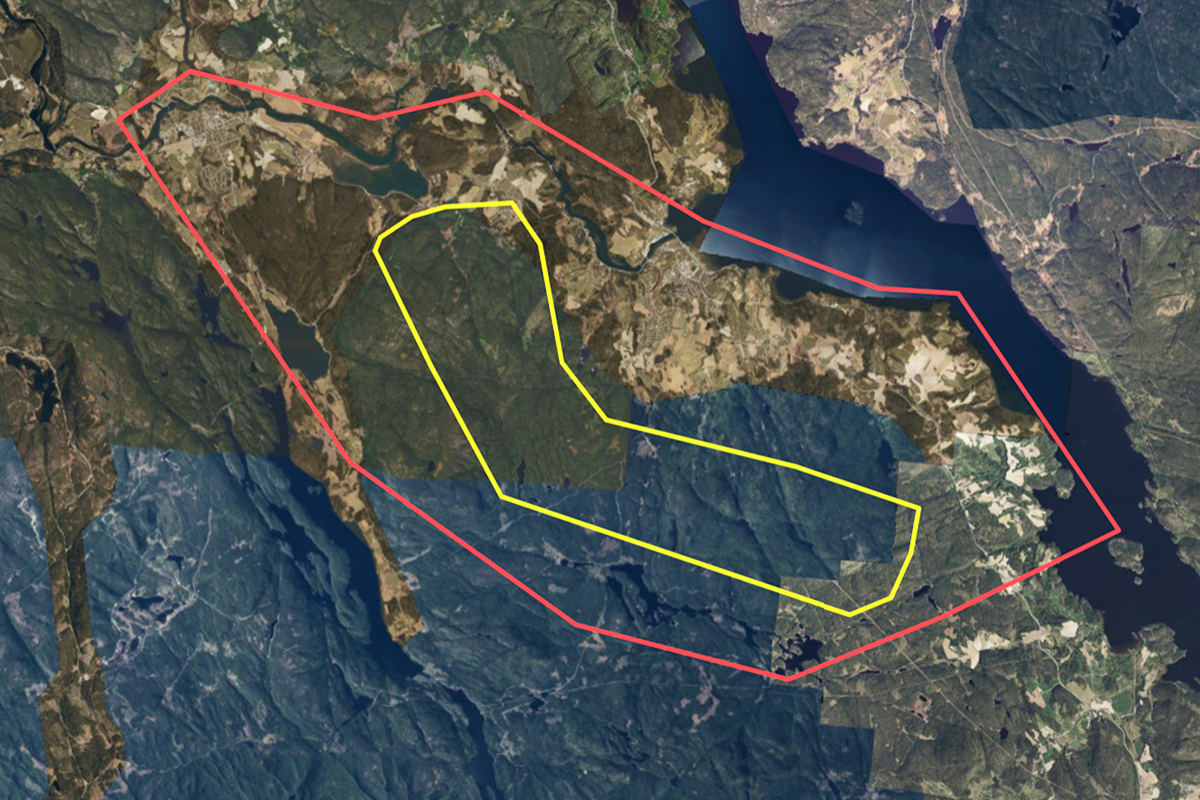
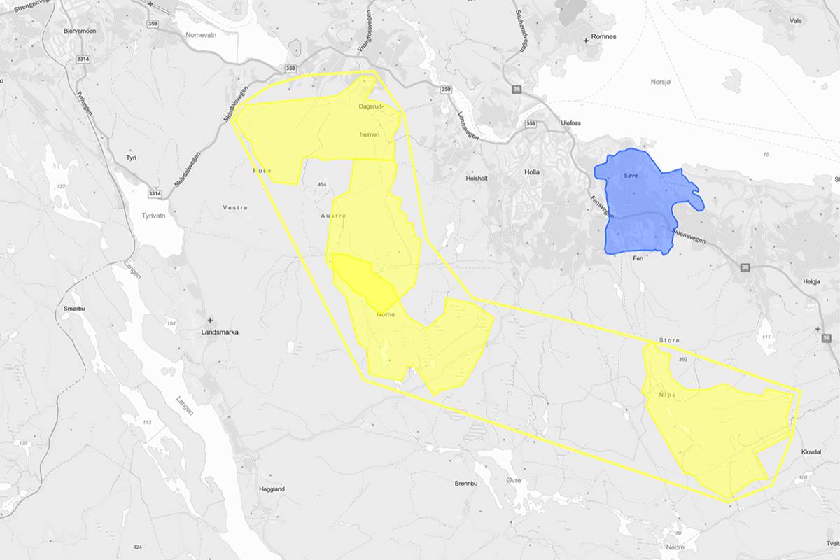
Reflection site 1200 ha - Project site 300 ha
Site proposed by Nome Municipality
Actors involved Nome Municipality
Owner(s) of the site Nome Municipality
Commission after competition After the competition, Nome Kommune has the intention to award a contract to the winning team(s) for detailing the proposal further and adapting it to work as a base for the planning processes.
More Information
SITE / CONTEXT
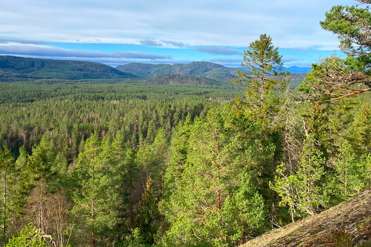
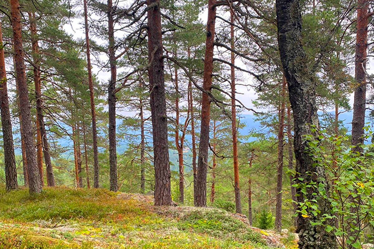
This competition invites proposals for the future of the Fen Complex, Europe’s largest rare earth element (REE) discovery —a resource vital for technologies like supermagnets, computers, and rockets. This discovery pressures Nome municipality to allow mining, but no decision has been made yet. If approved, the mine will permanently alter the landscape, requiring extensive infrastructure, including landfills that could rival the size of nearby mountains.
Nome is exploring the consept of a Green Mineral Park—an industrial ecosystem where companies collaborate to minimize waste and maximize circularity. Typically only 1% of the rock extracted contains REEs, the remaining 99% holds untapped potential. Instead of focusing solely on technical and economic factors, this competition highlights the broader spatial and societal implications. How can such a transformation integrate with its surroundings and remain adaptable for future technologies? How can it benefit local communities?
Ulefoss and Lunde, the towns closest to the mine, stand at a crossroads. This industrial intervention could either deepen stagnation or become a catalyst for growth, infrastructure, and identity. How can development support—not isolate— these communities? What role can architecture, landscape design, and urban planning play in making the Green Mineral Park a driver of sustainable transformation? Beyond mitigating environmental damage, this competition seeks ways to turn industrial change into a generative force that brings new opportunities for living, working, and coexisting with extraction landscapes.
Europan 18 invites architects, landscape designers, and planners to rethink industrial extraction—where infrastructure, ecologies, and communities coexist. Instead of a fixed master plan, proposals should offer a framework for discussion, helping local stakeholders understand the potential of this transformation. How can large-scale industries revitalize rather than deplete the small towns of Lunde and Ulefoss? How can this development set a precedent for sustainable mineral extraction elsewhere?
QUESTIONS TO THE COMPETITORS
This is a speculative task asking you to be a futurologist. Create a vision for the “Green Mineral park.” Use your skills as architects, landscapers, and planners to explore how one might imagine the planning of a circular industrial park with a large footprint.
(1) How can concepts for the Green Mineral Park ensure that industrial development is spatially, ecologically, and socially responsive?
(2) How can material reuse, reduced environmental impact, and industrial synergies transform mining byproducts into new opportunities for local development?
(3) How can you visualize spaces and strategies to help the public, decision-makers, and stakeholders imagine the park’s potential and spark discussions?
Questions on the site
Updated map data and 3D models for the Nome site are now available on the Europan server.
The material is organized into two folders:
-
Satellite Images and GIS Data: Includes various file types, such as satellite images and terrain data.
-
DXF and Rhino: Contains 3D data. This folder includes:
-
Individual files in their original formats
-
Combined 3D files in both 3dm and DXF formats (both files contain the same information, only in different formats).
-
Is there any requirements for types of drawings or maps to present in the final boards?
The requirements for the 3 vertical A1 PDFs are listed in the Europan 18 rules under §4.4 Items to Submit.
There is no fixed list of required drawings (e.g. plans, sections, etc.), but the content should visually and clearly communicate your proposal across scales. All drawings must include a graphic scale.
But as is written in the rules the panels must:
- explain the urban ideas developed in the project with regards to the site issues and the thematic orientations of the session;
- develop the project as a whole, highlighting the architecture of the project, and particularly the relationship between the new developments and the site’s existing context, including three-dimensional representations of the project;
- develop the method foreseen for the implementation process.
Hello, we have been trying to download the basic material by folder. But when I download one folder (such as "1-Territory (3)") it contains just empty folders. Do you have any idea why? Thank you
It looks like there was an issue with the transfer of several files during the initial upload. We’ve now uploaded a new folder called "Updated_Material_Folder" inside "0-New_Docs_after_Launch", which contains all the original materials.
Please try downloading the updated folder, and let us know if you encounter any further issues.
Hello, We are still unable to download the documents by folder, they can be downloaded only one file by one (e.g. if we download the folder "1-Territory (3)", the folder is empty, but if we can download the single file "nome_10000"). I would like to know if this is a problem related to our account or not and if we can find a solution.
Europan Norway is not able to solve this from our side. Therefore technical questions like this should be directed to Europan Europe at contact@europan-europe.eu, as they are responsible for managing the server platform across all countries, including Norway.
This site is connected to the following theme
Re-sourcing from natural elements How to design processes and projects for the revaluation of landscapes that focus on the interdependencies and eco-dependencies of resources (natural, cultural, productive) and the territory? The regeneration of landscapes can become a mediation tool between residential areas, facilities, and obsolete infrastructures and territories undergoing transformation (even at risk) as a result of the effects of climate change. Is an invitation to think at the resources of the area in a regenerative way to support a healthier environment for humans and non-humans?
Regenerating Landscapes
Questions on the site
You have to be connected –and therefore registered– to be able to ask a question.
Fr. 16 May 2025
Deadline for submitting questions
Fr. 30 May 2025
Deadline for answers
Before submitting a question, make sure it does not already appear in the FAQ.
Please ask questions on sites in the Sites section.
Please ask questions on rules in the Rules section.
If your question does not receive any answer in 10 days, check the FAQ to make sure the answer does not appear under another label or email the secretariat concerned by the question (national secretariat for the sites, European secretariat for the rules).