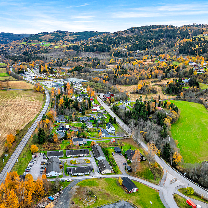
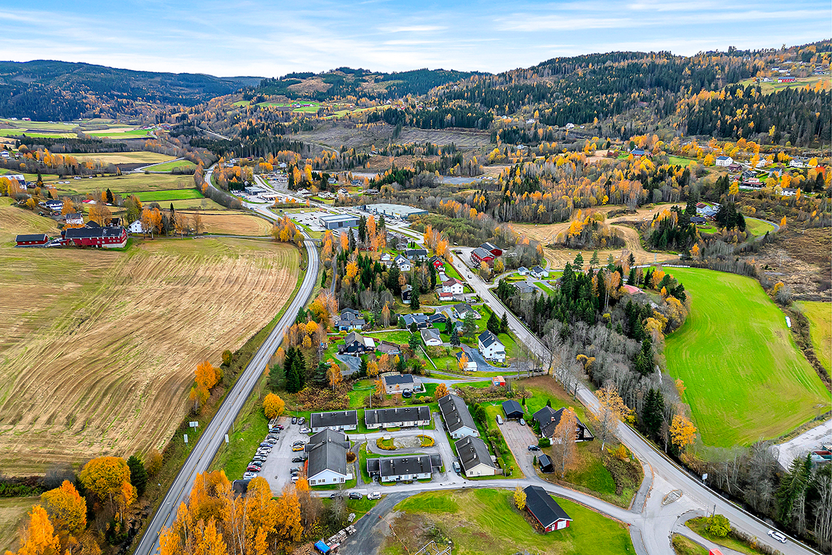
Roa (NO)
The Synthetic Site Folder and Site Brief are available for free.
Please register and login to access the Complete Site Folder.
- Synthetic site folder EN
- Site Brief EN
- Complete site folder
- Site on Google Maps
- Back to map
Data
Roa (NO)
Scales L
Team composition Architect non mandatory
Location Lunner municipality
Population 950 inhabitants
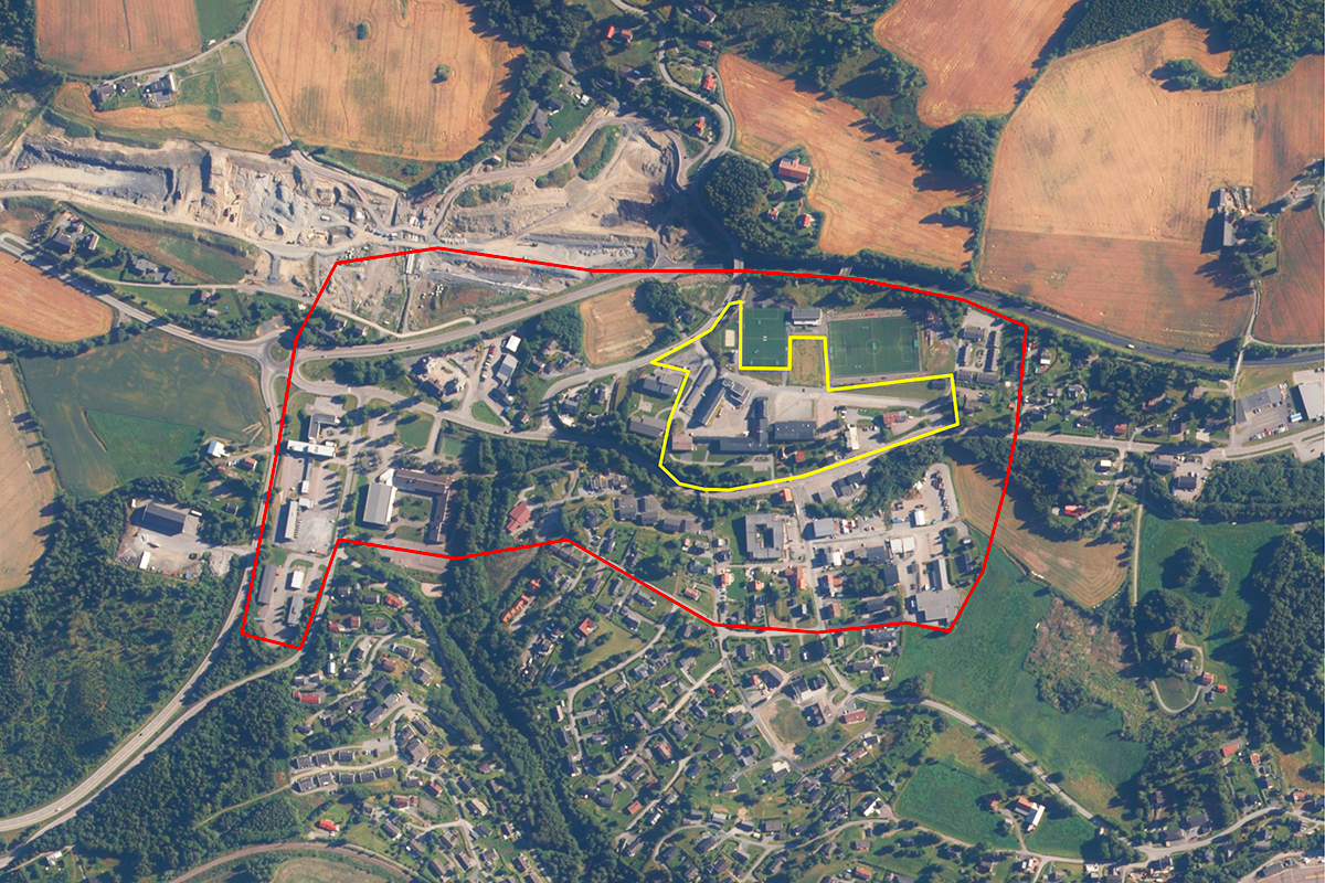
Reflection site 26 ha - Project site 3 ha
Site proposed by Lunner municipality
Actors involved Lunner municipality, Akershus county
Owner(s) of the site Lunner municipality
Commission after competition After the competition Lunner Kommune has the intention to award a contract to the winning team(s) for detailing the proposal further and adapting it to work as a base for the planning processes.
More Information
SITE / CONTEXT
Roa, nestled north of Oslo, faces a paradox. While its sister villages thrive as Oslo suburbs, the northernmost settlement of Lunner Municipality Roa, stagnates, seemingly "just a little too far away” from the metropolitan boom. Fragmented and dispersed planning and a dearth of public spaces further erode its appeal. Ironically, its strategic location sitting just outside of a newly established road toll is making Roa increasingly attractive to larger industries and big-box retailers.
Norway's unique geography, climate, and rugged terrain have led to the development of numerous communities with a car- based suburban structure. Additionally, Norway's economy has traditionally been based on resource extraction and agriculture, which has led to the development of smaller, dispersed communities like Roa. These settlements often lack the infrastructure and amenities of a traditional city center, such as public transportation, walkability, and mixed-use zoning. Often, these communities are characterized by an aging population, as the younger generations move to the cities in search of work. Thanks to better healthcare, nutrition, and living conditions, life expectancy is high, and people are living longer than before. Coupled with a rapidly declining birth rate and decrease in fertility, this results in fewer young people and, essentially, fewer hands at work. Norway is no exception to this. Neither is Roa.
The aging population, commonly known as “eldrebølgen,” will increase the demand for healthcare and support services, putting significant strain on the health system and its resources, personnel, and infrastructure. The very fabric of Roa – its dispersed single-family housing model – will aggravate these pressures. The fact that Roa needs 300 senior-adapted housing units underscores the urgency of addressing this demographic shift.
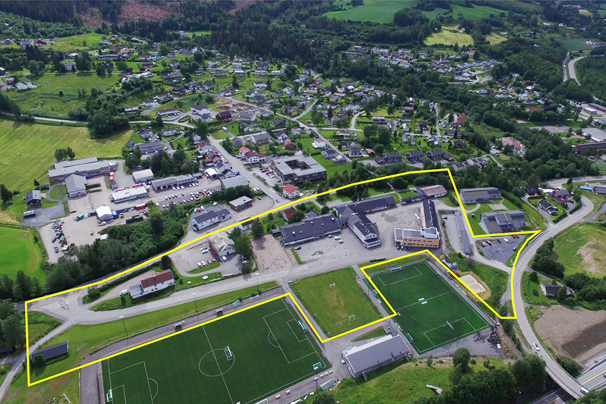
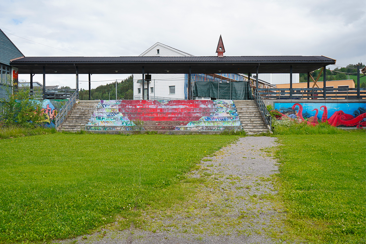
The need for housing, coupled with the need for modern medical facilities, a new library, and much-needed public spaces, presents a chance to reinvent the village centre. The former Frøystad school grounds and a soon-to-be-vacant industrial site offer a whole new chance to rethink the centre of Roa. It is essential for these housing units to be built as inclusive communities that prioritize social connections among residents and public spaces that give youth an elderly chances to meet and hang out all year. The vision is bold: to transform these sites into mixed-use neighborhoods, converging at the main street, breathing life into a new village heart.
QUESTIONS TO THE COMPETITORS
The task is about generating a vision for how the site can be transformed with housing, social and physical activities for young and elderly people as well as a few key services.
The second objective of the competition is to explore how developing Frøystad can be the starting point to help structure a denser, more attractive, and inclusive center in Roa beyond the project site, in a way that can free up brownfields for development to ease the pressure on virgin lands.
Questions on the site
Dear Europan team, are there floor plans for the following buildings on the property in Roa, Norway? 1. Library 2. Youth center 3. Part of the building where the swimming pool is located
We have uploaded available floor plans for the Frøystad building complex, which includes the areas used for the library, youth center, and swimming pool. You will find these files inside the folder Frøystad Building Documentation, which has been placed in the new documents after launch folder on the Europan site.
The folder contains:
-
Frøystad_SitePlan.dwg
-
Frøystad_FloorPlans_Level_U.dwg (Underground level)
-
Frøystad_FloorPlans_Level_1.dwg (Ground floor)
-
Frøystad_FloorPlans_Level_2.dwg (Second floor)
-
Frøystad_Sections.dwg
-
Frøystad_AsBuilt_IFC.ifc
Dear Europan Norway Team, Could you provide more details about the Røa site visit on April 28th? Specifically, how to reach Røa, the visit's timing, whether participation is mandatory, and whom participants will meet. I’d like to plan ahead accordingly. Thank you!
The site visit to Roa will take place on April 28th at 13:00. Participants will meet in front of the Town Hall, and the visit will include a site tour with representatives from Lunner Municipality, lasting approximately 1.5 hours.
Roa Stasjon can be reached by the RE30 and RE31 train from Oslo Central Station (a little over an hour). The Town Hall is about a 20-minute walk from the train station.
Participation is not mandatory.
Is it possible to obtain more details about the existing buildings on the site, such as drawings or additional pictures (both interior and exterior), which could be beneficial for resourcing?
We have uploaded a folder titled Frøystad Building Documentation in 0-New_Docs_after_Launch. It contains a range of drawings of the existing buildings. Unfortunately, we don’t have any additional interior or exterior images available to share.
Dear Europan Norway team, can you provide a map or mark-up showing lands owned by the municipality in Roa? Are the structures directly to the south of the swimming pool (the 2 buildings marked for demolition in the brief) owned by the municipality?
We have uploaded a map to 0-New_Docs_after_Launch folder called roa_municipal_owned_land which shows land owned by the municpality.
This site is connected to the following theme
Re-sourcing from social dynamic The “multiple heritage” of derelict buildings provides a precious source for a larger urban transformation, which is launched by interventions that operate first in the scale of the site itself, Integrating social and cultural traces in the sites’ geographical and physical rehabilitation enables an upscaling of the transformation’s impact. It can induce a second life whose urban energy radiates far beyond its physical limits.
Inducing a Second Life
Questions on the site
You have to be connected –and therefore registered– to be able to ask a question.
Fr. 16 May 2025
Deadline for submitting questions
Fr. 30 May 2025
Deadline for answers
Before submitting a question, make sure it does not already appear in the FAQ.
Please ask questions on sites in the Sites section.
Please ask questions on rules in the Rules section.
If your question does not receive any answer in 10 days, check the FAQ to make sure the answer does not appear under another label or email the secretariat concerned by the question (national secretariat for the sites, European secretariat for the rules).