Bærum
Les Dossiers synthétiques et d'enjeux sont disponibles gratuitement.
Merci de vous inscrire et vous connecter pour accéder au Dossier complet de site.
- Dossier synthétique EN
- Le site sur Google Maps
- Retour à la carte
Données synthétiques
Category Urban - architectural
Team representative architect - urban planner - landscape architect
Location Hamang, Sandvika, Bærum municipality
Population Bærum municipality 116,000
Strategic site 164 ha - Project site 25 ha
Site proposed by Bærum municipality
Owner(s) of the site Various private owners
Commision after competition Building commission (first phase intervention in area); Zoning plan
Information complémentaire
How can the site contribute to the adaptable city?
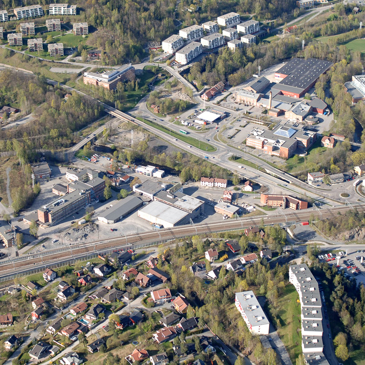
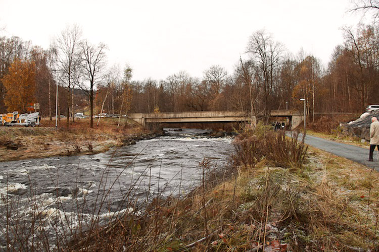
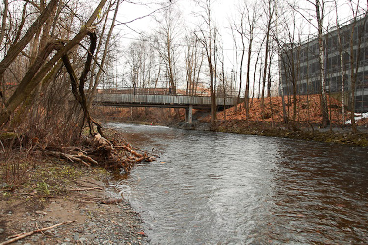
The post-industrial area of Hamang in northern Sandvika, the urban centre of Bærum municipality, is about to undergo a fundamental transformation. The E16 highway, currently splitting the area, will be rerouted into a new tunnel, opening up for a new use of this central part of the city. Competitors are asked to propose a strategy for the development of a carbon neutral area in one of the most central nodes in the Oslo region. The proposals should present a concept for the program, landscape and built volume that give the site a new identity. The Sandvika river runs through the site and is a carrier of rich biodiversity. The city wants a plan that demonstrates how the river can be integrated into the urban fabric and utilized in a more active manner and at the same time offer protection to the local ecosystem. The competition seeks to find a strategy for the use of the waterway, including plans for infrastructure as well as new programs for the river and riverbed. Climate change imposes restrictions on the flood-prone areas. An important part of the task is to find suitable programs and infrastructure adaptable to various water levels.
City strategy
The municipality wants to use the competition to explore the site and city’s capacity for growth. At the same time a mix of demography and programs is essential. Who can live here? What can people do here? It’s important that the site responds to a regional context, but at the same time develop a local identity, complementing the other areas in Sandvika. The site is part of the program Futurebuilt, which aims for a carbon neutral urban development and competitors are encouraged to show how the ambition of climate neutrality can be met. This includes good strategies for transport, to facilitate people walking, cycling, using public transport and strategies for energy reduction and energy production.
Site definition
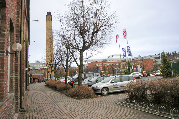
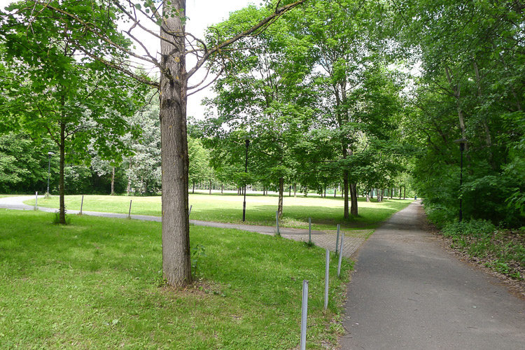
Hamang can be described – historically and topographically – as Sandvika’s backyard. Hamang is located on a delta, separated from the rest of Sandvika by the river, the highway and the railroad. The river is the dominant element as it meanders through the area, and a verdant and rural presence is strongly felt here due to the green belt and the lush vegetation alongside parts of the river. The mix of new and old industrial buildings contributes to a uniquely different identity to this district. Hamangsletta is today characterized by a mixed program; partly industrial, educational, infrastructural, commercial and recreational.
Adaptability: main challenges to take into account
The Hamang site’s main challenges regarding adaptability can be summarized in the following key points; the site’s ability to absorb growth, the site’s adaptability to Sandvika and the greater Oslo Region, how the flood restricted riverscape can be programmed, reuse of former industrial buildings and finally how one can introduce smaller temporary projects on site, adapting through time.
Questions à propos du site
What are the minimum requirements to comply with the objetives of housing density in the area?
Our Competition Program does not give absolute minimum standards for building density, but we recommend min. 6 flats per daa. Number of housing units might vary depending on unit size. A certain diversty in unit size is recommended. A size range from 40 to 100m2 sees reasonable.
Is it possible to have more information on the data/assumptions used for the study that was carried out to produce the map showing the flood levels (200-year,10-year) and/or information where we can obtain such data?
The source of the flood zone map is Norwegian Water Resources and Energy Directorate-(NVE). The map was approved in December 2003 and revised in 2013. It was retrieved information from various monitoring stations for rainfall and flooding for the following repetition interval: 500, 200, 100 and 10 years. This data has been the basis for establishing 18 profiles in strategic points in the river where future water level is estimated.
In the NVE guidelines it reads: In areas for residential buildings and commercial buildings it will be sufficient to delineate the area that is covered by the 200-year flood, as protected zone.
NVE states that a safety zone of 50 cm beyond the lines of 200-year flood will accommodate more water from climate change for the next 100 years. Bærum has indicated that a safety zone of 50 cm beyond the lines 200 year flood form the basis for further planning of the area.
Could you please give us links to official region maps (not only Google maps) on which we can see the city's borders, plots and some other layers, like schools, public buildings, or even a terrain in 3D?
Regional maps can be found here: www.geodata.no/Geodataonline/English
What does "daa" mean?
1 daa = 1,000 m2
Is it possible to obtain a 3D model of terrain and building that is not exploded (like it is in given files)? The best would be the model composed of solids, or faces, so we could render the area in different cad programs. From the material given we can conclude that Baerum poses a very precise 3D model but unfortunately it was exported to dxf without keeping faces, ora solids - that makes render totally impossible and we once should build the 3D model from the scratch.
Unfortunately the municipality does not posess a 3-D model of the site and the surroundings.
In the document BAERUM-NO-PS-M4-6.pdf, we can find the information about new housing development close to the competition zone. In the North-West side of the competition zone 100 new flats are planned. Could you please provide us more precise information about this new development? How many buildings, how many levels etc?
The development consists of 4 appartment blocks of 3-7 floors. See uploaded zoning plan for further information.
What's the approximative area of "project site"? In the competition brief only 43ha are given for "strategic site". According to measures made in cad we found out that "project site is around 25ha - that would mean that given "strategic site" it's much bigger than 43ha.
The project site is about 25 ha and the strategic site is about the 164 ha.
Can you please clarify whether the river protection zone is 30 m. across both sides of the bank, i.e. 15 m. on each side? And where is this protection zone measured from the midline of the river?
The protection zone is 30 m. on each side of the river, measured from the outer line of the river.
In the rules of the competition it is explained that the name of the city has to be next to the blank box where the code will be printed. Baerum is the region, should we write Sandvika or Baerum as the title in the web?
Bærum is the municipality responsible for the competition. You shall refer to Bærum when filling out forms.
Le site est lié au thème suivant
Ecorythmes La ville contemporaine cherche à anticiper l’avenir et à se préparer aux changements imprévisibles qu’il porte en lui. Différentes stratégies sont actuellement développées pour construire les conditions d’une résilience créative, donc à savoir s’adapter à un environnement changeant. L’hypothèse des Ecorythmes consiste à fonder le développement urbain sur une meilleure synergie entre les milieux naturels et urbains afin de rompre avec la logique d’opposition qui a conduit à un éloignement du citadin des réalités naturelles et à une dégradation progressive de celles-ci.
Cet éloignement du citadin et de la nature n’est pas seulement spatial, il est aussi temporel. En effet, le paysage n’est pas un tableau figé, une belle image, mais un milieu vivant où règnent des cycles (saisons, jour et nuit, marées, variations climatiques, vies faunistique et floristique…), des forces de croissance, des mouvements rapides ou lents, des migrations et transhumances, etc.
A l’inverse d’un urbanisme moderniste ayant privilégié une rupture entre les rythmes urbains et naturel, il s’agit, à travers les sites portant tous une dimension paysagère forte, d’encourager la mise en œuvre des processus opérationnels fondés sur le maintien, l’instauration ou la régénération de ces écorythmes.
Documents spécifiques
Questions à propos du site
Pour pouvoir poser une question, vous devez être connecté (et, par conséquent, inscrit au concours).
Ve. 16 mai 2025
Date limite de soumission des questions
Ve. 30 mai 2025
Date limite de réponses aux questions
Avant de soumettre votre question, assurez-vous qu'elle n'apparaît pas déjà dans la FAQ.
Merci de poser vos questions sur les sites dans le menu Sites.
Merci de poser vos questions sur le règlement dans le menu Règlement.
Si votre question ne reçoit pas de réponse dans les 10 jours, merci de vérifier qu'elle ne figure pas dans la FAQ sous un autre intitulé ; sinon, contactez le secrétariat concerné par email (secrétariats nationaux pour les sites, secrétariat européen pour le règlement.)