Gjilan
Les Dossiers synthétiques et d'enjeux sont disponibles gratuitement.
Merci de vous inscrire et vous connecter pour accéder au Dossier complet de site.
- Dossier synthétique EN
- Le site sur Google Maps
- Retour à la carte
Données synthétiques
Category Urban Transformation
Team representative Architect - urban planner - landscaper
Location Gjilan – Kosovo
Population Town 86,500 inhab. - Municipality 135,000 inhab.
Strategic site 12.5 ha - Site of project 1.95 ha
Site proposed by Municipality of Gjilan (www.gjilani-komuna.org)
Owner(s) of the site Municipality of Gjilan and private
Commission after competition urban study + involvement in the implementation process of the architectural project
Information complémentaire
How can the site contribute to the adaptable city?
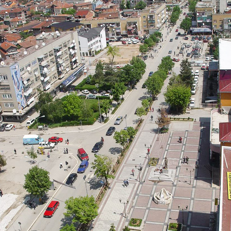
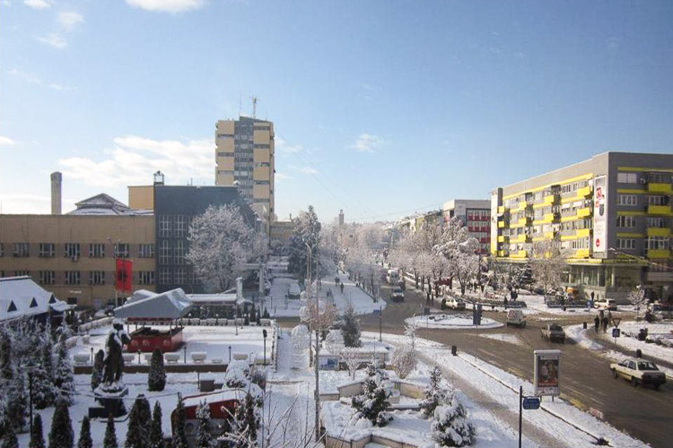
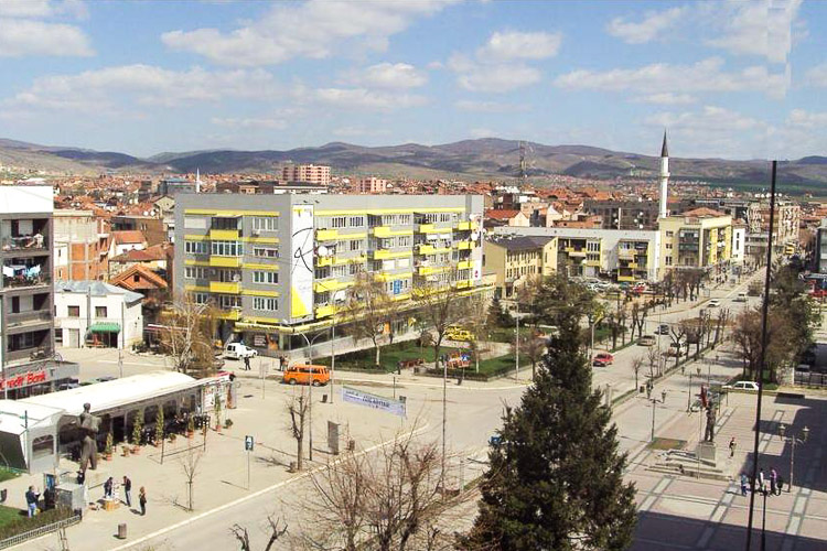
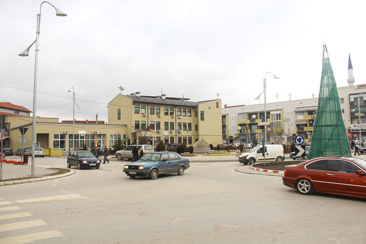
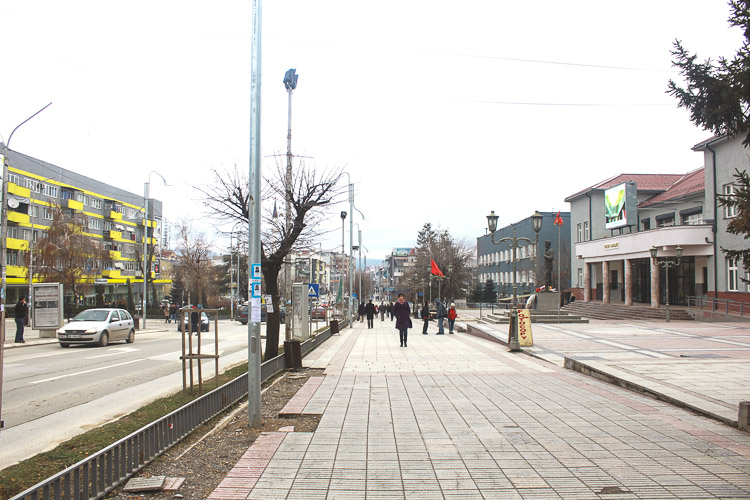
The city centre of Gjilan will undergo rapid transformation. Gjilan is one of the biggest towns in the eastern part of Kosovo known for the tradition of trade and agriculture. It is a regional centre that is important for the Morava river valley and bordering region with Macedonia and Serbia. The site proposed by the municipality currently contains the court building, police station, municipal administration and the hotel which is a private property. A big public space – more dedicated to car traffic than to pedestrians, and a small river in the northern boundary makes the link between buildings. Although this small river is covered within, the opening of riverbed and regulation will consider the spring as an open urban asset for public life.
The court and the police station buildings dates from early ‘60.
Since they are moving to the northern part of the city, Municipality has decided to demolish the old buildings and build the new municipal assembly hall and the administration building in order to bring all municipal departments in a single building.
The future development of the city centre requires more public spaces and facilities in order to support cultural life of the city. The existing municipal administration building was considered as temporary since the earthquake damaged it and caused demolition of the old municipal assembly hall. Since it can not be used properly, Municipality has decided to demolish it and leave the place for a new multifunctional cultural centre, open to all involved in culture production. The owner of the existing hotel is also interested to redevelop the site as well, and complement the hotel with shopping and leisure activities.
The public space around the buildings form the most lively city area.
Therefore municipal authorities consider that these transformations will contribute to improve the cultural life in the city and provide new facilities for municipal administration and change the image of the centre with new civic buildings and public spaces.
City strategy
The municipality of Gjilan aims to develop based on three interrelated strategies: Agriculture, tourism and cross border interchange. Urban Development strategies are linked to the vision of the whole municipality and related to spatial, economic and social deimensions of the city. One of the goals stated in the urban development plan is sustainble use of resources and use of the energy efficiency strategies.
Gjilan is gradually developing in a spatially compact city based on the following main principles: defining the building area, defining central area, housing densification, and development focused in the main strategic points of the city, creation of the efficient mobility system, easy access to the public and infrastructural services, protection and extension of the green spaces, etc.
Gjilan – a dynamic city promoting, and strengthening of the socio-economic conditions with the aim of reviving the city. The urban development plan has emphasized the culture to support the economy as one of the main development sectors based on landscape resources and cultural heritage.
The site and public space should take a role of a central area for major public events that can promote city of Gjilan as a lively and dynamic city in the southern part of Kosova.
The privatization of the main industrial plants brought the service economy in the focus and geographical position of the city in the wider region – short distance to Serbia and Macedonia, may turn it into a regional centre based on cross border cooperation between Kosovo, Serbia and Macedonia.
Site definition
The study area consist on the city centre urban area due to it’s position along the main axis which is also part of the national road linking Gjilan and Ferizaj. The site with a triangle shape, has an area of 19,650 m². It is located in the most busiest part of the city.
In the north boundary, a small Mirusha river, provide the natural feature to the cite. Covered for more then 40 it is now under recovery process to be transformed to an open public space. The river is considered as an asset to increase the value of the open public space.
The municipal authorities intents to built a new municipal assembly building which would house all municipal administration departments which are actually operating in 5 different buildings.
A cultural centre with a concert hall, dance and cinema and a small art gallery will improve the cultural life of the city.
Adaptability: main elements to take into account
Gjilan is a city with 86,500 inhabitants while the municipality has a 135,000 The main activities of the popullation are service economy, trade and small industry. The high percentage of young popullation is considerd as a resource for the future. The city has grown during 70-90 based on a two big industries – textile – carpets and curtains, and tobacco company known internatioanlly for production of cigarettes. The fall of these industries has caused economic decline which caused social problems. Gjilan is known for it’s strong tradition in cultural life. The vision for future is emphasizing the needs for cultural facilities – music, visual arts, community gathering.
Questions à propos du site
Are the buildings with orange boundary the ones that we have to shoot down and replace with others that has to create a new cultural centre? Does the new municipal assembly building have to be built into the project site?
Yes, the buildings that are marked with orange boundary are the ones that will be demolished.
And yes, the new municipal building will be built in the project site.
We will soon publish the detailed project programme.
Which are the two housing blocks close to the project site and damaged by the earthquake?
Which are the sports centre, the theatre, the big city mosque, the department store, the regional library under construction, the health care building? Is it possible to have a map with this indications?
The map with buildings marked are now available in the Complete Site Folder under "0-Additional docs on web."
We would like to have a map indicating the following existing buildings: the mosque, the sports centre, the two housing blocks damaged by the heartquake, the theatre, the department store, the regional library under construction, the health care building and the others public buildings/services (not commercial) facing the main road.
We will upload very soon the map showing the buildings that you requested.
Do you have the topography of the site?
We are preparing the file for topography. Sorry for delay because the original file was damaged. We will upload it very soon.
Where is the proposed university center going to be? The bus station currently on the south is mentioned to be moving on the North side of the site. Where exactly is its proposed new location?
The proposed University Center is going to be in the location where former military barracks were situated (north east from the project site). The location about bus station is explained.
Do we have to consider the possibility of demolishing the existing hotel and rebuilding a new and bigger building with more rooms, facilities, etc.? Can we have a detailed project programme for the new cultural centre and for the new municipal assembly hall and the administration building ? Is there a difference of level / topography on the site, between north and south? Can we have some informations/drawings about the Redevelopment Plan of Mirusha River?
Please find the Mirusha River development plan under the folder "0-Additional docs on the web"
Is it possible to have the drawing of the elevations of the existing buildings facing the main road? is it possible to have a complete dwg of the strategic area?
Sorry but we do not posses this file.
Would it be possible to have the skyscraper's height? (number 6 on the map: "Question_building_types")
How many square meters? Approximately, how many rooms?
Building number 6 in the picture is Municipality offices. It is not the tower.
The skyscraper will remain untouched.
The area which has to be designed is marked with the yellow line.
-Could you please specify the exact point, in the north of the city, where you'll plan to place the bus station?
The bus station will be positioned somewhere in the ring. It is not yet decided but as you can see from the plan, there will be a mobility point and also the bus station will be used as a connection hub.
Could you please confirm that the current market area will be displaced? Would it be possible to have the dwg file of the detailed project area (area's border line: red line)
The market will remain on the same spot but it will be smaller and more compact. It will be renewed with urban attributes. The big market will be relocated in the suburbs.
How it's possible to modify the logging informations about the team representative?
Yes, of course, the competitor can do so once logged in. Still, if it is about the email address, they have to go through Europan Europe.
Today the existing hotel is built in a private property. Would it be possible to relocate it? Is it necessary to relocate it into the same private area or can we decide of its place?
The property where the hotel is built is private property. So the hotel will be situated in the same area. We will upload the regulation lines for the hotel and the programme.
The file conurbation/gjilan-KO-C-M1.dxf partially contains the layer of the buildings. Could you provide a dxf file with the complete built layer of Gjilan? If this is not possible can you provide a wider area of project-site/gjilan-KO-PS-M.dxf?
There is no such file. You can use aerial photo.
Where exactly is the under-construction library site? Is the new bus station area already exactly planned? If so, where is it?
Under-construction library is marked in the map that is uploaded on the site folder.
Is the hotel to be demolished? If it cannot be demolished, could you give us the plans?
The hotel is part of the competition. It will be demolished and you have to propose a new hotel building. Please check under the folder (New docs after launch) where you can find the programme for the hotel and the footprint.
If our site plan involves a large area of influence so the scale of 1:1000 does not allow to include the entire area in the panel, is it possible to use a different scale? For example, a scale of 1:2000?
If you treat the area in that scale then you can present it 1:2000 for technical reasons. But the buildings designed should be presented in the requested scale.
Where exactly is the under-construction municipal court building and Police Station site?
Those buildings are mapped in the file uploaded in the folder.
Do the suggested building footprint and line that you show on the file correspond to the effective areas that we can build? Does it mean that the new builgings can only be placed in that postion with that footprint?
The footprint is presented so it can serve as orientation about the building lines.
Only the Hotel is more specific because it is private property but it doesn't mean that it has to be strict. The form of the building can be manipulated.
The Municipality building and the Cultural center are more flexibile but also it should be taken into consideration the programme that is presented.
Would it be possible to upload current street view and pedestrian view pictures of the strip-shaped city park?
Please find uploaded additional pictures from the park at the folder 5-Additional_docs_on_web - Additional pictures
Do we have to plan and design all the functions listed precisely in each building or can we just approximately fit the square meters requested without going into details of each single function requested?
The programme is specific for every building but since it is a design proposal it doesn't have to be 100% accurate. But those are the functions that have to be included in each bulding according to spatial needs.
Could you provide us a plan with heights of the buildings in the strategic site? Even for the surroundings? Thanks in advance.
Sorry, we do not have this file.
Could we have the file for topography as DWG file? (In the PDF file we can not see any number)
The file will be uploaded today.
Could you send us a plan with the localitation of the pictures?
The map of photo locations is uploaded at the folder: 05-Additional_docs_on_web
In the River study (river-Mirusha) there are some elevations of the main street (Bulevardi i Pavarësisë), could we have this elevations as DWG?
The whole study is presented in that file.
It would be possible to have pictures of the buildings that are on both sides of the main street (Bulevardi i Pavarësisë) to know how they look and how big are they? (From the busstation till the mosque)
From the folder strategic site and project site you can find pictures from the location and you can see the building hight.
How important is the traffic in the roundabout (Bulevardi i Pavarësisë / Dëshmorët e Kombit - Mulla Idrizi / Sadullah Brestovci)? It would be possible to change this crossroads to any other place of the main street or it has to stay there?
The idea is to have proposals different than existing roundabout. As it is stated in the brief, in the Urban Development Plan there is no strategy stated for the transport and mobility in the city. Feel free to give ideas that you think may work in the place.
The market is for daily use, once per week is the market day, but sometimes before holidays the number of buyers increases.
Is the underground parking a pre-condition for Gjilan competition or can we decide if we resolve the parking problem in another way?
No, underground parking is optional and one version of the solution. But certain buildings need underground parking as foreseen by the programme.
In which scale should the plans for the buildings be presented, 1:200 or 1:500?
Please read the general competition rules.
Is it possible to have the buildings program charts in excell format? Did you consider to provide more pictures of the context? Just few photos on the complete site folder are adequate for photomontages.
The programme is served as PDF format for all competitors. If we have more pictures we will upload them.
Is there any limit to the height for the new buildings? Is it realistic to plan more than one level deep underground parkings?
Building height is determined by the programe, according to the space needed and the site size.
Underground parking can be in levels but take into consideration possible access.
In the list of required informations (D section of the launching text) it seems the site plan (1:1000) should be represented separately for the study and the project site. Is it possible to depict them altogether in a single drawing? Is the detail plan (1:500) for the study site supposed to be a zoom into a limited sample of the area or a full representation of the whole area at that scale?
You have to follow the exact rules presented for all sites and locations.
Le site est lié au thème suivant
Plateformes urbaines dynamiques La revitalisation d’espaces publics actuellement peu attrayants nécessite une réflexion à une échelle plus large que celle du site donné. Même s'ils sont parfois de petite taille, ces espaces sont des leviers stratégiques pour une dynamisation urbaine. Leur influence en termes d'identité et d'image dépasse souvent leurs limites physiques et appelle donc à une transformation plus importante du tissu existant. « Angles morts » n’ayant jamais eu une utilisation adéquate ou bien lieux dont la fonction initiale est aujourd'hui obsolète ou inadaptée aux besoins des habitants, ces sites peuvent servir de plateformes à une appropriation, de point de départ pour la mobilisation de la population locale ou d’un public plus large. L'aménagement ou réaménagement de ces zones peut être considéré de diverses manières : comme un rafraîchissement par des espaces multifonctionnels, avec des structures temporaires ou extensibles qui agissent comme des piqûres d’acupuncture ; comme un ballon d'essai ayant pour but de faire connaître un territoire donné, de déclencher un cofinancement ou investissement privé et d’identifier de nouveaux rythmes d'intensité.
Questions à propos du site
Pour pouvoir poser une question, vous devez être connecté (et, par conséquent, inscrit au concours).
Ve. 16 mai 2025
Date limite de soumission des questions
Ve. 30 mai 2025
Date limite de réponses aux questions
Avant de soumettre votre question, assurez-vous qu'elle n'apparaît pas déjà dans la FAQ.
Merci de poser vos questions sur les sites dans le menu Sites.
Merci de poser vos questions sur le règlement dans le menu Règlement.
Si votre question ne reçoit pas de réponse dans les 10 jours, merci de vérifier qu'elle ne figure pas dans la FAQ sous un autre intitulé ; sinon, contactez le secrétariat concerné par email (secrétariats nationaux pour les sites, secrétariat européen pour le règlement.)