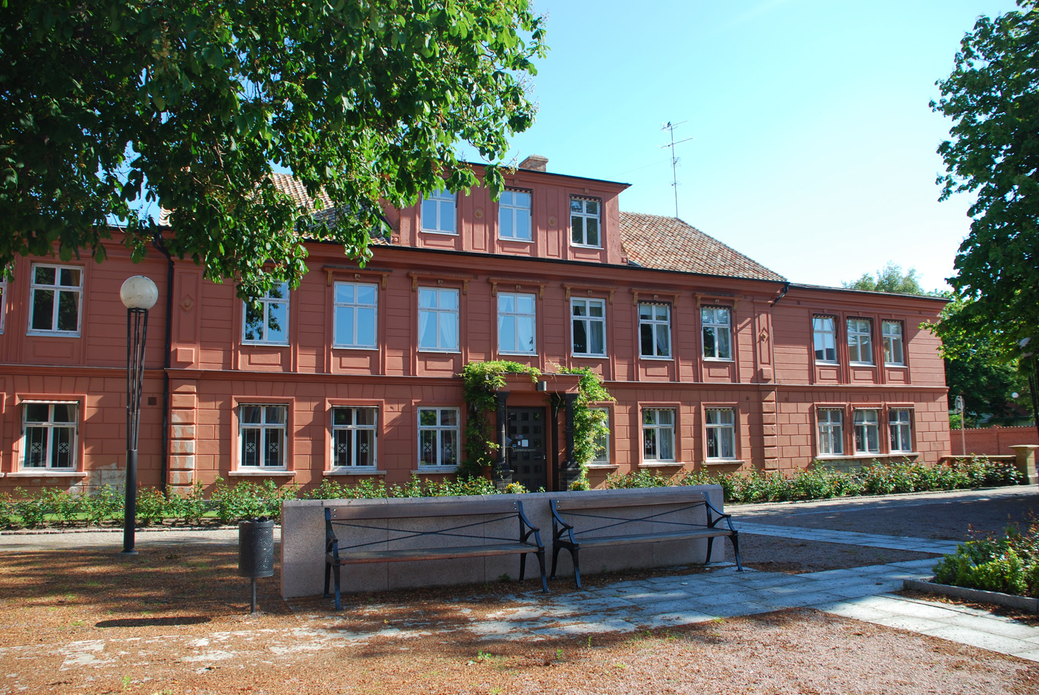
Höganäs
Les Dossiers synthétiques et d'enjeux sont disponibles gratuitement.
Merci de vous inscrire et vous connecter pour accéder au Dossier complet de site.
- Dossier synthétique EN
- Le site sur Google Maps
- Retour à la carte
Données synthétiques
Category Urban - landscape - architectural
Team representative Architect - urban planner - landscaper
Location Province of Höganäs/Skåne
Population City 8,553 inhab. - Conurbation 24,900 inhab.
Strategic site 180 ha - Project site 24 ha
Site proposed by Municipality of Höganäs
Owners of the site Municipality of Höganäs
Commission after competition Urban project management role, design of public and landscape areas.
Information complémentaire
How can the site contribute to the adaptable city?
Culture by the sea
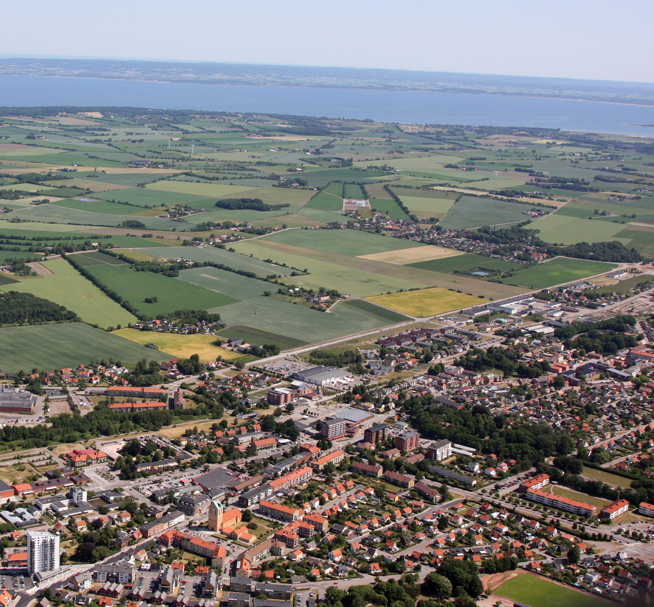
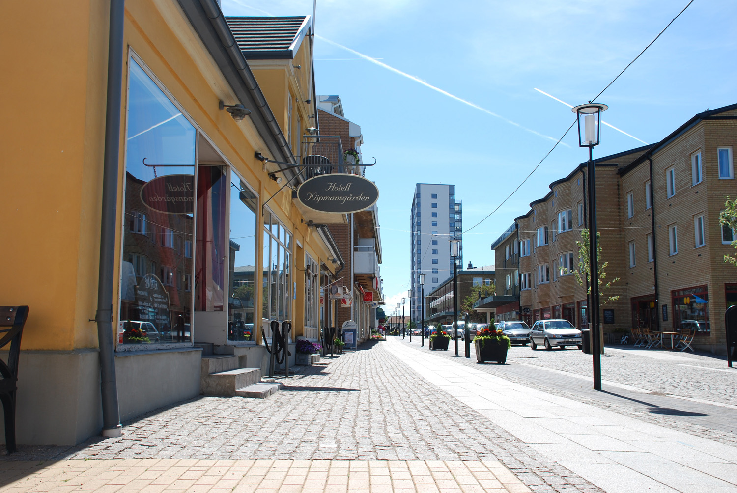
The rich soil and the beautiful scenery has attracted residents to this area for thousands of years during which the town has developed a vast historical and cultural heritage. Nowadays the town is more and more connected with the larger metropolitan area of Helsingborg, Malmö and Copenhagen, and because of its prime seaside location and excellent living conditions Höganäs is constantly increasing in population. Höganäs therefore needs a plan for future expansion, based on contemporary planning ideals in terms of density, sustainability, public transportation etc.
How can an organic expansion of a new neighbourhood be achieved that is integrated into the existing urban fabric?
How can a long term sustainable development help heal isolated areas? How should an expansion take into account the existing city centre and historical and cultural qualities?
City strategy
Cultivating urbanity
The city wants to develop the site in stages, starting with a project to be realised in a imminent future followed by a long term strategy for development of both the project site and the study site. The project site spans from the city centre to the city limits. This creates a unique opportunity to address a whole range of urban issues:
How can a future development help in healing fragmented and enclaved neighbourhoods, brake barriers created by roads, and create new paths/movements? What further values can future developments add to the rest of the city? How can bicycle and pedestrian traffic be encouraged and increased? How can existing recreational areas be connected to new developments?
Site definition
The strategic site contains points and areas of importance to the future planning of the city. Apart from the project site it also contains harbour and swimming areas, centre and commerce, areas of high cultural/historical value, and recreational areas. The boundaries of the project site correspond to land owned by the municipality, and it has been pointed out as a new neighbourhood in the comprehensive plan for the city. The proximity to the city centre and easy access bounds for a well integrated expansion. Within the limits of the project site new developments are therefore highly probable. The project site gradually slopes from north to south and consists mainly of agricultural land. There is a reserve for a light rail transit system in one part of the site that proposals must consider. This possible new station would create a new point of focus in the centre around which new housing could be developed.
Adaptability: main elements to take into account
Because of the small scale in the town the new development will shift the centre of gravity in the city, how will this affect the existing architectural and cultural qualities? How do visitors perceive entering the city? How should the contemporary city relate to new ways of life, work and movement? How can the new development achieve high density and urban life without conflicting with the existing small scale of the city and the surrounding nature? The area closest to the sea is considered to be more attractive, but the area around the project site could cultivate its own identity as a modern garden city where the agricultural heritage is nurtured.
Questions à propos du site
Can you clarify the location and intent for the “reserve for a light rail transit system” on the site?
Please see: folder new docs after launch, APPENDIX_4_LAND_USE_OWNERSHIP_DENSITY, page 2( future land use) : the red line : POSSIBLE POSITION FOR LIGHT RAIL and STATION/TERMINAL FOR LIGHT RAIL respectively. The purpouse of this system is to enhance the public transport connection to Helsingborg, Malmö and Copenhagen.
Is there any estimated density for the site? like number of house units per hectare, or buit surface per m2 of land, etc.
The municipality wants to achieve the highest possible density, but keeping in mind and respecting the existing scale in the area. The closer to the new station the more dense. The city wants a new borough - NOT a suburban setting with single family detatched housing.
Is there any program of public facilities that need to be included in the site? like nursery school, sport equipment, etc.?
There aren´t any programs for preschool or sporting facilities. The citys sporting facilities are concentrated to the southern parts so there isn´t any need for this in the strategic area. It is important however that the proposals allow mixed functions even if the focus should be on creating dwellings.
Det finns inte något program för förskola eller idrott etc. Stadens idrottsanläggningar är koncentrerade till den södra delen av staden så ngt sådan behov finns inte i europan området. Men det är viktigt att tävlingsförslagen ger möjligheter till förutsättningar för en ny tät stadsdel med flera blandade funktioner, även om huvuddelen utgörs av bostäder.
What plans does the municipality have for the old railroad area (currently a bicycle route)? Has any thoughts or plans been discussed regarding this area in general and particularly in connection to the project site?
This area is described in a number of maps both in the full site file and the appendices. For instance in appendix no.4 page 2 it is marked as an area for future development. It is a kind of void in the city web and regarded as unsafe by some while others value its quality as a green cooridor and bicycle/pedestrian path. It is indeed an area with great potential.
Shall we propose the exact location for the light rail station? Are stations located close to each other or there is just one per town center? Is it feasible to propose the extension of the line through the north of the town, or is the location on "Appendix_4_Land_Use" considered the Terminal/Last station?
You will find the location of the light railway transit system station on the map on page 2 in appendix no.4. in the folder "0_new_docs_after_launch" It is possible that the railway will coninue towards the north, in the future.
Must the buildings on the project site be retained? This land is shown as under the ownership of the municipality in Appendix 4 p. 4. Are these buildings also in the ownership of the municipality?
Yes, the municipally owns the buildings located on land owned by the municipally. It is not necessary to retain those buildings.
Can you give more information on the rain water treatment park shown on page 2 appendix 4? What type of treatments is proposed here and what area will it serve or what is its capacity for treating water?
it is a delay for rainwater to reach the sea.
Can you provide additional information on the 'ecology' of the site? For example: soil type & geological formation; prevailing wind; water table height; typical plant species for area; any particular protected animals or plant in area; typical agricultural production in area?
About climate see earlier question. regarding crops see pdf on "0 new docs after launch"
Could you send us some historical/vintage photos from Höganäs? We are interested in the evolution of a particular part of the city, if you have those historical photos from the part where the 111 and 112 cross (more or less), it will be great, although all serve us.
There is an archive with old photos on our website. If you click on the photos you will get info about year, adress, and so on.
The link is: ww2.hoganas.se/fotoarkiv/
Which are the prevailing winds? could you tell us some temperature, snowing and raining average?
Le site est lié au thème suivant
Ecorythmes La ville contemporaine cherche à anticiper l’avenir et à se préparer aux changements imprévisibles qu’il porte en lui. Différentes stratégies sont actuellement développées pour construire les conditions d’une résilience créative, donc à savoir s’adapter à un environnement changeant. L’hypothèse des Ecorythmes consiste à fonder le développement urbain sur une meilleure synergie entre les milieux naturels et urbains afin de rompre avec la logique d’opposition qui a conduit à un éloignement du citadin des réalités naturelles et à une dégradation progressive de celles-ci.
Cet éloignement du citadin et de la nature n’est pas seulement spatial, il est aussi temporel. En effet, le paysage n’est pas un tableau figé, une belle image, mais un milieu vivant où règnent des cycles (saisons, jour et nuit, marées, variations climatiques, vies faunistique et floristique…), des forces de croissance, des mouvements rapides ou lents, des migrations et transhumances, etc.
A l’inverse d’un urbanisme moderniste ayant privilégié une rupture entre les rythmes urbains et naturel, il s’agit, à travers les sites portant tous une dimension paysagère forte, d’encourager la mise en œuvre des processus opérationnels fondés sur le maintien, l’instauration ou la régénération de ces écorythmes.
Documents spécifiques
Questions à propos du site
Pour pouvoir poser une question, vous devez être connecté (et, par conséquent, inscrit au concours).
Ve. 16 mai 2025
Date limite de soumission des questions
Ve. 30 mai 2025
Date limite de réponses aux questions
Avant de soumettre votre question, assurez-vous qu'elle n'apparaît pas déjà dans la FAQ.
Merci de poser vos questions sur les sites dans le menu Sites.
Merci de poser vos questions sur le règlement dans le menu Règlement.
Si votre question ne reçoit pas de réponse dans les 10 jours, merci de vérifier qu'elle ne figure pas dans la FAQ sous un autre intitulé ; sinon, contactez le secrétariat concerné par email (secrétariats nationaux pour les sites, secrétariat européen pour le règlement.)