Kalmar
Les Dossiers synthétiques et d'enjeux sont disponibles gratuitement.
Merci de vous inscrire et vous connecter pour accéder au Dossier complet de site.
- Dossier synthétique EN
- Le site sur Google Maps
- Retour à la carte
Données synthétiques
Category Urban - landscape - architectural
Team representative architect - urban planner - landscaper
Location Province of Småland
Population City 63,505 inhab. - Conurbation 160,000 inhab.
Strategic site 2,168 ha - Project site 127 ha
Site proposed by Municipality of Kalmar
Owners of the site Municipality of Kalmar
Commission after competition Urban project management role, design of public and landscape areas.
Information complémentaire
How can the site contribute to the adaptable city?
Nature Nurtured
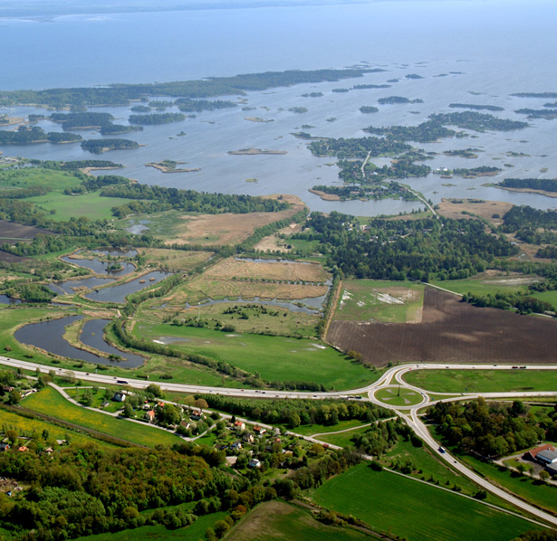
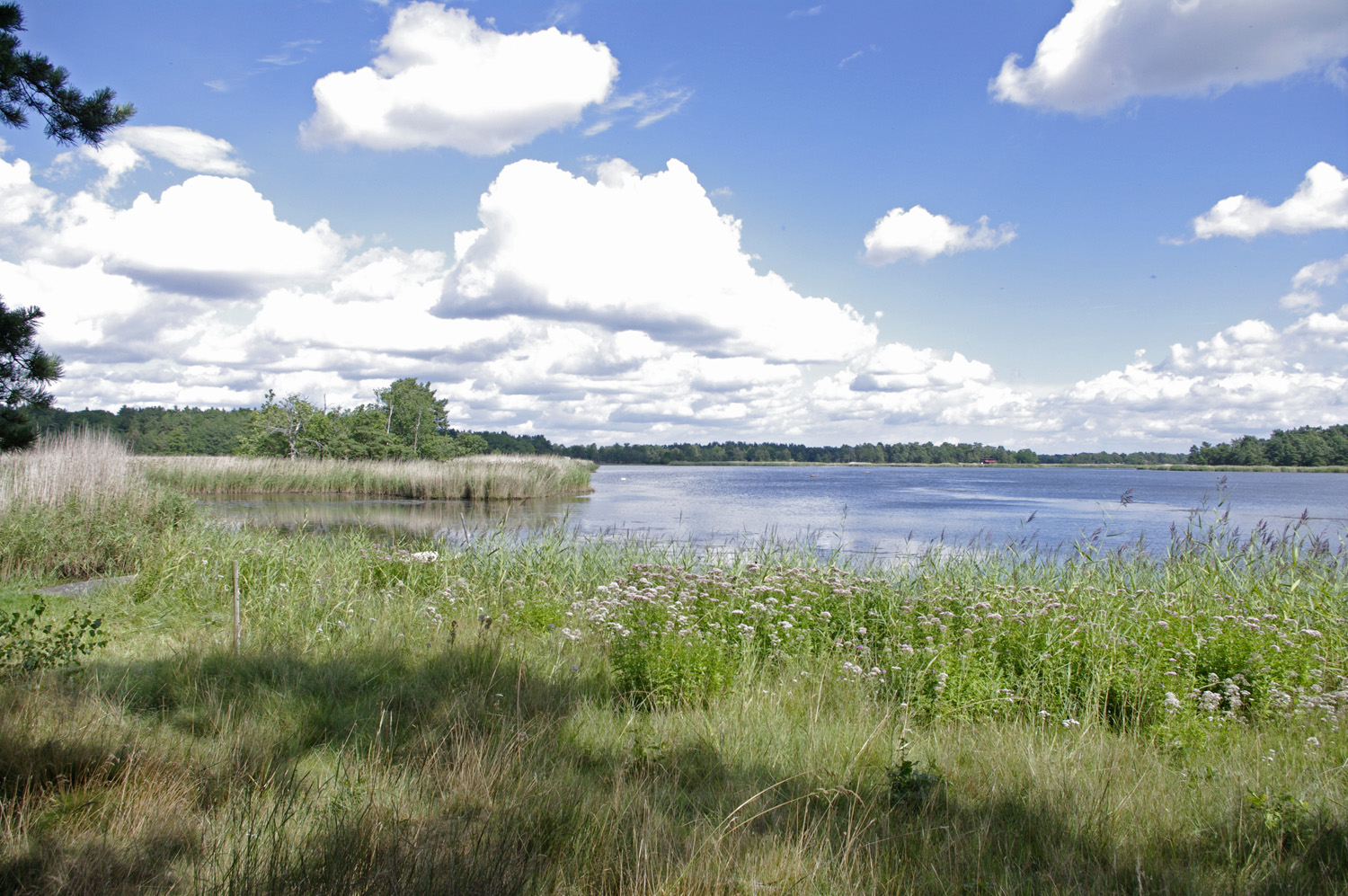
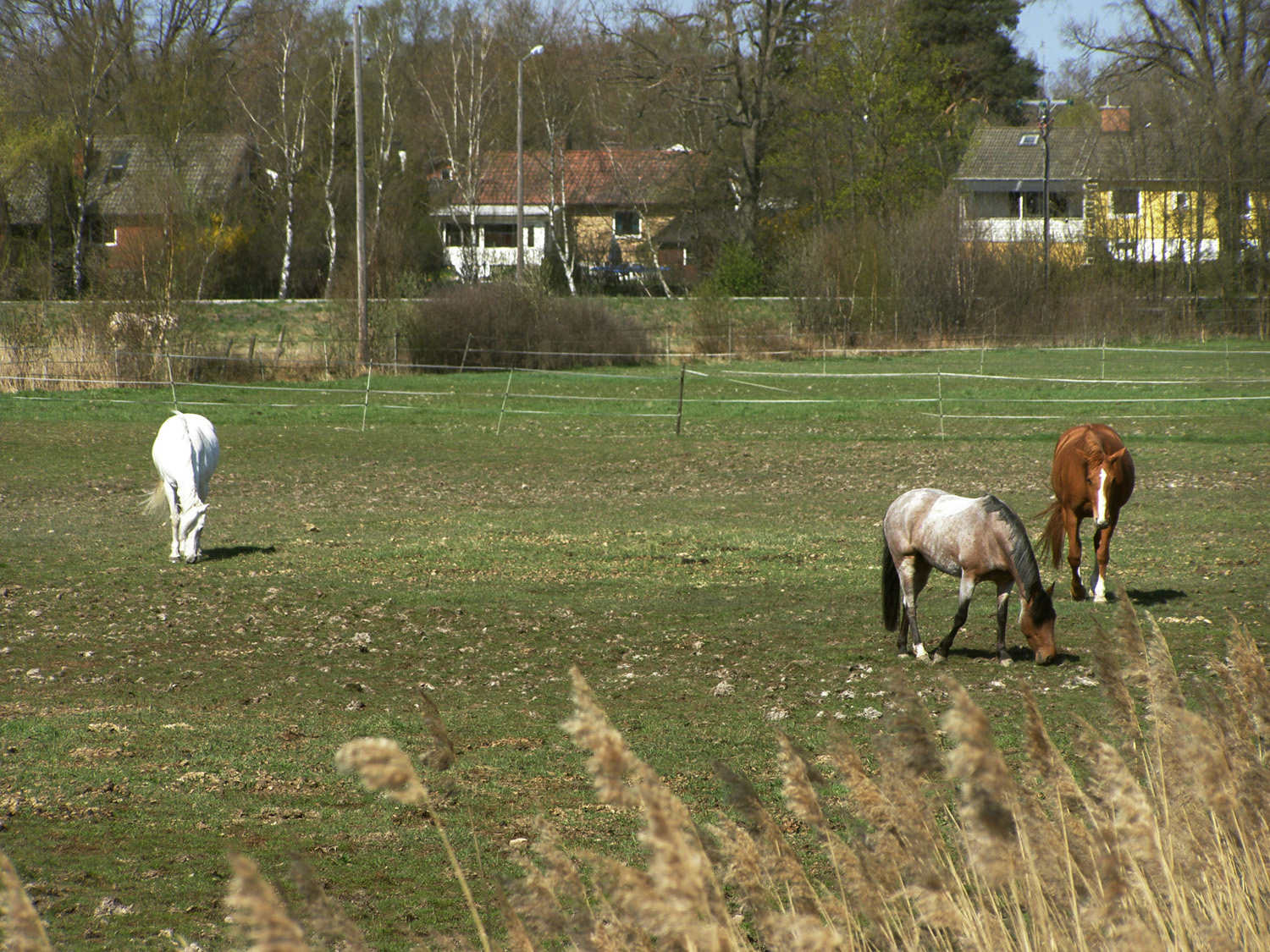
The site presents an opportunity to explore the human/nature relationship. This booming university city is surrounded by the beautiful Baltic archipelago and ancient pasture lands. As the planned expansion cannot take place in the valuable farm lands, the city must grow into the low lying areas between sea and land. The city wants to double the size of the existing neighbourhood from todays 3000 to 6000 inhabitants.
The seemingly untouched nature here is in fact the result of centuries of cultivation, grazing and logging. This long-time human interaction with the landscape has blurred the border between untouched nature and cultured land. An expansion into this area must take this into account. The city will expand here, but it must be done with respect and by nurturing the surrounding landscape just as people have been doing through history. The site poses a intriguing challenge for architects and landscape architects alike.
City strategy
The city wishes to strengthen the distinctive characters of its five boroughs. The strategic site area of Södra staden is one of these. The project site could be transformed from a monofunctional area with detached single family houses to a more diversified community. The plan is to double the size of södra staden by adding another 1500 dwellings. Rerouting the thoroughefare opens up possibilities for the creation of an attractive sea side borough.
Site definition
In the 15th century, Kalmar was the absolute centre of power and trade in Scandinavia. It has maintained a unique character and has renewed itself as a regional node for transportation, commerce, education and tourism. The strategic coastal location in the Kalmar sound, once chosen for military purposes, now proves a valuable asset in the creation of a successful contemporary city. The limits of the project site correspond to land ownership and geological conditions. The project site stretches from the archipelago westwards across pasture land that sometimes floods. Still west of this, European highway no. 22 divides the project site into two separated areas. This road will be moved and on the remaining road speed limit will be reduced and the road will become a local city street with mixed traffic. Areas on both sides of the road that previously were disturbed by traffic noise and left unbuilt as buffer zones, are included in the project site. West of the highway lies an area of homogeneous single family houses. The city centre is about 7 km to the northeast. Kalmar airport with connections mainly to Stockholm lies about 2 km to the north. To the north there is a trotting track. The housing area is connected to Kalmar with E22, and also with a disused railway track, made into a bicycle and pedestrian path. The project site could be transformed from a monofunctional area with detached single family houses to a more diversified community.
There is also a need for a local centre. The eastern part of the road offers fantastic nature. Within the strategic site area it is about making this nature accessible without consuming them.
Adaptability: main elements to take into account
The task is about proposing an organic expansion in stages, creating a unique identity/charachter, and proposing new dwelling typologies. It is also about exploring the human - nature interface.
Questions à propos du site
Where can we find the Appendix files of the text presentation of the site ?
The appendix files are all in the folder: 0-New_docs_after_launch
Is there a dxf in a larger scale of the whole city available?
No.
Is it possible to have a more detailed cartographic information about the site? We think that for a correct analysis, strategy and design for the site of Kalmar, we need the following information: contour and level dimensions; flooding areas, floods period and depths, cycles and seasons; aerial photos; existing building heights.
Additional data will be uploaded in the folder: new docs after launch.
Do we need to work on the project to reduce travel times between the cities of the coastal shore or is it already in process?
No, you don’t. We have a regional federation who calculate for optimizing our communications in terms of travelling time.
Do we need to double the inhabitants inside the strategic site or in the project site?
Strategic site
Are we allowed to built on piles on the geological unsuitable area near the sea?
Yes, you may propose buildings on piles. We are very aware about the challenging conditions along the coast.
In the project site on the south of E22 there are some existing constructions. Which is its use? Do we have to preserv them?
The existing buildings are summer cottages, mainly reconstructed for permanent living purposes. These will remain.
What kind of reasons imposes us to place the parking lots above the ground level?
Building underground parking is very expensive.
Under which conditions could we build in the geological unstable areas?
Yes, you are able to propose buildings on piles. We are very aware about the challenging conditions along the coast.
Which is the inundation frequency in the area? In which perdiods? And how long does the inondation last?
The area is not affected by tidal water but occasional flooding.
What is the extact meaning of "shore protection" as shown in map no2 of the appendix "visions"for this site?
Sea-shores and the shores of all lakes and watercourses are protected in a buffer zone extending up to 100 metres on either side of the shoreline. The purpose of shore protection is both to assure public access to private land in the shore area and to maintain good living conditions for plant and animal species on land and in water.
Certain measures are prohibited in shoreline protection areas. Examples of such measures are the construction of new buildings, alterations to buildings, excavation, the building of structures or devices to keep out the public or other measures that may significantly affect animal and plant species. Buildings and measures that are necessary for the purposes of agriculture, fishing, forestry or reindeer husbandry are permitted, however.
Exemptions can be granted in special circumstances: Exemptions from shore protection may be granted in special circumstances. The scale of the measure or the structure and the present and future importance of the area are taken into account. Normally, exemptions should not be granted in areas that are of particular importance with respect to nature conservation or recreation. Exemptions must not be granted if there is any question of unacceptable impacts on biological assets. They may, however, be granted where the site is situated on land that has already been developed or outdoor recreational exercise facilities are to be built. The county administrative boards decide whether to grant exemptions, but they can delegate these powers to municipalities. This does not apply, however, to the construction of defence installations or public highways.
Areas exempted from shore protection: A shore area that is obviously irrelevant to the purposes of shore protection may be exempted by the county administrative board. So far, however, such exemptions have rarely been granted. Areas covered by a detailed development plan or special area regulations or the Planning and Building Act may also be exempt in special circumstances.
Is it possible to predict the demolition of the cottages close to E22 in the future?
No the ambition is to keep and protect existing buildings at the E22.
What does the layer "Rättigheter Ledningsrätt Linje Ungefärligt läge" represent?
It is a pipeline for electricity but you don´t have to consider that.
if the sea level raise of 2,5 m lot of existent houses will be flooded. Is object of the competition solve also this problem in the strategic site, just in the project site, or just consider it for new buildings and landscape transformations?
Focus mainly on new buildings within the project site. Unfortunately existing buildings within the site will probably be flooded, if you can come up with new ideas for solving that problem as well we will be grateful.
There's a maximum height for the buildings that can be built in Rinkabiholm?
No there is no maximum height but all proposals need to closely motivated.
In the "Karta.dwg" file, which layer of contour line is the highest, and what is the distance between each contour line?
If the layer is a circle, the one in the middle is the highest. Otherwise is usually depends. The distance between the layers is 0.5 meter.
What will happen to the current houses built in the project site when the level will have reached them?
They will unfortunately be under water. If possible, protection will be calculated for.
What is the time horizon of the sea level rise?
The time horizon is 100 years, and the predicted sea level rise will approx. be 2.5 m.
Is it possible to shape the coast with piers and other operations for natural tourism despite of the buffer zone of 100 metres?
Yes, it is possible as long as you can motivate the changes
Is it possible to scoop out the soil in order to create new canals which will bring water inside the project land?
Yes, that is possible
Are we asked to forecast public buildings in the project site or in the strategic area?
Depending on the proposal, but with an emphasis on project area.
Are the 1500 dwellings expected in the project site or in the all strategic area?
In strategic site
Are the forests, within the project site, subject to any protection? If so, under which conditions could we consider it for building development?
No the forest are not protected, but some part of the forest vegetation includes very old oaks and are therefore important in maintaining biodiversity. The shore meadow on the other hand are protected and should be carefully developed.
What is the distance between each level curbs?
0,5m
does all the apartments have to be accessible?
please read appendix. no 1.
The brief says that other houses will be built within the study area - please indicate approximately where, and how many?
1500 aproximately. Where exactly is for you to propose.
The brief makes reference to Appendix 2 - Kalmar Facts - but Appendix 2 does not appear to be available on the europan website
these are lovated on page 6 in the competition brief
Should we propose a harbour / marina within the site?
If your proposal gains from it.
In the brief, the map on page 3 shows 'estimated sea level rise - 2.5m'. Please confirm how this should inform the proposals - is it acceptable to propose development in the area below the 2.5m sea level area? Are there measures in place to protect buildings that are already in this zone?
you may use this information as you please, as long as you can motivate your proposals.
In the brief, the map on page 3 shows areas that are 'geologically unsuitable for construction'. We have overlays this map on to the contour lines of the site plan, and the lack of alignment is surprising. Please can you confirm if the map on page 3 is accurate or only an approximate diagram?
These areas have unstable geology and the unstable conditions do not derive directly from the contour lines.
We understand that 1500 houses are to be proposed in the total strategic site. Therefore, approximately how many should be proposed within project site?
The approximated density in the whole strategic site should be reflected in and corresponding to the density in the project site with regards to their internal differences in size and buildable land.
Please confirm how the boundaries of the project site have been decided. Are these boundaries very approximate, as they do not seem to align with topography of site boundaries?
Some derive from land ownership, some from geological limitations.
Should proposals be very much focused on the project site?
The emphasis should be on the project area.
The 2.5m water line does not appear to align with the contour lines. Is this because the 2.5m line is only drawn in a very approximate way?
yes
The land that is marked as 'Geologically unsuitable land for construction' does not appear to align with the contours. Is this because this land is only drawn in a very approximate way?
This area is charachterized by unstable soil and the limits are dictated by this and not by contour lines.
Please can you supply a geological map of the area?
a map will be uploaded now on the "new docs after launch folder"
Le site est lié au thème suivant
Territoires en réseau Il s’agit de sites qui, en raison de leur lien avec une entité plus grande, développent leurs potentialités urbaines. Cette entité peut être physiquement concrète, comme une infrastructure de transport, ou peut être un réseau virtuel de relations entre plusieurs nœuds urbains. Bien que les communautés qui habitent ou utilisent ces sites puissent être petites et apparemment isolées, la connexion avec le réseau leur ouvre des possibilités d’amélioration de leur vie urbaine par un nouveau mélange de différents programmes et une urbanité plus complexe.
Comment peut-on préparer ces territoires à résister aux différents scénarios qui pourraient affecter les autres éléments du réseau ou le réseau lui-même ? Devraient-ils être organisés de façon à ce qu’ils puissent adopter différents rôles au sein du réseau ? Comment peuvent-ils s'adapter à la possibilité de changements importants du réseau, voire à sa disparition, par la définition de leurs propres caractéristiques urbaines et architecturales ?
Questions à propos du site
Pour pouvoir poser une question, vous devez être connecté (et, par conséquent, inscrit au concours).
Ve. 16 mai 2025
Date limite de soumission des questions
Ve. 30 mai 2025
Date limite de réponses aux questions
Avant de soumettre votre question, assurez-vous qu'elle n'apparaît pas déjà dans la FAQ.
Merci de poser vos questions sur les sites dans le menu Sites.
Merci de poser vos questions sur le règlement dans le menu Règlement.
Si votre question ne reçoit pas de réponse dans les 10 jours, merci de vérifier qu'elle ne figure pas dans la FAQ sous un autre intitulé ; sinon, contactez le secrétariat concerné par email (secrétariats nationaux pour les sites, secrétariat européen pour le règlement.)