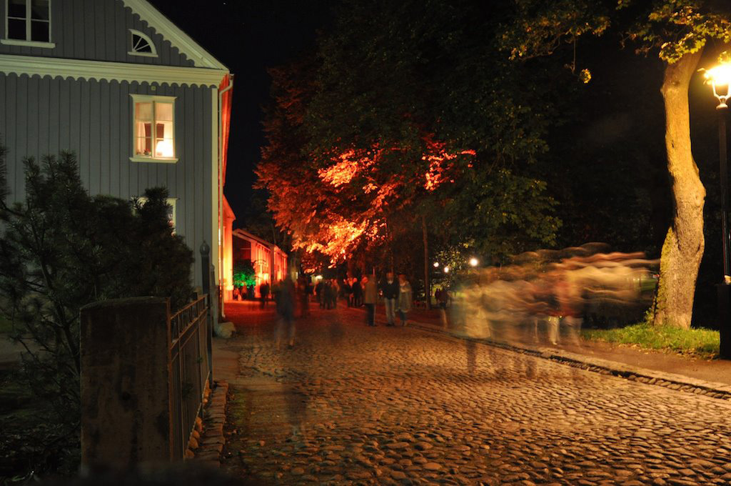
Kristinehamn
Les Dossiers synthétiques et d'enjeux sont disponibles gratuitement.
Merci de vous inscrire et vous connecter pour accéder au Dossier complet de site.
- Dossier synthétique EN
- Le site sur Google Maps
- Retour à la carte
Données synthétiques
Category Urban - landscape - architectural
Team representative architect - urban planner - landscaper
Location Province of Värmland
Population City 19,000 inhab. - Conurbation 24,000 inhab.
Strategic site 67 ha - Project site 6 ha
Site proposed by Kristinehamn Municipality
Owners of the site Kristinehamn Municipality
Commission after competition Urban project management role, design of public and landscape areas
Information complémentaire
How can the site contribute to the adaptable city?
The Kristinehamn site presents a fantastic opportunity to shape the future evolution of this lakeside town centre. Once a harbour area crucial to the creation and survival of the town, this centrally located park could again play a pivotal role, in the creation of local identity. The central location, the beautiful river Varnan meandering through the site, and the wooden architecture of the old town, create great potential for the creation of a successful inner city park. The project could function as a hub between different parts of the city. The competition is great opportunity for landscape architects and architects alike to be part of a crucial step of this towns development.
City strategy
One of the challenges is to create a good mix of acitivities, cultural and commercial, spontaneous and planned, in order to attract people of all ages on all hours of the day. It is important that the physical and mental connection between the city centre and the commercial area as well as the connections between the project site and the city centre are developed and strengthened. Kristinehamn has the possibility to specialize in excellent living conditions. People can live and work here or commute to Karlstad. The town needs to preserve the small-scale, idyllic, accessible city centre and to provide means for spontaneous social and recreational activities. The task of the competition is to create a long term plan for the site to be part of this development.
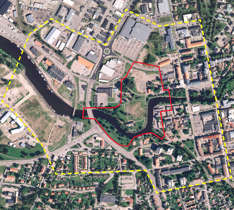
Site definition
The location of the site is very central. The site sits on a small peninsula with the river running on the eastern, southern, and western sides. Until the 1940s it used to be a part of the city’s harbour and the site was filled with warehouses and small industries. Most of the remaining harbour related buildings were cleared in the early 1960s and a public indoor swimming pool was built. As mentioned above, this building has recently been torn down.To the north there are shopping malls with big parking lots. It is easier to drive around than to walk here. Further to the east, opposite the river, there is an old cultural area and beyond that lies the centre of the city. To the west there are some buildings of commerce, the fire station and a four-lane thoroughfare that crosses over the river on a wide bridge. The low bridge closes the river since no large boats can travel under it. It is also a barrier for pedestrians. The project site was once the location of the old city harbour. It is centrally located between the old town and a former industrial area. The southern part contains a park that has lost its purpouse since the demolition of the public bathhouse. To the west there are housing areas, a sports arena, and the new harbour by Vänern, the largest lake in Sweden.
Adaptability: main elements to take into account
The site and its western surroundings were originally planned and dimensioned to handle the export of iron and forest products and for industrial purposes. Today a major part of the big surfaces needed for this have become obsolete. Beside theses obsolete surfaces, the central part of the city is roughly built up of three types of areas:
1) Housing and commerce in the old town centre.
2) Detached single family houses surrounding the old town centre
3) A shopping area with large parking lots built on a former industrial ground.
The site lies directly on the border where these different categories meet. The municipality wants to make a long term plan to protect and fortify the town centre. On the site there could be a public park that could extend the centre. This idea has to relate to the expansion of the large scale commercial area from the north linking it to the centre.
Questions à propos du site
We would like to know that there are planned, that it will happen, with the small wooded area which extends by the South Bank of the River until its mouth to the Lake and which is developed also on the shore of the Lake, before another small harbour area.
The wooded area will be preserved and used for recreational purposes. The city is currently building a new arena for football and track and fieldbeside the current public indoor swimmingpool and football fields.
What will happen, with the industrial zone and port located on the North Bank of the River, shortly before its mouth? Is planned to be maintained as industrial area with an adjacent shopping area, or is it intended to convert it into something else?How is it currently the port activity in Kristinehamn?
The commercial harbour is regarded as a strategic function of the city and will be maintained as a commercial harbour. On the north bank, from the railway bridge and about 200 meter to the west, is the city marina where visiting boats and motor homescan stay for a night or two.
The industrial area and adjacent shopping area will be maintained.
Speaking of the wooded area which extends by the North Bank of the River towards the Northeast, from the area of the project, and ending in a "bag" of green land, we would like to know to whom belong these lands, and if there is something planned for that area.
These areas form a smal park along the river. Most of the land belong the city.On the southern side one can walk along the river up to the Norra Staketgatan. On the northern side up to the small footbridge in the eastern end of the Trädgårdsgatan. Further north on this side the land along the river are private gardens. There are plans to extend the footpath on the southern side all the way up to the railway.
From the railway and a couple of hundred meters it is very hard to access the riverbecause of the private homes on the eastern side and the industrial area to the west. From the Östra Ringvägen and further north it is possible to follow the river on the eastern side. Most of the land here is owned by the city. The plans are to keep the area as it is.
In the brief you mention that “there have been requests for additional commercial establishments to be established on the gravel surface to the north of the competition site”. You also mention “an additional gravel area” located to the east. Could you please clearly identify these areas on a map and clarify whether or not these areas are both outside the project site?
The two "gravel areas" are shown in the picture and are both part of the project site. The information in the brief about the additional gravel area being outside the project site is wrong.
Could you please share some information regarding the type of function (industrial, logistic,..) that the area bounded by Kilshammargatan, Karlastadsvägen, Västra ringvägen, Hammanvägen and Kajgatan contains? Are these functions active? Does the City have a future vision for this area?
The western part of the area (on the western side of the 3:e Industrigatan) is the city harbour and is fully operational. The harbour is regarded as a strategic function for the city and the football field the the north has recently been taken over by the harbour and converted to terminal space. The eastern part is a mix of small industiries, warehouses, car-dealers and shops. Most of the shops are situated along the Västra Ringvägen.
Is it safe to walk on the frozen river Varnan in the winter?
Only if it is a really cold winter. Some winters there will be no ice at all.
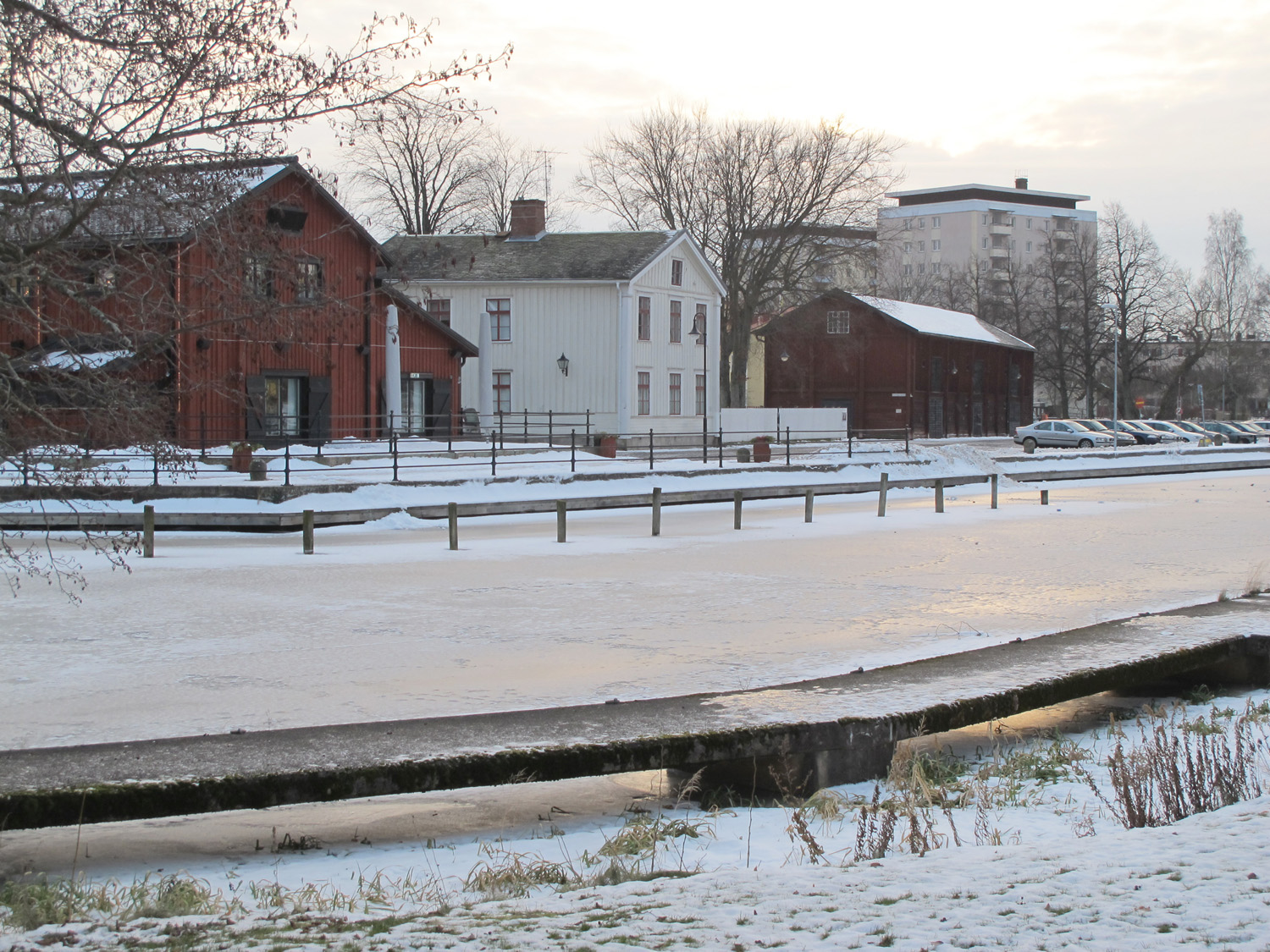
What are the functions in those two wooden buildings and that one on the east side of the project site?
In the "Vågen" area there are some artist studios. The other functions are displayed on page 7 on the map in the competition brief.
Are there planned any investment on the west side of the strategic site, the nother bank (below Hamnvagen street)?
No, it is uncertain what will happen to the area. Most likely will the city marina remain and develop. But, the warehouses behind the marina are privately owned and there are no indications that the owners are planning to do something with their property.
Le site est lié au thème suivant
Plateformes urbaines dynamiques La revitalisation d’espaces publics actuellement peu attrayants nécessite une réflexion à une échelle plus large que celle du site donné. Même s'ils sont parfois de petite taille, ces espaces sont des leviers stratégiques pour une dynamisation urbaine. Leur influence en termes d'identité et d'image dépasse souvent leurs limites physiques et appelle donc à une transformation plus importante du tissu existant. « Angles morts » n’ayant jamais eu une utilisation adéquate ou bien lieux dont la fonction initiale est aujourd'hui obsolète ou inadaptée aux besoins des habitants, ces sites peuvent servir de plateformes à une appropriation, de point de départ pour la mobilisation de la population locale ou d’un public plus large. L'aménagement ou réaménagement de ces zones peut être considéré de diverses manières : comme un rafraîchissement par des espaces multifonctionnels, avec des structures temporaires ou extensibles qui agissent comme des piqûres d’acupuncture ; comme un ballon d'essai ayant pour but de faire connaître un territoire donné, de déclencher un cofinancement ou investissement privé et d’identifier de nouveaux rythmes d'intensité.
Documents spécifiques
Parking and shopping i the nothern part of the project area. Music: Dose of Powder by Jawbone (http://www.dangblues.com/)
A panorama showing the view from the harbour restaurant in the Vågen area of the site. Music: Mahwah by Jawbone (http://www.dangblues.com/)
Yet another panorama. This time from the south showing the river, the old warehouse in the park area and the buildnings at the fish market (Fisktorget) on the Vågen side of the site. Music: Drop Down Low by Jawbone (http://www.dangblues.com/)
Another suitable title could be "From a park to parked cars". Music: John Said by Jawbone (http://www.dangblues.com/)
A near 360 panorama from the skate park in the centre of the park area. Music: Ready Or Not by Jawbone (http://www.dangblues.com/)
A panorama showing the dead park area along the thoughfare. Music: Reap What You Sow by Jawbone (http://www.dangblues.com/)
Questions à propos du site
Pour pouvoir poser une question, vous devez être connecté (et, par conséquent, inscrit au concours).
Ve. 16 mai 2025
Date limite de soumission des questions
Ve. 30 mai 2025
Date limite de réponses aux questions
Avant de soumettre votre question, assurez-vous qu'elle n'apparaît pas déjà dans la FAQ.
Merci de poser vos questions sur les sites dans le menu Sites.
Merci de poser vos questions sur le règlement dans le menu Règlement.
Si votre question ne reçoit pas de réponse dans les 10 jours, merci de vérifier qu'elle ne figure pas dans la FAQ sous un autre intitulé ; sinon, contactez le secrétariat concerné par email (secrétariats nationaux pour les sites, secrétariat européen pour le règlement.)