Regionale 2016
Les Dossiers synthétiques et d'enjeux sont disponibles gratuitement.
Merci de vous inscrire et vous connecter pour accéder au Dossier complet de site.
- Dossier synthétique DE | EN
- Le site sur Google Maps
- Retour à la carte
Données synthétiques
Category regional – urban - architectural
Team representative Architect - Urban Planner - Landscaper
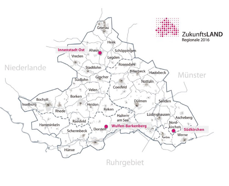
Location Westliches Münsterland
Population Ahaus 38,989 inhab., Dorsten 76,223 inhab., Nordkirchen 10,413 inhab.
Strategic site Westliches Münsterland
- Ahaus – Town centre east, 23.4 ha
- Dorsten – Wulfen-Barkenberg, 12.4 ha
- Nordkirchen – Südkirchen, 93.5 ha
Site of project to be defined by the competitors
Proposed by Regionale 2016 Agentur
Owners of the site private owners
Commission after competition Masterplan
Information complémentaire
How can the site contribute to the adaptable city?
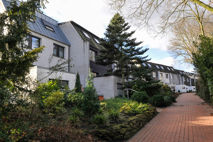
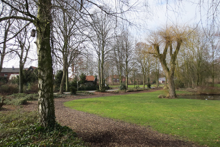
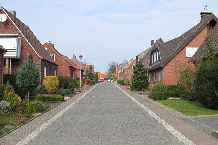
A sustainable approach to land-use changes is one of the central challenges of Regionale 2016. A consolidation and upgrading of existing population nuclei is required in order to restrict further incursion of the landscape. In the 1950s to 1970s spacious single- and two-family residential areas grew like ‘annual rings’ on the fringes of many towns in western Münsterland. How can these residential areas – attractive due to their central location and generous lot sizes – be equipped for the future from a structural and design aspect? This is to be examined according to the motto “Living on the fringe – Developing new qualities” for the municipalities of Ahaus, Dorsten and Nordkirchen.
Regional strategy
A generation change is currently taking place in many of these properties due to their homogeneous resident structure – an occasion to search for innovative strategies to enable both change and continuity. The objective is creative use and further development of the existing settlement structure. Urban neighbourhoods and individual buildings must be conceived in harmony with their landscaped environment. New elements must be inserted into the existing system to give it an additional meaning and extend use options. How can the neighbourhoods be supplemented with vital functions, new building and open space types? How can the existing buildings be energetically optimised and brought up to today’s standards of comfort and freedom from barriers?
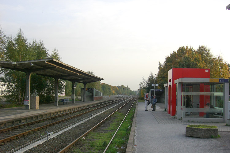
Ahaus – Town Centre East
The challenge presented by the residential neighbourhood from the 1950s with a homogeneous building structure on the urban fringe is to manage the generation change in the neighbourhood and develop perspectives for a new profile together with the ‘builder generation’. What opportunities are offered by controlled urban development of the neighbourhood? Ideas are sought for a sustainable transformation of a residential neighbourhood from the 1950s. At a neighbourhood level the question is how the public sphere can be improved to a high standard of design and revitalised with supplementary functions. With a view to the established housing stock, the goal is to develop exemplary solutions for this type of neighbourhood, including an energetic improvement and “generation-proof sample floor plans”.
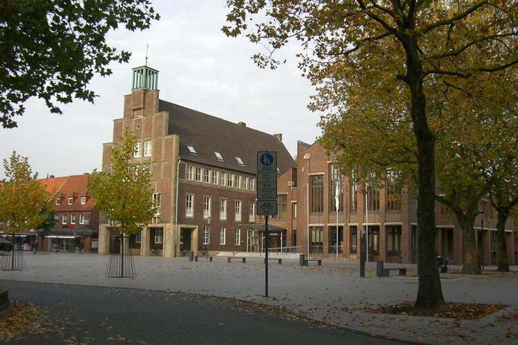
Dorsten – Wulfen-Barkenberg
“Wulfen New Town”, a generously landscaped satellite town dating from the 1960s and 70s, is currently being geared to the future by revitalisation and environmental improvement. Single, semi-detached and row houses are being constructed in one section. The latter are situated in close proximity of the large-scale centre of Barkenberg. This neighbourhood is characterised by a distinct field of tension in social and structural terms. The resident structure in the single-family neighbourhoods is exhibiting the first signs of aging population; overdimensioned infrastructure separates the areas. New housing forms are called for to supplement the ‘major housing estates’; likewise proposals for alternative, joint energy concepts and improved networking of the neighbourhoods.
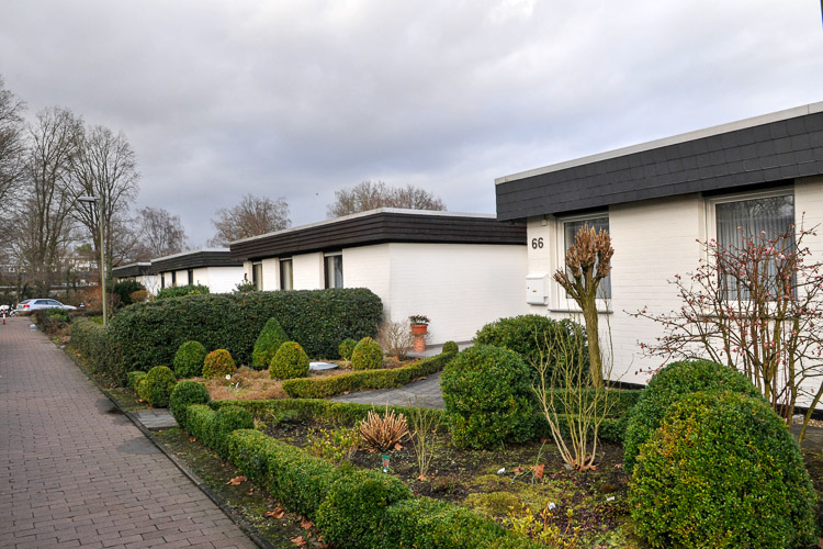
Nordkirchen – Südkirchen
The outlying district of Südkirchen with a population of approx. 3,200 is located to the south of the famous Nordkirchen Castle, embedded in an agricultural landscape. It was constructed mainly in the 1950s to 1970s as a typical commuter neighbourhood in the countryside. Shops, commercial zone and social infrastructure (school, citizens’ bus) ‘still’ exist to satisfy basic needs. The town is striving to promote “area rejuvenation” and is calling for ideas for a future-oriented, family-friendly living. Furthermore, what forms of intervention will be required to turn the village into a lively neighbourhood that is attractive to new residents?
Questions à propos du site
Dear organizers, The available materials / documents don't contain all the plans and sections of the houses on the project site of Ahaus. There is only one freestanding house and a multi-family house. Although we don't need all the plans we would like to ask if ground plans and sections of the rowhouses on the Schmalenstrothstrasse can be provided. Kind Regards, Jan Verhagen
Floor plans and sections (unfortunately in low quality) are available in the folder "new docs after launch" (REG2016-DE-AHAUS-PS-M6.pdf).
we are in this region, but this hat 3 sites more, we making the three and then one of them. But we wish presenting two projects for diferents local sites. Have we to pay twice?ist it possible two local regions to make with two projects?we´re waiting your answer as soon as possible. Thanks
There are two possible solutions:
1. You split your team into two. Consider that no team member should be part of the other team as well as it will lead to disqualification of both teams.
In this case you have to pay the entrance fee a second time.
2. You merging two projects into one proposition, displaying two of the three sites on the three panels and the brochure.
In this case everything stays as it is and you do not have to pay twice.
We wondered if we could have a file .dwg of Nordkirchen. We found only a pdf of the urban area.
We uploaded the dwg in the "New documents after launch"-folder: REG2016-DE-NORDKIRCHEN-PS-M1.dwg.
Le site est lié au thème suivant
Patrimoine du futur Le patrimoine est réputé tourné vers le passé, mais on peut faire à l’opposé l’hypothèse qu’il doit être tourné vers le futur. Le patrimoine est normalement considéré comme extraordinaire, mais ne faut-il pas s’intéresser à la définition d’un « patrimoine ordinaire » ? Le patrimoine est habituellement évalué comme objet architectural, cet atelier s’interrogera sur les manières de « faire patrimoine » – dans trois types de contexte qui en sont a priori dépourvus : la mutation de quartiers déshérités, la reconversion de grands bâtiments ou d’îlots délaissés, le re-développement de zones d’activités ou d’enclaves abandonnées.
On peut faire l’hypothèse que plus la ville, dans sa morphologie comme dans son fonctionnement, enchevêtre, ressaisit et met en scène les époques ou les étapes de son développement, plus elle développe ses capacités d’adaptation au changement, ses potentialités d’évolution urbaine et ses chances de résister à des crises brutales. La question posée est donc : faire patrimoine, est-ce augmenter la capacité d’adaptabilité de la ville de demain ?
Questions à propos du site
Pour pouvoir poser une question, vous devez être connecté (et, par conséquent, inscrit au concours).
Ve. 16 mai 2025
Date limite de soumission des questions
Ve. 30 mai 2025
Date limite de réponses aux questions
Avant de soumettre votre question, assurez-vous qu'elle n'apparaît pas déjà dans la FAQ.
Merci de poser vos questions sur les sites dans le menu Sites.
Merci de poser vos questions sur le règlement dans le menu Règlement.
Si votre question ne reçoit pas de réponse dans les 10 jours, merci de vérifier qu'elle ne figure pas dans la FAQ sous un autre intitulé ; sinon, contactez le secrétariat concerné par email (secrétariats nationaux pour les sites, secrétariat européen pour le règlement.)