Vila Viçosa
Les Dossiers synthétiques et d'enjeux sont disponibles gratuitement.
Merci de vous inscrire et vous connecter pour accéder au Dossier complet de site.
- Dossier synthétique EN
- Le site sur Google Maps
- Retour à la carte
Données synthétiques
Category Urban - architectural
Team representative Architect - urban planner - landscaper
Location Vila Viçosa
Population Town 4,000 inhab. - Conurbation (Municipality) 8,300 inhab.
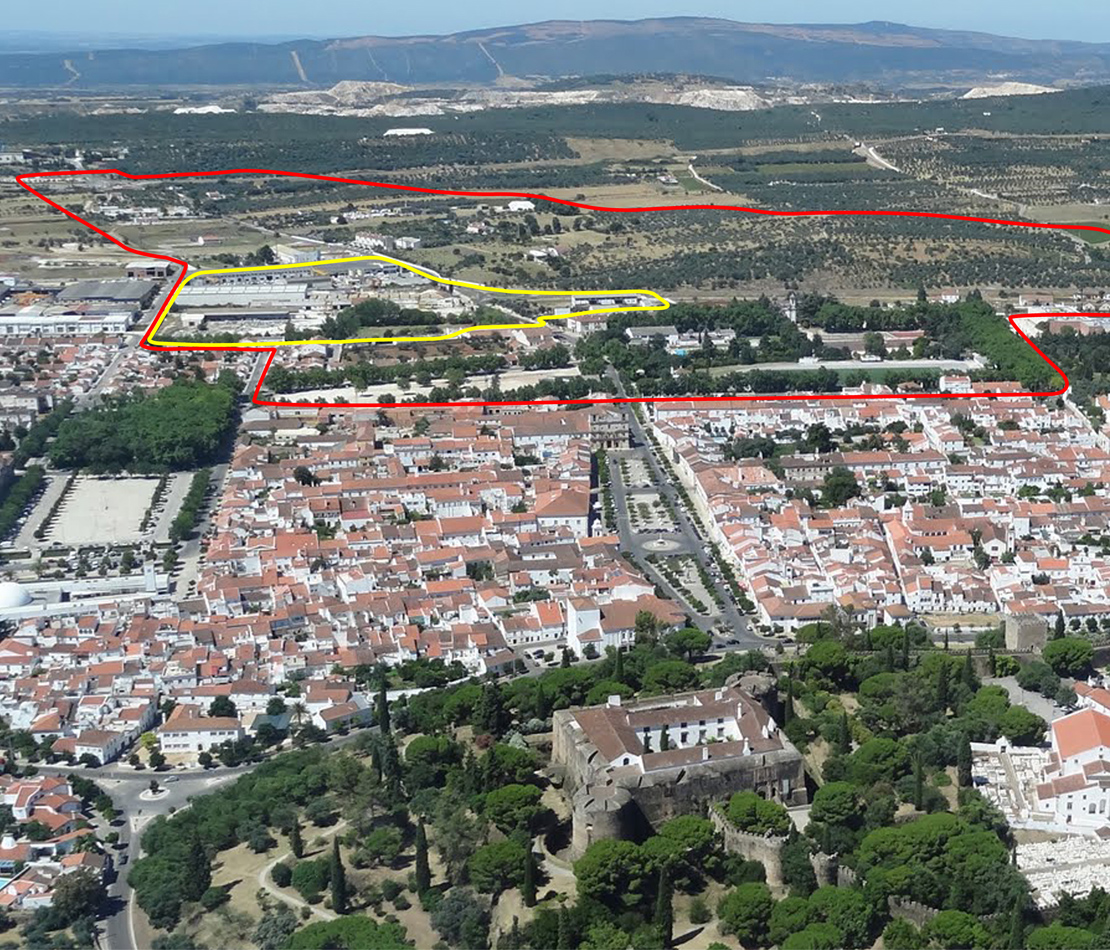
Strategic site 80 ha - Site of project 6 ha
Site proposed by Vila Viçosa Municipality
Owners of the site private and public parts
Commission after competition Urban Project. The team representative must be either an architect, a landscaper or an urban planner.
Information complémentaire
How can Vila Viçosa contribute to the adaptable city?
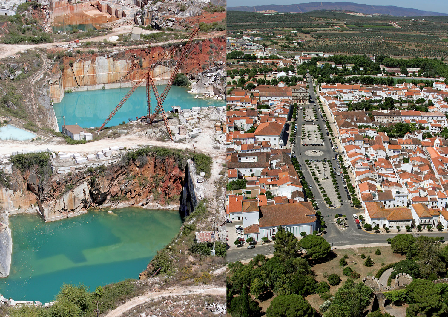
Vila Viçosa is situated in Alentejo, near Spain, in a scarcely inhabitated region. The city seeks to manage its territory by trying to preserve an important architectural and urban heritage in the context of a reactivating process of urban life and resources:
- Ensuring forms of production and management of new collective space: shared governance among public and private partners.
- Evaluating various spatial and time scenarios (from perennial to ephemeral and episodic), where multi-use places can be active in different times and ways.
- Recycling built stocks and empty spaces avoiding excessive space consumption to ensure "hospitality" to new uses (tourism, agriculture, sports, religion…).
- Incorporating the time dimension in urban policy: image, activity expansion and diversification, cohesion and focus, intensity and continuity in time (24 hours a day).
For urban spaces to adapt to changes in the context of an uncertain future, it is necessary to optimize their uses with new economic and social and cultural meaning, without losing the sense of inherited identities.
City strategy
There’s an ongoing development and urban regeneration strategic plan aimed at rehabilitation, recovery and integration of the urban landscape values, in a process with effective public participation and shared responsibility of local partners in their cultural inheritance with a financial supporting implementation program. The motivations of this plan are:
1. To activate the strategic potential of Vila Viçosa, as urban reference and national identity, in historical, social, landscape, urban and architectural domains;
2. To give the necessary response to existing architectural, urban and landscape cluttering, enhanced at economic and social level by marble processing industry.
The opportunity of an integrated management of urban heritage with new features and mechanisms allowing to expand their national and international potential justifies the choice of this Europan 12 competition location.
Site definition
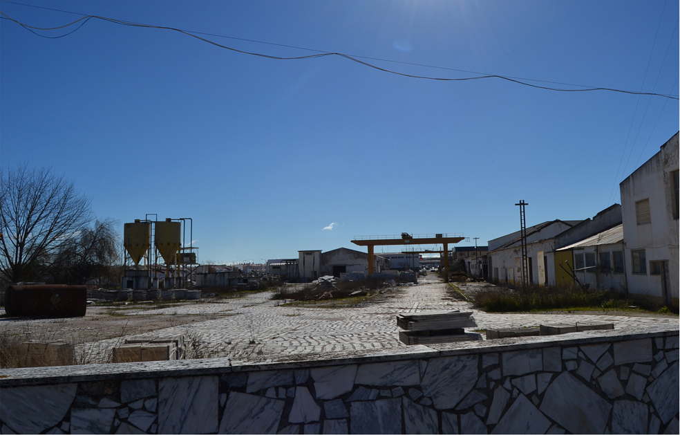
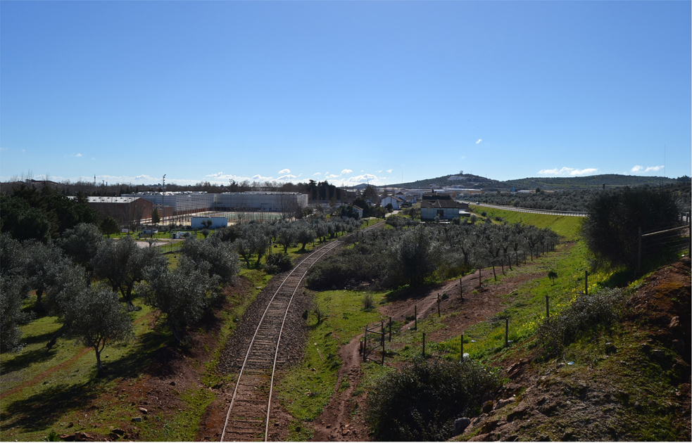
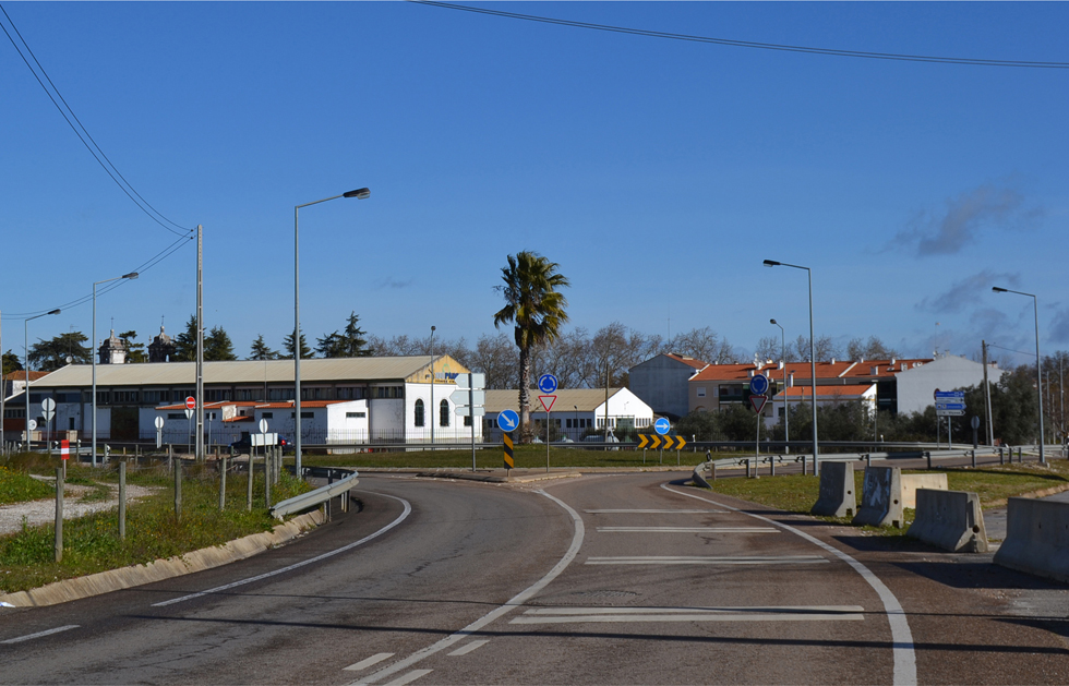
Europan site is located at the southern entrance of the village, previously polarized by the Railway and the location of presently in-crisis industries related to marble. It addresses the following issues of regeneration:
a) In the project area – Ancient industrial units for processing marble (which are today obsolete) and an adjacent roundabout and highway variant, are potentially to be integrated in the new city entrance and activity centre with a new image;
b) In the strategic area – The abandoned old railway line, station and warehouses potentially adaptable for new structures supporting leisure, religious and culture activities around an greenway, adjacent to contiguous church, dormitory and gardens, public schools, municipal library and sports facilities; and also reviving peri-urban' spaces in the olive grove area, adjacent to the new circular infrastructure (highway variant) with recreational potential for large-scale public multi-use spaces.
Adaptability: main elements to take into account
To ensure continuity of the valuable historical urban design, in the context of the Strategic Plan, it is necessary to introduce new urban concepts. The need to find alternatives that substitute the old large-scale public spaces (carrascais), for new type of events, aiming at a new and strong attractiveness and captivating markets on local, regional, national and international scales:
a) in the project area:
- Setting up a new 'entrance' of the village - with the regeneration of surrounding disused areas, and an effect of highly visibility and positive image;
- Providing a new exhibition and social area, attractive for the installation of new uses and functions (technology, research and exhibitions center), to support aspects of the marbles manufacturing (technology, design, marketing, commerce);
b) in the strategic area: The promotion of a new tourist destination (business, religious, eco-cultural), combining themes of culture and nature with new types of hotel infrastructures;
- Combining transition/integration spaces with the rural universe in a cultural landscape adaptable to new activities and lifestyles;
- Mobility, demonstrating the viability resulting from a stimulus to alternatives to car use within the village (a return asset from investment in new urbanity practices).
Questions à propos du site
How much of the marble industry will stay inside the strategic area given in Europan? Will the marble activities next to (south of) the project area still be there?
Although the marble industry shows a tendency for a decreasing activity, there are currently no indications that the marble industrial units will be shut down.
There should be 75% of “free permeable area”. How do you consider outdoor flooring?
It depends on the material used. If the chosen material has a permeable performance to the floor surface, it is considered as permeable area; otherwise it should be considered/count as construction area.
Are all the train tracks disused now?
Yes.
Is it possible to have further information about old “carrascais” spaces?
The answer can be found in the report of the site visit and images are joint (nr.10)
Could you provide any images or further information about the archive and library project?
You can see the answer in the report of the site visit (nr.11).
The new Marbrito pavilion, mentioned in the 1st site visit report, is the building on the back of the shedroof unit shown in P3 photo?
You can see the answer in the report of the site visit (nr.12)
The 75 % of free permeable area is to be considered in the project site limits or in the strategic site?
It is to be considered in the project site limits.
In the text “Project site” you speak about a permanent and ephemeral structure. This means that the goal of the competition is to imagine an area whit both typologies or is there a favourite choice?
Yes, both typologies, to be related with the adaptability concept.
Does the marble industry have a seasonal activity? Is the extraction/cutting/selling done at the same intensity trough all the year?
Yes, it has a continuous activity throughout the year.
Is it possible to get the architecture project (ground floor + elevation + cross section) of the main buildings that exist in the project site?
This information exists only for the ‘Marbrito’ Pavilion. It was asked for in the first visit and it is now available for download – see new file VILAVICOSA-PT-PS-M4.dwg
Is it possible to have the elevations and sections of the existing building of the competition area?
See answer A.10
In the competition area there’s a rectangle surrounded by the trees that in the layer’s file is named as “construçoes”; but from google maps it’s seems empty. Can you tell us what exactly it is or it will be?
The referred area used to be a playground or football field of the old school next to it. Even though the layer name is ‘construction’, you should consider it as a vacant/empty area, which is the present reality.
Le site est lié au thème suivant
Entre-temps L'adaptabilité, c’est aussi donner aux procédés d’élaboration d’un projet la possibilité d'intégrer de façon créative l'incertitude, le manque de financement, le rôle inconnu de la compétition du site donné à l'avenir, ou même les transformations territoriales de longue durée qui l’affecteront.
Comment, en effet, la « période d'attente », avant la mise en œuvre d'un projet, pourrait-elle être structurée de manière à faciliter des scénarios multiples, à impliquer de nombreux acteurs, à permettre enfin des transformations éventuelles de la vision initiale des aménagements urbains ? Dans un tel cas, l’adéquation et l’intelligence du projet pourraient être assurées par des procédés de toutes sortes façonnés en continu par la dynamique du contexte du territoire. En d'autres termes, il s’agirait de laisser le temps au projet d’évoluer de façon organique, de croître tel une plante enracinée dans le site-même.
Questions à propos du site
Pour pouvoir poser une question, vous devez être connecté (et, par conséquent, inscrit au concours).
Ve. 16 mai 2025
Date limite de soumission des questions
Ve. 30 mai 2025
Date limite de réponses aux questions
Avant de soumettre votre question, assurez-vous qu'elle n'apparaît pas déjà dans la FAQ.
Merci de poser vos questions sur les sites dans le menu Sites.
Merci de poser vos questions sur le règlement dans le menu Règlement.
Si votre question ne reçoit pas de réponse dans les 10 jours, merci de vérifier qu'elle ne figure pas dans la FAQ sous un autre intitulé ; sinon, contactez le secrétariat concerné par email (secrétariats nationaux pour les sites, secrétariat européen pour le règlement.)