Lund
Les Dossiers synthétiques et d'enjeux sont disponibles gratuitement.
Merci de vous inscrire et vous connecter pour accéder au Dossier complet de site.
- Dossier synthétique EN
- Le site sur Google Maps
- Retour à la carte
Données synthétiques
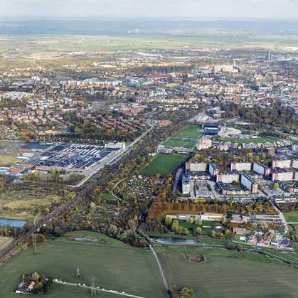
Category Urban – landscape – architectural
Location Lund - Sweden
Population Municipality 115,000 inhab.
Strategic site 520 ha - Project site 60 ha
Site proposed by Municipality of Lund, North Bridge and Estancia AB
Owner(s) of the site Municipality of Lund and private landowners
Commision after competition Urban and landscape strategic study. Development of plan program and masterplan in collaboration with municipality and other partners.
Team representative Professional of urban design – architect – landscape architect
Information complémentaire
How can the site contribute to the adaptable city?
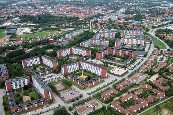
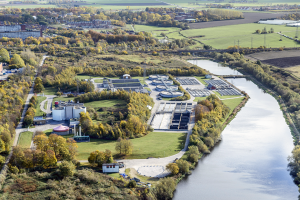
The area for the competition is the centrally located South West Lund. It is mainly a recreation and sports area today and has a good and well-used mix of programs. The area will undergo a transformation however, due to regional pressure. A new train station and an updated waste water treatment plant (WWTP) will open up to densification and a possibility to redefine the whole area. Within the project site, the city wants to create a dense urban environment with mixed uses and shared spaces for sports, recreation and smaller green spaces. The recreational potential of the area will be developed and integrated with the future housing/infrastructure developments and also with the existing city fabric, making it a natural extension of the city centre. The idea is to create a vibrant activity zone within the project area, and fortify the recreational potential of the green spaces along the water
City strategy
Lund has developed from a religious centre in the 12th century to today’s position as an important knowledge based city with key ingredients such us the university, progressive companies, the coming research plant ESS and MAX IV etcetera. The city of Lund has one of the best universities in the world where 36 000 students choose Lund every year.
Lund is close to Malmö and Copenhagen, and has together with Malmö formulated the vision Malmö-Lund 2030. One important node in this Malmö-Lund vision is the new train station in the site of project.
Site definition
The site consists of mono-functional islands with recreational areas, and leftover landscape in between. Typical urban periphery but right by the city park and less than 1 km south-west of the medieval city centre. The vast unbuilt space is there mainly due to the security zone between the waste water treatment plant (WWTP) and housing. In the process ahead two interventions will take place within the Strategic site and act as catalysts:
1. A new railway station on the line Lund - Malmö will be built within the site before 2022. It will be less than 45 minutes from Copenhagen and 15 minutes to Malmö. This will make the site area well linked to the region.
2. The WWTP inside the area will be transformed and updated according to the modern technological solutions. Land that today is within the security zone will opened up to new uses.
Future of the site in relation to the site family and Adaptability
The municipality has to respond to these two interventions. The area that today is a bit detached will tomorrow be a integrated part of the city centre. It is also pointed out to be the centre for sports, recreation and outdoor activities.
Programs or elements that shall fit in the site of project:
The common reinvented – There are circa 20 active sports clubs in the area. A central question is therefore: how can today’s usage of the green spaces be maintained in a densified situation and a future mixed urban pattern? The intention of the city is to let these clubs, surrounding schools and neighbouring communities share this recreative space and let it be a kind of social cement for this heterogeneous area. A chain of activities can create a dynamic axis through the area.
New housing, mixed use and new urban patterns – Lund is growing fast and the area near the new station will be subject to densification mainly through housing.
Connections – The area is not well connected to the other parts and the rail-road acts as a barrier today.
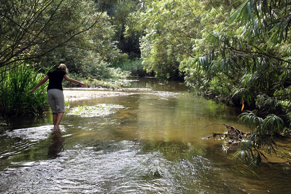
Water – The city slopes towards the competition area and two thirds of the water in the city makes its way to the WWTP and Höje Creek. The ponds at the sewage treatment plant and Höje creek are the only city-water surfaces in Lund which make this area very important. They will not be needed in the future for the WWTP and will therefore be accessible for other uses. This water could also potentially be co-used for offices (cooling), housing (recreation).
Questions à propos du site
In the LUND-SE-PR pdf there is a mention of archeological remains. It is stated that these are "moved to appendices". However, I can't seem to find the file this is referring to. Any help?
A pdf of the archeological remains has been uploaded on the FTP.
In the LUND-SE-PR pdf file, there is a mention of a stormwater drain going through the site. The text refers to "see Storm water image (appendix)" but no such page or file seems to exist. The grundkarta CAD file contains a "Dagvattenled" layer, but it is empty. Where do I find this info?
A pdf of storm water drains has been uploaded on the FTP.
Can urban planner be representative for the Lund site? in the web page it is written that it can (representative: professional of urban design–architect–landscape architect), however in the synthetic site file there is no option of urban planner (representative: architect / landscape architect)
Yes, an urban planner can be team representative, if other rules are complied too.
In the North-East corner, just outside the site area there is a street called Finalgatan. Around that area there is a new development planned, visible also in the 4-ARENA_DEVELOPMENT.pdf in the appendices. Is this supposed to be built in the future? Is this a residential complex? What is the height of those buildings ?
-1- Is this supposed to be built in the future? If there is a market for it, yes. There is a building regulation plan for this area today so it is up to the developers if they want to build, which they most likely will.
-2- Is this a residential complex?Mostly housing but the building regulation plan allows some shopping and hotelspace as well.
-3- What is the height of those buildings ? There is a building regulation plan specifying the maximum heights (see uploaded doc. 1281K-P37_plankarta, max storeys in roman numbers). However, it turned out that the first application for building permissions has lower building heights. See here to selling prospects.
How close can you build to the railway?
There are no absolute distances between for instance the rail and housing. For each and every situation in Sweden a risk analysis is made and that has not been done for this area yet. When building close to railway both noise and risks like train accident and explosions of goods has to been considered. There are some guiding principles to follow regarding the latter (i.e. like train accident and explosion of goods)
Distance from rail:
- 0-30 meters – To be kept clear of constructions. Constructions for the station is of course allowed. Parking, farming, etc. is normally allowed.
- 30-150 meters – Housing is the most critical program to put close to the rail and should therefore be kept at a distance. Offices and shopping (i.e. places where people do not sleep) can be built closer (c. 30-50m from the rail) These sort of programs typically constitute a buffer zone between the rail and housing.
If you wish to build closer to the rail than these guidlines suggest, remedial measures have to bee considered (like explosion proof walls in the houses or landscape banks).
Le site est lié au thème suivant
Comment utiliser de nouveaux inputs pour changer l’espace urbain ? Comment profiter de nouveaux inputs pour transformer l’espace urbain et rediriger les dynamiques positives émergeantes vers les zones adjacentes au profit de nouvelles urbanités ? Comment gérer les tensions potentielles entre les activités locales et translocales ? Ces inputs émargent soit des nouvelles connexions du réseau de transports publics, soit de nouveaux développements programmatiques. L’échelle de telles dynamiques urbaines émergeantes varie de l’agglomération urbaine au monde entier.
Documents spécifiques
Lund - Gyrocopter
Questions à propos du site
Pour pouvoir poser une question, vous devez être connecté (et, par conséquent, inscrit au concours).
Ve. 16 mai 2025
Date limite de soumission des questions
Ve. 30 mai 2025
Date limite de réponses aux questions
Avant de soumettre votre question, assurez-vous qu'elle n'apparaît pas déjà dans la FAQ.
Merci de poser vos questions sur les sites dans le menu Sites.
Merci de poser vos questions sur le règlement dans le menu Règlement.
Si votre question ne reçoit pas de réponse dans les 10 jours, merci de vérifier qu'elle ne figure pas dans la FAQ sous un autre intitulé ; sinon, contactez le secrétariat concerné par email (secrétariats nationaux pour les sites, secrétariat européen pour le règlement.)