Ørsta
Les Dossiers synthétiques et d'enjeux sont disponibles gratuitement.
Merci de vous inscrire et vous connecter pour accéder au Dossier complet de site.
- Dossier synthétique EN
- Le site sur Google Maps
- Retour à la carte
Données synthétiques
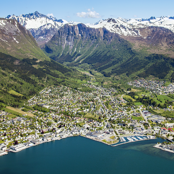
Category Urban - architectural
Location Ørsta, Møre og Romsdal, Norway
Population 10,500 inhab.
Strategic site 99 ha - Project site 13.5 ha
Site proposed by Ørsta municipality (in collaboration with Møre and Romsdal county)
Owner(s) of the site Ørsta municipality and private site owners
Commision after competition Planning commission
Team representative architect - urban planner - landscape architect
Information complémentaire
How can the site contribute to the adaptable city?
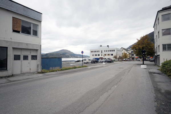
Ørsta, also known as «the white town», lies at the end of Ørstafjorden surrounded by the beautiful Sunnmøre Alps. Though encompassed in beauty, Ørsta suffers from being in the hinterlands of the more prosperous Sunnmøre Coast to the west.
How can Ørsta strengthen its position as an urban centre in the region? As the municipality recently opened up to develop the waterfront adjacent to the town centre, a potential for a new, more urban future at Ørsta has emerged. Now the municipality asks for ideas for how to re-invent its urban center and better connect the central areas and programs in Ørsta.
City strategy
Ørsta municipality is the largest on the mainland in the county of Møre og Romsdal. Farming is an important way of life, but there is also a wide variety of industries, mainly furniture, metal and food-processing. The main coastal highway E39 and RV 655 meet in Ørsta. 50 000 people live within an hour drive from this crossing. Ørsta has for long collaborated with its twin town, Volda, located 10 km to the south, and the future holds for a stronger collaboration between these two municipalities. Between them lies Hovden airport with daily flights to Bergen and Oslo. Currently the two municipalities are looking into the possibilities for developing the area around the airport to a new regional node for big box retail and other businesses.
Site definition
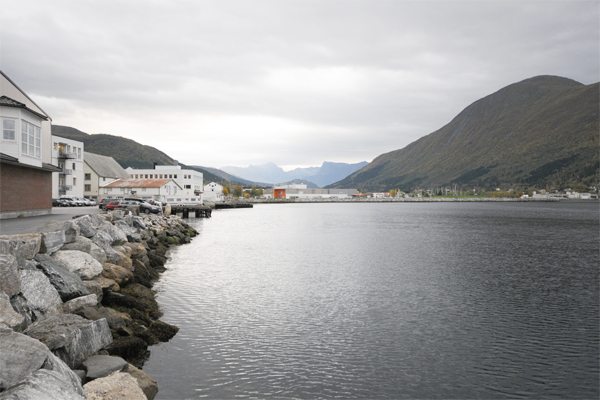
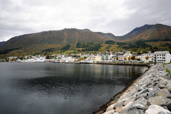
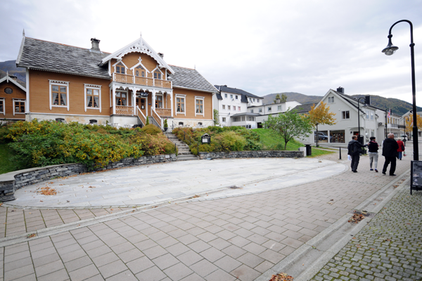
The site is comprised of Ørsta’s main street (Vikegata), main square (Ørsta Torg) and the waterfront. Two large shopping malls, as well as some shops and cafes along the Vikegata, constitute most of urban life there. Ørsta Torg is mainly comprised by a parking lot serving the Amfi shopping mall.
A new park, Ørsta Hamnepark, is located to the south. 500 meters to the southeast lies Ørsta Cultural centre, some schools, a football stadium and other public buildings. This area is currently detached from the site, and should be considered part of a new, urban networking strategy for Ørsta.
In the inner corner of the waterfront lies the listed landmark Kyrkjevoren, a former boat landing site for visiting churchgoers. Next to the site lies Svendsengarden, another important landmark in Ørsta.
Future of the site in relation to the site family and to Adaptability
A central task is to present a credible strategy for how to improve urban life and make attractive urban spaces that connects the site to the public functions within the study area. Furthermore a strategy for how to integrate Vikegata with the waterfront development and shopping mall in the south of the site has to be presented. Today mobility is mainly car-based. How can one encourage less car use in Ørsta?
A central premise for success in Ørsta will be to collaborate with local stakeholders that can contribute to the developing and activating of the urban center. Ørsta is both in need of a plan and a process that can transform its relationship to the urban centre.
Questions à propos du site
Is it possible to get an overview showing which buildings on the project site that are completely or partly vacant today?
The municipality of Ørsta has provided a map that shows empty, partly occupied and occupied commercial and office spaces in the centre. The buildings shown as empty or partly occupied might have apartments in use in the upper floors. The map named ORSTA-NO-SS-M2.jpg is available in the folder 0-New_docs_after_launch.
Can we suggest some infill in Strandgata? Is it possible to relocate the residential function towards Vinjevoll in different typologies, with buying the soil from the current landowners?
The projects can suggest some infill along Strandgata. As the municipality of Ørsta has little financial room for manoeuvre, realization of development projects is therefore, to a large extent, dependent on private investors, or collaborations between the private and public sector.
What is the function of the buildings facing the Vinjevoll area? They look occupied but it is not clear if we can consider some demolition and replacement in this area. May you provide us more information about their actual function?
Please see answer on the question of general demolition of buildings in Ørsta. The buildings along the coast in the Vinjevoll area are currently used as offices and housing with some commercial activity on the ground floor.
Can one moor boats in other areas then the marina? Does the municipality of Ørsta look for some terminal or jetty providing mooring spaces in the public area in the seaside, and not just in the marina?
The marina south of the project site and Strømpeneset, in the western part of the study area, are the two places where one can moor private leisure boats. The municipality of Ørsta is open to creative solutions on how to rediscover and reclaim lost qualities along the shoreline. This might include a marina if beneficial for the overall project.
Can we propose some floating buildings providing public services in the bay? Is it generally allowed to build floating structures? Can we suggest floating services in different areas then the marina?
Floating structures within the project site can be considered if beneficial for the overall project.
Can we suggest some demolition, and then replacement in the same footprint? We need some more info about the places and buildings where demolition and replacement can´t be done. Is it possible to consider some demolition of the detached buildings?
It is possible to suggest some buildings for demolition. Buildings and sites in the town that are protected as cultural heritage and should not be demolished are; Svendsengarden, Kyrkjevoren, the wooden houses along Kyrkjegata, and the burial mounds. These are described in the competition brief. The municipality informs that there are other buildings that might have a value as cultural heritage without formally being protected as such.
Can we change the coastal line in all the strategic area?
The coastal line can be modified with the aim of strengthening the relation between the urban centre and the waterfront within the project site. A part of the coastal line, Kyrkjevoren, is considered as cultural heritage and should not be modified. The participants are asked to consider the ground conditions when proposing modifications.
Can we propose interventions in some way on the rooftop of Amfi shopping mall?
Yes.
About the area close the Rossåa River. It looks like both the new school and the sports arena would be moved here. Are there some projects already planned, or may we propose a master plan for the area?
The participants are not asked to make a master plan for this area as the plan and design for the new school and sports arena has already started.
Is it possible to propose public leisure or playgrounds in the outdoor area connected with the Amfi shopping mall? The existing green "stripe" looks under dimensioned.
Yes, the participants may suggest new public spaces along the shoreline and outdoor areas connected to Amfi.
It is possible to propose excavations in order to hide some parking lots in the area connected to the E39 and the Vikegata?
There are no restrictions on this matter in the competition brief and the municipality of Ørsta is positive towards considering underground parking. Please keep in mind the protected burial mound in this location.
May we intervene on the E39 section, changing the areas deputed to the walksides ?
Yes, alternative solutions might be explored. Please note that it is the Norwegian Road Authority (Statens Vegvesen) who «own» the road.
Are we expected to propose housing typologies in some specific area? What are the limits? Are you looking for different typologies than single-family houses? If so, what the density and height limits?
The municipality of Ørsta welcome innovative suggestions on new housing typologies within the project site. They are investigating possibilities for a higher density in the central areas of the town. The location, typologies and limits of new programs and housing in Ørsta is a part of the overall task described in the competition brief.
Can you clarify where the Public Administration is looking for mixed-use buildings? What is the maximum height and footprint for new buildings?
The municipality of Ørsta is primarily looking for mixed-use buildings within the borders of the project site. There are no exact numbers or guidelines regarding maximum height or footprint of new buildings. Few existing buildings exceed four floors.
It is possible to build up light structures that overlap to the sea? Are light, dismountable structures allowed on the bay side?
Yes, light, dismountable structures are allowed along the shoreline.
If I understood correctly, landscape scale solutions are required but can we suggest physical buildings and/or modify existing buildings? Can we propose new mixed-use buildings?
Yes, the project proposals can suggest new built structures and/or modify existing buildings and propose new mixed-use programs.
Le site est lié au thème suivant
Comment créer une dynamique positive à partir d'une situation difficile ?
De nombreux sites doivent faire face à des situations urbaines difficiles, relevant de problèmes de différentes formes : économique, environnementale et urbaine, ou encore de valeurs. Confrontés à ces difficultés, ces sites constituent pourtant des terrains propices à de nouvelles dynamiques, s’appuyant sur des scénarios de partage ainsi que sur la régénération des outils de la discipline urbano-architecturale.
Questions à propos du site
Pour pouvoir poser une question, vous devez être connecté (et, par conséquent, inscrit au concours).
Ve. 16 mai 2025
Date limite de soumission des questions
Ve. 30 mai 2025
Date limite de réponses aux questions
Avant de soumettre votre question, assurez-vous qu'elle n'apparaît pas déjà dans la FAQ.
Merci de poser vos questions sur les sites dans le menu Sites.
Merci de poser vos questions sur le règlement dans le menu Règlement.
Si votre question ne reçoit pas de réponse dans les 10 jours, merci de vérifier qu'elle ne figure pas dans la FAQ sous un autre intitulé ; sinon, contactez le secrétariat concerné par email (secrétariats nationaux pour les sites, secrétariat européen pour le règlement.)