Streefkerk
Les Dossiers synthétiques et d'enjeux sont disponibles gratuitement.
Merci de vous inscrire et vous connecter pour accéder au Dossier complet de site.
- Dossier synthétique EN
- Le site sur Google Maps
- Retour à la carte
Données synthétiques
Category Urban - architectural
Location Streefkerk
Population Village 2,500 inhab.
Project site 1.678 ha
Site proposed by Waterschap Rivierenland
Owner(s) of the site Waterschap Rivierenland
Commision after competition Possibly participation in a project team working on future dike reinforcement or supervision from the landscape/architectonic perspective concerning the development of the site
Team representative architect - urban planner
Information complémentaire
How can the site contribute to the adaptable city?
Located in a delta region, almost 60% of The Netherlands is potentially flood-prone, either from sea or river water. The country is renowned throughout the world for its experience in the field of flood defence and technical know-how about water management. Waterschap Rivierenland plays a major role in this, given its responsibility for more than a thousand kilometres of dikes in the vicinity of large rivers. Owing to the rising sea level and the increase in heavy downpours, the dikes along the rivers will require reinforcing if the hinterland and towns and cities are to avoid flooding. In the Deltaprogramma 2015 the national strategy for rivers is laid out.
Regional strategy
The area is part of Alblasserwaard, a low-lying and predominantly sparsely-populated, agrarian region surrounded by rivers and canals. The landscape of Alblasserwaard can be characterised as an extensive, peat grassland area lying approximately one and a half metres below sea level. The area is transected by canals plus two small rivers, the river Alblas and the river Giessen. As far as development is concerned, Alblasserwaard mainly comprises villages, hamlets and a scattering of farms. In the near future dike reinforcement will be carried out along the south bank of the river Lek. This section of the river is affected by both high river-water levels and by the rising sea level.
Site definition
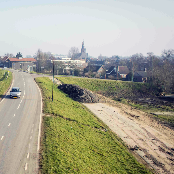
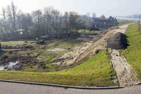
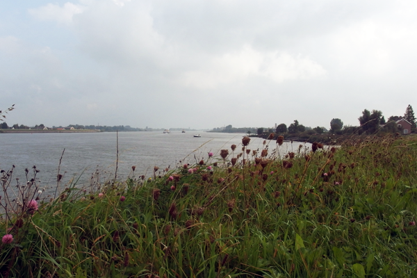
The site is situated on the dike bordering the river Lek and to the west of the centre of Streefkerk. Requested are small-scale, conceptual proposals for reconstruction on, in, or along the dike, while respecting the urban and surrounding rural landscape. The technical design of the new dike and the existing architecture elsewhere along the dike should be taken into account. The challenge is to reconstruct a plot of land – limited in space, between river and hinterland, with a considerable difference in height while at the same time anticipating a higher water level in the future due to a rising sea level – that blends in well with the surroundings.
Future of the site in relation to the site family and Adaptability
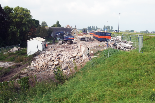
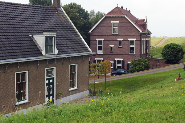
The site forms part of a dike reinforcement that will be carried out between 2014 and 2017. The dike reinforcement will necessitate demolishing all the existing housing on the site but, when completed, the site will be available again for development. In the area around Streefkerk, dike reinforcement is the order because there is a lot of development along the river and little space. Unavoidably, some buildings on a number of sites will have to be demolished in order to reinforce the dike. By mutual agreement, however, the buildings can be rebuilt. Either on another site, but the intention is that they are rebuilt on practically the same spot but on top of the newly-constructed bank.
Demolition and construction on condition that the foundations can be levered up (raised on their supporting piles) in connection with future reinforcement. The proposals for the site on the dike in Streefkerk should facilitate the river strategies developed within the framework of the Deltaprogramma and take into account the location, which is close by the river and the village of Streefkerk, as well as on a peat subsoil. Proposals can serve as examples for tackling the realisation of the developments in the national Deltaprogramma 2015. Streefkerk requires a lively landscape along the dike that connects the river and the village.
Questions à propos du site
Will we have complete information (in English) on the new dike reinforcement?
If you register for the site, this information is included in the competitioon material.
What kind of building has to be designed? Social housing, private dwellings,...?
The brief asks for private dwellings
If the brief asks for private dwellings, it will be difficult to implement the new ideas of the winning project on these future buildings because each owner will decide how he wants to build his new home. Are we only talking of conceptual ideas?
The site will be transfered to a private developer that will develop and build the housing and afterwards place it on the market. However, the conceptual ideas are important because there are many comparable sites in the Netherlands and interesting solutions may eventually lead to policy changes at the several District Water Boards.
Are there any "additional complete site folders"? How can this additional information be downloaded?
If you are registered for the site, you have access to all material that is available. If you think you need more information please ask for it.
Is the current entrance way for the house on adress Boezem 1 to be maintained?
Yes, it has to be maintained.
In the section (STREEFKERK-NL-PS-M5.pdf) there is a line explained: "profiel van vrije ruimte" = clearance cross-section. Can infrastructure, for example the driveway, be planned within this profile?
Profiel van vrije ruimte = section of free space. This space can only be used for the entrances of the planned dwellings.
Had the housing on the site to be demolished because of local raising of specific area of the dike (as indicated by and refered to figure 4.2) or because of excavation of the specific area of the dike (as indicated by figure 1.6 as shown in the extended site file of Streefkerk)?
The housing had to be demolished because the shape of the dike has to be changed. Figure 1.6 of the extended site file shows the former (green line) and the future shape of the dike (black line). Figure 4.2 indicates the building conditions. Please also read what is written in the report of the site visit about the need to change the dike profile.
For which probability of flooding has been sized the new dike reinforcement? A 100-year flood? What is the level of the current river, given to those values?
As the site partners are looking for future-proof designs, they would like to focus on the design itself, without taking into account specific measurements.
Is it possibile to change and remodel the cross section of the levee?
Remodeling of the cross section of the dike only is possible if the stability and safety of the dike are ensured. This requires a lot of technical knowledge and skill.
Are building regulations for the Streefkerk site available? If so, what is the minimum slope of the roof?
The relevant conditions for rebuilding are all indicated in the extended site file.
Is it possible to intervene the infrastructural layout of the dike to enhance and integrate it with housing and additional programs?
The infrastructural layout of the dike is fixed, only the entrances of the housing have to be designed.
Is it possible to propose examples for strategies that can be implemented in other dike reinforcement projects along the river, such as varied public programs?
Yes, it is possible to propose examples for strategies that can be implemented in other dike reinforcement projects. The site partners are looking forward to good conceptual designs.
Le site est lié au thème suivant
Comment créer une dynamique positive à partir d'une situation difficile ? De nombreux sites doivent faire face à des situations urbaines difficiles, relevant de problèmes de différentes formes : économique, environnementale et urbaine, ou encore de valeurs. Confrontés à ces difficultés, ces sites constituent pourtant des terrains propices à de nouvelles dynamiques, s’appuyant sur des scénarios de partage ainsi que sur la régénération des outils de la discipline urbano-architecturale.
Questions à propos du site
Pour pouvoir poser une question, vous devez être connecté (et, par conséquent, inscrit au concours).
Ve. 16 mai 2025
Date limite de soumission des questions
Ve. 30 mai 2025
Date limite de réponses aux questions
Avant de soumettre votre question, assurez-vous qu'elle n'apparaît pas déjà dans la FAQ.
Merci de poser vos questions sur les sites dans le menu Sites.
Merci de poser vos questions sur le règlement dans le menu Règlement.
Si votre question ne reçoit pas de réponse dans les 10 jours, merci de vérifier qu'elle ne figure pas dans la FAQ sous un autre intitulé ; sinon, contactez le secrétariat concerné par email (secrétariats nationaux pour les sites, secrétariat européen pour le règlement.)