Zagreb
Les Dossiers synthétiques et d'enjeux sont disponibles gratuitement.
Merci de vous inscrire et vous connecter pour accéder au Dossier complet de site.
- Dossier synthétique EN
- Le site sur Google Maps
- Retour à la carte
Données synthétiques
Category Urban - architectural
Location Zagreb, Croatia
Population City 790,000 inhab.
Project sites 1.5 ha / 4.5 ha / 5.8 ha / 16 ha
Site proposed by City of Zagreb
Owner(s) of the site City of Zagreb, private owners
Commision after competition The sites are proposed for temporary public use, organized by the City in cooperation with NGOs, citizens' organizations and similar stakeholders
Team representative architect
Information complémentaire
How can the site contribute to the adaptable city?
The programme can be associated to each of the three subthemes of adaptable city: self organization‐ inclusion of inhabitants into the decision‐making process is considerable through NGOs and citizens' organizations, sites can be shared both in terms of purpose and in terms of time. The planning process is democratic and transparent, and can be influenced in many stages.
City strategy
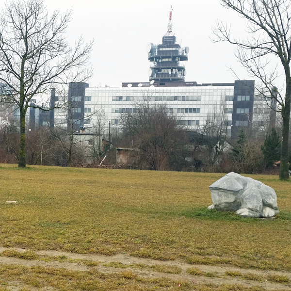
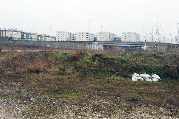
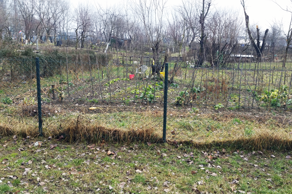
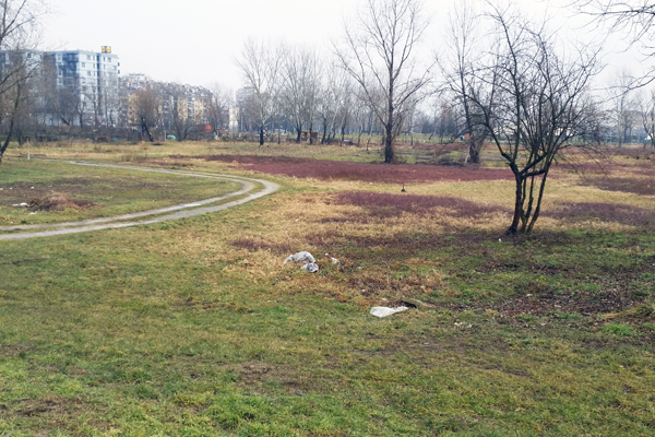
In the new Europan competition, City of Zagreb proposes four sites positioned along the Sava river, derelict and unused at the moment, yet with a potential to provide good and dynamic public space.
The competitors are asked to propose modalities of use and urban furniture/temporary buildings that can enable variety of public uses before the site is used as planned in the long term development plans. This flexible approach is in accordance with the subthemes of Europan 13, and low cost makes implementation more likely. One of the modalities of implementation can be partnership with NGOs with direct involvement of the citizens as future users. The competitors should propose several possibilities for use, to enable multifunctionality. The proposed schemes should be adaptable to different sites, and implementation should be possible in phases. Flexibility of use is very important.
Site definition
The site comprises of four derelict and unbuilt sites positioned along the Sava river. Some of the sites are within areas in need of further planning procedure, and other are in areas of mixed uses. Until they are used according to planned purpose, these areas will be proposed for temporary public use, with light temporary/mobile structures. The competitors can propose variations of use and potential activities. The sites can be connected by bicycle tracks along the Savaembankment (levee). Sites 1,2 and 3 are positioned close to urban activity, and site 4 is in a separate area, away from public transport or dense housing areas.
Future of the site in relation to the site family and to Adaptability
The subject of sharing can be regarded in terms of space and in terms of ownership. Urban life has always implied a certain degree of sharing. Not just for reasons of economic crisis, but also rationally use of resources at our disposal, the principle of sharing is shown to be a very logical and sustainable approach. The question is in what way could this principle be applied to other areas of urban living, and how can it be implemented, through institutions or otherwise.
The aim of the project is to propose experimental uses on sites of high attractive potential, on which renewal and development has stopped due to various circumstances, transition processes or economic situation. While waiting for the final use of proposed sites, a reflection of new temporary use is proposed. The expected result is a representation of possible scenarios of public use of derelict spaces by implementing new activities, accessible to the public, while avoiding aggressive and permanent interventions in space. Public spaces also provide the city with identity, as well as a stage for cultural, political and entertainment events.
Questions à propos du site
1- Do the bike lanes have to remain temporary. 2- Should we design process integrate with NGOS? Would that be before of after submitting the proposal? 3- Is it still possible to visit the site during the beginning of June?
1- The temporary character of the designs is not related to a fixed time frame, so as long as the proposed design doesn't interfere with a new design following the planning guidelines, the temporary structures and paths can remain on site. We suppose that some of the temporary design features will remain for a longer period, even as permanent elements.
2- The NGO's can be included in the implementation process but the competitors aren't obliged to include them in the design process.
3- Site visits can be arranged whenever a competitor travels to Zagreb, they just need to contact the Zagreb site representatives in advance (ana.magdic@zagreb.hr and iva.bedenko@zagreb.hr)
Is it possible to have a planimetry with the points of the altitude or level curves of the ground for the study area? Or otherwise a section for each site project showing height profiles.
The topographic maps, cad drawings with the marked spot elevations at survey points, have been uploaded in the "documents added after launching" folder on the Europan website. The altitudes of the project sites and most of the study site including the levee are shown in the drawing, allowing the competitors to define the terrain topography.
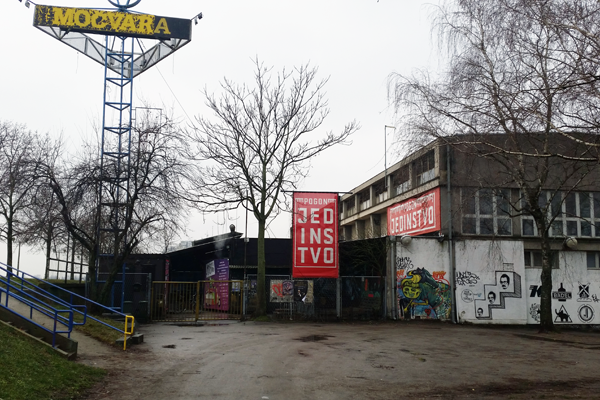
Hello! We didn't understand how temporary should structures be. Can we plan anything with foundations? Can we change the relief of the sites? How should we consider the pogon project? is it going to be built or is it just a suggestion?
The planned structures should be mobile, and interventions in the terrain could be proposed if those interventions can be easily removed if needed. The character of the land by the river is such that concrete foundation is needed for larger structures, but it should be possible to move these foundations, so they should be made of precast concrete. The pogon project is in the permit obtaining phase and will be built. Its character and programme should be respected in planning the site, and can be seen on their website http://www.upogoni.org/en/
Do we have to think to host events or public activities during the whole year ( from 1st January to 31st of December)? Is it possible to rethink the sites morphology included the strategic sites area?
The idea is to enable the use of the new public spaces during the entire year. Changes to the study site morphology can be proposed as ideas, but the actual design and planning should be focused on the project sites.
Hi, referring to the Zagreb competition site, the these following questions have emerged among our team: 1. Concerning the site visit of April 20th, has a visit report been prepared?
The visit report has been prepared and it is available on the Europan Europe website.
2. Concerning the project site / strategic site, has any of the further development projects been defined? This would help to set our project coherently, with regard to the defined evolution of the sites, to the ephemeral character of the project, and to the possible permanent elements.
The idea of the Europan 13 competition for the Zagreb site is to propose temporary structures and public uses. The entire area along the Sava river is a green belt with scattered construction. The plans for the four sites propose as follows:
Site 1 (on the west) is a part of a wider planned high-urbanity zone with commercial and business facilities on the South towards the road, and residential buildings on the north. A pedestrian bridge is planned on the western border of the site.
Site 2 is also planned as a high-urbanity site with public and government buildings, with the intention to create an identity to this central position
Sites 3 and 4 are planned for sports purposes, site 3 sports with construction and site 4 open-air sports fields with auxilliary buildings. Site 3 is surrounded with mostly residential buildings and site 4 is near the water treatment plant and urban sprawl, and undeveloped areas.
Dear Sir or Madam, the plan for the site 4 that you provided us is consistently different from present day reality, as visible in google maps, or google earth views. There is a road and several ponds which are not shown in your plans. Should we make our proejct on the base of your documentarion? thank you for your answer
The topographic map showing the actual state odf the terrain on the site 4 is uploaded in the "documents added after launching" folder on the Europan website. The ponds have been created by gravel excavation and considering the character of the competition brief, the site should be regarded in its present state.
Le site est lié au thème suivant
Comment intégrer des sites vacants dans le développement urbain ? Des changements d’économie, de gouvernance ou sociétaux peuvent faire apparaître des espaces vacants dans le paysage urbain : complexes entiers de bâtiments en attente de nouveaux usagers, anciennes zones militaires, zones vertes délaissées… Ces espaces sont parfois difficiles à intégrer dans le développement urbain normal/organique car trop grands et nécessitant une adaptation totale. Où chercher les moyens de combler le vide et quand le considérer comme valeur ? Comment donner du sens à la vacance et l’intégrer dans de nouvelles façons de faire la ville ?
Questions à propos du site
Pour pouvoir poser une question, vous devez être connecté (et, par conséquent, inscrit au concours).
Ve. 16 mai 2025
Date limite de soumission des questions
Ve. 30 mai 2025
Date limite de réponses aux questions
Avant de soumettre votre question, assurez-vous qu'elle n'apparaît pas déjà dans la FAQ.
Merci de poser vos questions sur les sites dans le menu Sites.
Merci de poser vos questions sur le règlement dans le menu Règlement.
Si votre question ne reçoit pas de réponse dans les 10 jours, merci de vérifier qu'elle ne figure pas dans la FAQ sous un autre intitulé ; sinon, contactez le secrétariat concerné par email (secrétariats nationaux pour les sites, secrétariat européen pour le règlement.)