Casar de Cáceres (ES)
Les Dossiers synthétiques et d'enjeux sont disponibles gratuitement.
Merci de vous inscrire et vous connecter pour accéder au Dossier complet de site.
- Dossier synthétique EN | ES
- Dossier d’enjeux EN | ES
- Le site sur Google Maps
- Retour à la carte
Données synthétiques
Échelle de projet L - urbain + architecture
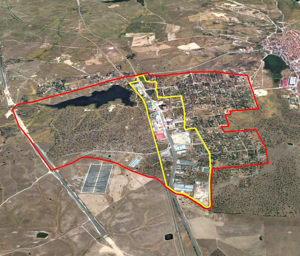
Localisation La Charca del hambre zone industrielle, Casar de Cáceres, Provincia de Cáceres
Population 4 532 hab.
Site stratégique 255 ha – Site de projet 8,8 ha
Site proposé par Directorat Général d'Architecture, Gouvernement Régionale d'Estrémadure
Acteurs impliqués Gouvernement Régionale d'Extremadoure, Conseil Municipal de la ville de Casar
Propriétaire du site Publics et privés
Phase post concours Projet de développement urbain
Représentant d'équipe Architecte - urbaniste - paysagiste
Information complémentaire
How can the site contribute to a productive city?
The proposed site forms a backbone for the "Charca del Hambre" Industrial Estate in Casar de Cáceres, alongside the N-630 highway. This industrial zone contains a variety of small and medium businesses, of great value for the area’s competitive economy and a good opportunity for local development, taking advantage of its location between two natural areas. The work done by the enterprises based here will contribute to the technological, economic and social growth of the area. In this context, the potential of this industrial space is to be analysed with a view to drafting a sustainable urban development proposal. Proposals should improve the current conditions and attract new businesses to set up on the estate.
City strategy
The present and future of this industrial area is closely linked to its urban planning and its connection to the "Las Capellanías" Industrial Estate in Cáceres. These two estates, barely 10 km apart, are both located beside the N-630 highway. They constitute a potential growth and development axis. The value of this axis will soon be further incremented when a new eminently technological estate opens at the junction of the A66 and N630 highways.
On a more local scale, work has been done to improve the main road link, CC-100, between the town and its industrial area, including a new bicycle path. The authorities wish to continue improving the connections with the Southern part of the town along “Polígono Casar de Cáceres” Road. The disappearance of the current railway tracks will enable as well to improve connections between East and West, between Cojuge Pond, Charca del Hambre pond and El Casar Lagoon.
Site definition
The area proposed for the operation is on the "Charca del Hambre" Industrial Estate. It has a clearly linear structure, marked by the adjacent N-630 highway and the railway easement. There is a broad diversity of business activity on the estate, with predominantly small-scale production systems.
One of the features of this area is the relationship between the industries and the natural environment, represented by Charca del Hambre and Charca del Cojuge ponds. This relationship lends a distinctive character to the area and is also a good opportunity for the reappraisal of the spaces that define it.
How is production inserted in the urban diversity programme?
The major highways that form the backbone of Casar de Cáceres —mainly the A-66 motorway and the N-630 national highway— and the town’s proximity to the province capital, Cáceres, make the project area an interesting opportunity for local development and the promotion of industrial activity. The relation between the current industrial estate and the new one foreseen in the Southern part of the city, will help to the productive development of Casar.
The aim is to improve the value of the "Charca del Hambre" Industrial Estate and create a relationship between the traditions of Casar de Cáceres’ economic activities —the reception of raw materials— and their transformation in the industrial pavilions that are the focus of this proposal.
Any new activities must be established in an environmentally responsible and respectful way with the area that receives them and its ethnographic values. It is worthwhile reappraising the evolution of traditional production activities and the way they have transformed and adapted to technological progress.
The disappearance of the current railway tracks underlines the importance of the role of this area in the relationship between Dehesa Boyal neighbourhood and Charcha del Hambre pond, using the opportunities that the area’s natural resources provide.
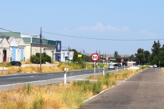 Industrial estate - Charca del Hambre
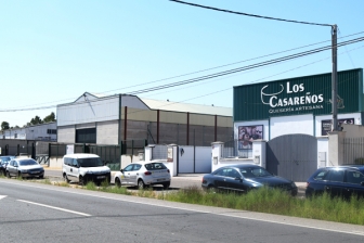 Production area - industrial estate Charca del Hambre
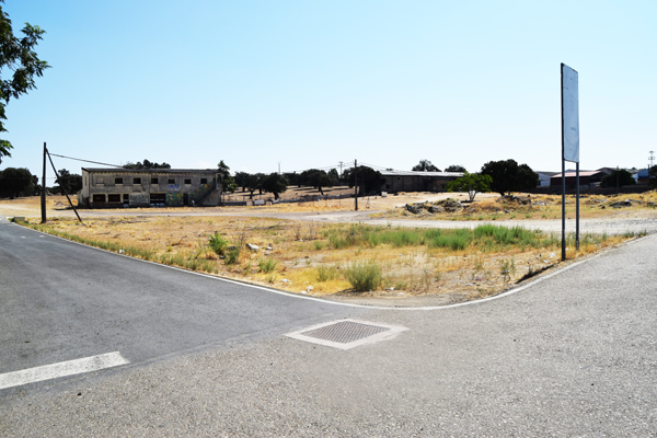 Abandoned buildings and wasteland at Charca del Cojuge
 Charca del Hambre Pond - landscape of the project site
Questions à propos du site
Hi! I can't seem to unzip or open the jpg's you've uploaded, they're nither zip-files nor pure jpgs (can't open them in photoshop and the files don't have a jpg extention. Is there a chance you could see to that/ another way to access the files. Thank you!
Dear participant, I am very sorry to hear that. However, we have just checked the Casar files and we have had no problem to download them. No other team has reported any problems.Please, try again.
Le site est lié au thème suivant
CRÉER DES PROXIMITÉS CRÉER DES PROXIMITÉS Interfaces et cycles courts
Interfaces et cycles courts
Dans l'espace physique de la ville, mais aussi aux échelles temporelles et des acteurs, il s'agit d'établir des proximités entre habiter et travailler à l’intérieur de quartiers résidentiels et entre les quartiers résidentiels et les zones de production monofonctionnelle. Il s’agit aussi de repenser le passage de la mobilité métropolitaine à grande vitesse vers la vitesse plus lente des quartiers.
La création d'interfaces contribue à la transformation des infrastructures de mobilité, de logistique, de commerce ou de service, en raccourcissant les cycles de production, et produit de nouvelles relations entre habitat, agriculture et services, entre espaces et populations. L’interface un espace fluide autour de processus incrémentaux et adaptatifs, refusant les master-plans prédéfinis.
Documents spécifiques
Questions à propos du site
Pour pouvoir poser une question, vous devez être connecté (et, par conséquent, inscrit au concours).
Ve. 16 mai 2025
Date limite de soumission des questions
Ve. 30 mai 2025
Date limite de réponses aux questions
Avant de soumettre votre question, assurez-vous qu'elle n'apparaît pas déjà dans la FAQ.
Merci de poser vos questions sur les sites dans le menu Sites.
Merci de poser vos questions sur le règlement dans le menu Règlement.
Si votre question ne reçoit pas de réponse dans les 10 jours, merci de vérifier qu'elle ne figure pas dans la FAQ sous un autre intitulé ; sinon, contactez le secrétariat concerné par email (secrétariats nationaux pour les sites, secrétariat européen pour le règlement.)