Aalborg
The Synthetic Site Folder and Site Brief are available for free.
Please register and login to access the Complete Site Folder.
- Synthetic site folder DA | EN
- Site on Google Maps
- Back to map
Data
Category urban
Team representative architect - urban planner - landscaper
Location Aalborg
Population City 120,000 inhab. - Conurbation 125,000 inhab.
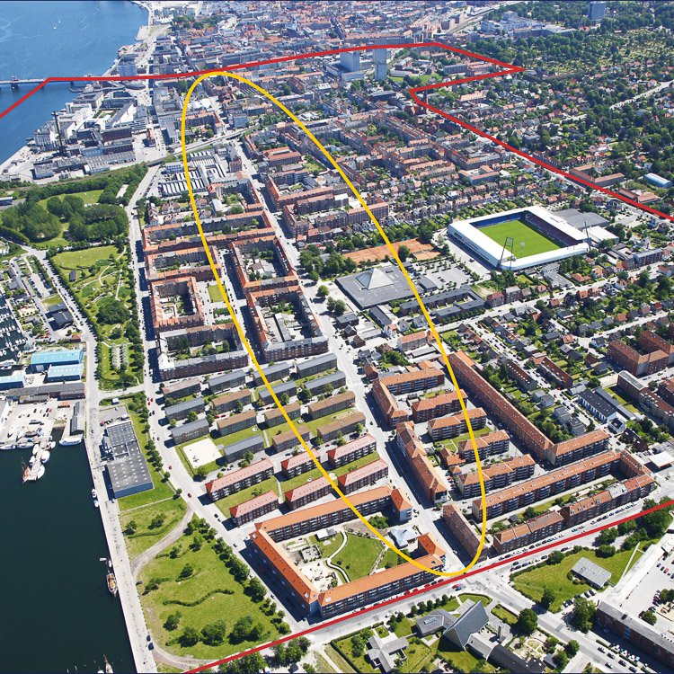
Strategic site 80 ha - Project site 32 ha
Site proposed by Municipality, Region and housing associations
Owner of the site Municipality, Region and housing associations
Commission after competition It is the intention that the competition proposals be used as input to a further process and actualization of the overall vision and strategy for Vestbyen. In addition, there may also be a need to expand upon the competition proposals in regards to specific efforts and defined areas.
More Information
How can the site contribute to the adaptable city?
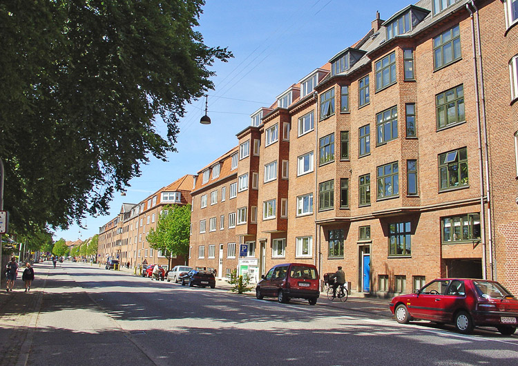
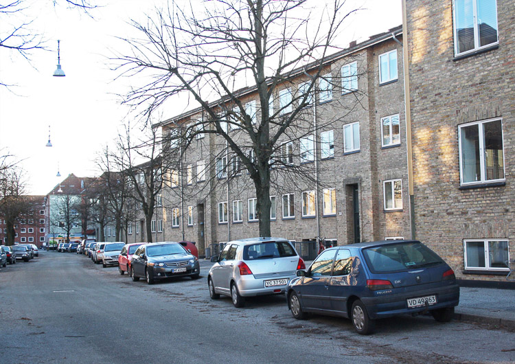
Vestbyen is one of the oldest boroughs in Aalborg, established as a residential area to house the workers employed by industrial advances between 1900 and 1950. The district has not developed noticeably since it was built. This is in contrast to the rest of the city - especially the centre - which has experienced major change and expansion over the last few years, with investment in large-scale international projects. Along with the neighborhood’s untapped potential, new strategies for Vestbyen can contribute to this development of Aalborg as the small but internationally-oriented city. A new strategy for Vestbyen could highlight the kind of solutions, which when taken out of the pre-existing framework can provide new activities in increasing quality of life for those who live and work in the neighborhood, as well as in tackling climate change and social problems. These overall themes could form the basis for the establishment of new meeting places, a new use of urban space and fresh ideas regarding green and blue areas in the quarter.
City strategy
With a population of 122,000, Aalborg is the largest town in the northernmost region of Denmark. In recent years, the city has undergone an extreme transformation from industrial town to knowledge and experience city. The city has revamped itself as «the city on the fjord», and has over the past 10-15 years made great investments in the regeneration of the central waterfronts and the central Midtbyen district, which has provided the entire city centre with a lift and a new identity. In 1974, a large university was built in the eastern part of Aalborg, which today is hugely influential on the city’s growth and business life. There are plans to extend Aalborg University, as well as to construct a large, internationally-oriented University Hospital, scheduled to open in 2020.
Aalborg Municipality is currently examining the possibility of constructing a high-classification public transport system in the form of a light railway, which would connect the central city districts to the University Hospital. Work is expected to start on the light railway line in 2020.
Site definition
Vestbyen is part of a string of neighborhoods situated attractively along the Limfjord Strait: it also has close connections to Aalborg Midtby, large green recreational areas west of the neighborhood and large suburban residential districts further south. The neighborhood is characterized by its multiple identities, which are evident in the area’s diverse collection of services, large recreational areas by the fjord and the broad range of housing available.
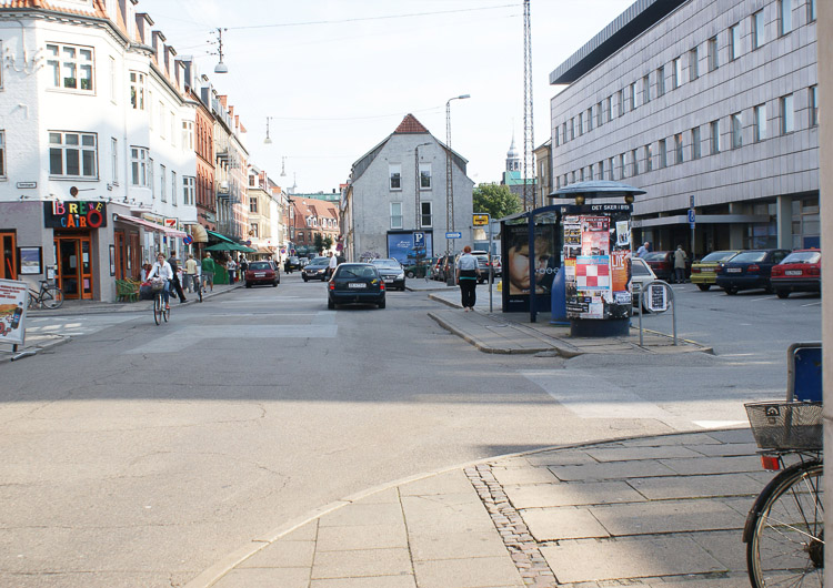
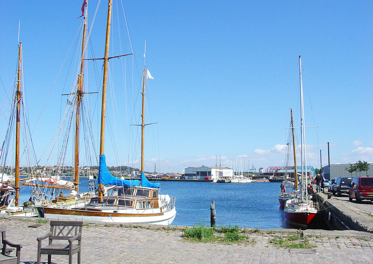
A particular characteristic of Vestbyen is that there has always been open access to the Limfjord. The areas next to the fjord are marked by the activities of rowing and sailing clubs, while for the residents, access and proximity to the water is limited. Like the building pattern, the infrastructure is clearly defined by a grid of roads. Kastetvej, which is in focus as a project area, is one of the primary link roads between Midtbyen and Vestbyen, and this is also the location of the planned light railway, which will connect Vestbyen with Midtbyen and the eastern part of Aalborg.
Adaptability: main elements to take into account
The starting point for the strategy is the establishment of the light railway, which will run on a track along the central link roads in Vestbyen. This provides an ideal opportunity to kick-start a development of the entire area, which today presents a rather boring and worn-out framework for life in the quarter. In order to make Vestbyen an adaptable neighborhood, the strategy must take into consideration not only the development but also the preservation of the quarter’s many, diverse identities. These identities can manifest themselves, for example, in the different qualities of living and visiting the area, special environmentally sustainable supplements or climate change adaptations. A new programming for the neighborhood is sought, which both fits in with Aalborg’s development as a knowledge and experience city and considers the critical mass for a city the size of Aalborg. It could also be considered how a new application of the infrastructure could help bring change to the quarter. New meeting places and better connections are equally important elements that can help to create a more effective coherence in the district. A new strategy and access to using the public space will also be a focus point.
Questions on the site
What do you mean by snapshots in the complete file?
We are asking for the snapshot so that we are able to see the development in the strategic over time. What is strategically smart to focus on in 2018 and why, and how does this affects the area. What is the next step and how fare is the development in 2025. Why is this this steps and focus that you take a smart strategy for the area and how does it affect the project site? Why have you thought that this is the right steps for the municipality of Aalborg to take and how can your plan help increasing the life quality in the area?
Do you want to have us solve or pick all the mentioned areas on the study site?
The mentioned areas on the study site, for example the hospital, should be seen as starting point - the question is therefore when is it smart to develop what (on a general scale), and how does this development affect the project site. We are therefore not asking you to make a detailed drawing off any of the mentioned areas in the study site, but to whole these drawings/diagrams on a general strategic scale, and then show on a more detailed scale how this affects what is happening/needed/working in parts of the project site.
In the material placed on the website, you have a map showing the water level on the study site – does this mean you want us to focus specific on solving this issue?
No, this is just as an information about the study site and to show you that it is not everywhere that you can count on leading the rainwater into the ground without having though of extra security. This is not the main issue for the study and project site, and should probably be solved on a much higher strategic level and a masterplan for the whole of region of Aalborg. If you want to take the issue into account in the proposals you should therefore just bare this in mind.
Do you want us to show a details drawing on the whole project site?
As it is written in the complete file there is a difference is the scale and details you have to show/draw. For the whole project site you need to show/draw a plan in the scale 1:5000, and only show selected areas on the project site in 1:1000 with additional visualizations.
4 of the 7 development projects you talk about in the program (pp. 16-18) are located within the study site. How do we have to deal with them? Do we have to take into consideration only the effects these projects will have on the rest of study site, knowing that others have already been involved in studying the matter, or do we have to make proposals consistent with what will be their future? To put it in more practical terms, ignoring the details of these development projects, on the demanded site plans (1:5'000) do we have to leave these areas 'blank' – so to speak, or make project proposals on the basis of what we know from the brief descriptions at pp. 16-18 of the competition program?
The “competition task” is to make: - A strategic plan for Vestbyen, which is a strategic area in the competion, - Two snapshots of Vestbyen, for 2018 and 2025 respectively, with Kastetvej as starting point, - A time schedule.
Depending on your answer in the strategic plan it is required to show ideas from the development areas that can influenze on the development of the project site, that includes drawings “snapshots” (1:5000) that shows the overall ideas.
In the pdf text document, in the appendix we can see some references. One of them, the link to the Municipality's strategic plan doesn't seem to work. Is it possible to make this document available to us as a reference?
Please find the reference here - http://www.e-pages.dk/aalborgkommune/517/
The competition program is to develop a detail drawing for the Kastetvej street regarding the future intervention of the area, or should we develop a detail drawing for the area 5 (Aalborg University Hospital) and area 2 (apartments blocks) as well?
The competition program is to develop a strategic plan for the strategic area “Vestbyen” within the Aalborg University Hospital and area 2 (apartments blocks) and in addition it is up to the suggestion maker to point out which efforts should be included in the strategy. The detailed drawing required in the program includes the project area and the limits areas (see map page 11 and the diagram on page 37 in program).
The snapshot 2018 that must include the apartments blocks in the western part of the district and the Aalborg University Hospital is one aereal snapshot (to include both proposals) or could be two different snapshots (for example two street views)?
The competition program is to develop a strategic plan for the strategic area “Vestbyen” which as a minimum includes both the Aalborg University Hospital and area 2 (apartments blocks) and in addition it is up to the suggestion maker to point out which efforts should be included in the strategy. The snapshots should include a drawing for the project area and the limits areas (see map on page 11 and the diagram on page 37 in program ).
For the snapshot 2018 that includes, for example, the apartments blocks, should we consider the existing buildings or should we draw a new proposal for that area?
It depends on your strategics …
This site is connected to the following theme
Dynamic urban platforms Revitalising currently unattractive public spaces needs consideration on a broader scale than the immediate site environment. Even if these spaces are sometimes small in scale, they are strategic levers for activation on an urban level. Their impact in terms of identity and image often exceeds their physical limits and calls for a wider transformation of the existing fabric. Blind spots that have never had adequate use, or places whose initial functions are now obsolete or out of sync with the requirements of the inhabitants, can serve as platforms for activation and appropriation to mobilize the local population or a broader public. The development or redevelopment of these areas can be approached in many ways: in the form of refreshment by multifunctional spaces, with temporary or extendable structures acting as acupunctures, or as a trial balloon to put a site on the map, initiate private co-financing or investment and find new rhythms of intensity.
Questions on the site
You have to be connected –and therefore registered– to be able to ask a question.
Fr. 16 May 2025
Deadline for submitting questions
Fr. 30 May 2025
Deadline for answers
Before submitting a question, make sure it does not already appear in the FAQ.
Please ask questions on sites in the Sites section.
Please ask questions on rules in the Rules section.
If your question does not receive any answer in 10 days, check the FAQ to make sure the answer does not appear under another label or email the secretariat concerned by the question (national secretariat for the sites, European secretariat for the rules).