Navalmoral de la Mata (ES)
The Synthetic Site Folder and Site Brief are available for free.
Please register and login to access the Complete Site Folder.
- Synthetic site folder EN | ES
- Site Brief EN | ES
- Complete site folder
- Site on Google Maps
- Back to map
Data
NAVALMORAL DE LA MATA (ES)
Scales L/S
Team composition Architect mandatory
Location Navalmoral de la Mata (Cáceres)
Population 16,895 inhabitants
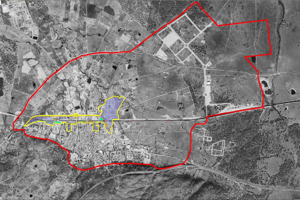
Reflection site 1.197 ha - Project site 55 ha
Site proposed by Regional Government of Extremadura
Actors involved Regional Government of Extremadura, Navalmoral de la Mata City Council + ADI
Owner(s) of the site Public & private
Commission after competition Strategic Document, Special Plan, partial project commissioning contained in the awarded solution or similar document.
More Information
SITE / CONTEXT
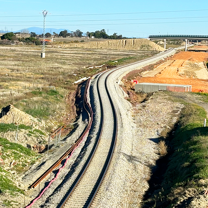
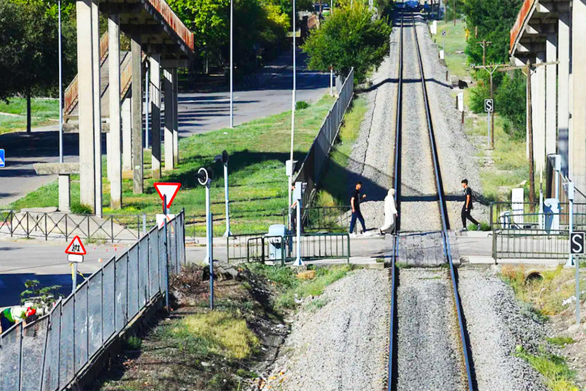
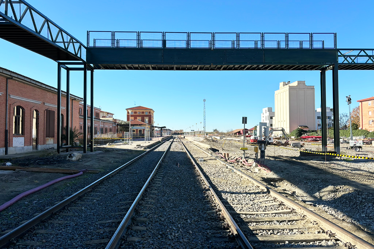
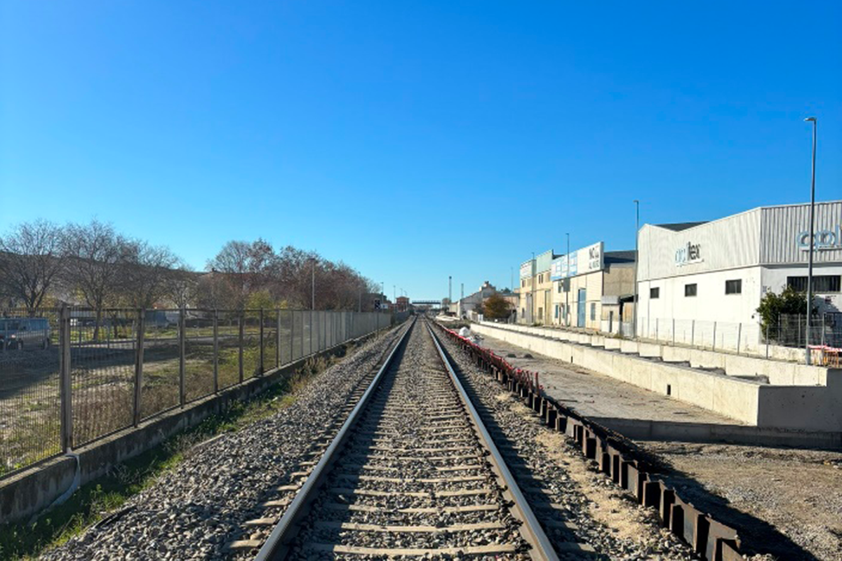
Navalmoral de la Mata is a municipality located in the northeast of the province of Cáceres, in the region of Extremadura. It enjoys a privileged location, at a crossroads that connects it directly with other cities, including Madrid and Lisbon. The A5 (Madrid-Lisbon) and the EX-A1 to Portugal (which in turn connects with the A66 and links Oviedo with Seville) pass through it. In this way, the journey time by road is 2 hours to Madrid and Badajoz, and 3 hours to Seville. The Madrid-Lisbon railway line also passes through the town, a line which is currently under construction for the high-speed train.
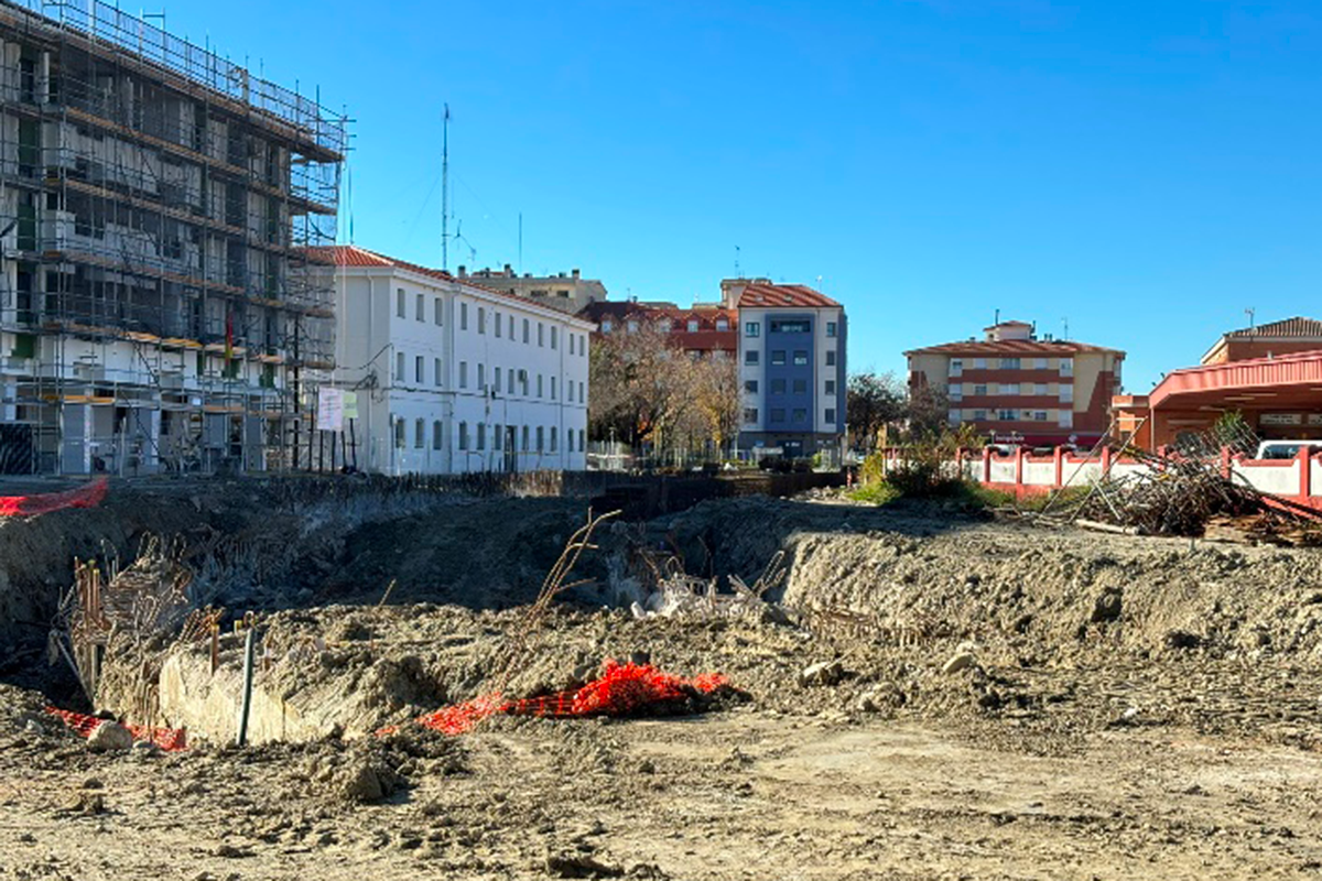
The implementation of the significant industrial and logistics centre Expacio Navalmoral, the construction and operation of the high-speed railway line and the simultaneous creation of new residential areas are causing a major transformation, not only on a socio-economic level, but also on an urban and territorial one.
QUESTIONS TO THE COMPETITORS
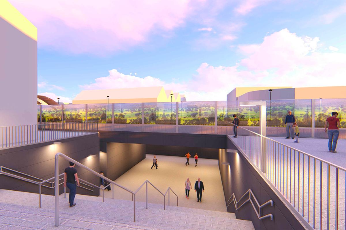
The action should qualify the empty spaces generated after different interventions, as well as the last ADIF layout (in execution), by integrating them as green areas, leisure spaces, etc. that act as strategic landmarks or points of interest in its development, as well as the study of mobility between the areas of residential growth (Los Viñazos) and the new industrial area. The identification of the areas in the project site is only a non-exhaustive compilation of degraded areas or areas considered to be susceptible to being taken into account for inclusion as part of the project area in the proposals to be developed, with the possibility of their extension, correction or qualification.
Could existing empty spaces be re-qualified?
Could the spaces separated by the high-speed line be re-connected? Could the mobility of the municipality be re-arranged?
Questions on the site
You have to be connected -and therefore registered- to be able to ask a question.
This site is connected to the following theme
Re-sourcing from social dynamic A missing layer of urbanity is added on a territory with underlying complexities. In all these large sites, the question is how inhabit them, how to relate to them, how to add a human ecosystem while negotiating the pros and cons of the existing complexity. It may be to reconsider an urban interrupted development, to care wounds left or created by old or new infrastructures; to regenerate sub-standard housing or the damage left behind a brownfield, to reconsider a river or former agricultural fields.
Creating New Urban Relationships
Specific documents
Questions on the site
You have to be connected –and therefore registered– to be able to ask a question.
Fr. 16 May 2025
Deadline for submitting questions
Fr. 30 May 2025
Deadline for answers
Before submitting a question, make sure it does not already appear in the FAQ.
Please ask questions on sites in the Sites section.
Please ask questions on rules in the Rules section.
If your question does not receive any answer in 10 days, check the FAQ to make sure the answer does not appear under another label or email the secretariat concerned by the question (national secretariat for the sites, European secretariat for the rules).