Almada - Porto Brandão
Les Dossiers synthétiques et d'enjeux sont disponibles gratuitement.
Merci de vous inscrire et vous connecter pour accéder au Dossier complet de site.
- Dossier synthétique EN
- Le site sur Google Maps
- Retour à la carte
Données synthétiques
Category Urban - architectural
Team representative Architect - urban planner - landscaper
Location Almada - Porto Brandão
Population City 174,000 inhab. - Conurbation 2,822,000 inhab.
Strategic site 117 ha - Project site 8 ha
Site proposed by Almada Municipality
Owners of the site Various (public and private)
Commission after competition Urban Project. The team representative must be either an Architect or an Urban Planner
Information complémentaire
How Can Porto Brandão Contribute to the Adaptable City?
The aim is put on a reflection about the value of special places, in the process of decay in its lifecycle. To sustain urban design with sensitiveness to relations between space and time factors, the qualities of a place like Porto Brandão must be based on adaptability - the use of these places depend on new perspectives of hospitality: regarding landscape, heritage, economy, interacting in close proximity (University, business nucleus, infrastructure ...) and distance (Lisbon):
a- To identify values that are in crisis (devaluation or abandonment of industrial activities, precarious housing, heavy traffic, instability of the cliffs...) and possible action on the problems;
b- To contain space consumption, keeping "landscape reserves" in processing changing scenarios: morphology (terraces for agriculture, promenades between high and low grounds) and metabolism (events, activities...);
c- To test a strategy of leveraging temporality enhancing the site’s specificities (vegetation, views, accesses...) and tuning with variations in space and time, in an uncertain future;
d- To act at different scales, in a process that fits the site to new ways of life and economic to social cycles’ sequences towards a better intensity in land use.
City Strategy
The strategy for the area now being studied, includes to restrain the industrial expansion in the north riverfront, by defining an axis of recreational and leisure activities to the beaches to the west and by the expansion of the university campus to the south.
The geographic location and privileged environmental quality at the mouth of the Tagus estuary and the Atlantic front, establishes links between Almada and the water on various potential possibilities. Under the concept of "City of Two Margins", the centrality characteristics, the landscape values, the level of urban facilities and infrastructures with priority to the network of modes of soft mobility (MST light tram network), all support a strategy of "Place for Inhabiting, for Work, of Culture, and Knowledge" and promote the accessibility between the territories’ multiple functions. To enhance the development of the University and Innovation pole, internationalization and articulation with job-creating economic activities, culture and knowledge is also stimulated by transnational connectivity and student mobility in Almada, as an Erasmus City.
Reconversion of obsolete urban areas of Porto Brandão results from the goal of environmental and landscape quality, as part of quality of life in the territory of Almada, consolidating ecological structures and ensuring cultural continuity, in both rural and urban components.
Site Definition
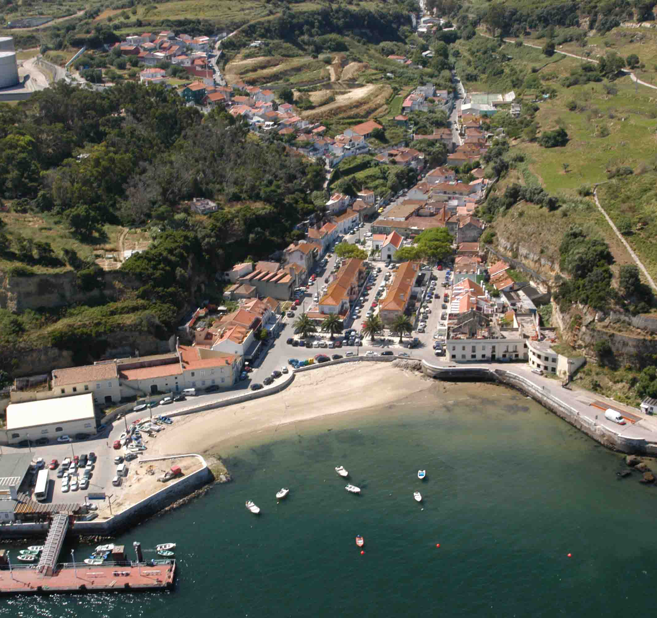
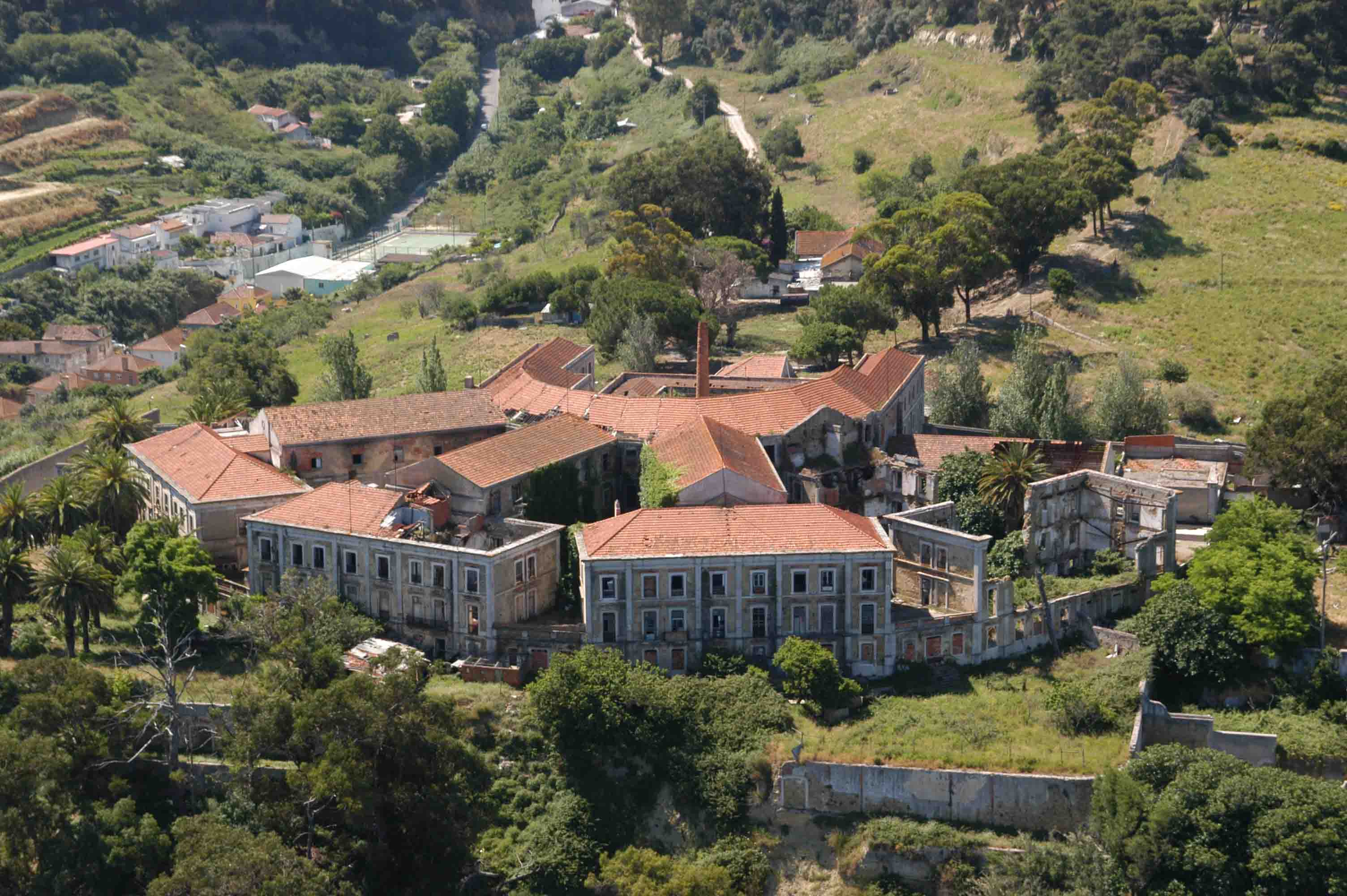
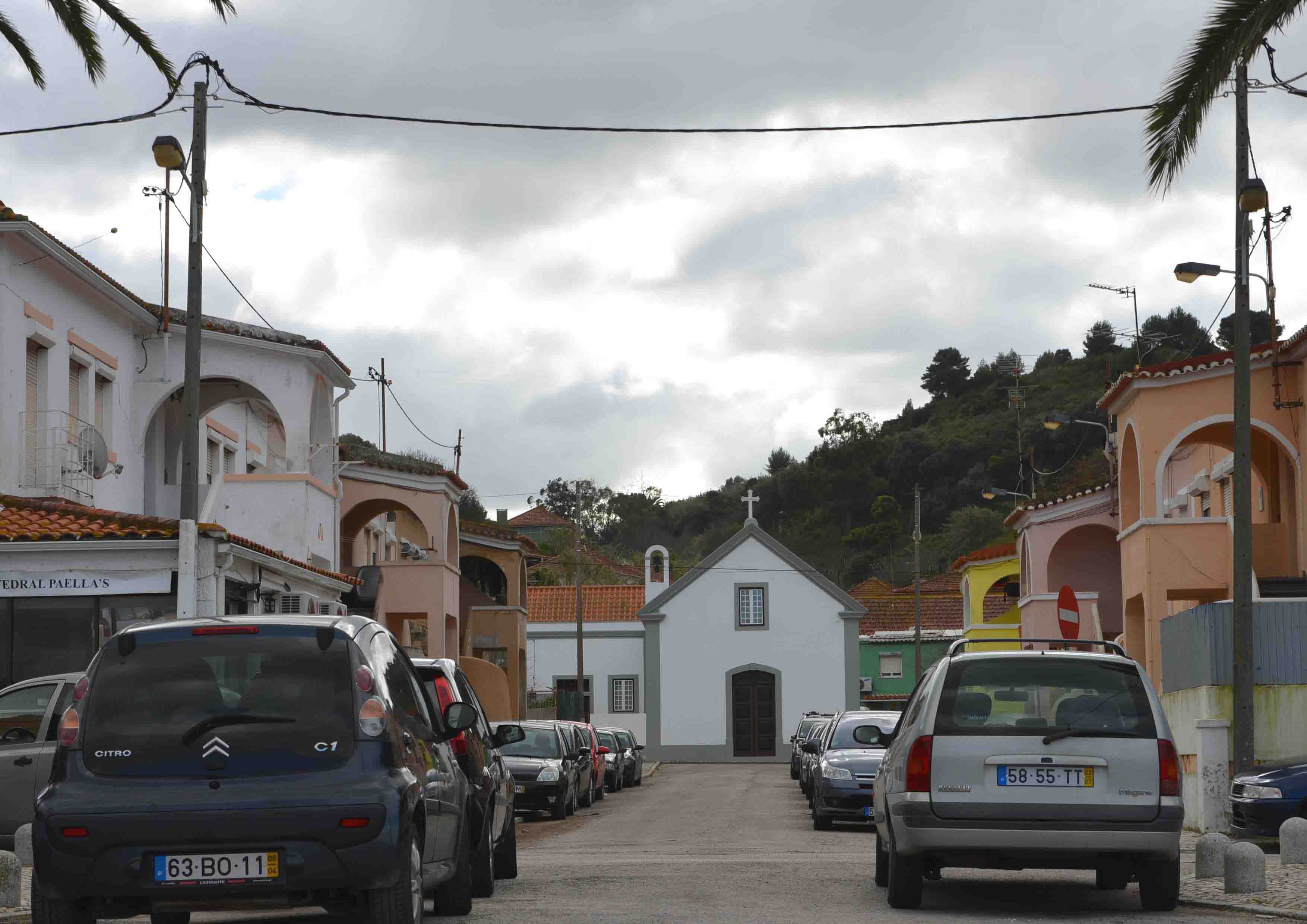
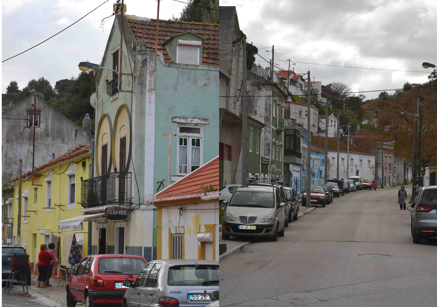
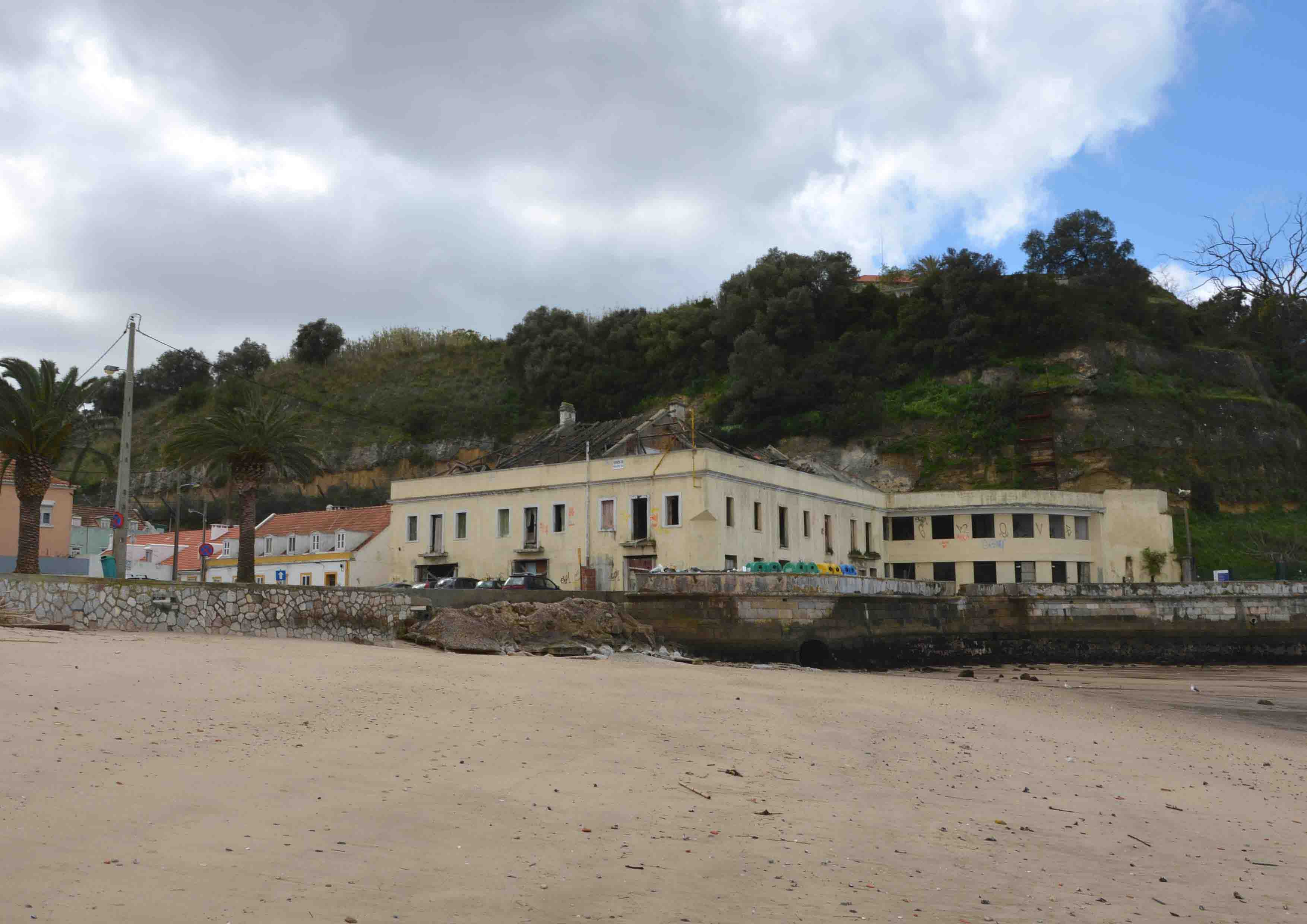
Porto Brandão is at the bottom of a valley which, from a plateau where lies a University, opens onto the river. It was a village linked to the river activities, open to the beach through a large square that in the late '40s, was populated by houses that withdrew its large cove. Among the existing buildings of greater significance is the church and along the river the old fish cannery.
The picturesque character of this place is given by its ancient way fishing tradition, the fame of its restaurants and the slope located on the west, the existence of two unique buildings, the Lazareto (a sanatorium/nursing hospital) and the Torre Velha (Old Tower -an ancient fortification of Lisbon’s sea defense).
Porto Brandão is very conditioned not only by its morphology between two rugged slopes (one with illegal housing) where straight connections between up and down hill would require future mechanical features), but mainly by its industrial occupation (fuel oil depositories) that limits the experience the sites’ exceptionality and its relationship with the river and the landscape of Lisbon.
Adaptability: Main Elements to Take into Account
The most relevant partners of these location’ regeneration are the fuel terminal companies that are soon to be disused and the University that like the Innovation Center should boost greater intensity in territory occupation and interweave their action with urban functions (home, leisure, work).
New links and connections may be fostered by soft mobility stimulation and topographic constraints amelioration (todays’ simple upgrading solutions are welcomed in some more urgent points) by upgrading leisure pathways or functional quick links namely from the riverside to the University and existing urban transport facilities:
1. Interior links:
a. Through the valley - raising new uses and offering activities with time diversity (weekend, summer holidays…) and better connection to the light Metro line
b. Through the east cliff (fuel terminal soon in disuse) until the Innovation center
c. Through the west cliff from the university to the Lazareto and its reallocation to tourism, services...)
2. Joining "neighborhood" urban fragments, promoting the potential diversity of activities:
a. Possible urbanity upgrading in the Azinhaga settlement and connections down the cliff (to the riverfront) and on top of the east hillside with "quality paths"
b. Improve uses, accesses and public spaces; support communities
c. Attracting new residents of different types and “times”, new users and publics
3. A "Center" at the riverfront:
a. Fluvial (fishing, access to Lisbon’s riverside - sports, production service, leisure...)
b. Creative activities, cultural, gastronomical, recreational
c. Meeting (between University and the river; Almada and Lisbon; locals and travelers; night and day)
Questions à propos du site
Where can I find a dwg base file from the site?
The dwg files are available for download in the competition website, after making the registration.
Have you got any information on the fuel tanks structure? Is it made out of steel, or concrete?
Not relevant. The fuel tanks will be dismantled. However, and based on mere observation only, they are apparently made out of some kind of metal.
Do we have to consider the conditions of pollution of the ground in the zone of the oil cisterns?
No, you shouldn't.
Could you give some specific information regarding the terraced site, southwards from Azinhaga neighbourhood? Is there a development project already going on? Is it conceived as a mainly residential-public development site?
The answer can be found in the report of the site visit (nr.1)
Is there already a development project going on for the university campus? Is it possible to intervene on the boundary (the eastern slope) between the project site and the campus?
You can read the answer in the report of the site visit (nr.2)
Is it generally possible to propose light structures suspended on the rocky slopes, or light excavations like excavated terraces, etc?
Yes, all of those are possible, attending to the approach perspective: realistic or theoretic. The municipality doesn’t wish to impose or limit the competitors’ conceptual freedom, but understands that one should value sustainable solutions with natural/landscape values, attending to the existing features/risks.
Would it be possible to have all the photos that are inserted in the brief pdf document, especially the aerial ones (Paulina cove, fuel deposit, etc...)?
You can see the answer in the report of the site visit (nr.4-6)
When will the zone of the oil cisterns be released? Does it require a cleanup? And what type of pollution?
There’s no information about the date for dismantling the fuel tanks.
There’s no information about pollution, but from a visual observation at the site, there’s no evidence of fuel or any other type of pollution.
Can you inform us the height of tides in Porto Brandao?
Why is there two different limits in the drawings (dxf and dwg) of the site plan?
There are no different limits.
Le site est lié au thème suivant
Territoires en réseau Il s’agit de sites qui, en raison de leur lien avec une entité plus grande, développent leurs potentialités urbaines. Cette entité peut être physiquement concrète, comme une infrastructure de transport, ou peut être un réseau virtuel de relations entre plusieurs nœuds urbains. Bien que les communautés qui habitent ou utilisent ces sites puissent être petites et apparemment isolées, la connexion avec le réseau leur ouvre des possibilités d’amélioration de leur vie urbaine par un nouveau mélange de différents programmes et une urbanité plus complexe.
Comment peut-on préparer ces territoires à résister aux différents scénarios qui pourraient affecter les autres éléments du réseau ou le réseau lui-même ? Devraient-ils être organisés de façon à ce qu’ils puissent adopter différents rôles au sein du réseau ? Comment peuvent-ils s'adapter à la possibilité de changements importants du réseau, voire à sa disparition, par la définition de leurs propres caractéristiques urbaines et architecturales ?
Questions à propos du site
Pour pouvoir poser une question, vous devez être connecté (et, par conséquent, inscrit au concours).
Ve. 16 mai 2025
Date limite de soumission des questions
Ve. 30 mai 2025
Date limite de réponses aux questions
Avant de soumettre votre question, assurez-vous qu'elle n'apparaît pas déjà dans la FAQ.
Merci de poser vos questions sur les sites dans le menu Sites.
Merci de poser vos questions sur le règlement dans le menu Règlement.
Si votre question ne reçoit pas de réponse dans les 10 jours, merci de vérifier qu'elle ne figure pas dans la FAQ sous un autre intitulé ; sinon, contactez le secrétariat concerné par email (secrétariats nationaux pour les sites, secrétariat européen pour le règlement.)