Bamberg
Les Dossiers synthétiques et d'enjeux sont disponibles gratuitement.
Merci de vous inscrire et vous connecter pour accéder au Dossier complet de site.
- Dossier synthétique DE | EN
- Le site sur Google Maps
- Retour à la carte
Données synthétiques
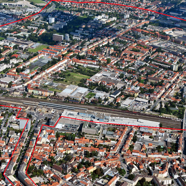
E13-DE-Bamberg_Cover
Category Urban – landscape – architectural
Location Bamberg East
Population City c. 71,000 inhab. – Strategic site c. 13,000 inhab.
Strategic sitec. 200 ha - Project site A 5.5 ha / B 18.1 ha / C 6.5 ha
Site proposed by Bamberg City Council
Owner(s) of the site Bamberg City Council, various ownership (private and public), Conversion areas: Federal Republic of Germany (BImA), acquisition by Bamberg City Council planned
Commision after competition Outline or local development plan
Team representative professional of urban design/architecture
Information complémentaire
How can the site contribute to the adaptable city?
Bamberg East is a primary focus of the Urban Development Plan (SEK) approved in 2014. The barracks site is to be opened and linked to Bamberg East and the city centre by the development and extension of a network of attractive landscaped paths in an East-West direction. A key element of the SEK is the vision of an East Park extending from Hauptsmoorwald to the Lagarde Barracks. The proposed green link towards the railway station is to be extended to create a connection to the town centre. Lessening the disruptive effect of the railway line poses a considerable challenge. The goal is to highlight the special qualities of Bamberg’s east and strengthen the identity of the district.
City strategy
Bamberg is a mediaeval city whose historic centre was declared a UNESCO world heritage site in 1993. The historic subdivision of the old town into Berggebiet (Hill Town), Inselstadt (Island Town) and Gärtnerstadt (Gardener Town) is still recognizable today and determines how Bamberg is perceived from the outside. Bamberg’s Eastern district with the newer 20th century development and extensive barracks complex has hitherto stood in the shadow of the old town and is sharply separated from the same by the railway line. With the abandonment of military use and withdrawal of the US forces in 2014 this area has moved into the sight line of planners. In order to integrate the conversion areas into the urban fabric and strengthen the connection to the city centre, our attention must be directed in particular to the adjoining neighbourhoods.
Site definition
The strategic site of approx. 200 ha extends from the former barracks site to the railway station and will thus play a major role in the future linkage of the conversion site to the city centre. The district is predominantly residential, and is made up of several neighbourhoods. The highly heterogeneous development reflects the different urban planning ideals of the past few decades. Retail businesses, educational facilities and commercial premises lie scattered between the neighbourhoods, and there is a lack of visible urban landmarks that would lend the district a distinct character.
Future of the site in relation to the site family and Adaptability
The identity of Bamberg East is to be reinforced by conceptual, planning and design solutions. A lively neighbourhood is to be created by a mixture of residential, cultural, work and recreational uses.
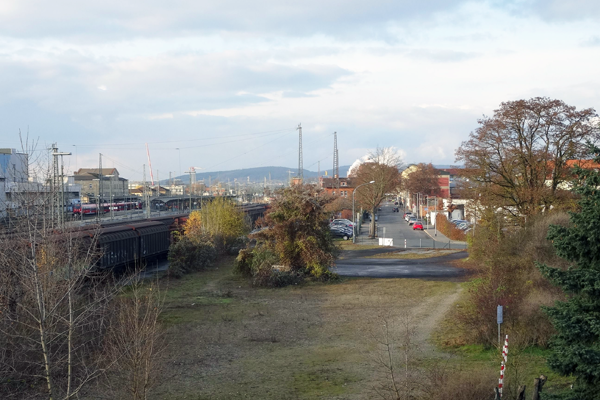
Zollnerstrasse and Luitpoldstrasse will assume overriding importance as the main traffic arteries between the city centre and the conversion site. A key role here will be played by the design of the streetscape and improvement of amenity value. The focus of the study will be three project sites with special development potential: The site behind the railway station is the first impression of Bamberg acquired by passengers arriving by rail. Architectural solutions with a high design standard are sought that also take account of emission control requirements.
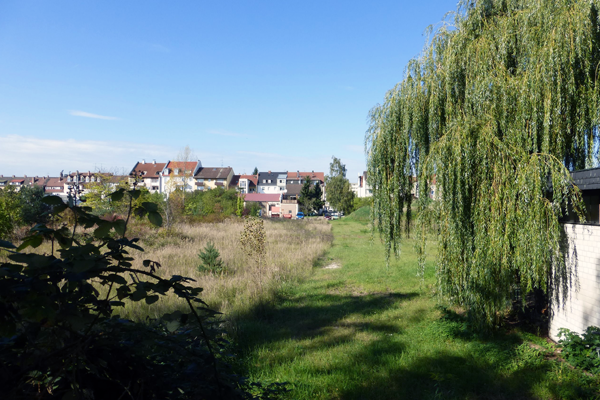
Ideas for an open space with integrated pathway are needed for the undeveloped and in part landscaped areas in project area B, to the east of the railway line. In addition, innovative approaches for urban infill at the interface between residential and commercial are called for.
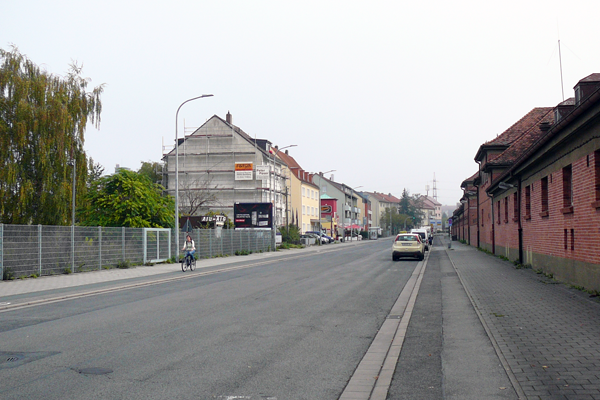
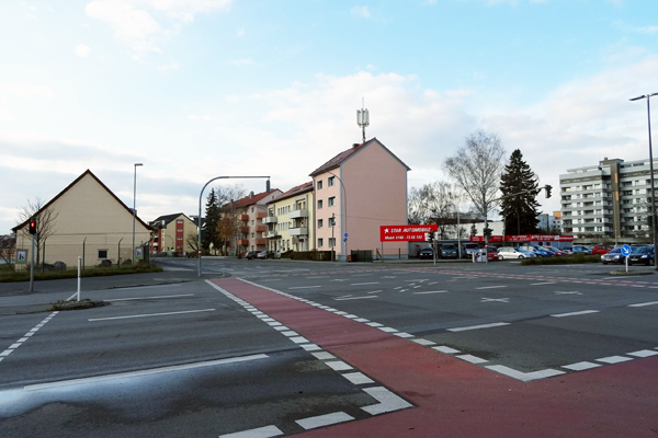
The appearance of the underused area C immediately adjoining the Lagarde Barracks is determined by its location at the intersection of two trunk roads. Vacant building sites and wasteland offer potential for upgrading and redevelopment here.
Questions à propos du site
Could we have the last Bamberg East Conversion Plan modified in February 2015?
The Bamberg East Conversion Plan is in process an will be available not until the end of competition phase. The basis for the further development of Lagarde barracks is the winning project of the architectural firm Pesch & Partner, the basis for the whole conversion area is the SEK structural concept (Bamberg-DE-SS5).
We would like to know which existent building/s in the railway station area do we have to preserve?
Most of the plots in focus area A are in posession of private owners or property of Deutsche Bahn. The whole area requires striking new ideas. Which buildings should be demolished depends on the proposed concept. Historical monuments should in any case be preserved (BAMBERG-DE-SS-22).
Can you give us some documents (drawings: plans, sections etc.) about the existing buildings in the railway station area?
Floor plans and sections for each building are unfortunately not available (and are not essential for the task).
Is it possibe to have a text or video report of the site visit and colloquium?
You can find the report on the site page, with a click on site visit.
Is it possible to have the aerial pictures in hight resolution?
All aerial pictures are available in high resolution (300 dpi). Please specify what pictures you need in better resolution.
Is it possibile to have the translantion in english of the presentation of march 2015 - BAMBERG-DE-SS-Pr2.pdf ?
The translated version of the whole document is not available. A translation of the whole document is not essential for the competition task, a translation of page 6 showing the winning project for lagarde-barracks will be provided.
Le site est lié au thème suivant
Comment transformer des obstacles physiques en nouvelles connexions ? Il s’agit de créer des « ponts » comme des connections linéaires entre différents contextes, surplombant une obstacle qui peut être une rivière, un chemin de fer ou d’autres barrières physiques. Parfois cependant, il est possible de transformer l’obstacle afin qu’il devienne producteur de mouvements dans différents sens et directions, passant alors de barrière de séparation en élément connecteur. L’obstacle peut être habité, coupé, entrecroisé ; il peut être l’opportunité d’augmenter la densité, de changer les fonctions des entités divisées ou encore apporter une nouvelle perspective à un contexte familier.
Questions à propos du site
Pour pouvoir poser une question, vous devez être connecté (et, par conséquent, inscrit au concours).
Ve. 16 mai 2025
Date limite de soumission des questions
Ve. 30 mai 2025
Date limite de réponses aux questions
Avant de soumettre votre question, assurez-vous qu'elle n'apparaît pas déjà dans la FAQ.
Merci de poser vos questions sur les sites dans le menu Sites.
Merci de poser vos questions sur le règlement dans le menu Règlement.
Si votre question ne reçoit pas de réponse dans les 10 jours, merci de vérifier qu'elle ne figure pas dans la FAQ sous un autre intitulé ; sinon, contactez le secrétariat concerné par email (secrétariats nationaux pour les sites, secrétariat européen pour le règlement.)